File:Worldheight.jpg
Jump to navigation
Jump to search

Size of this preview: 800 × 536 pixels. Other resolutions: 320 × 214 pixels | 640 × 429 pixels | 1,024 × 686 pixels | 1,280 × 857 pixels | 1,780 × 1,192 pixels.
Original file (1,780 × 1,192 pixels, file size: 1.5 MB, MIME type: image/jpeg)
Captions
Captions
Add a one-line explanation of what this file represents
Summary[edit]
| Description |
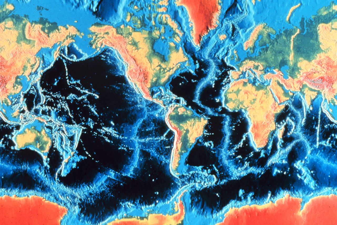
Nederlands: wereldkaart met hoogte van het land en diepte van de oceanen - bron:US National Oceanic and Atmospheric Administration
English: World map with elevation of the land and depth of the oceans - Source: U.S. National Oceanic and Atmospheric Administration |
|||||||||
| Source | http://www.photolib.noaa.gov/htmls/nur09764.htm | |||||||||
| Creator |
NOAA/OAR/National Undersea Research Program |
|||||||||
| Geotemporal data | ||||||||||
| Bounding box |
|
|||||||||
| Georeferencing | ||||||||||
Licensing[edit]
This image is in the public domain because it contains materials that originally came from the U.S. National Oceanic and Atmospheric Administration, taken or made as part of an employee's official duties.
|
Original upload log[edit]
The original description page was here. All following user names refer to nl.wikipedia.
- 2004-01-22 17:03 Andre Engels 700×468× (56070 bytes) wereldkaart met hoogte van het land en diepte van de oceanen - bron:US National Oceanic and Atmospheric Administration
File history
Click on a date/time to view the file as it appeared at that time.
| Date/Time | Thumbnail | Dimensions | User | Comment | |
|---|---|---|---|---|---|
| current | 22:33, 22 September 2015 | | 1,780 × 1,192 (1.5 MB) | Huntster (talk | contribs) | Taken from NOAA source. |
| 11:32, 7 September 2009 |  | 700 × 468 (55 KB) | File Upload Bot (Magnus Manske) (talk | contribs) | {{BotMoveToCommons|nl.wikipedia|year={{subst:CURRENTYEAR}}|month={{subst:CURRENTMONTHNAME}}|day={{subst:CURRENTDAY}}}} {{Information |Description={{nl|wereldkaart met hoogte van het land en diepte van de oceanen - bron:US National Oceanic and Atmospheric |
You cannot overwrite this file.
File usage on Commons
There are no pages that use this file.
File usage on other wikis
The following other wikis use this file:
- Usage on pl.wikipedia.org