File talk:Czechoslovakia 1930 linguistic map - cz.svg
Jump to navigation
Jump to search
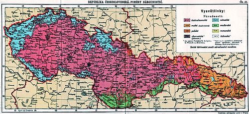
The map appears to be incorrect. See the old Czechoslovak map based on the Czechoslovak census of 1930 below. It is different than this map and the areas inhabitated by the Czechs and Slovaks are substantially smaller in this map than according to the Czechoslovak census.--Kostěj (talk) 21:09, 19 October 2010 (UTC)--Kostěj (talk) 21:12, 19 October 2010 (UTC)
