File:Aegean Sea by Piri Reis.jpg
Aegean_Sea_by_Piri_Reis.jpg (724 × 562 pixels, file size: 304 KB, MIME type: image/jpeg)
Captions
Captions
Summary[edit]
| Description |
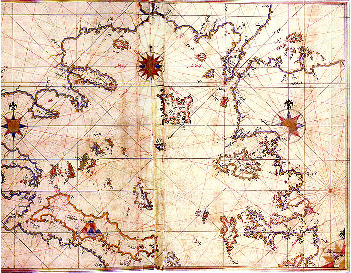
English: Aegean Sea in the Kitab-ı Bahriye (Book of Navigation) of Piri Reis
Map of Rhodes and Marmaris made by Turkish Admiral Piri Reis appearing in his maritime guide-book of 1528, Kitab-i Bahriye. Original is in Nuruosmaniye Library in Istanbul, Turkey. |
||||||||||||||||||||
| Date | 29 October 2006 (original upload date) | ||||||||||||||||||||
| Source | Transferred from en.wikipedia to Commons. | ||||||||||||||||||||
| Author |
|
||||||||||||||||||||

Licensing[edit]
|
This work is in the public domain in its country of origin and other countries and areas where the copyright term is the author's life plus 70 years or fewer.
| |
| This file has been identified as being free of known restrictions under copyright law, including all related and neighboring rights. | |
| This is a retouched picture, which means that it has been digitally altered from its original version. Modifications: central vertical part flattened (stretched). Modifications made by PawełMM.
|
Original upload log[edit]
- 2006-10-29 23:03 Shuppiluliuma 795×567× (280442 bytes) [[Aegean Sea]] in the Kitab-ı Bahriye (Book of Navigation) of [[Piri Reis]] {{PD-old}}
File history
Click on a date/time to view the file as it appeared at that time.
| Date/Time | Thumbnail | Dimensions | User | Comment | |
|---|---|---|---|---|---|
| current | 16:48, 15 June 2010 | | 724 × 562 (304 KB) | PawełMM (talk | contribs) | vertical center part flattened |
| 09:09, 6 April 2008 |  | 795 × 567 (274 KB) | Marsyas (talk | contribs) | {{Information |Description=Map of Rhodes and Marmaris made by Turkish Admiral Piri Reis appearing in his maritime guide-book of 1528, Kitab-i Bahriye. Original is in Nuruosmaniye Library in Istanbul, Turkey. |Source=[http://upload.wikimedia.org/wikipedia/ |
You cannot overwrite this file.
File usage on Commons
The following page uses this file:
File usage on other wikis
The following other wikis use this file:
- Usage on ar.wikipedia.org
- Usage on az.wikipedia.org
- Usage on bn.wikipedia.org
- Usage on co.wikipedia.org
- Usage on en.wikipedia.org
- Aegean Sea
- Camirus
- Lindus
- Saria Island
- Rineia
- Dracanum
- Ialysus
- Thasos (town)
- Wikipedia:Graphics Lab/Photography workshop/Archive/Jun 2010
- Polium
- Islands (Roman province)
- Oenoe (Icaria)
- Delphinium (Chios)
- Nysa (Naxos)
- Panormus (Skopelos)
- Polichne (Chios)
- Polichne (Naxos)
- Poeeessa
- Apollonia, Sifnos (ancient town)
- Serrheum (Samothrace)
- Arisba (Lesbos)
- Nape (Lesbos)
- Aegeirus
- Pyrrha (Lesbos)
- Hiera (Lesbos)
- Metaon
- Geren (Lesbos)
- Issa (Lesbos)
- Xanthus (Lesbos)
- Penthile
- Therma (Lesbos)
- Malea (Lesbos)
- Sigron
- Messon (Lesbos)
- Agamede (Lesbos)
- Chryse (Lesbos)
- Hyperdexion
- Minoa (Amorgos)
- Aegiale (Amorgos)
- Arcesine
- Melania (Amorgos)
- Coressia
- Lepsia
- Phora (Greece)
- Corsiae
View more global usage of this file.