File:Aladag zoom.PNG
Jump to navigation
Jump to search

Size of this preview: 752 × 599 pixels. Other resolutions: 301 × 240 pixels | 602 × 480 pixels | 985 × 785 pixels.
Original file (985 × 785 pixels, file size: 2.05 MB, MIME type: image/png)
Captions
Captions
Add a one-line explanation of what this file represents
Summary[edit]
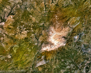
Zoom above Aladağ range in Turkey. Caption from NASA World Wind. Some place names of surrounding villages included.
Licensing[edit]
| This image is in the public domain because it is a screenshot from NASA’s globe software World Wind using a public domain layer, such as Blue Marble, MODIS, Landsat, SRTM, USGS or GLOBE.
|
 |
File history
Click on a date/time to view the file as it appeared at that time.
| Date/Time | Thumbnail | Dimensions | User | Comment | |
|---|---|---|---|---|---|
| current | 14:44, 25 September 2007 | | 985 × 785 (2.05 MB) | Bicounet~commonswiki (talk | contribs) | Zoom above Aladağ range in Turkey. Caption from NASA World Wind. Some place names of surrounding villages included. |
You cannot overwrite this file.
File usage on Commons
There are no pages that use this file.
File usage on other wikis
The following other wikis use this file:
- Usage on fr.wikipedia.org
- Usage on he.wikipedia.org
- Usage on it.wikipedia.org