File:Basiskarte.png
(Redirected from File:Basiskarte.gif)

Size of this preview: 800 × 553 pixels. Other resolutions: 320 × 221 pixels | 640 × 443 pixels | 1,024 × 708 pixels | 1,280 × 885 pixels | 2,560 × 1,770 pixels | 4,035 × 2,790 pixels.
Original file (4,035 × 2,790 pixels, file size: 8.18 MB, MIME type: image/png)
Captions
Captions
Add a one-line explanation of what this file represents
Summary[edit]
| Description |
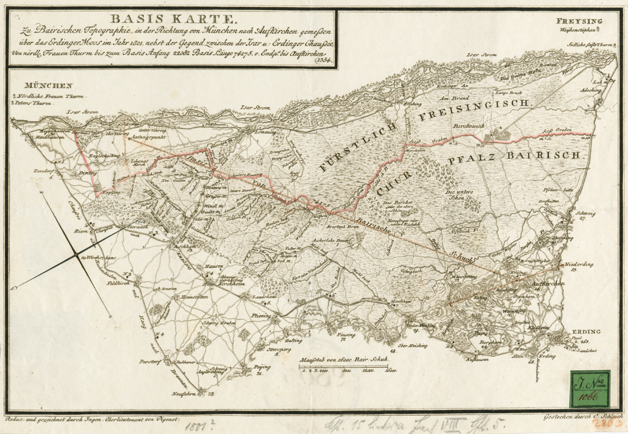
Basiskarte 1801 von München nach Aufkirchen |
|||||||||
| Date | ||||||||||
| Source | Landesamt für Vermessung und Geoinformation Bayern | |||||||||
| Creator |
Oberlieuntant von Pigenot |
|||||||||
| Permission (Reusing this file) |
Author died more than 70 year ago | |||||||||
| Geotemporal data | ||||||||||
| Bounding box |
|
|||||||||
| Georeferencing | ||||||||||
Licensing[edit]
|
This work is in the public domain in its country of origin and other countries and areas where the copyright term is the author's life plus 100 years or fewer. | |
| This file has been identified as being free of known restrictions under copyright law, including all related and neighboring rights. | |
Original upload log[edit]
| Date/Time | Dimensions | User | Comment |
|---|---|---|---|
| 3 September 2006, 00:51:48 | 4035 × 2790 (7496638 bytes) | Linos203 (talk · contribs) | {{Information |Description=Basiskarte 1801 von München nach Aufkirchen |Source=Landesamt für Vermessung und Geoinformation Bayern |Date=1801 |Author=Oberlieuntant von Pigenot |Permission=Author died more than 70 year ago |other_versions= }} [[Category: |
File history
Click on a date/time to view the file as it appeared at that time.
| Date/Time | Thumbnail | Dimensions | User | Comment | |
|---|---|---|---|---|---|
| current | 20:21, 23 August 2014 | | 4,035 × 2,790 (8.18 MB) | GifTagger (talk | contribs) | Bot: Converting file to superior PNG file. (Source: Basiskarte.gif). This GIF was problematic due to non-greyscale color table. |
You cannot overwrite this file.
File usage on Commons
The following 2 pages use this file:
- File:Basiskarte.gif (file redirect)
- Category:Basislinie Unterföhring–Aufkirchen
File usage on other wikis
The following other wikis use this file:
- Usage on de.wikipedia.org
- Usage on www.wikidata.org