File:Coba Noloch Mull Pano-27527.jpg
Jump to navigation
Jump to search
Size of this preview: 800 × 140 pixels. Other resolutions: 320 × 56 pixels | 640 × 112 pixels | 1,024 × 179 pixels | 1,280 × 224 pixels | 8,000 × 1,400 pixels.
Original file (8,000 × 1,400 pixels, file size: 3.7 MB, MIME type: image/jpeg)
Captions
Captions
Add a one-line explanation of what this file represents
Summary[edit]
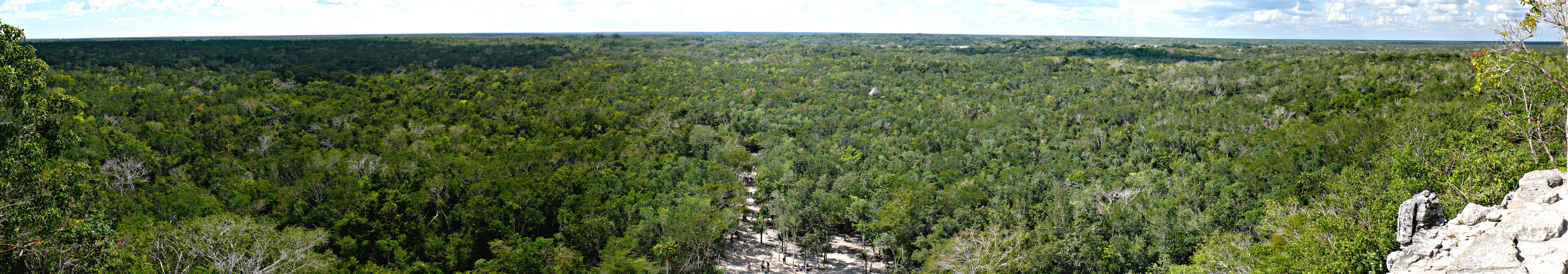
| Description | Miles and miles of jungle, as seen from the top of the Mayan Nohoch Mul pyramid on the northen edge of the Cobá archeological site in Quintana Roo, Mexico. Panoramic image compiled with Autostitch from twelve individual photographs, each taken with a Panasonic Lumix DMC-FZ50 mounted to a Panosaurus tripod head. |
| Date | 1 February 2008, 12:15 −06:00 |
| Source |
KenThomas.us (personal website of photographer) |
| Author | Ken Thomas |
| Permission (Reusing this file) |
This image is released to the public domain, and therefore no permission or credit is required. Comments, feedback and/or questions however, are always welcome. See my user page for contact info. |
| Camera location | | View this and other nearby images on: OpenStreetMap |
|---|
Licensing[edit]
| I, the copyright holder of this work, release this work into the public domain. This applies worldwide. In some countries this may not be legally possible; if so: I grant anyone the right to use this work for any purpose, without any conditions, unless such conditions are required by law. |
File history
Click on a date/time to view the file as it appeared at that time.
| Date/Time | Thumbnail | Dimensions | User | Comment | |
|---|---|---|---|---|---|
| current | 22:10, 5 February 2008 | 8,000 × 1,400 (3.7 MB) | Ken Thomas (talk | contribs) | {{Information |Description=Miles and miles of jungle, as seen from the top of the Mayan ''Noloch Mul'' pyramid on the northen edge of the Cobá archeological site in Quintana Roo, Mexico. |
You cannot overwrite this file.
File usage on Commons
The following page uses this file:
File usage on other wikis
The following other wikis use this file:
- Usage on ar.wikipedia.org
- Usage on be.wikipedia.org
- Usage on en.wikipedia.org
- Usage on fr.wikipedia.org
- Usage on ja.wikipedia.org
- Usage on lt.wikipedia.org
- Usage on zh.wikipedia.org