File:Istres BA125 Landsat.png
Aller à la navigation
Aller à la recherche
Pas de plus haute résolution disponible.
Istres_BA125_Landsat.png (301 × 301 pixels, taille du fichier : 188 kio, type MIME : image/png)
Légendes
Légendes
Ajoutez en une ligne la description de ce que représente ce fichier
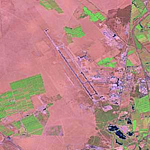
This image was generated by the NGA Raster Roam application, at coordinates 43°31'21"N 04°55'25"E.
This image is a work of the United States National Geospatial-Intelligence Agency or one of its predecessor agencies. As a work of the U.S. federal government, the image is in the public domain.
|
 |
Historique du fichier
Cliquer sur une date et heure pour voir le fichier tel qu'il était à ce moment-là.
| Date et heure | Vignette | Dimensions | Utilisateur | Commentaire | |
|---|---|---|---|---|---|
| actuel | 23 août 2009 à 16:00 | | 301 × 301 (188 kio) | Bwmoll3 (d | contributions) | Color enhanced |
| 26 octobre 2005 à 02:41 |  | 301 × 301 (127 kio) | David.Monniaux (d | contributions) | Base aérienne d'Istres {{NGA Raster Roam|latitude=43°31'21"N|longitude=04°55'25"E}} |
Vous ne pouvez pas remplacer ce fichier.
Utilisations locales du fichier
La page suivante utilise ce fichier :
Utilisations du fichier sur d’autres wikis
Les autres wikis suivants utilisent ce fichier :
- Utilisation sur en.wikipedia.org
- Utilisation sur fa.wikipedia.org
- Utilisation sur fr.wikipedia.org
- Utilisation sur tg.wikipedia.org