File:Ludas Lake Sat.png
Jump to navigation
Jump to search
No higher resolution available.
Ludas_Lake_Sat.png (502 × 541 pixels, file size: 539 KB, MIME type: image/png)
Captions
Captions
Add a one-line explanation of what this file represents
Summary[edit]
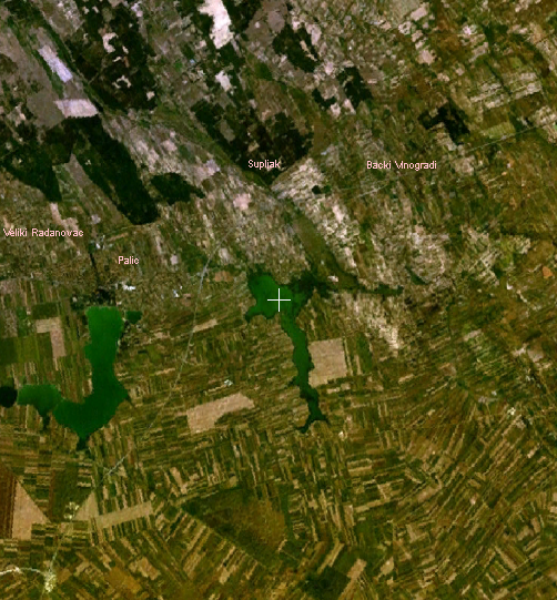
Satellite image of en:Ludaš Lake in northern Serbia
Licensing[edit]
| This image is in the public domain because it is a screenshot from NASA’s globe software World Wind using a public domain layer, such as Blue Marble, MODIS, Landsat, SRTM, USGS or GLOBE.
|
 |
File history
Click on a date/time to view the file as it appeared at that time.
| Date/Time | Thumbnail | Dimensions | User | Comment | |
|---|---|---|---|---|---|
| current | 08:58, 3 August 2007 | | 502 × 541 (539 KB) | Duja (talk | contribs) | == Summary == Satellite image of en:Ludaš Lake in northern Serbia ==Licensing== {{PD-WorldWind}} Category:Geography of Serbia |
You cannot overwrite this file.
File usage on Commons
The following page uses this file:
File usage on other wikis
The following other wikis use this file:
- Usage on de.wikivoyage.org
- Usage on en.wikipedia.org
- Usage on en.wikivoyage.org
- Usage on es.wikipedia.org
- Usage on fr.wikipedia.org
- Usage on hr.wikipedia.org
- Usage on nn.wikipedia.org
- Usage on no.wikipedia.org
- Usage on www.wikidata.org