File:Map Parthian Empire-fr.png
Jump to navigation
Jump to search
Size of this preview: 800 × 414 pixels. Other resolutions: 320 × 166 pixels | 640 × 331 pixels | 1,024 × 530 pixels | 1,766 × 914 pixels.
Original file (1,766 × 914 pixels, file size: 351 KB, MIME type: image/png)
Captions
Captions
Add a one-line explanation of what this file represents
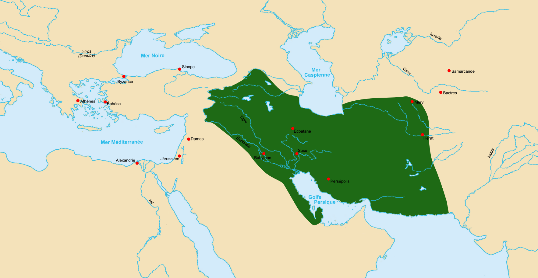
| Description | Map of Parthian Empire ca 60 BCE. |
| Date | |
| Source | Made using Image:LocationParthia.PNG as a source. |
| Author | Fabienkhan |
| Permission (Reusing this file) |
I, the copyright holder of this work, hereby publish it under the following license: This file is licensed under the Creative Commons Attribution-Share Alike 2.5 Generic license.
|
| Other versions | Derivative works of this file: Map Parthian Empire-bg.png |
File history
Click on a date/time to view the file as it appeared at that time.
| Date/Time | Thumbnail | Dimensions | User | Comment | |
|---|---|---|---|---|---|
| current | 15:25, 7 October 2006 | | 1,766 × 914 (351 KB) | Fabienkhan (talk | contribs) | {{Information |Description=Map of Parthian Empire ca 60 BCE. |Source=Made using Image:LocationParthia.PNG as a source. |Date=7 october 2006 |Author=Fabienkhan |Permission={{self|cc-by-sa-2.5}} |other_versions= }} [[Category:His |
You cannot overwrite this file.
File usage on Commons
The following 4 pages use this file:
File usage on other wikis
The following other wikis use this file:
- Usage on bg.wikipedia.org
- Usage on ca.wikipedia.org
- Usage on cs.wikipedia.org
- Usage on en.wikipedia.org
- Usage on eu.wikipedia.org
- Usage on fr.wikipedia.org
- Usage on ja.wikipedia.org
- Usage on ka.wikipedia.org
- Usage on ku.wikipedia.org
- Usage on mg.wikipedia.org
- Usage on nl.wikipedia.org
- Usage on pl.wikipedia.org
- Usage on sv.wikipedia.org
- Usage on tr.wikipedia.org
- Usage on vi.wikipedia.org
- Usage on www.wikidata.org