File:Map of Alaska highlighting Juneau City and Borough.svg
Aller à la navigation
Aller à la recherche

Taille de cet aperçu PNG pour ce fichier SVG : 800 × 423 pixels. Autres résolutions : 320 × 169 pixels | 640 × 338 pixels | 1 024 × 541 pixels | 1 280 × 677 pixels | 2 560 × 1 353 pixels | 1 470 × 777 pixels.
Fichier d’origine (Fichier SVG, nominalement de 1 470 × 777 pixels, taille : 338 kio)
Légendes
Légendes
Ajoutez en une ligne la description de ce que représente ce fichier
Description[modifier]
| Description |
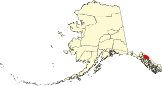
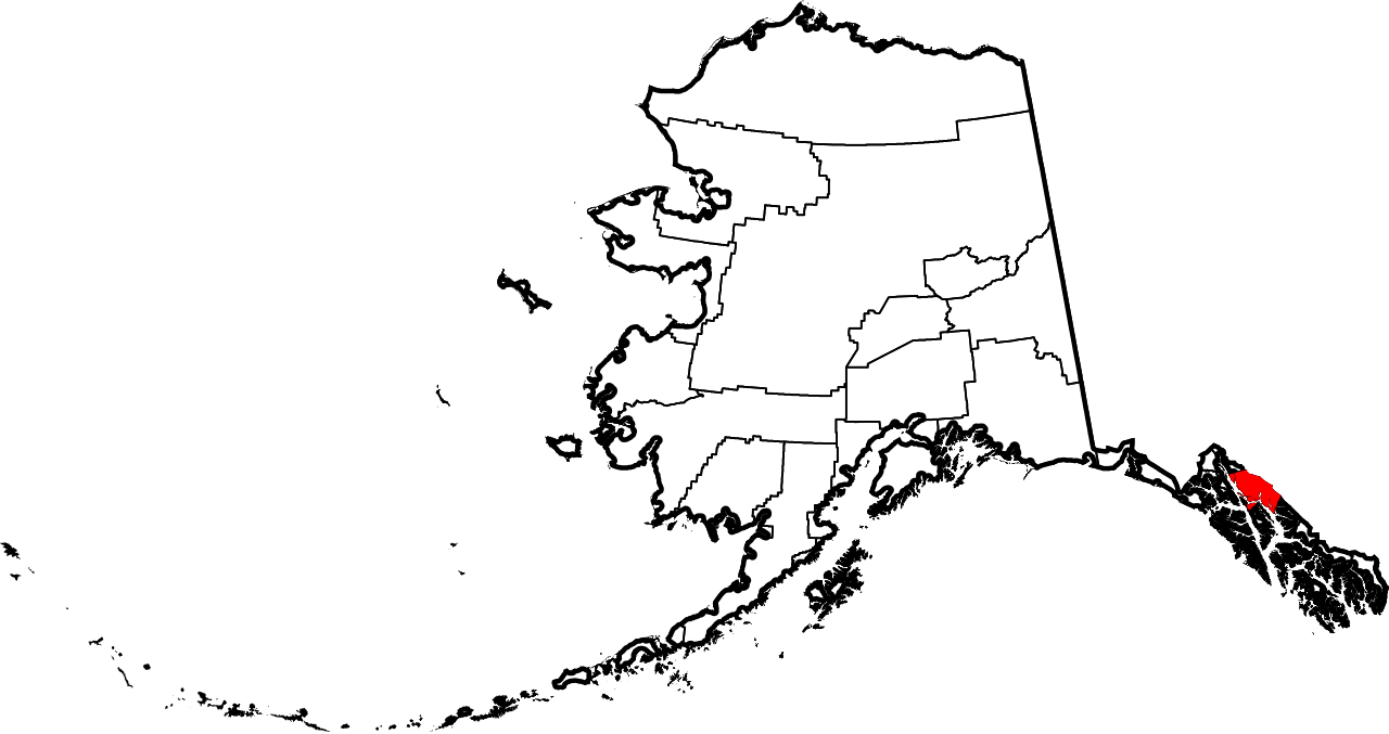
English: This is a locator map showing Juneau City and Borough in Alaska |
| Date | |
| Source |
Travail personnel: English: The maps use data from nationalatlas.gov, specifically countyp020.tar.gz on the Raw Data Download page. The maps also use state outline data from statesp020.tar.gz. The Florida maps use hydrogm020.tar.gz to display Lake Okeechobee. |
| Auteur | David Benbennick |
Conditions d’utilisation[modifier]
| Moi, propriétaire des droits d’auteur sur cette œuvre, la place dans le domaine public. Ceci s'applique dans le monde entier. Dans certains pays, ceci peut ne pas être possible ; dans ce cas : J’accorde à toute personne le droit d’utiliser cette œuvre dans n’importe quel but, sans aucune condition, sauf celles requises par la loi. |
Historique du fichier
Cliquer sur une date et heure pour voir le fichier tel qu'il était à ce moment-là.
| Date et heure | Vignette | Dimensions | Utilisateur | Commentaire | |
|---|---|---|---|---|---|
| actuel | 5 mars 2006 à 19:26 | | 1 470 × 777 (338 kio) | David Benbennick (d | contributions) | {{subst:User:Dbenbenn/clm|county=Juneau City and Borough|state=Alaska|type=borough and census area}} |
Vous ne pouvez pas remplacer ce fichier.
Utilisations locales du fichier
Aucune page n’utilise ce fichier.
Utilisations du fichier sur d’autres wikis
Les autres wikis suivants utilisent ce fichier :
- Utilisation sur bpy.wikipedia.org
- Utilisation sur ca.wikipedia.org
- Utilisation sur de.wikipedia.org
- Utilisation sur en.wikipedia.org
- List of boroughs and census areas in Alaska
- Juneau Empire
- Eaglecrest Ski Area
- Stephens Passage
- Gastineau Channel
- Wikipedia:WikiProject Alaska
- Capital City Weekly
- Adair-Kennedy Memorial Park
- Mount Roberts (Alaska)
- Lincoln Island (Alaska)
- Point Sherman Light
- Sentinel Island Light
- Mendenhall Lake
- ABC Islands (Alaska)
- Red Dog Saloon
- Alaska Electric Light & Power
- Snettisham hydroelectric power plant
- Quartz Gulch
- Dipyramid (Alaska)
- Vanderbilt Reef
- Taku Harbor
- Template:JuneauAK-geo-stub
- National Register of Historic Places listings in Juneau, Alaska
- Mount Nesselrode
- Whiting River
- Auke Lake
- Kakuhan Range
- Nugget Falls
- Thunder Mountain High School
- Douglas Harbor
- Lena Beach, Juneau
- Kootznoowoo Wilderness
- Bacon Glacier
- New Boston, Juneau
- Starr Hill, Juneau
- West Juneau, Alaska
- Aaron Island (Alaska)
- Tolch Rock
- Fish Creek (Douglas Island, Juneau, Alaska)
- Tee Harbor, Juneau
- Amherst Peak
- Table Top Mountain (Juneau, Alaska)
- Mount Troy
- Ninemile Creek (Juneau, Alaska)
- Celebration (Alaska festival)
- Elevenmile Creek
Voir davantage sur l’utilisation globale de ce fichier.