File:Map of Russia - Tyumen Oblast (2008-03).svg
Jump to navigation
Jump to search

Size of this PNG preview of this SVG file: 800 × 462 pixels. Other resolutions: 320 × 185 pixels | 640 × 369 pixels | 1,024 × 591 pixels | 1,280 × 738 pixels | 2,560 × 1,477 pixels | 1,092 × 630 pixels.
Original file (SVG file, nominally 1,092 × 630 pixels, file size: 208 KB)
Captions
Captions
Add a one-line explanation of what this file represents
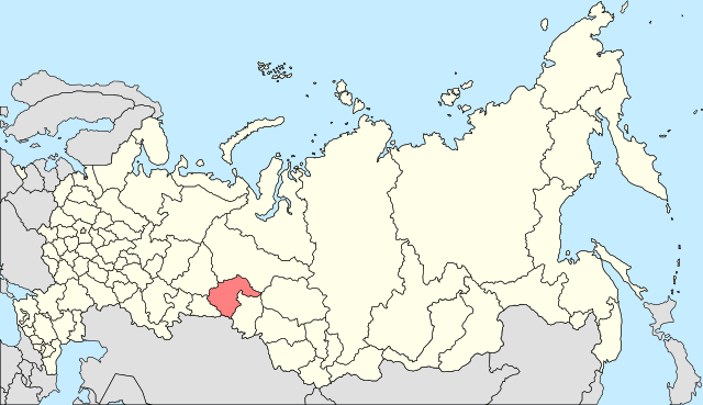
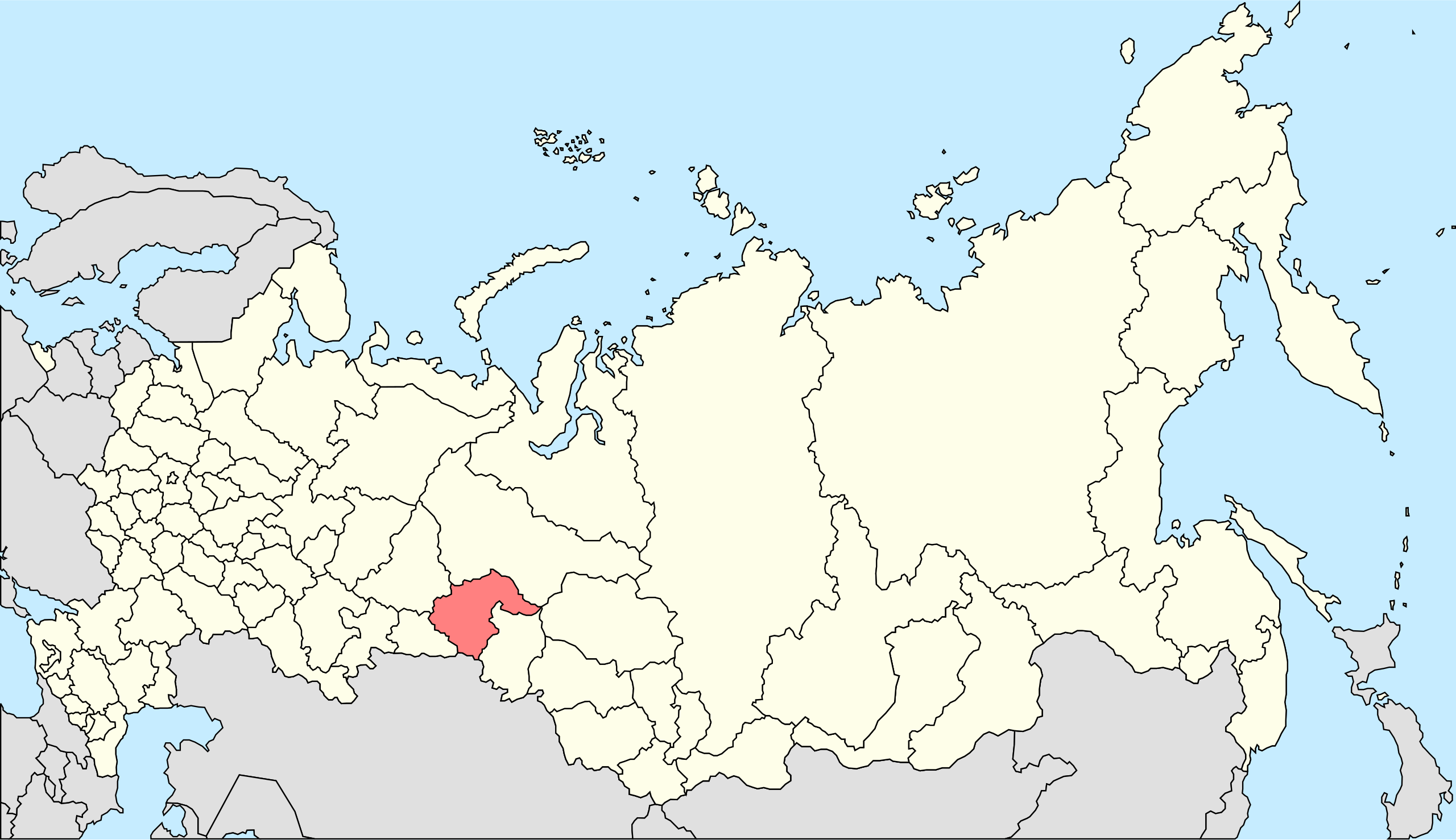
| Description | Autogenerated image to indicate Russian subjects as of 2008-03. Tyumen Oblast highlighted. Tyumen Oblast (region) includes Yamalo-Nenets and Khanty-Mansi (Ugra) AO (on the map you may see only part of Tyumen oblast, it is tyumen nearest location). For a map which includes the Yamalo-Nenets and Khanty-Mansi Autonomous Okrugs (administratively subordinated to Tyumen Oblast) please see Image:Map of Russia - Tyumen Oblast, Yamalo-Nenets and Khanty-Mansi Autonomous Okrugs (2008-03).svg. |
| Date | |
| Source | Made from Image:Map of Russian subjects, 2008-03-01.svg |
| Author | Marmelad |
| Permission (Reusing this file) |
Attribution ShareAlike 2.5 |
.svg)
This file is licensed under the Creative Commons Attribution-Share Alike 2.5 Generic license.
- You are free:
- to share – to copy, distribute and transmit the work
- to remix – to adapt the work
- Under the following conditions:
- attribution – You must give appropriate credit, provide a link to the license, and indicate if changes were made. You may do so in any reasonable manner, but not in any way that suggests the licensor endorses you or your use.
- share alike – If you remix, transform, or build upon the material, you must distribute your contributions under the same or compatible license as the original.
File history
Click on a date/time to view the file as it appeared at that time.
| Date/Time | Thumbnail | Dimensions | User | Comment | |
|---|---|---|---|---|---|
| current | 17:52, 4 February 2010 | | 1,092 × 630 (208 KB) | Виктор В (talk | contribs) | new colors |
| 16:45, 28 May 2009 |  | 1,092 × 630 (222 KB) | Egor13 (talk | contribs) | full size RF | |
| 16:33, 28 May 2009 |  | 744 × 1,052 (209 KB) | Egor13 (talk | contribs) | real region territory | |
| 18:22, 27 January 2008 |  | 1,092 × 630 (222 KB) | Marmelad (talk | contribs) | {{Information |Description=Autogenerated image to indicate Russian subjects as of 2008-03. Subject as indicated by filename. |Source=Made from Image:Map of Russian subjects, 2008-03-01.svg |Date=2008-01-27 |Author=Marmelad |Permissi |
You cannot overwrite this file.
File usage on Commons
There are no pages that use this file.
File usage on other wikis
The following other wikis use this file:
- Usage on ace.wikipedia.org
- Usage on bs.wikipedia.org
- Usage on cs.wikipedia.org
- Usage on de.wikipedia.org
- Usage on en.wikipedia.org
- Usage on fi.wikipedia.org
- Usage on hak.wikipedia.org
- Usage on no.wikipedia.org
- Usage on pnb.wikipedia.org
- Usage on si.wikipedia.org
- Usage on sk.wikipedia.org
- Usage on sl.wikipedia.org
- Usage on sw.wikipedia.org
- Usage on tl.wikipedia.org
- Usage on war.wikipedia.org
- Usage on zh.wikipedia.org
.svg&oldid=456701552)