File:Namibia Regions Omaheke 250px.png
Jump to navigation
Jump to search
No higher resolution available.
Namibia_Regions_Omaheke_250px.png (250 × 254 pixels, file size: 15 KB, MIME type: image/png)
Captions
Captions
Add a one-line explanation of what this file represents
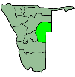
Map of the Omaheke region in Namibia. found on en.wikipedia.org.
| Description |
Credit: Sascha Noyes, 2004 Info: Map of the Omaheke Region in Namibia; Created with the GIMP
|
||||||||
| Source | Originally from en.wikipedia; description page is (was) here | ||||||||
| Author | User Snoyes on en.wikipedia | ||||||||
| Permission (Reusing this file) |
|

File history
Click on a date/time to view the file as it appeared at that time.
| Date/Time | Thumbnail | Dimensions | User | Comment | |
|---|---|---|---|---|---|
| current | 15:03, 21 April 2005 | | 250 × 254 (15 KB) | Bries (talk | contribs) | Map of the Omaheke region in Namibia. found on en.wikipedia.org. Category:Maps of Namibia {{GFDL}} |
You cannot overwrite this file.
File usage on Commons
There are no pages that use this file.
File usage on other wikis
The following other wikis use this file:
- Usage on bg.wikipedia.org
- Usage on ca.wikipedia.org
- Usage on eo.wikipedia.org
- Usage on fa.wikipedia.org
- Usage on fo.wikipedia.org
- Usage on hi.wikipedia.org
- Usage on hr.wikipedia.org
- Usage on it.wikipedia.org
- Usage on lt.wikipedia.org
- Usage on pl.wikipedia.org
- Usage on pnb.wikipedia.org
- Usage on pt.wikipedia.org
- Usage on ro.wikipedia.org
- Usage on sk.wikipedia.org
- Usage on ur.wikipedia.org