Category:Cambridge
Jump to navigation
Jump to search
English: Cambridge is a city in England, UK.
Français : Cambridge est une ville anglaise.
Nederlands: Cambridge is een stad in Engeland.
Main Wikipedia article: Cambridge.
city in Cambridgeshire, England   | |||||
| Upload media | |||||
| Instance of |
| ||||
|---|---|---|---|---|---|
| Location | Cambridge, Cambridgeshire, East of England, England | ||||
| Legislative body | |||||
| Official language | |||||
| Inception |
| ||||
| Population |
| ||||
| Area |
| ||||
| Elevation above sea level |
| ||||
| Different from | |||||
| official website | |||||
 | |||||
Subcategories
This category has the following 32 subcategories, out of 32 total.
A
- Audio files of Cambridge (2 F)
B
C
- Coats of arms of Cambridge (10 F)
E
F
- Farms in Cambridge (259 F)
G
H
L
N
O
- Open Cambridge (12 F)
P
R
S
T
V
Pages in category "Cambridge"
The following 2 pages are in this category, out of 2 total.
Media in category "Cambridge"
The following 200 files are in this category, out of 591 total.
(previous page) (next page)-

-
 20 MPH zone - geograph.org.uk - 6430616.jpg 1,024 × 681; 164 KB
-
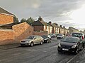
 25, 27 High Street, Chesterton, Cambridge - geograph.org.uk - 6351300.jpg 1,280 × 861; 412 KB
-
 A bird scarer on Downing College Sports Ground - geograph.org.uk - 6413922.jpg 1,024 × 768; 756 KB
-
 A changed view towards Addenbrooke's Hospital - geograph.org.uk - 6432903.jpg 1,024 × 768; 834 KB
-
 A changing view on Hooper Street - geograph.org.uk - 6334713.jpg 1,024 × 683; 683 KB
-
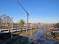
 A crane on the Cambridge Union site - geograph.org.uk - 6297024.jpg 1,024 × 819; 901 KB
-
 A dead tree on the edge of Cambridge - geograph.org.uk - 6302383.jpg 1,024 × 1,024; 1.32 MB
-
 A new close off Perne Road - geograph.org.uk - 6322381.jpg 1,024 × 1,024; 1.09 MB
-
 A new cycle path on the edge of Cambridge - geograph.org.uk - 6420182.jpg 1,024 × 731; 904 KB
-
 A new house on Baldock Way - geograph.org.uk - 6385521.jpg 1,024 × 1,024; 1.19 MB
-
 A new view towards Perne Road - geograph.org.uk - 6322379.jpg 1,024 × 1,024; 1.2 MB
-
 A picket line at Homerton College - geograph.org.uk - 6331840.jpg 800 × 800; 792 KB
-
 A Plant, Swann's Road - geograph.org.uk - 6351757.jpg 960 × 1,280; 1.02 MB
-
 A sprinkling of snow on Sheep's Green, 1997 - geograph.org.uk - 6409240.jpg 1,024 × 683; 570 KB
-
 A wet morning on King's Parade - geograph.org.uk - 6342473.jpg 819 × 1,024; 929 KB
-
 A wet October morning - geograph.org.uk - 6294368.jpg 1,024 × 1,024; 1.23 MB
-
 Abbey-Chesterton Bridge developments - geograph.org.uk - 6407745.jpg 1,024 × 768; 855 KB
-
 Abbey-Chesterton Bridge works - geograph.org.uk - 6371120.jpg 1,024 × 1,024; 1.41 MB
-
 Abbey-Chesterton Bridge works - south bank - geograph.org.uk - 6407751.jpg 1,024 × 1,024; 1.05 MB
-
 Across All Saints' Garden - geograph.org.uk - 6385293.jpg 1,024 × 1,024; 1.48 MB
-
 Across St Matthew's Piece - geograph.org.uk - 6334505.jpg 819 × 1,024; 1.49 MB
-
 Across the Cam on a rainy morning - geograph.org.uk - 6392218.jpg 1,024 × 1,024; 1,005 KB
-
 Adkins Corner rebuilding - geograph.org.uk - 6278364.jpg 1,024 × 1,024; 1.11 MB
-
 Air ambulance and Abcam - geograph.org.uk - 6378499.jpg 1,024 × 768; 862 KB
-
 Air ambulance and Addenbrooke's Hospital - geograph.org.uk - 6378501.jpg 1,024 × 768; 908 KB
-
 Alfred Close, Queen Edith's Way - geograph.org.uk - 6368639.jpg 1,024 × 768; 883 KB
-
 Allotments at Trumpington Meadows - geograph.org.uk - 6341896.jpg 1,024 × 768; 1.1 MB
-
 Almoners' Avenue, roofs on - geograph.org.uk - 6418589.jpg 1,024 × 819; 1.08 MB
-
 Almoners' Avenue, site clearance - geograph.org.uk - 6302555.jpg 1,024 × 683; 773 KB
-
 Almoners' Avenue, turning leaves - geograph.org.uk - 6302373.jpg 1,024 × 683; 726 KB
-
 Almoners' Avenue, winter sunlight - geograph.org.uk - 6338761.jpg 1,024 × 731; 982 KB
-
 Along Abbey Walk - geograph.org.uk - 6353894.jpg 1,024 × 1,024; 1.23 MB
-
 Along Cross Street - geograph.org.uk - 6426577.jpg 1,024 × 768; 758 KB
-
 Along Davy Road in November - geograph.org.uk - 6326409.jpg 1,024 × 1,024; 1.51 MB
-
 Along Hills Avenue in early October - geograph.org.uk - 6292735.jpg 1,024 × 1,024; 1.38 MB
-
 Along New Park Street - geograph.org.uk - 6297016.jpg 1,024 × 1,024; 1.07 MB
-
 Along Newton Road - geograph.org.uk - 6427605.jpg 1,024 × 683; 850 KB
-
 Along Perne Avenue - geograph.org.uk - 6348119.jpg 1,024 × 1,024; 1.41 MB
-
 Along Trafalgar Street - geograph.org.uk - 6285433.jpg 819 × 1,024; 951 KB
-
 Along Trumpington Street - geograph.org.uk - 6402337.jpg 1,024 × 1,024; 1.11 MB
-
 An extension on Derwent Close - geograph.org.uk - 6390221.jpg 1,024 × 732; 868 KB
-
 Angel on a cross - geograph.org.uk - 6351747.jpg 1,280 × 1,280; 769 KB
-

-
-

-

-

-
 Approaching Bellatrix on the cycle path - geograph.org.uk - 6348904.jpg 1,024 × 768; 871 KB
-
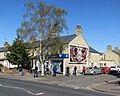
 Arbury Road Baptist Church, Cambridge - geograph.org.uk - 6351288.jpg 1,280 × 960; 482 KB
-
 Arbury Road, Cambridge - geograph.org.uk - 6351292.jpg 1,280 × 896; 378 KB
-
 At the corner of Latham Road - geograph.org.uk - 6427633.jpg 1,024 × 819; 1.01 MB
-
 At the end of Covent Garden - geograph.org.uk - 6426583.jpg 1,024 × 768; 936 KB
-
 At the Mowbray Road end of the Rock Allotments - geograph.org.uk - 6385529.jpg 819 × 1,024; 1.12 MB
-
 Bancroft Close birches - geograph.org.uk - 6314220.jpg 1,024 × 819; 1,008 KB
-
 Bare branches on Bentley Road - geograph.org.uk - 6427221.jpg 819 × 1,024; 1.2 MB
-
 Bateman St - geograph.org.uk - 6430605.jpg 1,024 × 681; 173 KB
-
 Beechwood Medical Centre - geograph.org.uk - 6430607.jpg 1,024 × 681; 225 KB
-
 Before the 1997 General Election - geograph.org.uk - 6395256.jpg 1,024 × 682; 952 KB
-
 Blackbird, Mill Road Cemetery - geograph.org.uk - 6353708.jpg 960 × 1,280; 653 KB
-
 Blue sky and white walls - geograph.org.uk - 6359195.jpg 819 × 1,024; 804 KB
-
 Blue sky over Kaleidoscope - geograph.org.uk - 6359045.jpg 1,024 × 1,024; 1.16 MB
-
 Blue sky, blue water, blue hospital - geograph.org.uk - 6372012.jpg 1,024 × 731; 853 KB
-
 Bolton's Warehouse - geograph.org.uk - 6309228.jpg 480 × 640; 72 KB
-
 Botanic House - geograph.org.uk - 6336821.jpg 640 × 480; 63 KB
-
 Bowers Croft birches - geograph.org.uk - 6343813.jpg 1,024 × 768; 1.02 MB
-
 Brackyn Road on a February afternoon - geograph.org.uk - 6399007.jpg 1,024 × 731; 950 KB
-
 Brook House - geograph.org.uk - 6430774.jpg 639 × 1,024; 206 KB
-
 Brooklands Avenue and The Royal Albert Homes - geograph.org.uk - 6359288.jpg 1,024 × 682; 898 KB
-
 Brooklands Avenue, autumn sunlight - geograph.org.uk - 6323442.jpg 1,024 × 1,024; 1.85 MB
-
 Brookside - geograph.org.uk - 6430646.jpg 1,024 × 681; 206 KB
-
 Brookside, Cambridge - geograph.org.uk - 6348409.jpg 4,032 × 3,024; 6.42 MB
-
 Building at Gwydir Street Enterprise Centre - geograph.org.uk - 6353800.jpg 1,280 × 1,012; 316 KB
-
 Building at Magdalene College - geograph.org.uk - 6384848.jpg 819 × 1,024; 1.03 MB
-
 Building on the Mill Road Depot site - geograph.org.uk - 6414467.jpg 1,024 × 768; 960 KB
-
 Building on the Mill Road Depot site - geograph.org.uk - 6426591.jpg 819 × 1,024; 1.3 MB
-
 Building site at the end of Almoners' Avenue - geograph.org.uk - 6338757.jpg 1,024 × 731; 956 KB
-
 Building the Cambridge Heart and Lung Research Institute - geograph.org.uk - 6411968.jpg 1,024 × 1,024; 1.11 MB
-
 Building work at Clare College - geograph.org.uk - 6365725.jpg 1,024 × 768; 914 KB
-
 Building work at Clay Farm - geograph.org.uk - 6400651.jpg 819 × 1,024; 932 KB
-
 Building work at Magdalene College - geograph.org.uk - 6296896.jpg 819 × 1,024; 1.07 MB
-
 Burleigh Street in the time of Coronavirus - geograph.org.uk - 6427895.jpg 1,024 × 768; 238 KB
-
 Bus on the Busway to Cambridge North - geograph.org.uk - 6351260.jpg 1,280 × 843; 350 KB
-
 Business Centre, Station Rd - geograph.org.uk - 6430599.jpg 681 × 1,024; 198 KB
-
 Busway crossing - geograph.org.uk - 6351267.jpg 1,280 × 960; 511 KB
-
 Busway, bus, cycle path and Clay Farm crane - geograph.org.uk - 6369591.jpg 1,024 × 768; 868 KB
-
 Cambridge 104.jpg 3,648 × 5,472; 14.57 MB
-
 Cambridge Audi, Babraham Road - geograph.org.uk - 6422551.jpg 1,024 × 732; 742 KB
-

-
 Cambridge Biomedical Campus, clearing a new site - geograph.org.uk - 6431269.jpg 1,024 × 819; 892 KB
-
 Cambridge Biomedical Campus, Project Atria - geograph.org.uk - 6411979.jpg 1,024 × 768; 1.01 MB
-
 Cambridge City Cemetery - geograph.org.uk - 6351742.jpg 1,280 × 960; 492 KB
-
 Cambridge City Cemetery - geograph.org.uk - 6351749.jpg 1,280 × 833; 362 KB
-
 Cambridge Farmers' Outlet - geograph.org.uk - 6430626.jpg 1,024 × 681; 153 KB
-
 Cambridge Half Marathon runners on Sidney Street - geograph.org.uk - 6414112.jpg 3,807 × 2,855; 2.01 MB
-
 Cambridge Leisure Car Park changing colour - geograph.org.uk - 6307602.jpg 1,024 × 768; 942 KB
-
 Cambridge Market Square and Great St Mary's - geograph.org.uk - 6385310.jpg 1,024 × 1,024; 1.09 MB
-
 Cambridge Nuffield Hospital - geograph.org.uk - 6427618.jpg 1,024 × 732; 913 KB
-
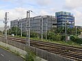
 Cambridge Science Park cranes - geograph.org.uk - 6350168.jpg 1,024 × 683; 790 KB
-
 Cambridge UK ward map 2024.svg 1,319 × 1,266; 119 KB
-
 Cambridge United's Abbey Stadium - geograph.org.uk - 6425034.jpg 1,024 × 682; 675 KB
-
 Cambridge War Memorial - geograph.org.uk - 6430601.jpg 1,024 × 681; 195 KB
-
 Cambridge War Memorial - geograph.org.uk - 6430604.jpg 1,024 × 681; 249 KB
-
 Cambridge's new carriage sidings - geograph.org.uk - 6285697.jpg 800 × 800; 681 KB
-
 Cambridge, a wet day for a General Election - geograph.org.uk - 6342469.jpg 819 × 1,024; 810 KB
-
 Cambridge, approaching Station Square - geograph.org.uk - 6335024.jpg 1,024 × 1,024; 1.09 MB
-
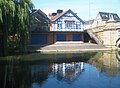 Cambridge, Christ's College boathouse - geograph.org.uk - 6304720.jpg 1,024 × 752; 183 KB
-
 Cambridge, Christmas coming - geograph.org.uk - 6329349.jpg 1,024 × 1,024; 1.1 MB
-
 Cambridge, Emmanuel College boathouse - geograph.org.uk - 6304953.jpg 1,024 × 756; 185 KB
-
 Cambridge, Former Cheddar's Lane pumping station - geograph.org.uk - 6304964.jpg 768 × 1,024; 156 KB
-
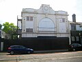 Cambridge, Former Tivoli Cinema - geograph.org.uk - 6304640.jpg 1,024 × 768; 125 KB
-
 Cambridge, Goldie boathouse - geograph.org.uk - 6304941.jpg 1,024 × 768; 161 KB
-
 Cambridge, Jesus Green - geograph.org.uk - 6304681.jpg 1,024 × 768; 315 KB
-
 Cambridge, Logan's Meadow Swift Tower - geograph.org.uk - 6304985.jpg 1,024 × 768; 230 KB
-
 Cambridge, railway buildings awaiting demolition, 2014 - geograph.org.uk - 6345598.jpg 1,024 × 1,024; 1.02 MB
-
 Cambridge, Station Square and Station Road - geograph.org.uk - 6334724.jpg 819 × 1,024; 945 KB
-
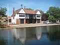
 Cambridge, The Boathouse - geograph.org.uk - 6304661.jpg 1,024 × 756; 141 KB
-
 Cambridge, Trinity Hall boathouse - geograph.org.uk - 6304945.jpg 1,024 × 768; 180 KB
-
 Cantabrigian Rowing Club, Christmas Day 2019 - geograph.org.uk - 6351759.jpg 1,280 × 899; 768 KB
-
 Car trap - geograph.org.uk - 6351258.jpg 1,280 × 960; 633 KB
-
 Catholic Church of St Vincent de Paul - geograph.org.uk - 6351740.jpg 1,280 × 868; 437 KB
-
 Cavendish III cranes - geograph.org.uk - 6366124.jpg 1,024 × 1,024; 1.1 MB
-
 CB1 development - geograph.org.uk - 6430597.jpg 1,024 × 681; 188 KB
-
 CCSS - geograph.org.uk - 6430598.jpg 1,024 × 681; 185 KB
-
 CCSS, Lensfield Rd - geograph.org.uk - 6430644.jpg 1,024 × 717; 162 KB
-
 Central Cambridge - geograph.org.uk - 6375773.jpg 3,008 × 2,000; 2.94 MB
-
 Changes at Adkins Corner - geograph.org.uk - 6355901.jpg 1,024 × 819; 968 KB
-
 Changes at the end of Almoners' Avenue - geograph.org.uk - 6372215.jpg 1,024 × 732; 1,001 KB
-
 Changes on Hills Road - geograph.org.uk - 6402341.jpg 1,024 × 682; 802 KB
-
 Cheddars Lane and the Pumping Station chimney - geograph.org.uk - 6378003.jpg 1,024 × 768; 770 KB
-
 Cherry Hinton Road almost deserted - geograph.org.uk - 6428391.jpg 1,024 × 683; 801 KB
-
 Cherry Hinton Road and Cowper Road - geograph.org.uk - 6389640.jpg 1,024 × 683; 837 KB
-
 Cherry Hinton Road in early March - geograph.org.uk - 6403649.jpg 1,024 × 1,024; 1.22 MB
-
 Cherry Hinton Road on a December morning - geograph.org.uk - 6341718.jpg 1,024 × 1,024; 1.09 MB
-
 Cherry Hinton Road on a November morning - geograph.org.uk - 6332509.jpg 1,024 × 682; 730 KB
-
 Cherry Hinton Road, Boots ready for re-slating - geograph.org.uk - 6405299.jpg 1,024 × 1,024; 1.3 MB
-
-
 Cherry Hinton Road, magnolia at the crossroads - geograph.org.uk - 6401232.jpg 768 × 1,024; 1.07 MB
-
 Cherry Hinton Road, slater at work - geograph.org.uk - 6412647.jpg 1,024 × 1,024; 1.34 MB
-
 Cherry Hinton Road, The Garden Library - geograph.org.uk - 6283980.jpg 819 × 1,024; 898 KB
-
 Cherry Hinton Road, waiting at the lights - geograph.org.uk - 6401235.jpg 1,024 × 1,024; 1.22 MB
-
 Chesterton, at Fen Road level crossing - geograph.org.uk - 6377865.jpg 819 × 1,024; 1,007 KB
-
 Chesterton, Fallowfield - geograph.org.uk - 6339236.jpg 1,024 × 732; 967 KB
-
 Chesterton, foundations for the new cycle bridge - geograph.org.uk - 6306430.jpg 1,024 × 768; 985 KB
-
 Chesterton, Mansfield Almshouses, Church Street - geograph.org.uk - 6377983.jpg 1,024 × 1,024; 1.05 MB
-
 Chesterton, on Church Street - geograph.org.uk - 6377994.jpg 1,024 × 1,024; 995 KB
-
 Chesterton, Pye Terrace, Church Street - geograph.org.uk - 6377963.jpg 1,024 × 819; 847 KB
-
 Chesterton, Two Tees Boatyard - geograph.org.uk - 6429114.jpg 800 × 533; 406 KB
-

-
 Chesterton, winter sunlight, Church Street - geograph.org.uk - 6377959.jpg 923 × 1,024; 1.07 MB
-
 Chisholm Trail construction, Ditton Meadows - geograph.org.uk - 6351733.jpg 1,280 × 872; 399 KB
-
 Chisholm Trail works near Barnwell Lake - geograph.org.uk - 6414514.jpg 1,024 × 768; 1.01 MB
-
 Church of Our Lady and The English Martyrs - geograph.org.uk - 6430620.jpg 681 × 1,024; 213 KB
-
 Church of Our Lady and The English Martyrs - geograph.org.uk - 6430623.jpg 681 × 1,024; 183 KB
-
 Church of St Andrew, Chesterton - geograph.org.uk - 6351308.jpg 1,280 × 960; 446 KB
-
 Church of St Andrew, Chesterton - geograph.org.uk - 6351312.jpg 1,280 × 1,280; 525 KB
-
 Church of St Andrew, Chesterton - geograph.org.uk - 6351315.jpg 1,280 × 872; 384 KB
-
 Church of St Andrew, Chesterton - geograph.org.uk - 6351317.jpg 1,280 × 911; 332 KB
-
 Church of St Andrew, Chesterton - geograph.org.uk - 6351425.jpg 1,280 × 1,280; 576 KB
-
 Church of St Andrew, Chesterton - geograph.org.uk - 6351427.jpg 960 × 1,280; 505 KB
-
 Church of St Andrew, Chesterton - geograph.org.uk - 6351434.jpg 931 × 1,280; 374 KB
-
 Church of St Andrew, Chesterton - geograph.org.uk - 6351438.jpg 960 × 1,280; 493 KB
-
 Church of St Andrew, Chesterton - geograph.org.uk - 6351443.jpg 1,097 × 1,280; 347 KB
-
 Church of St Paul - geograph.org.uk - 6430610.jpg 681 × 1,024; 146 KB
-
 Church of St Paul - geograph.org.uk - 6430613.jpg 681 × 1,024; 153 KB
-
 Church of St Paul - geograph.org.uk - 6430615.jpg 681 × 1,024; 131 KB
-
 Clare Bridge from Garret Hostel Lane, Cambridge - geograph.org.uk - 6417271.jpg 1,600 × 1,067; 561 KB
-
 Clare College garden with the College behind - geograph.org.uk - 6334509.jpg 1,024 × 678; 204 KB
-
 Clare College gardens - geograph.org.uk - 6334518.jpg 687 × 1,024; 181 KB
-
 Clare College Gate to The Backs - geograph.org.uk - 6299079.jpg 819 × 1,024; 1.18 MB
-
 Clay Farm Square - geograph.org.uk - 6369554.jpg 1,024 × 1,024; 1.82 MB
-
 Clay Farm, spring blossom on Northrop Road - geograph.org.uk - 6423571.jpg 1,024 × 768; 788 KB
-
 Clay Farm, The Aura Building, Northrop Road - geograph.org.uk - 6423569.jpg 1,024 × 1,024; 989 KB
-
 Clay Farm, the latest phase - geograph.org.uk - 6369552.jpg 1,024 × 1,024; 1.34 MB
-
 Closed cycle track to Cambridge North Station - geograph.org.uk - 6307385.jpg 819 × 1,024; 1.4 MB
-
 Coleridge Rec on a November afternoon - geograph.org.uk - 6317900.jpg 819 × 1,024; 1.28 MB
-
 Coleridge Rec on a winter afternoon - geograph.org.uk - 6337654.jpg 1,024 × 1,024; 1.71 MB
-
 Coleridge Rec, green willow and February snow - geograph.org.uk - 6399683.jpg 1,024 × 768; 1.08 MB
-
 Coleridge Rec, life goes on - geograph.org.uk - 6424483.jpg 819 × 1,024; 1.3 MB
-
 Coleridge Road, magnolia time - geograph.org.uk - 6412034.jpg 1,024 × 768; 989 KB
-
 Coleridge Road, sunlight and stormclouds - geograph.org.uk - 6398704.jpg 1,024 × 683; 746 KB
-
 Construction work north of Mill Road Bridge - geograph.org.uk - 6334485.jpg 1,024 × 768; 835 KB
-
 Corfield Court - geograph.org.uk - 6365549.jpg 1,067 × 1,600; 962 KB
-
 Corner cutting - geograph.org.uk - 6283935.jpg 1,024 × 731; 868 KB
-
 Cowper Road, after sunset in late December - geograph.org.uk - 6355001.jpg 1,024 × 1,024; 847 KB
-
 Cowper Road, downpour and sunlight - geograph.org.uk - 6289549.jpg 1,024 × 768; 751 KB
-
 Cowper Road, mist and frost - geograph.org.uk - 6332511.jpg 1,024 × 683; 737 KB
-
 Cowper Road, new slates at Boots - geograph.org.uk - 6405295.jpg 819 × 1,024; 937 KB
-
 Cowper Road, roofers at work - geograph.org.uk - 6394216.jpg 819 × 1,024; 1.05 MB
-
 Cowper Road, the first snow of the year - geograph.org.uk - 6399688.jpg 1,024 × 768; 862 KB
-
 Cranes on the West Cambridge Site - geograph.org.uk - 6402262.jpg 1,024 × 1,024; 1.23 MB
-
 Cranes over the Cavendish III site - geograph.org.uk - 6366133.jpg 1,024 × 819; 847 KB
-
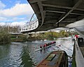 Crew and coach at Riverside Bridge - geograph.org.uk - 6396677.jpg 1,024 × 819; 965 KB
-
 Croft Gardens, exclusion zone - geograph.org.uk - 6413939.jpg 1,024 × 731; 706 KB
-
 Cross of Sacrifice, Cambridge City Cemetery - geograph.org.uk - 6351745.jpg 1,280 × 775; 501 KB
-
 Crossing Riverside Bridge - geograph.org.uk - 6378001.jpg 1,024 × 819; 802 KB
-
 Crossing the Cam - geograph.org.uk - 6371118.jpg 819 × 1,024; 1.02 MB
-
 Cycle path, busway and railway - geograph.org.uk - 6283908.jpg 1,024 × 682; 898 KB
-
 Cycle path, busway and railway - geograph.org.uk - 6411879.jpg 1,024 × 819; 1,016 KB
-
 Darwin College from Laundress Green - geograph.org.uk - 6382474.jpg 819 × 1,024; 1.18 MB


