Category:Fulmer
Jump to navigation
Jump to search
English: Fulmer is a village and civil parish within South Bucksdistrict in Buckinghamshire, England. Originally a village in its own right, today it is considered by many to be a part of Gerrards Cross, though residents of Fulmer like to maintain that it is a separate place.
Français : Fulmer est un village d'Angleterre situé dans le sud du Buckinghamshire. Il est aujourd'hui considéré par de nombreuses personnes comme faisant partie de Gerrards Cross.
village in Buckinghamshire, United Kingdom  | |||||
| Upload media | |||||
| Instance of | |||||
|---|---|---|---|---|---|
| Location | Buckinghamshire, South East England, England | ||||
| Area |
| ||||
| Said to be the same as | Fulmer (Wikimedia duplicated page, civil parish) | ||||
 | |||||
Subcategories
This category has the following 3 subcategories, out of 3 total.
Media in category "Fulmer"
The following 183 files are in this category, out of 183 total.
-
 Adopted K6 Telephone Box in Fulmer - geograph.org.uk - 5442702.jpg 1,944 × 2,592; 916 KB
-
 Alder Bourne - geograph.org.uk - 2084705.jpg 1,280 × 960; 454 KB
-
 Alder Bourne ford - geograph.org.uk - 2084707.jpg 1,280 × 960; 447 KB
-
 Alder Bourne Ford - geograph.org.uk - 6025545.jpg 3,648 × 2,736; 5.92 MB
-
 Alder Bourne Ford, Fulmer - geograph.org.uk - 5621523.jpg 2,304 × 1,728; 821 KB
-
 Alderbourne Lane at the junction of Fulmer Common Road - geograph.org.uk - 5621610.jpg 2,304 × 1,728; 799 KB
-
 Alderbourne Lane, Fulmer - geograph.org.uk - 5621576.jpg 2,304 × 1,728; 804 KB
-
 Alderbourne Lane, Fulmer - geograph.org.uk - 5624974.jpg 2,304 × 1,728; 796 KB
-
 Alderbourne Lane, Fulmer - geograph.org.uk - 5624994.jpg 2,304 × 1,728; 820 KB
-
 Alderbourne Lane, Langley Corner - geograph.org.uk - 5621585.jpg 1,728 × 2,304; 2.12 MB
-
 Alderbourne Lane, Langley Corner - geograph.org.uk - 5625348.jpg 2,304 × 1,728; 833 KB
-
 Approaching J1a, M40 - geograph.org.uk - 5654041.jpg 640 × 372; 55 KB
-
-
 Beeches Way (53) - geograph.org.uk - 3474764.jpg 800 × 600; 218 KB
-
 Beeches Way (54) - geograph.org.uk - 3474766.jpg 800 × 600; 185 KB
-
 Beeches Way (55) - geograph.org.uk - 3474768.jpg 800 × 600; 190 KB
-
 Beeches Way (58) - geograph.org.uk - 3474771.jpg 800 × 600; 89 KB
-
 Beeches Way (59) - geograph.org.uk - 3474772.jpg 600 × 800; 169 KB
-
 Beeches Way (60) - geograph.org.uk - 3474773.jpg 601 × 800; 37 KB
-
 Beeches Way (61) - geograph.org.uk - 3474774.jpg 800 × 600; 194 KB
-
 Beeches Way (62) - geograph.org.uk - 3474776.jpg 800 × 600; 140 KB
-
 Beeches Way (63) - geograph.org.uk - 3474777.jpg 800 × 600; 149 KB
-
 Beeches Way (64) - geograph.org.uk - 3474779.jpg 800 × 600; 178 KB
-
 Beeches Way (65) - geograph.org.uk - 3474780.jpg 800 × 600; 168 KB
-
 Beeches Way (66) - geograph.org.uk - 3474782.jpg 800 × 600; 158 KB
-
 Beeches Way - geograph.org.uk - 3301657.jpg 640 × 480; 150 KB
-
 Beeches Way, Fulmer Common - geograph.org.uk - 5624491.jpg 2,304 × 1,728; 801 KB
-
 Black Park Road near Fulmer - geograph.org.uk - 6099633.jpg 1,024 × 817; 692 KB
-
 Bridgettine Catholic Church, Fulmer - geograph.org.uk - 3195117.jpg 640 × 479; 141 KB
-

-

-
 Catholic Church - geograph.org.uk - 1475742.jpg 640 × 480; 94 KB
-
 Church Row, Fulmer - geograph.org.uk - 20802.jpg 640 × 480; 132 KB
-
 Cottages on Fulmer Road - geograph.org.uk - 5430576.jpg 1,993 × 1,470; 842 KB
-
 Derelict lodge near Fulmer - geograph.org.uk - 6100911.jpg 1,024 × 768; 659 KB
-
 Emergency access to M25 - geograph.org.uk - 4175585.jpg 640 × 480; 121 KB
-
 Emergency access to M25 near junction 16 - geograph.org.uk - 5431535.jpg 1,600 × 1,277; 807 KB
-

-
 Entrance to the Fulmer Rise Manor Estate - geograph.org.uk - 6026033.jpg 5,120 × 3,840; 7.28 MB
-
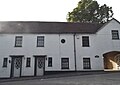
 Farm in Fulmer - geograph.org.uk - 912191.jpg 640 × 480; 120 KB
-
 Fields by Alder Bourne - geograph.org.uk - 4175576.jpg 640 × 480; 99 KB
-
 Fields near Alderbourne Farm - geograph.org.uk - 6026580.jpg 3,648 × 2,736; 3.96 MB
-
 Framewood Manor - Gatehouse - geograph.org.uk - 148463.jpg 640 × 480; 101 KB
-
 Fulmer Common Road - geograph.org.uk - 1475760.jpg 640 × 480; 97 KB
-
 Fulmer Common Road - geograph.org.uk - 3195127.jpg 640 × 480; 183 KB
-
 Fulmer Common Road - geograph.org.uk - 3195131.jpg 640 × 480; 174 KB
-
 Fulmer Common Road - geograph.org.uk - 5629553.jpg 2,304 × 1,728; 1.46 MB
-
 Fulmer Common Road - geograph.org.uk - 5629555.jpg 2,304 × 1,728; 1.78 MB
-
 Fulmer Common Road at the junction of Beeches Way - geograph.org.uk - 5624490.jpg 2,304 × 1,728; 811 KB
-
 Fulmer Common Road at the junction of Cherry Tree Lane - geograph.org.uk - 5629554.jpg 2,304 × 1,728; 1.54 MB
-
 Fulmer Common Road heads west - geograph.org.uk - 4865414.jpg 640 × 480; 83 KB
-

-

-
 Fulmer Drive, Gerrards Cross - geograph.org.uk - 20841.jpg 640 × 480; 135 KB
-
 Fulmer Lane at the junction of Fulmer Road - geograph.org.uk - 5429703.jpg 2,048 × 1,536; 996 KB
-
 Fulmer Lane at the junction of Hawkswood Lane - geograph.org.uk - 5432893.jpg 2,048 × 1,536; 1.52 MB
-
 Fulmer Lane, Tatling End - geograph.org.uk - 5624899.jpg 2,304 × 1,728; 821 KB
-

-
 Fulmer Road Bridge, M40 - geograph.org.uk - 2698755.jpg 640 × 448; 49 KB
-
 Fulmer Road Bridge, M40 - geograph.org.uk - 5654039.jpg 640 × 387; 42 KB
-
 Fulmer Road II, Fulmer - geograph.org.uk - 854485.jpg 640 × 480; 92 KB
-
 Fulmer Road leaving Fulmer - geograph.org.uk - 4865436.jpg 640 × 480; 53 KB
-
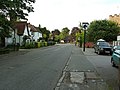
 Fulmer Road, Fulmer - geograph.org.uk - 3195259.jpg 640 × 480; 174 KB
-
 Fulmer Road, Fulmer - geograph.org.uk - 854473.jpg 640 × 480; 115 KB
-
 Fulmer Telephone Exchange (1) - geograph.org.uk - 1346073.jpg 640 × 480; 114 KB
-
 Fulmer Telephone Exchange (2) - geograph.org.uk - 1346078.jpg 640 × 480; 121 KB
-
 Fulmer village - geograph.org.uk - 5430575.jpg 2,048 × 1,536; 988 KB
-
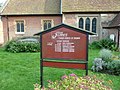
 Fulmer Village Hall - geograph.org.uk - 3195248.jpg 640 × 481; 177 KB
-
 Fulmer Village Hall - geograph.org.uk - 613408.jpg 640 × 480; 87 KB
-
 Fulmer, B416 Windsor Road - geograph.org.uk - 3792160.jpg 640 × 480; 89 KB
-

-

-
 Fulmer, Black Park Road - geograph.org.uk - 614215.jpg 640 × 480; 121 KB
-
 Fulmer, Black Park Road - geograph.org.uk - 614228.jpg 640 × 480; 141 KB
-
 Gantry over M25 and slip road at junction 16 of M25 - geograph.org.uk - 5431532.jpg 1,600 × 1,067; 640 KB
-
 Gateway to Fulmer Rise Manor - geograph.org.uk - 3465275.jpg 800 × 600; 207 KB
-
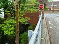
 Hawkswood Lane bridge over the M25 - geograph.org.uk - 6026229.jpg 5,120 × 3,840; 7.45 MB
-
 Hawkswood Lane bridge, M40 - geograph.org.uk - 2698758.jpg 640 × 430; 52 KB
-
 Hawkswood Lane crossing the M40 - geograph.org.uk - 5621903.jpg 2,304 × 1,728; 842 KB
-
 Horses being led in pairs east of Fulmer - geograph.org.uk - 3465267.jpg 800 × 600; 167 KB
-
 House on Fulmer Lane near Gerrards Cross - geograph.org.uk - 20847.jpg 640 × 480; 126 KB
-
 House on Fulmer Lane, Tatling End - geograph.org.uk - 5432911.jpg 2,048 × 1,536; 1.1 MB
-
 Houses at Allhusen Gardens, Fulmer - geograph.org.uk - 20813.jpg 640 × 480; 98 KB
-
 Inside of Adopted K6 Telephone Box, Fulmer - geograph.org.uk - 5442779.jpg 1,944 × 2,592; 926 KB
-
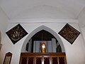
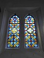
 Inside St James, Fulmer (a) - geograph.org.uk - 5073428.jpg 640 × 480; 37 KB
-
 Inside St James, Fulmer (b) - geograph.org.uk - 5073429.jpg 480 × 640; 93 KB
-
 Inside St James, Fulmer (c) - geograph.org.uk - 5073431.jpg 640 × 480; 54 KB
-
 Inside St James, Fulmer (d) - geograph.org.uk - 5073433.jpg 640 × 480; 43 KB
-
 Isolated House on Fulmer Lane - geograph.org.uk - 6025538.jpg 5,120 × 3,840; 6.86 MB
-
 Joining M25 from M40 eastbound - geograph.org.uk - 2208298.jpg 640 × 400; 270 KB
-
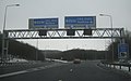
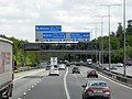
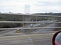
 Junction 1a-6, M40-M25 - geograph.org.uk - 2698762.jpg 640 × 398; 44 KB
-
-

-
 Langley Corner - geograph.org.uk - 4175572.jpg 640 × 480; 190 KB
-
 Looking west on Fulmer Common Road - geograph.org.uk - 3465279.jpg 600 × 800; 184 KB
-
 M25 clockwise, junction 16 - geograph.org.uk - 2866457.jpg 640 × 480; 35 KB
-
 M25 clockwise, junction 16 - geograph.org.uk - 2866755.jpg 640 × 459; 34 KB
-
-
 M25 northbound - geograph.org.uk - 4428382.jpg 640 × 459; 43 KB
-
 M25, Junction 16 - geograph.org.uk - 3445497.jpg 640 × 375; 37 KB
-
 M40 - geograph.org.uk - 5654036.jpg 640 × 388; 40 KB
-
 M40 at Gerrards Cross (1) - geograph.org.uk - 3096172.jpg 2,958 × 1,910; 4.6 MB
-
 M40 eastbound nears junction 1A for M25 - geograph.org.uk - 2213270.jpg 640 × 360; 232 KB
-
 M40 just west of M25 - geograph.org.uk - 4175567.jpg 640 × 480; 94 KB
-
 M40 motorway - geograph.org.uk - 854281.jpg 640 × 480; 78 KB
-

-

-

-

-
 M40 Motorway Junction 1a - geograph.org.uk - 614382.jpg 640 × 480; 89 KB
-

-

-
 M40 Motorway south of Gerrards Cross - geograph.org.uk - 2358047.jpg 640 × 480; 54 KB
-

-
 M40 motorway west of Hawkswood Lane - geograph.org.uk - 2358031.jpg 640 × 480; 57 KB
-
 M40 near Fulmer - geograph.org.uk - 2866405.jpg 640 × 480; 61 KB
-
 M40 near Gerrards Cross (2) - geograph.org.uk - 3179063.jpg 2,978 × 1,951; 3.32 MB
-
 M40 near Gerrards Cross - geograph.org.uk - 2869106.jpg 640 × 480; 47 KB
-
 M40 near Langley - geograph.org.uk - 3179048.jpg 3,036 × 2,010; 3.38 MB
-
 M40 northbound near Gerrards Cross - geograph.org.uk - 2869101.jpg 640 × 480; 36 KB
-
 M40 Sign Gantry near Gerrards Cross - geograph.org.uk - 3572432.jpg 640 × 480; 259 KB
-
 M40 slip road junction 1a - geograph.org.uk - 2449540.jpg 640 × 295; 38 KB
-
 M40 towards Oxford - geograph.org.uk - 2866393.jpg 640 × 465; 55 KB
-
 M40 towards Oxford - geograph.org.uk - 5946908.jpg 1,024 × 684; 209 KB
-
 M40, Hawkswood Lane overbridge - geograph.org.uk - 2449535.jpg 640 × 320; 25 KB
-
 M40, southbound - geograph.org.uk - 5654034.jpg 640 × 378; 51 KB
-
 M40, southbound - geograph.org.uk - 5654038.jpg 640 × 426; 46 KB
-
 Motorway equipment store under junction 16 of M25 - geograph.org.uk - 5431530.jpg 1,600 × 1,200; 834 KB
-
 Northbound M40, Furzeney Wood - geograph.org.uk - 3575948.jpg 640 × 480; 208 KB
-
 Pair of houses, Fulmer - geograph.org.uk - 3195277.jpg 640 × 480; 136 KB
-
 Parkspring Wood by Alderbourne Lane, Fulmer - geograph.org.uk - 5625346.jpg 2,304 × 1,728; 820 KB
-

-
 Pinewood Road at the junction of Alderbourne Lane - geograph.org.uk - 5624458.jpg 2,304 × 1,728; 1.69 MB
-
 Pylons across the field - geograph.org.uk - 1475859.jpg 640 × 480; 62 KB
-
 Row of houses on Hay Lane, Fulmer - geograph.org.uk - 3195156.jpg 640 × 480; 155 KB
-
 Slip road onto the M40 - geograph.org.uk - 2866389.jpg 640 × 480; 47 KB
-
 Slip road to the M25 - geograph.org.uk - 5654046.jpg 640 × 388; 66 KB
-
 Sodbury United Bikers Club - geograph.org.uk - 3421933.jpg 1,024 × 680; 242 KB
-
 Sodbury United Bikers Club - geograph.org.uk - 3427964.jpg 640 × 425; 52 KB
-
 Sodbury United Bikers Club - geograph.org.uk - 3427966.jpg 640 × 425; 65 KB
-
 Sodbury United Bikers Club - geograph.org.uk - 3427968.jpg 640 × 425; 54 KB
-
 South Bucks , M25 Motorway - geograph.org.uk - 6113676.jpg 6,000 × 4,000; 7.26 MB
-
 Southbound M40 near Fulmer - geograph.org.uk - 3572448.jpg 640 × 480; 243 KB
-
 Southbound M40, Gerrards Cross - geograph.org.uk - 3572438.jpg 640 × 480; 234 KB
-

-

-
-

-
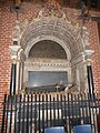
 St James, Fulmer, altar - geograph.org.uk - 5073437.jpg 480 × 640; 61 KB
-
 St James, Fulmer, banner - geograph.org.uk - 5073440.jpg 480 × 640; 26 KB
-
 St James, Fulmer, churchyard - geograph.org.uk - 5073436.jpg 480 × 640; 92 KB
-
 St James, Fulmer, font - geograph.org.uk - 5073425.jpg 480 × 640; 59 KB
-
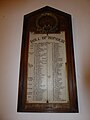
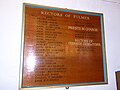 St James, Fulmer, incumbency board - geograph.org.uk - 5073435.jpg 640 × 480; 70 KB
-
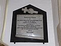
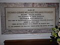
 St James, Fulmer, memorial (a) - geograph.org.uk - 5073409.jpg 640 × 480; 39 KB
-
 St James, Fulmer, memorial (b) - geograph.org.uk - 5073410.jpg 480 × 640; 59 KB
-
 St James, Fulmer, memorial (c) - geograph.org.uk - 5073411.jpg 640 × 480; 40 KB
-
 St James, Fulmer, memorial (d) - geograph.org.uk - 5073414.jpg 640 × 480; 47 KB
-
 St James, Fulmer, memorial (e) - geograph.org.uk - 5073415.jpg 640 × 480; 55 KB
-
 St James, Fulmer, memorial (f) - geograph.org.uk - 5073417.jpg 640 × 480; 63 KB
-
 St James, Fulmer, memorial (g) - geograph.org.uk - 5073418.jpg 480 × 640; 60 KB
-
 St James, Fulmer, memorial (h) - geograph.org.uk - 5073419.jpg 640 × 480; 52 KB
-
 St James, Fulmer, memorial (i) - geograph.org.uk - 5073421.jpg 640 × 480; 58 KB
-
 St James, Fulmer, memorial (j) - geograph.org.uk - 5073422.jpg 480 × 640; 43 KB
-
 St James, Fulmer, memorial (k) - geograph.org.uk - 5073423.jpg 640 × 480; 42 KB
-
 St James, Fulmer, mid August 2016 - geograph.org.uk - 5072585.jpg 640 × 480; 72 KB
-
 St James, Fulmer, path - geograph.org.uk - 5073424.jpg 480 × 640; 68 KB
-
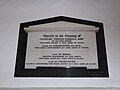
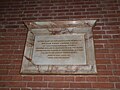
 St James, Fulmer, Roll of Honour - geograph.org.uk - 5073442.jpg 480 × 640; 46 KB
-

-

-
-

-

-

-

-
 Stoke Common Road - geograph.org.uk - 5431735.jpg 2,048 × 1,536; 1.56 MB
-
 Terrace of houses on Fulmer Road - geograph.org.uk - 5430574.jpg 1,934 × 1,368; 637 KB
-
 The entrance to Alderbourne Manor - geograph.org.uk - 5429696.jpg 2,048 × 1,536; 1.52 MB
-
 View by Hedgerley Lane, Gerrards Cross - geograph.org.uk - 5429685.jpg 2,048 × 1,536; 1.49 MB
-

-
 Windmill Road, Fulmer - geograph.org.uk - 3195284.jpg 640 × 480; 144 KB
-
 House near Dromenagh, New Denham - geograph.org.uk - 20469.jpg 640 × 480; 197 KB
-
 M25 at junction 16 - geograph.org.uk - 355719.jpg 640 × 473; 54 KB
-


_-_geograph.org.uk_-_3474764.jpg)
_-_geograph.org.uk_-_3474766.jpg)
_-_geograph.org.uk_-_3474768.jpg)
_-_geograph.org.uk_-_3474771.jpg)
_-_geograph.org.uk_-_3474772.jpg)
_-_geograph.org.uk_-_3474773.jpg)
_-_geograph.org.uk_-_3474774.jpg)
_-_geograph.org.uk_-_3474776.jpg)
_-_geograph.org.uk_-_3474777.jpg)
_-_geograph.org.uk_-_3474779.jpg)
_-_geograph.org.uk_-_3474780.jpg)
_-_geograph.org.uk_-_3474782.jpg)


_-_geograph.org.uk_-_1346073.jpg)
_-_geograph.org.uk_-_1346078.jpg)


_-_geograph.org.uk_-_5073428.jpg)
_-_geograph.org.uk_-_5073429.jpg)
_-_geograph.org.uk_-_5073431.jpg)
_-_geograph.org.uk_-_5073433.jpg)


_-_geograph.org.uk_-_3096172.jpg)


_-_geograph.org.uk_-_3179063.jpg)


_-_geograph.org.uk_-_5073409.jpg)
_-_geograph.org.uk_-_5073410.jpg)
_-_geograph.org.uk_-_5073411.jpg)
_-_geograph.org.uk_-_5073414.jpg)
_-_geograph.org.uk_-_5073415.jpg)
_-_geograph.org.uk_-_5073417.jpg)
_-_geograph.org.uk_-_5073418.jpg)
_-_geograph.org.uk_-_5073419.jpg)
_-_geograph.org.uk_-_5073421.jpg)
_-_geograph.org.uk_-_5073422.jpg)
_-_geograph.org.uk_-_5073423.jpg)


_-_geograph.org.uk_-_5073443.jpg)
_-_geograph.org.uk_-_5073444.jpg)
_-_geograph.org.uk_-_5073445.jpg)
_-_geograph.org.uk_-_5073446.jpg)
_-_geograph.org.uk_-_5073447.jpg)
_-_geograph.org.uk_-_5073448.jpg)
_-_geograph.org.uk_-_5073450.jpg)


