Category:Maesbrook
Jump to navigation
Jump to search
English: Maesbrook is a village in Shropshire, England. Maesbury and Maesbury Marsh are about a mile north of Maesbrook. Pant is also nearby, just north of Llanymynech.
village in Shropshire, United Kingdom  | |||||
| Upload media | |||||
| Instance of | |||||
|---|---|---|---|---|---|
| Location | Kinnerley, Shropshire, West Midlands, England | ||||
 | |||||
Media in category "Maesbrook"
The following 21 files are in this category, out of 21 total.
-
 Derelict cottages at Pentre perfa - geograph.org.uk - 532846.jpg 640 × 480; 90 KB
-
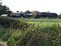 Farm buildings at Pentre perfa - geograph.org.uk - 532867.jpg 640 × 480; 110 KB
-
 Floods at Llwyntidmon - geograph.org.uk - 313597.jpg 640 × 480; 90 KB
-
 Footbridge over the River Morda - geograph.org.uk - 532756.jpg 640 × 480; 134 KB
-
 New houses at Four Ashes - geograph.org.uk - 313240.jpg 640 × 480; 98 KB
-
 Path of redundant railway line - geograph.org.uk - 532829.jpg 640 × 480; 107 KB
-
 Primitive Methodist Chapel at Pen-y-Parc - geograph.org.uk - 533629.jpg 640 × 480; 105 KB
-
 The Black Horse Inn at Maesbrook - geograph.org.uk - 532885.jpg 640 × 415; 112 KB
-
 Bridge beside redundant railway - geograph.org.uk - 532801.jpg 640 × 480; 136 KB
-
 Cattle loading place - geograph.org.uk - 515744.jpg 640 × 480; 106 KB
-
 Domgay Hall dairy farm - geograph.org.uk - 584986.jpg 640 × 480; 61 KB
-
 Farm bridge over the River Morda - geograph.org.uk - 578106.jpg 640 × 480; 100 KB
-
 Farmland and industrial units - geograph.org.uk - 313235.jpg 640 × 480; 90 KB
-

-
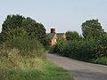
 Lane near Maesbrook - geograph.org.uk - 313234.jpg 640 × 480; 160 KB
-
 Lane to The Wood - geograph.org.uk - 313238.jpg 640 × 480; 146 KB
-

-
 Secluded drive to Caegweision Farm - geograph.org.uk - 532779.jpg 640 × 480; 140 KB
-

-

-


