Category:Milton Ernest
Jump to navigation
Jump to search
village and civil parish in Bedfordshire, UK  | |||||
| Upload media | |||||
| Instance of | |||||
|---|---|---|---|---|---|
| Location | Bedford, Bedfordshire, East of England, England | ||||
 | |||||
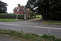
English: Milton Ernest is a village and civil parish in the Bedford district of Bedfordshire, England, and is about five miles north of Bedford itself. The village is situated on the east bank of the River Great Ouse, and is the site of Milton Ernest Hall, which was used as the US 8th air force's support command headquarters in the Second World War. [1]
Subcategories
This category has the following 3 subcategories, out of 3 total.
Media in category "Milton Ernest"
The following 48 files are in this category, out of 48 total.
-
 2014 Replacement of New Road Bridge, Milton Ernest, Bedfordshire.png 2,592 × 4,333; 10.88 MB
-
 A very large arable field - geograph.org.uk - 4741138.jpg 640 × 426; 62 KB
-
 BB Crash Repairs, Milton Ernest - geograph.org.uk - 6292609.jpg 1,892 × 1,236; 1.07 MB
-
 BB Crash Repairs, Milton Ernest - geograph.org.uk - 6292610.jpg 1,920 × 1,280; 1.62 MB
-
 Bedford Road leaving Milton Ernest - geograph.org.uk - 5426848.jpg 2,048 × 1,536; 1.47 MB
-
 Bedford Road, Oakley - geograph.org.uk - 6292612.jpg 1,920 × 1,280; 743 KB
-
 Bridleway to Red Gate Farm - geograph.org.uk - 4188825.jpg 1,200 × 1,600; 801 KB
-

-
 Butterfield Court, Milton Ernest - geograph.org.uk - 5426839.jpg 2,048 × 1,536; 903 KB
-
 Copse in the field by Twinwood Road - geograph.org.uk - 4188861.jpg 1,600 × 1,069; 355 KB
-
 Farmhouse on Bedford Road, Oakley - geograph.org.uk - 5426860.jpg 1,994 × 1,460; 627 KB
-
 Flewton End - geograph.org.uk - 3458922.jpg 1,600 × 1,200; 396 KB
-
 Gateway at Milton Ernest Hall - geograph.org.uk - 3458898.jpg 2,592 × 1,944; 1.13 MB
-
 Green on Rushden Road, Milton Ernest - geograph.org.uk - 6275414.jpg 1,854 × 1,174; 1.66 MB
-
 Green on Rushden Road, Milton Ernest - geograph.org.uk - 6292613.jpg 1,892 × 1,236; 1.64 MB
-

-
 Mill Cottage by the Bedford Road - geograph.org.uk - 4188830.jpg 1,600 × 1,068; 465 KB
-
 Milton Ernest, 1962 geograph-3378173-by-Ben-Brooksbank.jpg 2,361 × 1,245; 4 MB
-
 New Road Bridge, Milton Ernest, Bedfordshire.png 2,440 × 1,691; 3.81 MB
-
 Power over the pasture - geograph.org.uk - 4188867.jpg 1,600 × 1,067; 327 KB
-
 Queens Head Hotel - geograph.org.uk - 3458877.jpg 2,592 × 1,944; 1.15 MB
-
 Radwell Bridge (geograph 7570978).jpg 1,024 × 768; 261 KB
-
 Radwell Causeway - geograph.org.uk - 3020116.jpg 3,264 × 2,448; 3.23 MB
-
-
 River Great Ouse - geograph.org.uk - 4741139.jpg 640 × 426; 73 KB
-
 Stafford Bridge - geograph.org.uk - 83084.jpg 640 × 480; 61 KB
-
 Thatched barn by the Bedford Road - geograph.org.uk - 4188828.jpg 1,600 × 1,067; 407 KB
-
 The old Highfield Road - geograph.org.uk - 79527.jpg 640 × 480; 88 KB
-
 The Queen's Head Hotel, Milton Ernest - geograph.org.uk - 5426842.jpg 2,000 × 1,470; 799 KB
-
 The Queen's Head Hotel, Milton Ernest - geograph.org.uk - 6275413.jpg 1,840 × 1,148; 1.43 MB
-
 The Queen's Head Hotel, Milton Ernest - geograph.org.uk - 6292611.jpg 1,872 × 1,202; 1.43 MB
-
 The road to Yarl's Wood detention centre - geograph.org.uk - 4188864.jpg 1,600 × 1,067; 434 KB
-
 Twin woods Adventure jump tower - geograph.org.uk - 5081251.jpg 480 × 640; 36 KB
-

-
 Twinwood Airfield - geograph.org.uk - 595.jpg 640 × 480; 39 KB
-
 USAAF War Memorial - geograph.org.uk - 3458905.jpg 2,592 × 1,944; 1.18 MB
-
 View across the field to Yarl's Wood - geograph.org.uk - 4188885.jpg 1,600 × 1,065; 600 KB
-
 Winter wheat and Oakley Little Wood - geograph.org.uk - 2464513.jpg 2,592 × 1,944; 2.9 MB
-
 Winter wheat and private farm road to Little Oakley - geograph.org.uk - 2464518.jpg 2,592 × 1,944; 2.41 MB
-
 Winter wheat at Mead Farm - geograph.org.uk - 2464430.jpg 2,592 × 1,944; 2.85 MB
-
 Back of Milton Ernest - geograph.org.uk - 86502.jpg 480 × 640; 89 KB
-
 Houses in Pavenham - geograph.org.uk - 83083.jpg 640 × 480; 60 KB
-
 New houses in Milton Ernest - geograph.org.uk - 86498.jpg 640 × 480; 139 KB
-
 Oakley, A6 Clapham Bypass - geograph.org.uk - 91316.jpg 640 × 425; 78 KB
-
 Road to Yarls Wood - geograph.org.uk - 79531.jpg 480 × 640; 58 KB
-
 Thatched restaurant in Milton Ernest - geograph.org.uk - 86499.jpg 640 × 480; 90 KB
-
 Tops of the industrial unit - geograph.org.uk - 81707.jpg 640 × 480; 97 KB
-
 View from Oakley hill - geograph.org.uk - 82571.jpg 640 × 480; 68 KB


.jpg)


