Category:Pfarrkirche St. Nikolaus, Oberzeiring
Jump to navigation
Jump to search
| Object location | | View all coordinates using: OpenStreetMap |
|---|
church building in Pölstal, Austria   | |||||
| Upload media | |||||
| Instance of | |||||
|---|---|---|---|---|---|
| Location | Oberzeiring, Pölstal, Murtal District, Styria, Austria | ||||
| Street address |
| ||||
| Heritage designation | |||||
 | |||||
Subcategories
This category has the following 2 subcategories, out of 2 total.
Media in category "Pfarrkirche St. Nikolaus, Oberzeiring"
The following 12 files are in this category, out of 12 total.
-
 Oberzeiring - Blick auf den Ort mit der Pfarrkirche hl Nikolaus.jpg 3,607 × 2,706; 5.22 MB
-
 Oberzeiring - Ortsansicht von Osten.jpg 5,607 × 3,738; 16.72 MB
-
 Oberzeiring - Pfarrkirche hl Nikolaus - Fresken an der Außenseite.jpg 3,511 × 2,633; 5.59 MB
-
 Oberzeiring - Pfarrkirche hl Nikolaus.jpg 2,518 × 3,357; 4.34 MB
-
 Oberzeiring - Pfarrkirche St. Nikolaus - 01.jpg 3,648 × 2,736; 3.18 MB
-
 Oberzeiring - Pfarrkirche St. Nikolaus - 02.jpg 4,000 × 3,000; 3.12 MB
-
 Oberzeiring - Pfarrkirche St. Nikolaus - 03.jpg 3,000 × 4,000; 2.91 MB
-
 Oberzeiring Kirche 1.jpg 4,242 × 4,230; 3.59 MB
-
 Pfarrkirche Oberzeiring.jpg 2,000 × 3,008; 3.4 MB
-
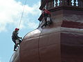
 St.NikolausKirche OberzeiringAnstrich01.JPG 2,736 × 3,648; 3.74 MB
-
 St.NikolausKirche OberzeiringAnstrich02.JPG 3,648 × 2,736; 1.76 MB
-
 St.NikolausKirche OberzeiringAnstrich03.JPG 2,736 × 3,648; 3.63 MB


