Category:Toot Baldon
Jump to navigation
Jump to search
village and civil parish in South Oxfordshire, England  | |||||
| Upload media | |||||
| Instance of | |||||
|---|---|---|---|---|---|
| Location | South Oxfordshire, Oxfordshire, South East England, England | ||||
| Area |
| ||||
| official website | |||||
 | |||||
Subcategories
This category has the following 3 subcategories, out of 3 total.
Media in category "Toot Baldon"
The following 173 files are in this category, out of 173 total.
-
 'Holly Tree Cottage', ^21 Toot Baldon - geograph.org.uk - 3950955.jpg 684 × 1,024; 156 KB
-
 Altar in St Lawrence - geograph.org.uk - 5257459.jpg 1,024 × 683; 111 KB
-
 Approaching Toot Baldon - geograph.org.uk - 3401823.jpg 640 × 427; 195 KB
-
 Arable field in Toot Baldon - geograph.org.uk - 1566243.jpg 640 × 427; 68 KB
-
 Arable field near Garsington - geograph.org.uk - 1566266.jpg 640 × 421; 55 KB
-
 Arable field near Toot Baldon - geograph.org.uk - 1566221.jpg 640 × 427; 71 KB
-
 Back of the Rood Screen - geograph.org.uk - 5262043.jpg 533 × 800; 112 KB
-
 Baldon Lane to Toot Baldon - geograph.org.uk - 1566237.jpg 640 × 427; 88 KB
-
 Barns beside track from Marsh Baldon - geograph.org.uk - 3950675.jpg 1,024 × 683; 221 KB
-
 Barns on the footpath to Marsh Baldon - geograph.org.uk - 2380344.jpg 1,500 × 1,000; 167 KB
-
 Benchmark and letter box on the Mole Inn - geograph.org.uk - 3951202.jpg 683 × 1,024; 279 KB
-
 Benchmark on 'Holly Tree Cottage' - geograph.org.uk - 3950939.jpg 1,024 × 626; 223 KB
-
 Benchmark on outbuilding at New Farm - geograph.org.uk - 3950998.jpg 683 × 1,024; 287 KB
-
 Benchmark on St Lawrence Toot Baldon - geograph.org.uk - 5267754.jpg 533 × 800; 124 KB
-
 Benchmark on the 'Old School' - geograph.org.uk - 3950741.jpg 691 × 1,024; 255 KB
-
 Benchmark on wooden gatepost at path junction - geograph.org.uk - 3950646.jpg 683 × 1,024; 259 KB
-
 Bridleway from Greater Leys - geograph.org.uk - 1447279.jpg 640 × 427; 133 KB
-
 Buildings at New Farm - geograph.org.uk - 3951090.jpg 1,024 × 683; 169 KB
-
 Caroline Emma Forbes - geograph.org.uk - 5268036.jpg 533 × 800; 116 KB
-
 Cereal field near Marsh Baldon - geograph.org.uk - 2380339.jpg 1,500 × 1,000; 216 KB
-
 Chancel Window - geograph.org.uk - 5257511.jpg 533 × 800; 101 KB
-
 Chapel Window - geograph.org.uk - 5257448.jpg 533 × 800; 87 KB
-
 Chest Tomb - geograph.org.uk - 5256483.jpg 533 × 800; 116 KB
-
 Choir Stall - geograph.org.uk - 5262128.jpg 1,024 × 683; 104 KB
-
 Choir Stalls - geograph.org.uk - 5262055.jpg 1,024 × 683; 134 KB
-
 Church Banner - geograph.org.uk - 5257563.jpg 533 × 800; 62 KB
-
 Church in the trees - geograph.org.uk - 5267893.jpg 1,024 × 683; 173 KB
-
 Church Pulpit - geograph.org.uk - 5257453.jpg 533 × 800; 90 KB
-
 Churchyard at St Lawrence - geograph.org.uk - 5255825.jpg 1,024 × 683; 179 KB
-
 Churchyard by the trees - geograph.org.uk - 5267894.jpg 1,024 × 683; 201 KB
-
 Churchyard Extension - geograph.org.uk - 5255828.jpg 1,024 × 683; 138 KB
-
 Churchyard Extension - geograph.org.uk - 5268025.jpg 1,024 × 683; 238 KB
-
 Colourful Weeds - geograph.org.uk - 3633271.jpg 1,600 × 1,200; 496 KB
-
 Court Leys - geograph.org.uk - 3401829.jpg 640 × 427; 185 KB
-
 Cross by the Base - geograph.org.uk - 5267748.jpg 1,024 × 683; 171 KB
-
 Cross on the Ground - geograph.org.uk - 5268031.jpg 533 × 800; 139 KB
-
 Cross on the Screen - geograph.org.uk - 5257546.jpg 533 × 800; 119 KB
-
 Cross ^ Ceiling - geograph.org.uk - 5256547.jpg 533 × 800; 97 KB
-
 Crossing of bridleways - geograph.org.uk - 2380331.jpg 1,500 × 1,000; 271 KB
-
 Deer Proof Gate - geograph.org.uk - 3633264.jpg 1,600 × 1,200; 569 KB
-
 Dutch Barns near Marsh Baldon - geograph.org.uk - 3402072.jpg 640 × 427; 156 KB
-
 Electricity Pylons at Toot Baldon - geograph.org.uk - 1566211.jpg 640 × 417; 55 KB
-
 Entering Toot Baldon - geograph.org.uk - 1384900.jpg 640 × 480; 75 KB
-
 Entrance View - geograph.org.uk - 5262260.jpg 1,024 × 683; 99 KB
-
 Family Vault - geograph.org.uk - 5263558.jpg 1,024 × 683; 213 KB
-
 Farm building by the bridleway - geograph.org.uk - 2380333.jpg 1,500 × 1,000; 145 KB
-
 Farm track alongside Grenoble Road - geograph.org.uk - 1447312.jpg 640 × 413; 76 KB
-
 Farmland by Shakespeare's Way - geograph.org.uk - 5950627.jpg 4,777 × 3,302; 5.17 MB
-
 Farmland, Toot Baldon - geograph.org.uk - 2676814.jpg 640 × 480; 147 KB
-
 Farmland, Toot Baldon - geograph.org.uk - 2809292.jpg 640 × 480; 131 KB
-
 Farmland, Toot Baldon - geograph.org.uk - 2817494.jpg 640 × 480; 157 KB
-
 Field of rape at Marsh Baldon - geograph.org.uk - 2380347.jpg 1,500 × 1,000; 288 KB
-
 Fields, Fence and A Small Flood - geograph.org.uk - 3268901.jpg 2,456 × 1,866; 1.25 MB
-
 Floral Display - geograph.org.uk - 5257562.jpg 533 × 800; 71 KB
-
 Flowers near the Altar - geograph.org.uk - 5257509.jpg 533 × 800; 88 KB
-
 Font ^ Cover - geograph.org.uk - 5256492.jpg 533 × 800; 92 KB
-
 Footpath at Toot Baldon - geograph.org.uk - 1566224.jpg 640 × 427; 88 KB
-
 Footpath to Chiselhampton - geograph.org.uk - 1384942.jpg 640 × 480; 67 KB
-
 Footpath to Chiselhampton - geograph.org.uk - 2380337.jpg 1,500 × 1,000; 162 KB
-
 Footpath towards Chislehampton - geograph.org.uk - 3402103.jpg 640 × 427; 195 KB
-
 Forgotten Graves - geograph.org.uk - 5263607.jpg 1,024 × 683; 209 KB
-
 Forked oak near Marsh Baldon - geograph.org.uk - 3402080.jpg 640 × 424; 197 KB
-
 From under a Tree - geograph.org.uk - 5255990.jpg 1,024 × 683; 184 KB
-
 Fruin memorial - geograph.org.uk - 5268033.jpg 533 × 800; 127 KB
-
 Gate at Pebble Hill - geograph.org.uk - 3402021.jpg 640 × 427; 176 KB
-
 Gates on the Porch - geograph.org.uk - 5262261.jpg 533 × 800; 114 KB
-
 Grave Marker - geograph.org.uk - 5263603.jpg 533 × 800; 151 KB
-
 Graves at the West End - geograph.org.uk - 5267758.jpg 1,024 × 683; 241 KB
-
 Graves under the Tree - geograph.org.uk - 5262266.jpg 1,024 × 683; 213 KB
-
 Hasp on the Box - geograph.org.uk - 5262256.jpg 1,024 × 683; 152 KB
-
 Hay bales near Toot Baldon - geograph.org.uk - 192184.jpg 640 × 481; 110 KB
-
 Headstones at St Lawrence - geograph.org.uk - 5255981.jpg 1,024 × 683; 198 KB
-
 Hedgerow near Toot Baldon - geograph.org.uk - 1566271.jpg 640 × 427; 69 KB
-
 Hidden Organ - geograph.org.uk - 5257458.jpg 1,024 × 683; 92 KB
-
 Houses at Marsh Baldon - geograph.org.uk - 3402052.jpg 640 × 427; 194 KB
-
 In Memory of Sophia - geograph.org.uk - 5255987.jpg 1,024 × 683; 130 KB
-
 Into another field - geograph.org.uk - 4804048.jpg 3,818 × 2,776; 2.72 MB
-
 Kneelers on the Pews - geograph.org.uk - 5262143.jpg 533 × 800; 75 KB
-
 Lamp over the Font - geograph.org.uk - 5256546.jpg 533 × 800; 111 KB
-
 Lancet Window - geograph.org.uk - 5257461.jpg 533 × 800; 52 KB
-
 Lancet Window - geograph.org.uk - 5257556.jpg 533 × 800; 66 KB
-
 Last (or first) view towards Oxford - geograph.org.uk - 3401510.jpg 640 × 427; 193 KB
-
 Left hand Screen - geograph.org.uk - 5257552.jpg 533 × 800; 107 KB
-
 Letter box, Baldon Row - geograph.org.uk - 3401864.jpg 462 × 640; 226 KB
-
 Light from the Window - geograph.org.uk - 5257506.jpg 533 × 800; 69 KB
-
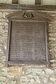
 List of Servicemen - geograph.org.uk - 5256653.jpg 1,024 × 683; 95 KB
-
 Looking along the West End - geograph.org.uk - 5268027.jpg 1,024 × 683; 195 KB
-
 Looking over a field towards Garsington - geograph.org.uk - 2380342.jpg 1,500 × 1,000; 165 KB
-
 Looking to the Lychgate - geograph.org.uk - 5263566.jpg 533 × 800; 133 KB
-
 Lych Gate to St Lawrence - geograph.org.uk - 5255824.jpg 1,024 × 683; 164 KB
-
 Memorial on the North Wall - geograph.org.uk - 5256554.jpg 533 × 800; 67 KB
-
-
 Minor road to Watlington Road - geograph.org.uk - 1447283.jpg 640 × 416; 76 KB
-
 Much more room along here - geograph.org.uk - 4801438.jpg 4,000 × 3,000; 4.27 MB
-
 No Footpath - geograph.org.uk - 4801373.jpg 4,000 × 3,000; 4.18 MB
-
 North side of St Lawrence - geograph.org.uk - 5263604.jpg 1,024 × 683; 238 KB
-
 North West Corner - geograph.org.uk - 5267752.jpg 533 × 800; 135 KB
-
 Not much room along here - geograph.org.uk - 4801435.jpg 4,000 × 3,000; 4.69 MB
-
 Old Cross - geograph.org.uk - 5255994.jpg 533 × 800; 106 KB
-
 Old Headstones - geograph.org.uk - 5267750.jpg 1,024 × 683; 246 KB
-
 Old School, Baldon Row - geograph.org.uk - 3401859.jpg 640 × 427; 227 KB
-

-
 On top of the Organ Screen - geograph.org.uk - 5262053.jpg 1,024 × 683; 86 KB
-
 One of the Angels - geograph.org.uk - 5262130.jpg 1,024 × 683; 67 KB
-
 Oxfordshire Countryside - geograph.org.uk - 5263561.jpg 1,024 × 683; 101 KB
-
 Path Through The Tree - geograph.org.uk - 3268896.jpg 2,206 × 1,599; 1.41 MB
-
 Pews in the Arches - geograph.org.uk - 5256550.jpg 533 × 800; 87 KB
-
 Post box, Baldon Row - geograph.org.uk - 3401862.jpg 619 × 640; 242 KB
-
 Praying Hands - geograph.org.uk - 5262254.jpg 1,024 × 683; 79 KB
-
 Pylon on the Roman Road - geograph.org.uk - 2137483.jpg 2,736 × 3,648; 3.08 MB
-
 Right hand Screen - geograph.org.uk - 5257550.jpg 533 × 800; 116 KB
-
 Road Between The Baldons - geograph.org.uk - 2331983.jpg 3,564 × 2,592; 1.42 MB
-
 Roman Road leaves the Baldons - geograph.org.uk - 2137474.jpg 3,212 × 2,616; 3.19 MB
-
 Roman Road, Baldon Row - geograph.org.uk - 2341887.jpg 3,264 × 2,448; 1.89 MB
-
 Rood Cross ^ Nave Ceiling - geograph.org.uk - 5262058.jpg 1,024 × 683; 168 KB
-
 Rood Screen in St Lawrence - geograph.org.uk - 5256493.jpg 1,024 × 683; 140 KB
-
 Rust and Collapse - geograph.org.uk - 4801380.jpg 4,000 × 3,000; 4.44 MB
-
 Screen behind the Altar - geograph.org.uk - 5257510.jpg 1,024 × 683; 126 KB
-
 Shakespeare's Way near Chiselhampton - geograph.org.uk - 5950612.jpg 4,722 × 3,224; 3.7 MB
-
 Sheltered by the Tree - geograph.org.uk - 5255983.jpg 533 × 800; 110 KB
-
 Sinking Headstone - geograph.org.uk - 5267756.jpg 1,024 × 683; 271 KB
-
 Sky Trails - geograph.org.uk - 5263564.jpg 1,024 × 683; 104 KB
-
 South Chapel - geograph.org.uk - 5257447.jpg 533 × 800; 61 KB
-
 St Lawrence Church and lych gate - geograph.org.uk - 3950850.jpg 1,024 × 683; 218 KB
-
 St Lawrence North wall - geograph.org.uk - 5263605.jpg 1,024 × 683; 178 KB
-
 St Lawrence Toot Baldon - geograph.org.uk - 5262264.jpg 1,024 × 683; 171 KB
-
 St Lawrence West End - geograph.org.uk - 5255832.jpg 1,024 × 683; 179 KB
-
 Stained Glass Window - geograph.org.uk - 5257444.jpg 533 × 800; 104 KB
-
-
 The east end of - geograph.org.uk - 5263565.jpg 1,024 × 683; 179 KB
-
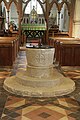 The Font in St Lawrence - geograph.org.uk - 5256490.jpg 533 × 800; 102 KB
-
 The Lancet Window - geograph.org.uk - 5257464.jpg 533 × 800; 68 KB
-
 The Nave at St Lawrence - geograph.org.uk - 5256488.jpg 1,024 × 683; 146 KB
-
 The North Aisle - geograph.org.uk - 5262136.jpg 533 × 800; 85 KB
-
 The Pitson memorial - geograph.org.uk - 5262052.jpg 1,024 × 683; 103 KB
-
 The road to Toot Baldon - geograph.org.uk - 1566151.jpg 640 × 427; 56 KB
-

-
 The road up to Toot Baldon - geograph.org.uk - 1566273.jpg 427 × 640; 72 KB
-
 The Rood Cross at St Lawrence - geograph.org.uk - 5256495.jpg 533 × 800; 78 KB
-
 The South Aisle - geograph.org.uk - 5262140.jpg 1,024 × 683; 94 KB
-
 The West End of St Laurence - geograph.org.uk - 5263608.jpg 1,024 × 683; 194 KB
-
 To the East End - geograph.org.uk - 5263560.jpg 1,024 × 683; 233 KB
-

-
 Toot Baldon Roll of Honour - geograph.org.uk - 5256486.jpg 533 × 800; 100 KB
-
 Toot Baldon Roll of Honour - geograph.org.uk - 5257451.jpg 533 × 800; 63 KB
-
 TootBaldon ParishSchool.JPG 2,790 × 1,860; 1.54 MB
-
 Towards Garsington - geograph.org.uk - 3576651.jpg 1,600 × 1,200; 629 KB
-
 Towards Marsh Baldon Dutch Barns - geograph.org.uk - 3402068.jpg 640 × 427; 207 KB
-
 Towards New Farm - geograph.org.uk - 3401517.jpg 640 × 427; 192 KB
-
 Towards the Lychgate - geograph.org.uk - 5262269.jpg 1,024 × 683; 228 KB
-
 Track to Chiselhampton - geograph.org.uk - 113948.jpg 640 × 481; 66 KB
-
 Vase of Flowers - geograph.org.uk - 5262252.jpg 533 × 800; 91 KB
-
 View from the Pulpit - geograph.org.uk - 5257455.jpg 1,024 × 683; 111 KB
-
 View of the Memorial - geograph.org.uk - 5256647.jpg 1,024 × 683; 68 KB
-
 View up at the Chancel Window - geograph.org.uk - 5257561.jpg 533 × 800; 105 KB
-
 View up on the Right Side - geograph.org.uk - 5262040.jpg 533 × 800; 100 KB
-
 Water Tank at Toot Baldon - geograph.org.uk - 2056664.jpg 1,024 × 694; 164 KB
-
 Watlington Road - geograph.org.uk - 1384898.jpg 640 × 480; 82 KB
-
 West and South - geograph.org.uk - 5267760.jpg 1,024 × 683; 162 KB
-
 Wet in the dip - geograph.org.uk - 3401514.jpg 640 × 427; 183 KB
-
 William Fruin - geograph.org.uk - 5257442.jpg 533 × 800; 58 KB
-
 Wilmots - geograph.org.uk - 3401803.jpg 640 × 425; 187 KB
-
 Window in the Chancel - geograph.org.uk - 5257507.jpg 533 × 800; 97 KB
-
 Wooden Marker - geograph.org.uk - 5263606.jpg 533 × 800; 146 KB
-
 Wreaths on the Memorial - geograph.org.uk - 5256644.jpg 1,024 × 683; 83 KB
-
 Baldon Brook - geograph.org.uk - 159025.jpg 640 × 480; 141 KB
-

-
 Farmland, Marsh Baldon - geograph.org.uk - 158960.jpg 640 × 480; 129 KB
-
 Richmond Hill - geograph.org.uk - 158968.jpg 640 × 480; 96 KB
-
 The track to Drayton St. Leonard's - geograph.org.uk - 83517.jpg 640 × 481; 31 KB
-
 Track near Drayton St Leonard - geograph.org.uk - 158946.jpg 640 × 480; 112 KB
-
 Tree and field near Berinsfield - geograph.org.uk - 158951.jpg 640 × 480; 129 KB
-
 Willow trees near Toot Baldon - geograph.org.uk - 192185.jpg 640 × 480; 116 KB


_view_towards_Oxford_-_geograph.org.uk_-_3401510.jpg)


