File:Canada relief map public domain.png
Jump to navigation
Jump to search

Size of this preview: 574 × 600 pixels. Other resolutions: 230 × 240 pixels | 459 × 480 pixels | 735 × 768 pixels | 1,160 × 1,212 pixels.
Original file (1,160 × 1,212 pixels, file size: 4.03 MB, MIME type: image/png)
Captions
Captions
Add a one-line explanation of what this file represents
Summary[edit]
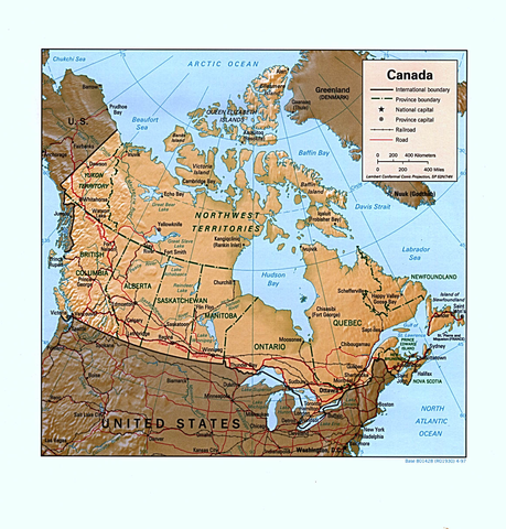
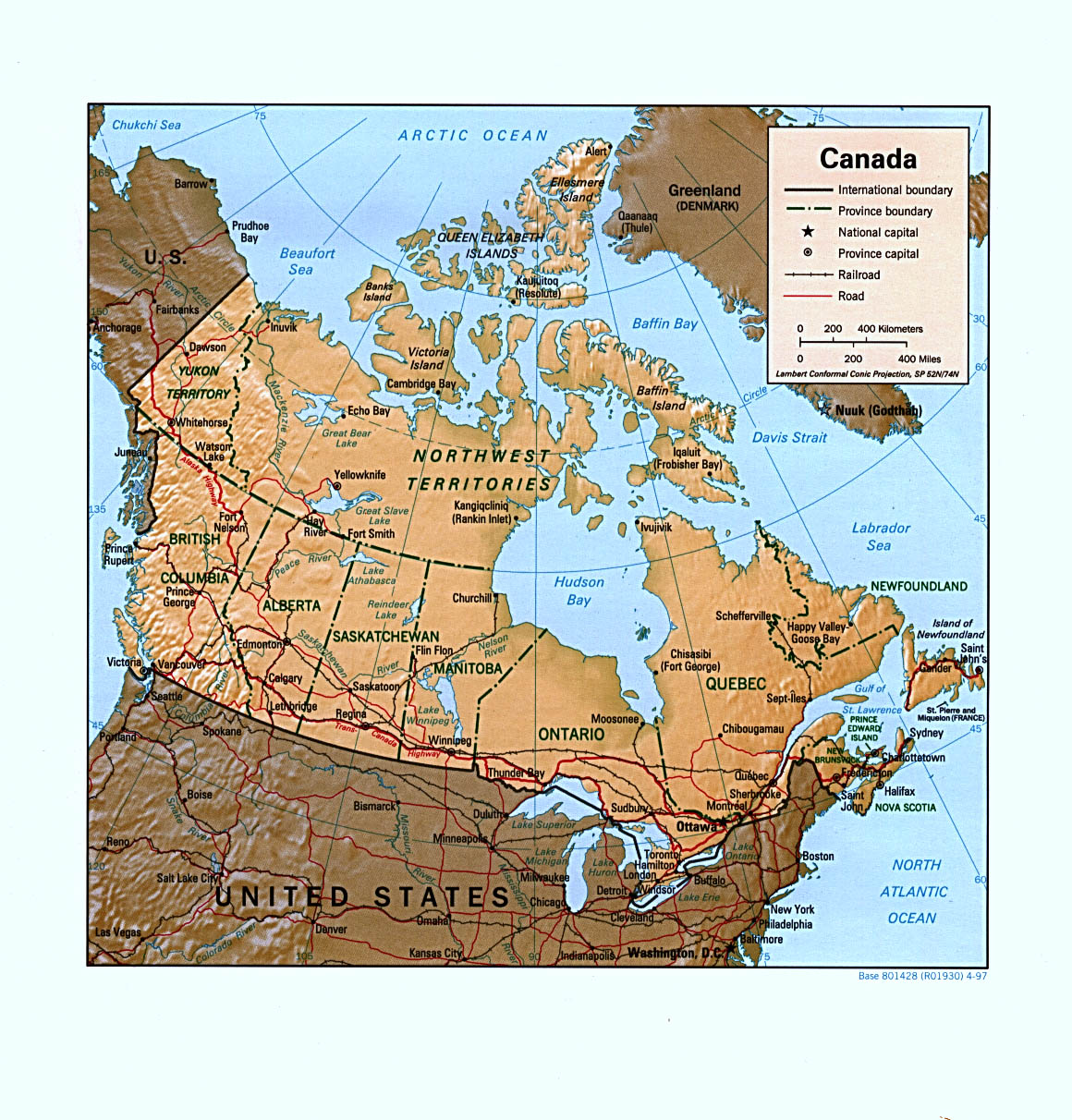
| Description | Canada (Shaded Relief) U.S. Central Intelligence Agency 1997. Courtesy of the University of Texas Libraries, Perry-Castañeda Library Map Collection. |
| Date | |
| Source | http://www.lib.utexas.edu/maps/americas/canada_rel97.jpg |
| Author | U.S. Central Intelligence Agency |
Licensing[edit]
This file is in the public domain because of the courtesy of the University of Texas Libraries, Perry-Castañeda Library Map Collection.
|
File history
Click on a date/time to view the file as it appeared at that time.
| Date/Time | Thumbnail | Dimensions | User | Comment | |
|---|---|---|---|---|---|
| current | 03:52, 13 March 2012 | | 1,160 × 1,212 (4.03 MB) | Canoe1967 (talk | contribs) |
You cannot overwrite this file.
File usage on Commons
There are no pages that use this file.
File usage on other wikis
The following other wikis use this file:
- Usage on en.wikipedia.org