Uploads by Dormskirk
Jump to navigation
Jump to search
For Dormskirk (talk · contributions · Move log · block log · uploads · Abuse filter log)
This special page shows all uploaded files that have not been deleted; for those see the upload log.
| Date | Name | Thumbnail | Size | Description |
|---|---|---|---|---|
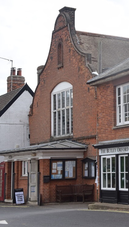
| 14:25, 27 May 2024 | Shops and Town Hall on Market Hill, Orford (geograph 7262208) (cropped).jpg (file) | _(cropped).jpg) |
109 KB | {{Information |Description =Orford Town Hall |Source =*File:Shops and Town Hall on Market Hill, Orford (geograph 7262208).jpg |Author =Trevor Harris |Date =22 August 2022 |Permission ={{CC BY-SA 2.0|Trevor Harris}} |other_versions = }} {{RetouchedPicture|cropped|editor=Dormskirk|orig=Shops and Town Hall on Market Hill, Orford (geograph 7262208).jpg}} |
| 13:44, 27 May 2024 | Shops and Town Hall on Market Hill, Orford (geograph 7262208).jpg (file) | .jpg) |
441 KB | == {{int:filedesc}} == {{Information |Description={{en|1=Shops and Town Hall on Market Hill, Orford}} |Source=From [https://www.geograph.org.uk/photo/7262208 geograph.org.uk] |Date=2022-08-22 |Author=[https://www.geograph.org.uk/profile/27744 Trevor Harris] |Permission=Creative Commons Attribution Share-alike license 2.0 |Other fields={{Credit line |Author=Trevor Harris |License=[https://creativecommons.org/licenses/by-sa/2.0/ CC BY-SA 2.0] |Other=''Shops and Town Hall on Market Hill, Orfo... |
| 22:30, 26 May 2024 | Colyton - Town Hall (geograph 6676371).jpg (file) | .jpg) |
6.2 MB | == {{int:filedesc}} == {{Information |Description={{en|1=Colyton - Town Hall}} |Source=From [https://www.geograph.org.uk/photo/6676371 geograph.org.uk] |Date=2019-06-17 |Author=[https://www.geograph.org.uk/profile/3972 Colin Smith] |Permission=Creative Commons Attribution Share-alike license 2.0 |Other fields={{Credit line |Author=Colin Smith |License=[https://creativecommons.org/licenses/by-sa/2.0/ CC BY-SA 2.0] |Other=''Colyton - Town Hall'' }} }} {{Location|50.740423|-3.070076|source:g... |
| 22:32, 24 May 2024 | Library, Ottery St. Mary (geograph 6735010).jpg (file) | .jpg) |
129 KB | == {{int:filedesc}} == {{Information |Description={{en|1=Library, Ottery St. Mary}} |Source=From [https://www.geograph.org.uk/photo/6735010 geograph.org.uk] |Date=2018-09-18 |Author=[https://www.geograph.org.uk/profile/46229 Jonathan Thacker] |Permission=Creative Commons Attribution Share-alike license 2.0 |Other fields={{Credit line |Author=Jonathan Thacker |License=[https://creativecommons.org/licenses/by-sa/2.0/ CC BY-SA 2.0] |Other=''Library, Ottery St. Mary'' }} }} {{Location|50.7522... |
| 22:21, 23 May 2024 | Axminster Guildhall (geograph 6576521).jpg (file) | .jpg) |
67 KB | == {{int:filedesc}} == {{Information |Description={{en|1=Axminster Guildhall}} |Source=From [https://www.geograph.org.uk/photo/6576521 geograph.org.uk] |Date=2012-04-12 |Author=[https://www.geograph.org.uk/profile/4264 Chris Allen] |Permission=Creative Commons Attribution Share-alike license 2.0 |Other fields={{Credit line |Author=Chris Allen |License=[https://creativecommons.org/licenses/by-sa/2.0/ CC BY-SA 2.0] |Other=''Axminster Guildhall'' }} }} {{Location|50.781327|-3.000795|source:g... |
| 18:46, 20 May 2024 | Castell Cricieth o'r awyr yn 2023 - Cricieth Castle from a drone - Welsg built castle in Gwynedd, Wales 18 (cropped).jpg (file) | .jpg) |
273 KB | {{Information |Description =Criccieth Castle Visitor Centre (also known as the Old Town Hall, Criccieth) |Source =*File:Castell Cricieth o'r awyr yn 2023 - Cricieth Castle from a drone - Welsg built castle in Gwynedd, Wales 18.jpg |Author =Llywelyn2000 |Date =2 October 2022 |Permission ={{cc-by-sa-4.0|Llywelyn2000}} |other_versions = }} {{RetouchedPicture|cropped|editor=Dormskirk|orig=Castell Cricieth o'r awyr yn 2023 - Cricieth Castle from a drone - Wels... |
| 21:42, 18 May 2024 | Keeping the Town Hall going (geograph 7763325).jpg (file) | .jpg) |
4.61 MB | == {{int:filedesc}} == {{Information |Description={{en|1=Keeping the Town Hall going}} |Source=From [https://www.geograph.org.uk/photo/7763325 geograph.org.uk] |Date=2024-04-18 |Author=[https://www.geograph.org.uk/profile/47623 Neil Owen] |Permission=Creative Commons Attribution Share-alike license 2.0 |Other fields={{Credit line |Author=Neil Owen |License=[https://creativecommons.org/licenses/by-sa/2.0/ CC BY-SA 2.0] |Other=''Keeping the Town Hall going'' }} }} {{Location|51.056199|-2.41... |
| 21:41, 18 May 2024 | The old town hall and a bakery (geograph 7764163).jpg (file) | .jpg) |
4.52 MB | == {{int:filedesc}} == {{Information |Description={{en|1=The old town hall and a bakery}} |Source=From [https://www.geograph.org.uk/photo/7764163 geograph.org.uk] |Date=2024-04-18 |Author=[https://www.geograph.org.uk/profile/47623 Neil Owen] |Permission=Creative Commons Attribution Share-alike license 2.0 |Other fields={{Credit line |Author=Neil Owen |License=[https://creativecommons.org/licenses/by-sa/2.0/ CC BY-SA 2.0] |Other=''The old town hall and a bakery'' }} }} {{Location|51.056107... |
| 21:40, 18 May 2024 | Let's hope this one lasts (geograph 7767303).jpg (file) | .jpg) |
3.77 MB | == {{int:filedesc}} == {{Information |Description={{en|1=Let's hope this one lasts}} |Source=From [https://www.geograph.org.uk/photo/7767303 geograph.org.uk] |Date=2024-04-18 |Author=[https://www.geograph.org.uk/profile/47623 Neil Owen] |Permission=Creative Commons Attribution Share-alike license 2.0 |Other fields={{Credit line |Author=Neil Owen |License=[https://creativecommons.org/licenses/by-sa/2.0/ CC BY-SA 2.0] |Other=''Let's hope this one lasts'' }} }} {{Location|51.056199|-2.410869... |
| 23:04, 16 May 2024 | Erased school sign (geograph 6605295).jpg (file) | .jpg) |
1.79 MB | == {{int:filedesc}} == {{Information |Description={{en|1=Erased school sign}} |Source=From [https://www.geograph.org.uk/photo/6605295 geograph.org.uk] |Date=2020-08-31 |Author=[https://www.geograph.org.uk/profile/47623 Neil Owen] |Permission=Creative Commons Attribution Share-alike license 2.0 |Other fields={{Credit line |Author=Neil Owen |License=[https://creativecommons.org/licenses/by-sa/2.0/ CC BY-SA 2.0] |Other=''Erased school sign'' }} }} {{Location|51.436805|-2.849467|source:geogra... |
| 22:55, 16 May 2024 | Clevedon Town Council Offices (geograph 6605293).jpg (file) | .jpg) |
1.93 MB | == {{int:filedesc}} == {{Information |Description={{en|1=Clevedon Town Council Offices}} |Source=From [https://www.geograph.org.uk/photo/6605293 geograph.org.uk] |Date=2020-08-31 |Author=[https://www.geograph.org.uk/profile/47623 Neil Owen] |Permission=Creative Commons Attribution Share-alike license 2.0 |Other fields={{Credit line |Author=Neil Owen |License=[https://creativecommons.org/licenses/by-sa/2.0/ CC BY-SA 2.0] |Other=''Clevedon Town Council Offices'' }} }} {{Location|51.436895|-... |
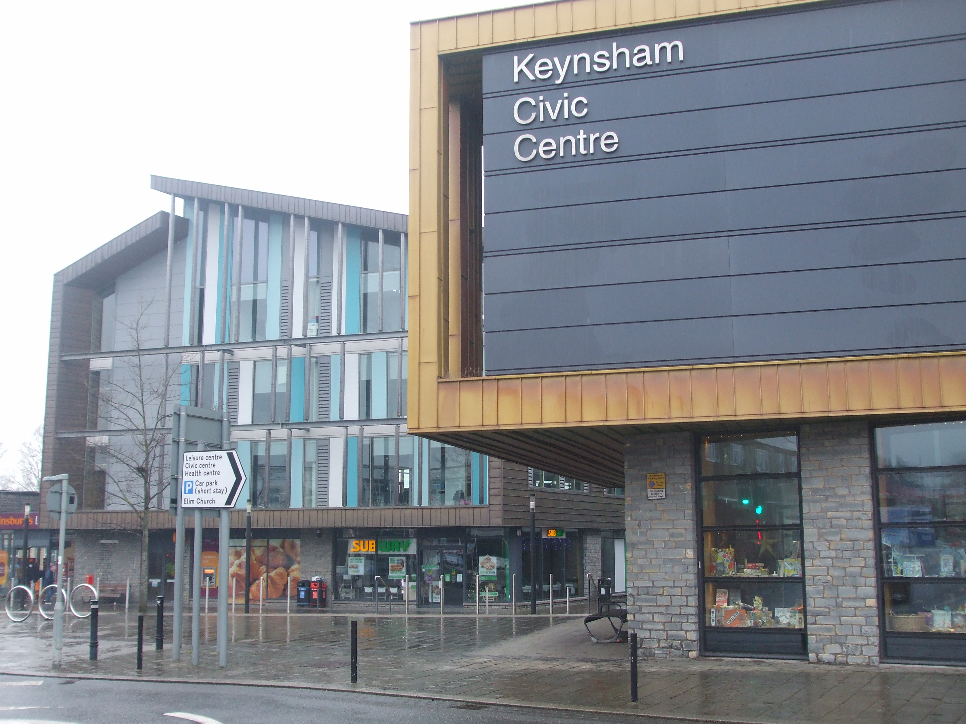
| 22:01, 15 May 2024 | Keynsham Civic Centre (geograph 6723053).jpg (file) | .jpg) |
3.31 MB | == {{int:filedesc}} == {{Information |Description={{en|1=Keynsham Civic Centre}} |Source=From [https://www.geograph.org.uk/photo/6723053 geograph.org.uk] |Date=2021-01-01 |Author=[https://www.geograph.org.uk/profile/47623 Neil Owen] |Permission=Creative Commons Attribution Share-alike license 2.0 |Other fields={{Credit line |Author=Neil Owen |License=[https://creativecommons.org/licenses/by-sa/2.0/ CC BY-SA 2.0] |Other=''Keynsham Civic Centre'' }} }} {{Location|51.413829|-2.497899|source:... |
| 22:05, 12 May 2024 | Cricklade Library, High Street (geograph 6565133).jpg (file) | .jpg) |
348 KB | == {{int:filedesc}} == {{Information |Description={{en|1=Cricklade Library, High Street}} |Source=From [https://www.geograph.org.uk/photo/6565133 geograph.org.uk] |Date=2020-08-09 |Author=[https://www.geograph.org.uk/profile/48698 Jeff Gogarty] |Permission=Creative Commons Attribution Share-alike license 2.0 |Other fields={{Credit line |Author=Jeff Gogarty |License=[https://creativecommons.org/licenses/by-sa/2.0/ CC BY-SA 2.0] |Other=''Cricklade Library, High Street'' }} }} {{Location|51.... |
| 22:18, 8 May 2024 | Construction work alongside council offices (geograph 6677174).jpg (file) | .jpg) |
253 KB | == {{int:filedesc}} == {{Information |Description={{en|1=Construction work alongside council offices}} |Source=From [https://www.geograph.org.uk/photo/6677174 geograph.org.uk] |Date=2020-11-16 |Author=[https://www.geograph.org.uk/profile/50150 Adrian Benn] |Permission=Creative Commons Attribution Share-alike license 2.0 |Other fields={{Credit line |Author=Adrian Benn |License=[https://creativecommons.org/licenses/by-sa/2.0/ CC BY-SA 2.0] |Other=''Construction work alongside council offices... |
| 22:56, 6 May 2024 | High Street, Epping (geograph 2910403) (cropped).jpg (file) | _(cropped).jpg) |
120 KB | {{Information |Description =Old Town Hall, Epping, Essex |Source =*File:High Street, Epping (geograph 2910403).jpg |Author =Stacey Harris |Date =21 April 2012 |Permission ={{CC BY-SA 2.0|Stacey Harris}} |other_versions = }} {{RetouchedPicture|cropped|editor=Dormskirk|orig=High Street, Epping (geograph 2910403).jpg}} Category:Epping, Essex |
| 09:48, 1 May 2024 | South and City College, Birmingham (geograph 6722446).jpg (file) | .jpg) |
3.5 MB | == {{int:filedesc}} == {{Information |Description={{en|1=South and City College, Birmingham}} |Source=From [https://www.geograph.org.uk/photo/6722446 geograph.org.uk] |Date=2013-05-29 |Author=[https://www.geograph.org.uk/profile/127703 habiloid] |Permission=Creative Commons Attribution Share-alike license 2.0 |Other fields={{Credit line |Author=habiloid |License=[https://creativecommons.org/licenses/by-sa/2.0/ CC BY-SA 2.0] |Other=''South and City College, Birmingham'' }} }} {{Location|52... |
| 22:02, 28 April 2024 | Shops and bins in Newmarket - geograph.org.uk - 4458391 (cropped).jpg (file) | .jpg) |
155 KB | {{Information |Description =Newmarket Town Hall |Source =*File:Shops and bins in Newmarket - geograph.org.uk - 4458391.jpg |Author =Bill Boaden |Date =19 April 2015 |Permission ={{cc-by-2.0|Bill Boaden}} |other_versions = }} {{RetouchedPicture|cropped|editor=Dormskirk|orig=Shops and bins in Newmarket - geograph.org.uk - 4458391.jpg}} Category:Newmarket, Suffolk |
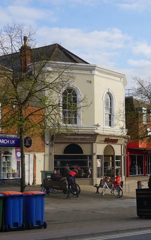
| 23:36, 24 April 2024 | Swaffham Town Hall.jpg (file) |  |
78 KB | {{Information |Description =Swaffham Town Hall |Source =*File:The White Hart, Swaffham, Norfolk 02-03-2009.JPG |Author =Stavros1 |Date =2 March 2009 |Permission ={{cc-by-3.0|Stavros1}} |other_versions = }} {{RetouchedPicture|cropped|editor=Dormskirk|orig=The White Hart, Swaffham, Norfolk 02-03-2009.JPG}} Category:Swaffham |
| 15:41, 21 April 2024 | High Street, Rickmansworth (cropped).png (file) | .png) |
280 KB | {{Information |Description =High Street, Rickmansworth |Source =*File:High Street, Rickmansworth.png |Author =Unknown |Date =c. 1910 |Permission ={{PD-Old}}{{PD-US}} |other_versions = }} {{RetouchedPicture|cropped|editor=Dormskirk|orig=High Street, Rickmansworth.png}} Category:Rickmansworth |
| 15:35, 21 April 2024 | High Street, Rickmansworth.png (file) |  |
995 KB | {{Information |Description=Old post card showing High Street, Rickmansworth |Source=https://www.ebay.co.uk/itm/355616416958?mkevt=1&mkcid=1&mkrid=710-53481-19255-0&campid=5338722076&customid=&toolid=10050 |Date=c.1910 |Author=Unknown |Permission={{PD-old}}{{PD-US}} |other_versions= }} Category:Rickmansworth |
| 22:28, 16 April 2024 | Sandy - former town hall (geograph 7220935).jpg (file) | .jpg) |
656 KB | == {{int:filedesc}} == {{Information |Description={{en|1=Sandy : former town hall}} |Source=From [https://www.geograph.org.uk/photo/7220935 geograph.org.uk] |Date=2022-07-06 |Author=[https://www.geograph.org.uk/profile/11136 Jim Osley] |Permission=Creative Commons Attribution Share-alike license 2.0 |Other fields={{Credit line |Author=Jim Osley |License=[https://creativecommons.org/licenses/by-sa/2.0/ CC BY-SA 2.0] |Other=''Sandy : former town hall'' }} }} {{Location|52.129693|-0.290277|s... |
| 22:51, 11 April 2024 | Kington Town Hall (geograph 6523284).jpg (file) | .jpg) |
1.02 MB | == {{int:filedesc}} == {{Information |Description={{en|1=Kington Town Hall}} |Source=From [https://www.geograph.org.uk/photo/6523284 geograph.org.uk] |Date=2020-06-30 |Author=[https://www.geograph.org.uk/profile/125723 Fabian Musto] |Permission=Creative Commons Attribution Share-alike license 2.0 |Other fields={{Credit line |Author=Fabian Musto |License=[https://creativecommons.org/licenses/by-sa/2.0/ CC BY-SA 2.0] |Other=''Kington Town Hall'' }} }} {{Location|52.203406|-3.028780|source:g... |
| 17:22, 8 April 2024 | Dundee House, Dundee (geograph 6420836).jpg (file) | .jpg) |
70 KB | == {{int:filedesc}} == {{Information |Description={{en|1=Dundee House, Dundee}} |Source=From [https://www.geograph.org.uk/photo/6420836 geograph.org.uk] |Date=2016-10-21 |Author=[https://www.geograph.org.uk/profile/4264 Chris Allen] |Permission=Creative Commons Attribution Share-alike license 2.0 |Other fields={{Credit line |Author=Chris Allen |License=[https://creativecommons.org/licenses/by-sa/2.0/ CC BY-SA 2.0] |Other=''Dundee House, Dundee'' }} }} {{Location|56.460114|-2.974737|source... |
| 00:11, 8 April 2024 | Old Council Buildings, Pershore High Street (geograph 6617384).jpg (file) | .jpg) |
224 KB | == {{int:filedesc}} == {{Information |Description={{en|1=Old Council Buildings, Pershore High Street}} |Source=From [https://www.geograph.org.uk/photo/6617384 geograph.org.uk] |Date=2020-09-11 |Author=[https://www.geograph.org.uk/profile/128349 V1ncenze] |Permission=Creative Commons Attribution Share-alike license 2.0 |Other fields={{Credit line |Author=V1ncenze |License=[https://creativecommons.org/licenses/by-sa/2.0/ CC BY-SA 2.0] |Other=''Old Council Buildings, Pershore High Street'' }... |
| 00:10, 8 April 2024 | Pershore - Town Hall (geograph 6658485).jpg (file) | .jpg) |
5.37 MB | == {{int:filedesc}} == {{Information |Description={{en|1=Pershore - Town Hall}} |Source=From [https://www.geograph.org.uk/photo/6658485 geograph.org.uk] |Date=2018-08-14 |Author=[https://www.geograph.org.uk/profile/3972 Colin Smith] |Permission=Creative Commons Attribution Share-alike license 2.0 |Other fields={{Credit line |Author=Colin Smith |License=[https://creativecommons.org/licenses/by-sa/2.0/ CC BY-SA 2.0] |Other=''Pershore - Town Hall'' }} }} {{Location|52.111311|-2.075449|source... |
| 01:05, 26 March 2024 | District Council Offices (geograph 7235039).jpg (file) | .jpg) |
141 KB | == {{int:filedesc}} == {{Information |Description={{en|1=District Council Offices}} |Source=From [https://www.geograph.org.uk/photo/7235039 geograph.org.uk] |Date=2022-06-18 |Author=[https://www.geograph.org.uk/profile/81352 Arthur C Harris] |Permission=Creative Commons Attribution Share-alike license 2.0 |Other fields={{Credit line |Author=Arthur C Harris |License=[https://creativecommons.org/licenses/by-sa/2.0/ CC BY-SA 2.0] |Other=''District Council Offices'' }} }} {{Location|53.390863... |
| 17:19, 4 March 2024 | Former Ear, Nose and Throat Hospital, Middlesbrough (geograph 30539).jpg (file) | .jpg) |
58 KB | == {{int:filedesc}} == {{Information |Description={{en|1=Former Ear, Nose and Throat Hospital, Middlesbrough}} |Source=From [https://www.geograph.org.uk/photo/30539 geograph.org.uk] |Date=2005-07-20 |Author=[https://www.geograph.org.uk/profile/343 Mick Garratt] |Permission=Creative Commons Attribution Share-alike license 2.0 |Other fields={{Credit line |Author=Mick Garratt |License=[https://creativecommons.org/licenses/by-sa/2.0/ CC BY-SA 2.0] |Other=''Former Ear, Nose and Throat Hospital,... |
| 10:12, 3 March 2024 | Tottington Hall (geograph 6542989).jpg (file) | .jpg) |
590 KB | == {{int:filedesc}} == {{Information |Description={{en|1=Tottington Hall}} |Source=From [https://www.geograph.org.uk/photo/6542989 geograph.org.uk] |Date=2020-02-19 |Author=[https://www.geograph.org.uk/profile/60932 philandju] |Permission=Creative Commons Attribution Share-alike license 2.0 |Other fields={{Credit line |Author=philandju |License=[https://creativecommons.org/licenses/by-sa/2.0/ CC BY-SA 2.0] |Other=''Tottington Hall'' }} }} {{Location|53.612976|-2.340209|source:geograph-osg... |
| 21:13, 2 March 2024 | Dickinson's War Memorial, Apsley (geograph 7609815).jpg (file) | .jpg) |
5.95 MB | == {{int:filedesc}} == {{Information |Description={{en|1=Dickinson's War Memorial, Apsley}} |Source=From [https://www.geograph.org.uk/photo/7609815 geograph.org.uk] |Date=2023-08-31 |Author=[https://www.geograph.org.uk/profile/137152 Bryn Holmes] |Permission=Creative Commons Attribution Share-alike license 2.0 |Other fields={{Credit line |Author=Bryn Holmes |License=[https://creativecommons.org/licenses/by-sa/2.0/ CC BY-SA 2.0] |Other=''Dickinson's War Memorial, Apsley'' }} }} {{Location|... |
| 00:49, 27 February 2024 | Former Milnrow Town Hall – 1 (geograph 7613524).jpg (file) | .jpg) |
324 KB | == {{int:filedesc}} == {{Information |Description={{en|1=Former Milnrow Town Hall – 1}} |Source=From [https://www.geograph.org.uk/photo/7613524 geograph.org.uk] |Date=2023-10-01 |Author=[https://www.geograph.org.uk/profile/9181 Alan Murray-Rust] |Permission=Creative Commons Attribution Share-alike license 2.0 |Other fields={{Credit line |Author=Alan Murray-Rust |License=[https://creativecommons.org/licenses/by-sa/2.0/ CC BY-SA 2.0] |Other=''Former Milnrow Town Hall – 1'' }} }} {{Location|... |
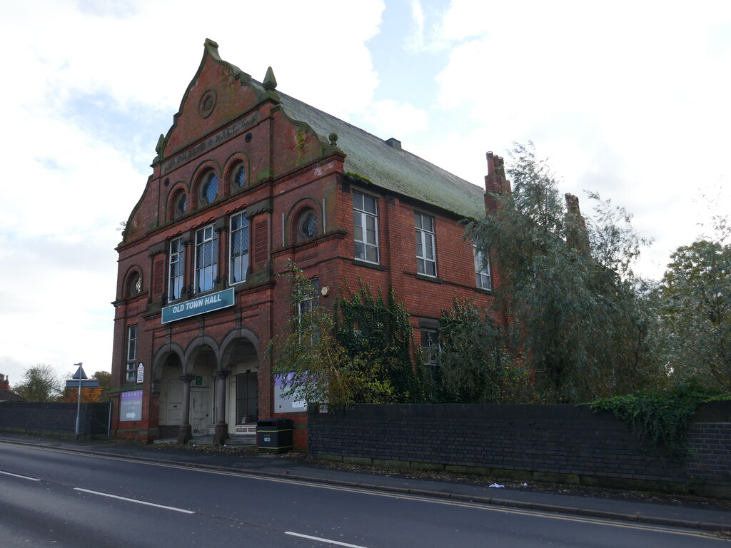
| 11:41, 25 February 2024 | Mossley Old Town Hall - geograph.org.uk - 1563840 (cropped).jpg (file) | .jpg) |
38 KB | {{Information |Description =Mossley Hall |Source =*File:Mossley Old Town Hall - geograph.org.uk - 1563840.jpg |Author =Richard Brierley |Date =2009-03-30 |Permission ={{CC-BY-SA-2.0|Richard Brierley}} |other_versions = }} {{RetouchedPicture|cropped|editor=Dormskirk|orig=Mossley Old Town Hall - geograph.org.uk - 1563840.jpg}} Category:Mossley Hall |
| 19:02, 24 February 2024 | Court Street Uppermill - geograph.org.uk - 1185741 (cropped).jpg (file) | .jpg) |
46 KB | {{Information |Description =Court Street Uppermill |Source =*File:Court Street Uppermill - geograph.org.uk - 1185741.jpg |Author =Paul Anderson |Date =2009-03-01 |Permission ={{CC-BY-SA-2.0|Paul Anderson}} |other_versions = }} {{RetouchedPicture|cropped|editor=Dormskirk|orig=Court Street Uppermill - geograph.org.uk - 1185741.jpg}} Category:Uppermill Civic Hall |
| 23:58, 20 February 2024 | Victorian postbox on Archway Road, L36 (geograph 7523555).jpg (file) | .jpg) |
154 KB | == {{int:filedesc}} == {{Information |Description={{en|1=Victorian postbox on Archway Road, L36}} |Source=From [https://www.geograph.org.uk/photo/7523555 geograph.org.uk] |Date=2022-11-19 |Author=[https://www.geograph.org.uk/profile/35313 JThomas] |Permission=Creative Commons Attribution Share-alike license 2.0 |Other fields={{Credit line |Author=JThomas |License=[https://creativecommons.org/licenses/by-sa/2.0/ CC BY-SA 2.0] |Other=''Victorian postbox on Archway Road, L36'' }} }} {{Locati... |
| 00:13, 19 February 2024 | Old Felling Town Hall (geograph 7670109).jpg (file) | .jpg) |
1.98 MB | == {{int:filedesc}} == {{Information |Description={{en|1=Old Felling Town Hall}} |Source=From [https://www.geograph.org.uk/photo/7670109 geograph.org.uk] |Date=2023-12-03 |Author=[https://www.geograph.org.uk/profile/140214 Michael Weston] |Permission=Creative Commons Attribution Share-alike license 2.0 |Other fields={{Credit line |Author=Michael Weston |License=[https://creativecommons.org/licenses/by-sa/2.0/ CC BY-SA 2.0] |Other=''Old Felling Town Hall'' }} }} {{Location|54.951788|-1.567... |
| 11:19, 2 February 2024 | Grassington Town Hall and Devonshire Institute (geograph 7030250).jpg (file) | .jpg) |
3.96 MB | == {{int:filedesc}} == {{Information |Description={{en|1=Grassington Town Hall and Devonshire Institute}} |Source=From [https://www.geograph.org.uk/photo/7030250 geograph.org.uk] |Date=2021-11-27 |Author=[https://www.geograph.org.uk/profile/45714 Andrew Abbott] |Permission=Creative Commons Attribution Share-alike license 2.0 |Other fields={{Credit line |Author=Andrew Abbott |License=[https://creativecommons.org/licenses/by-sa/2.0/ CC BY-SA 2.0] |Other=''Grassington Town Hall and Devonshire... |
| 01:04, 27 January 2024 | Stanhope Town Hall (geograph 7287268).jpg (file) | .jpg) |
2.68 MB | == {{int:filedesc}} == {{Information |Description={{en|1=Stanhope Town Hall}} |Source=From [https://www.geograph.org.uk/photo/7287268 geograph.org.uk] |Date=2022-08-27 |Author=[https://www.geograph.org.uk/profile/43370 Des Blenkinsopp] |Permission=Creative Commons Attribution Share-alike license 2.0 |Other fields={{Credit line |Author=Des Blenkinsopp |License=[https://creativecommons.org/licenses/by-sa/2.0/ CC BY-SA 2.0] |Other=''Stanhope Town Hall'' }} }} {{Location|54.748566|-2.010222|s... |
| 16:20, 23 January 2024 | Edenderry Town Hall.jpg (file) |  |
892 KB | {{Information |Description=Edenderry Town Hall |Source=https://www.flickr.com/photos/peterm7/48337168671/in/photolist-2gDoCcR-2gDoxM8-2gDotv2-2ecUA2V-2gDpfXv-2gDosNv-2gDot88-2gDoBzP-2gDpfyE-2ecUyx2-2gDpnQD-2euRiTW-2gDosZh-2gDor98-2ecUAdM-2gDpoB8-2ecUz1X-2gDpf1L-2gDoy9v-2gDpinf-2ecUAjZ-2gDpgrr-2gDpcnp-2gDph79-2gDpmQx-2gDorwN-2gDoyLn-RQoxEB-p8TUKG-ponhVm-2euRjiJ-pqnhgu-p8TThw-p8UK1N-pomNPb-pqnCNG-p8U3Pr-pq7TyT-2euRj4q-2gDpmkQ-2gDoyv2-2gDpdQQ-2gDosw8-2gDozi9-2gDpj3P-2gDorQP-2ecUyGF-RQozce-RQoymg... |
| 17:35, 13 January 2024 | Bakewell, King Street (geograph 7024333).jpg (file) | .jpg) |
7.06 MB | == {{int:filedesc}} == {{Information |Description={{en|1=Bakewell, King Street}} |Source=From [https://www.geograph.org.uk/photo/7024333 geograph.org.uk] |Date=2021-10-06 |Author=[https://www.geograph.org.uk/profile/118660 Michael Garlick] |Permission=Creative Commons Attribution Share-alike license 2.0 |Other fields={{Credit line |Author=Michael Garlick |License=[https://creativecommons.org/licenses/by-sa/2.0/ CC BY-SA 2.0] |Other=''Bakewell, King Street'' }} }} {{Location|53.212672|-1.6... |
| 23:45, 8 January 2024 | Former public hall, Bulwell (geograph 7643699).jpg (file) | .jpg) |
149 KB | == {{int:filedesc}} == {{Information |Description={{en|1=Former public hall, Bulwell}} |Source=From [https://www.geograph.org.uk/photo/7643699 geograph.org.uk] |Date=2023-11-03 |Author=[https://www.geograph.org.uk/profile/46229 Jonathan Thacker] |Permission=Creative Commons Attribution Share-alike license 2.0 |Other fields={{Credit line |Author=Jonathan Thacker |License=[https://creativecommons.org/licenses/by-sa/2.0/ CC BY-SA 2.0] |Other=''Former public hall, Bulwell'' }} }} {{Location|5... |
| 09:35, 6 January 2024 | North Parade, Skegness - geograph.org.uk - 815526 (cropped).jpg (file) | .jpg) |
15 KB | {{Information |Description =Skegness Town Hall |Source =*File:North Parade, Skegness - geograph.org.uk - 815526.jpg |Author =Dave Hitchborne |Date =8 May 2008 |Permission ={{cc-by-sa-2.0|Dave Hitchborne}} |other_versions = }} {{RetouchedPicture|cropped|editor=Dormskirk|orig=North Parade, Skegness - geograph.org.uk - 815526.jpg}} Category:Skegness |
| 23:12, 4 January 2024 | Stanhope Hall, former Horncastle Town Hall (geograph 6672906).jpg (file) | .jpg) |
318 KB | == {{int:filedesc}} == {{Information |Description={{en|1=Stanhope Hall, former Horncastle Town Hall }} |Source=From [https://www.geograph.org.uk/photo/6672906 geograph.org.uk] |Date=2020-07-11 |Author=[https://www.geograph.org.uk/profile/35313 JThomas] |Permission=Creative Commons Attribution Share-alike license 2.0 |Other fields={{Credit line |Author=JThomas |License=[https://creativecommons.org/licenses/by-sa/2.0/ CC BY-SA 2.0] |Other=''Stanhope Hall, former Horncastle Town Hall '' }} }... |
| 16:08, 31 December 2023 | Skibbereen Town Hall.jpg (file) |  |
158 KB | {{Information |Description=Skibbereen Town Hall |Source=https://www.flickr.com/photos/coniecto/193835461/in/photolist-i8swH-WW5d7f-XZs1tx-ixwhfu-ixwwZE-aqpibr-ixvUcF-i8swL-ixwjo7-ixwGiX-ixwrfv-ixwFCt-ixw16z-ixw5Qz-ixw2QW-ixvWJ4-ixwvxG-ixwBNz-ixvYpD-ixwoh9-i8swK-ixwuTq-ixwtHr-ixw8Ju-i8swJ-2jGkkDS-7ptSEC-rsDh5b-8Co3dW-9zbQ5Z-ixwBqk-ixvXwM-ixwam7-ixw3ct-565dCa-7SDvnR-9d2N7o-GTLf7n-21KoMKN-8Co2Xu-8CjVhc-LEh21j-8Co35u-Mz6wcv-8CjUNg-8CjTAn-vi9vex-ukP8PE-WW58Vj-88HmHm |Date=13 January 2004 |Author=G... |
| 19:05, 29 December 2023 | Former courthouse, Castleblaney (geograph 3011828) (cropped).jpg (file) | _(cropped).jpg) |
40 KB | {{Information |Description =Former courthouse, Castleblaney |Source =*File:Former courthouse, Castleblaney (geograph 3011828).jpg |Author =Kenneth Allen |Date =25 June 2012 |Permission ={{geograph|3011828|Kenneth Allen}} |other_versions = }} {{RetouchedPicture|cropped|editor=Dormskirk|orig=Former courthouse, Castleblaney (geograph 3011828).jpg}} Category:Castleblayney Market House |
| 16:29, 26 December 2023 | Saint Anthony's Parish Church Old and New.jpg (file) |  |
21.5 MB | {{Information |Description=Saint Anthony's Parish Church, Clontarf |Source=https://www.flickr.com/photos/infomatique/36349726041 |Date=August 10, 2017 |Author=William Murphy |Permission={{Cc-by-sa-2.0}} |other_versions= }} Category:Clontarf |
| 15:35, 24 December 2023 | The Old Town Hall, Wombwell (geograph 4323760).jpg (file) | .jpg) |
73 KB | == {{int:filedesc}} == {{Information |Description={{en|1=The Old Town Hall, Wombwell}} |Source=From [https://www.geograph.org.uk/photo/4323760 geograph.org.uk] |Date=2014-09-27 |Author=[https://www.geograph.org.uk/profile/35313 JThomas] |Permission=Creative Commons Attribution Share-alike license 2.0 |Other fields={{Credit line |Author=JThomas |License=[https://creativecommons.org/licenses/by-sa/2.0/ CC BY-SA 2.0] |Other=''The Old Town Hall, Wombwell'' }} }} {{Location|53.521772|-1.397353... |
| 12:41, 20 December 2023 | Cashel - Main St (geograph 6008326) (cropped).jpg (file) | _(cropped).jpg) |
173 KB | {{Information |Description =Cashel Town Hall |Source =*File:Cashel - Main St (geograph 6008326).jpg |Author =Colin Park |Date =28 June 2018 |Permission ={{cc-by-sa-2.0|Colin Park}} |other_versions = }} {{RetouchedPicture|cropped|editor=Dormskirk|orig=Cashel - Main St (geograph 6008326).jpg}} Category:Cashel Town Hall |
| 10:47, 20 December 2023 | Cashel - Main St (geograph 6008326).jpg (file) | .jpg) |
1.99 MB | == {{int:filedesc}} == {{Information |Description={{en|1=Cashel - Main St}} |Source=From [https://www.geograph.ie/photo/6008326 geograph.org.uk] |Date=2018-06-28 |Author=[https://www.geograph.ie/profile/4335 Colin Park] |Permission=Creative Commons Attribution Share-alike license 2.0 |Other fields={{Credit line |Author=Colin Park |License=[https://creativecommons.org/licenses/by-sa/2.0/ CC BY-SA 2.0] |Other=''Cashel - Main St'' }} }} {{Location|52.516515|-7.888044|source:geograph-irishgri... |
| 19:37, 10 December 2023 | 1 High Street, Tadcaster – carved shield (geograph 7621174).jpg (file) | .jpg) |
380 KB | == {{int:filedesc}} == {{Information |Description={{en|1=1 High Street, Tadcaster – carved shield}} |Source=From [https://www.geograph.org.uk/photo/7621174 geograph.org.uk] |Date=2023-10-03 |Author=[https://www.geograph.org.uk/profile/9181 Alan Murray-Rust] |Permission=Creative Commons Attribution Share-alike license 2.0 |Other fields={{Credit line |Author=Alan Murray-Rust |License=[https://creativecommons.org/licenses/by-sa/2.0/ CC BY-SA 2.0] |Other=''1 High Street, Tadcaster – carved shi... |
| 08:02, 6 December 2023 | Banba Square (cropped).jpg (file) | .jpg) |
36 KB | {{Information |Description =Nenagh Town Hall |Source =*File:Banba Square.JPG |Author =Gramscis cousin |Date =14 July 2006 |Permission ={{GFDL-user-en-with-disclaimers|Gramscis cousin|migration=relicense}} |other_versions = }} {{RetouchedPicture|cropped|editor=Dormskirk|orig=Banba Square.JPG}} |
| 11:08, 30 November 2023 | Rafter Street, Enniscorthy - geograph.org.uk - 3645888 (cropped).jpg (file) | .jpg) |
56 KB | {{Information |Description =Enniscorthy Market House |Source =*File:Rafter Street, Enniscorthy - geograph.org.uk - 3645888.jpg |Author =Kenneth Allen |Date =4 September 2013 |Permission ={{PD-user|Kenneth Allen}} |other_versions = }} {{RetouchedPicture|cropped|editor=Dormskirk|orig=Rafter Street, Enniscorthy - geograph.org.uk - 3645888.jpg}} Category:Enniscorthy |
.jpg)
.jpg)