Uploads by Gryphonis
Jump to navigation
Jump to search
For Gryphonis (talk · contributions · Move log · block log · uploads · Abuse filter log)
This special page shows all uploaded files that have not been deleted; for those see the upload log.
| Date | Name | Thumbnail | Size | Description |
|---|---|---|---|---|
| 21:45, 3 November 2014 | Grasmobanen.jpg (file) |  |
387 KB | update |
| 20:44, 3 November 2014 | Soot watershed divide.jpg (file) |  |
7.29 MB | update |
| 01:42, 8 March 2013 | Senkaku-Diaoyu-Tiaoyu-Island-no.jpg (file) |  |
706 KB | Changed spelling of island |
| 16:50, 26 December 2012 | Korsvegen2012.png (file) |  |
755 KB | {{Information |Description ={{en|1=dsafsf}} |Source ={{own}} |Author =Gryphonis |Date =2012-12-26 |Permission = |other_versions = }} sdfsf |
| 23:05, 22 October 2012 | Lillestrom Skedsmo 2012.png (file) |  |
1.44 MB | {{Information |Description ={{en|1=hjjlk}} |Source ={{own}} |Author =Gryphonis |Date =2012-10-23 |Permission = |other_versions = }} Category:Maps of urban areas in Norway |
| 18:42, 2 October 2012 | Europäische-Wasserscheiden-NO.jpg (file) |  |
743 KB | Satt inn vannskille mellom Norskehavet og Norsjøen pluss Norske- og Barentshavet. |
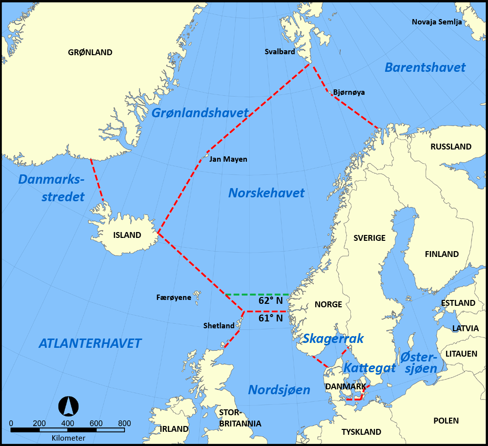
| 12:19, 2 October 2012 | Norwegian Sea map no.png (file) |  |
406 KB | update of limits |
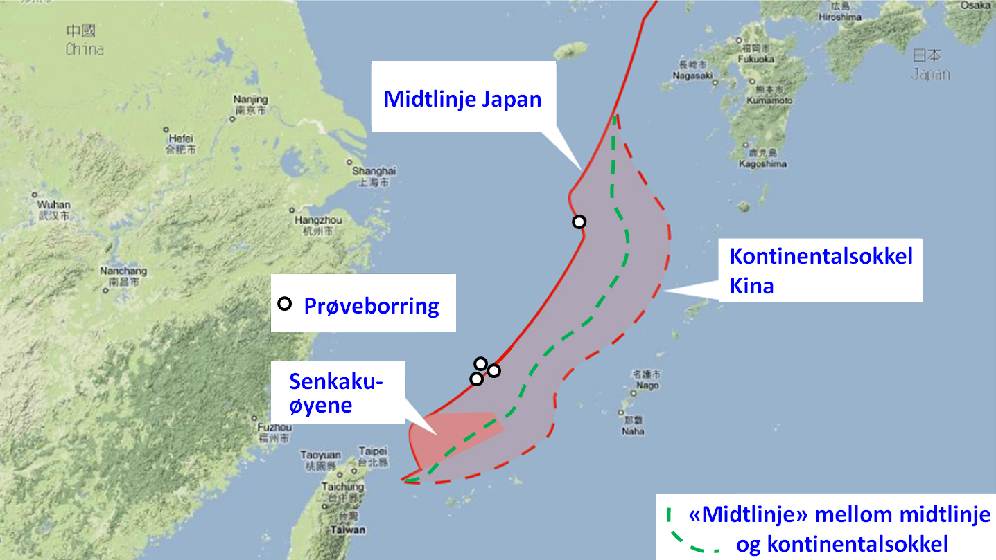
| 12:56, 24 September 2012 | EEZ disputes in East China Sea NO.jpg (file) |  |
501 KB | {{Information |Description ={{en|1=Map in Norwegian of EEZ disputes in East China Sea}} |Source ={{own}} |Author =Gryphonis |Date =2012-09-24 |Permission ={{self|GFDL|cc-by-sa-3.0,2.5,2.0,1.0}} |other... |
| 07:46, 4 September 2012 | Soot Canal Lock System.jpg (file) |  |
499 KB | Arrow change |
| 03:22, 10 April 2012 | Azawad map-norwegian.jpg (file) |  |
249 KB | {{Information |Description ={{en|1==={{int:filedesc}}== {{Information |description={{en|1=Azawad map}} |date=2012-04-09 |source={{own}} |author=Mihai mad |permission= |other_versions= |other_fields= }} =={{int:license-header}}== ... |
| 15:44, 1 January 2012 | DiretoratetForByggKvalitet.jpg (file) |  |
185 KB | == {{int:filedesc}} == {{Information |Description={{en|1=Official National Office of Building Technology and Administration Icon}} {{no|1=Offisiel logo: Direktoratet for byggkvalitet}} |Source=dep.no |Author=Gryphonis |Date=2012-01-01 | |
| 16:41, 7 November 2011 | MidtPaaE6.jpg (file) |  |
197 KB | {{Information |Description ={{no|1=Skilt på Fauske vegstasjon «midt på E6»}} |Source ={{own}} |Author =Gryphonis |Date =2008 |Permission = |other_versions = }} [[Category:Category:E6 (Nordland)] |
| 22:20, 10 September 2011 | Glomma-river.png (file) |  |
221 KB | Added in yellow: Glomma's area of precipitation |
| 15:47, 4 September 2011 | Svinefylking1.jpg (file) |  |
180 KB | {{Information |Description={{no|Svinefylking etter Store norske leksikon (http://snl.no/.bilde/fylking_(prinsippskisse%2C_svinefylking))}}{{en|Tactical formation svinefylking after Norwegian Encyclopedia: http://snl.no/.bilde/fylking_(prinsippskisse%2C_sv |
| 09:18, 21 August 2011 | PrologStation.jpg (file) |  |
531 KB | {{Information |Description={{en|1=The Prolog Station. Artist image of the first station at the Tromsø railway}} {{no|1=Prolog Stasjon. Kunstinstallasjon son viser Nordnorgesbanens første stasjon på Setermoen.}} |Source={{o |
| 22:31, 27 June 2011 | Romerike grenser.jpg (file) |  |
322 KB | Changed position of Nannestad and Hurdal |
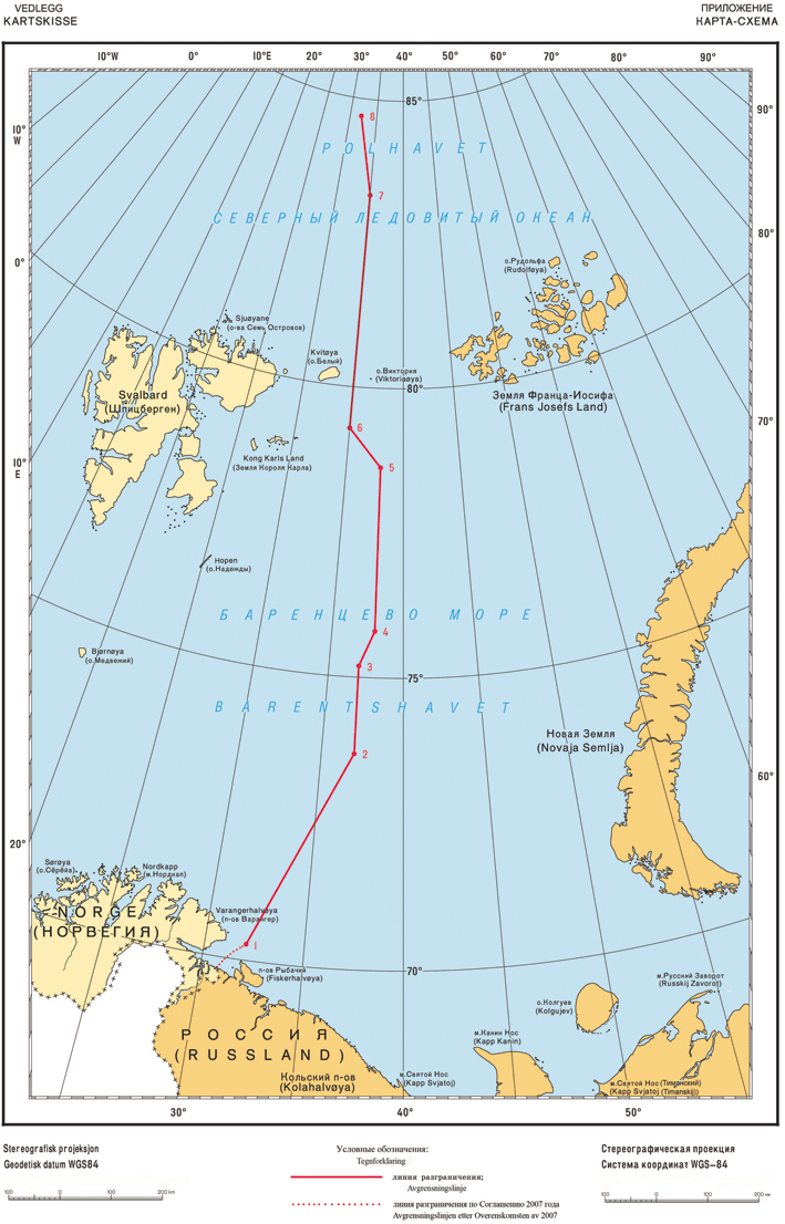
| 15:57, 8 June 2011 | Map borderline at sea Norway Russia.gif (file) |  |
265 KB | {{Information |Description={{no|Delelinjen i Barentshavet.}} |Source=Own work, based upon [http://www.regjeringen.no/upload/UD/Vedlegg/Folkerett/100914_Kartskisse_final.pdf Norwegian State Departement.] |Date=2011-06-08 |Author=[[User: |
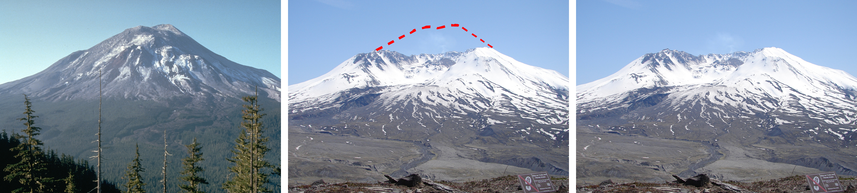
| 16:34, 24 March 2011 | StHelensBeforeAfter.jpg (file) | 1.65 MB | == {{int:filedesc}} == {{Information |Description={{en|Left: Mount Saint Helens from Johnson Ridge, State of Washington, United-States, one day before the devastating eruption; Middle: dotted line indicate what disappeared in the eruption; Right: Mountain | |
| 07:43, 19 March 2011 | Libya ethnic no.svg (file) |  |
73 KB | {{Information |Description={{en|1=Ethnic groups in Libya (1974). {{legend|#d9b36c|en:Arab et en:Arabized Berber}} {{legend|#ff9403|en:Berber}} {{legend|#d777ff|en:Tuareg}} {{legend|#b4fb71|en:Toubou}} {{legend|#c8c8c8|uninhabited} |
| 13:55, 16 March 2011 | SeismoNemogram.jpg (file) |  |
464 KB | == Summary == {{Information |Description={{en|1=Calculation of Magnitude with seismogram and nemogram}} {{no|1=Beregning av styrke (magnitude) med seismogram og nemogram}} |Source={{English Wikipedia, [[w:en:User:Crickett|Cri |
| 07:57, 10 March 2011 | Map Haldenwaterway with neighbour waterways.jpg (file) |  |
1.63 MB | inseted Østelva, Vestelva, Flolangen and Tunnsjøen |
| 11:11, 1 March 2011 | Sorum communities.jpg (file) |  |
141 KB | == Summary == {{Information |Description={{en|1=Map of the communities in Sørum}} {{no|1=Kart over tettsteder i Sørum kommune}} |Source={{own}} |Author=Gryphonis |Date=2011-03-01 |Permission= |other_versions= }} Category:Sørum = |
| 20:54, 30 January 2011 | Jan Mayen topography no.png (file) |  |
384 KB | {{Information |Description={{no|Topografisk kart over Jan Mayen, Norge}}{{fr|Carte topographique de l'île de Jan Mayen, Norvège}}{{en|Topographic map of Jan Mayen, Norway}} |Source=Rémih |Date=2011-01-30 |Author=[[User:Gryphonis|Grypho |
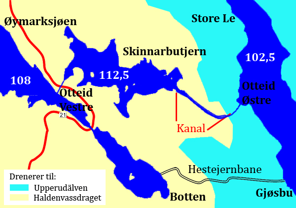
| 17:33, 10 December 2010 | Soot Otteidkanalen.jpg (file) |  |
200 KB | Lagt inn vannskillet |
| 21:18, 9 December 2010 | Kolstadfoss.jpg (file) |  |
248 KB | == Summary == {{Information |Description={{en|1=Map over Kolstadfoss (waterfall) old timberpass (water transport)}} {{no|1=Kart over Kolstadfoss}} |Source={{own}} |Author=Gryphonis |Date=2010-12-09 |Permission= |other_versions= }} [[Ca |
| 10:17, 8 December 2010 | Mangenvassdraget.jpg (file) |  |
1.05 MB | Satt inn Norge og Sverige. Säffle kanal. Sootkanalen og Grasmobanen |
| 02:19, 6 December 2010 | Kjerraten i Aasa.jpg (file) |  |
287 KB | == Summary == {{Information |Description={{en|1=The Asa Kjerrat - Map of log haul up}} {{no|1= Kart som viser de 11 kjerratene i Åsa. Den 12. ble aldri bygd, men erstattet med en hestebane}} {{de|1=Holzaufzug}} |Source={{own}} |Author=[[User:Gryphonis|G |
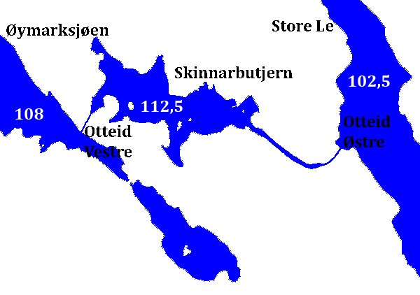
| 06:36, 4 December 2010 | Soot Otteidkanalen.gif (file) |  |
9 KB | == Summary == {{Information |Description={{en|1=The Soot Canal - Map of the Otteid Canal}} {{no|1=Sootkanalen kart over Otteidkanalen}} |Source={{own}} |Author=Gryphonis |Date=2010-12-04 |Permission= |other_versions= }} [[Category:Hald |
| 02:22, 4 December 2010 | Soot Hvervselva3106.jpg (file) |  |
771 KB | == Summary == {{Information |Description={{en|1=The Soot Canal - picture of old Lock (water transport)}} {{no|1=Sootkanalen (slusesystemet] bilder av sluser}} |Source={{own}} |Author=Gryphonis |Date=2010-12-04 |Permission= |other_v |
| 02:21, 4 December 2010 | Soot Hvervselva3104.jpg (file) |  |
1.87 MB | == Summary == {{Information |Description={{en|1=The Soot Canal - picture of old Lock (water transport)}} {{no|1=Sootkanalen (slusesystemet] bilder av sluser}} |Source={{own}} |Author=Gryphonis |Date=2010-12-04 |Permission= |other_v |
| 02:20, 4 December 2010 | Soot Konstitution Sverige.jpg (file) |  |
1.17 MB | == Summary == {{Information |Description={{en|1=The Soot Canal - picture of old Lock (water transport)}} {{no|1=Sootkanalen (slusesystemet] bilder av sluser}} |Source={{own}} |Author=Gryphonis |Date=2010-12-04 |Permission= |other_v |
| 02:20, 4 December 2010 | Soot Stang Schwegaard.jpg (file) |  |
1.27 MB | == Summary == {{Information |Description={{en|1=The Soot Canal - picture of old Lock (water transport)}} {{no|1=Sootkanalen (slusesystemet] bilder av sluser}} |Source={{own}} |Author=Gryphonis |Date=2010-12-04 |Permission= |other_v |
| 02:19, 4 December 2010 | Soot Fredrikshald.jpg (file) |  |
1.29 MB | == Summary == {{Information |Description={{en|1=The Soot Canal - picture of old Lock (water transport)}} {{no|1=Sootkanalen (slusesystemet] bilder av sluser}} |Source={{own}} |Author=Gryphonis |Date=2010-12-04 |Permission= |other_v |
| 02:18, 4 December 2010 | Soot Konstitution.jpg (file) |  |
2.29 MB | == Summary == {{Information |Description={{en|1=The Soot Canal - picture of old Lock (water transport)}} {{no|1=Sootkanalen (slusesystemet] bilder av sluser}} |Source={{own}} |Author=Gryphonis |Date=2010-12-04 |Permission= |other_v |
| 13:59, 3 December 2010 | Trygve Gulbranssen signature.jpg (file) | 377 KB | Svart hvit | |
| 21:58, 2 December 2010 | Dam reservoir filling grade.jpg (file) |  |
292 KB | {{Information |Description= |Source={{own}} |Date= |Author= Gryphonis |Permission= |other_versions= }} Category:Dams in Norway |
| 06:35, 5 October 2010 | Ile de la Deception Norwegian.svg (file) |  |
291 KB | Forandret noen navn |
| 22:48, 9 September 2010 | Measuring Total Level Area (TLA).gif (file) | .gif) |
41 KB | {{Information |Description=Measuring area of building |Source={{own}} |Date=10.09.2010 |Author= Gryphonis |Permission= |other_versions= }} |
| 22:47, 9 September 2010 | Measuring Plot Area (PLA).gif (file) | .gif) |
8 KB | {{Information |Description=Measuring area of building |Source={{own}} |Date=10.09.2010 |Author= Gryphonis |Permission= |other_versions= }} |
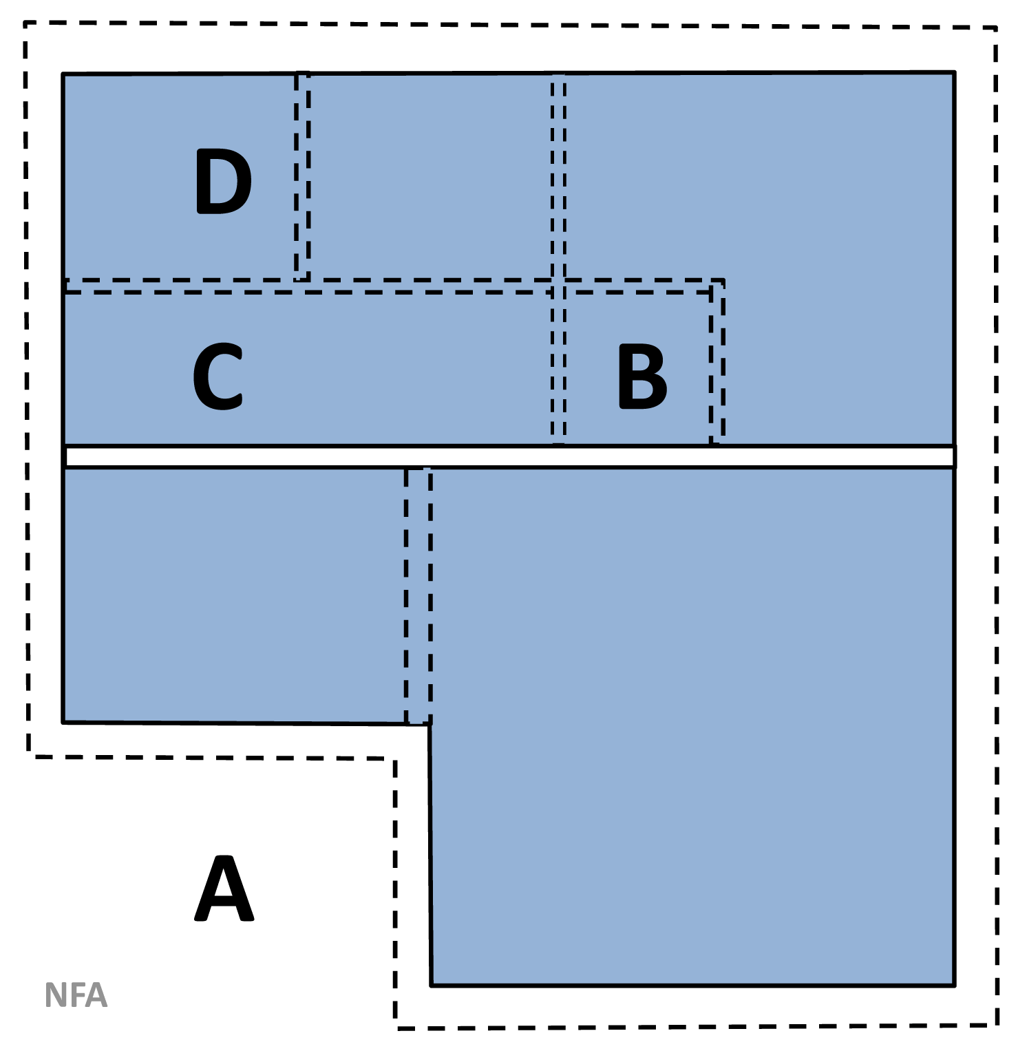
| 22:47, 9 September 2010 | Measuring Net Floor Area (NFA).gif (file) | .gif) |
32 KB | {{Information |Description=Measuring area of building |Source={{own}} |Date=10.09.2010 |Author= Gryphonis |Permission= |other_versions= }} |
| 22:47, 9 September 2010 | Measuring Circulation Area (CA).gif (file) | .gif) |
33 KB | {{Information |Description=Measuring area of building |Source={{own}} |Date=10.09.2010 |Author= Gryphonis |Permission= |other_versions= }} |
| 22:46, 9 September 2010 | Measuring Primary Area Un-Restricted (UPA).gif (file) | .gif) |
36 KB | {{Information |Description=Measuring area of building |Source={{own}} |Date=10.09.2010 |Author= Gryphonis |Permission= |other_versions= }} |
| 22:46, 9 September 2010 | Measuring Partition Wall Area (PWA).gif (file) | .gif) |
33 KB | {{Information |Description=Measuring area of building |Source={{own}} |Date=10.09.2010 |Author= Gryphonis |Permission= |other_versions= }} |
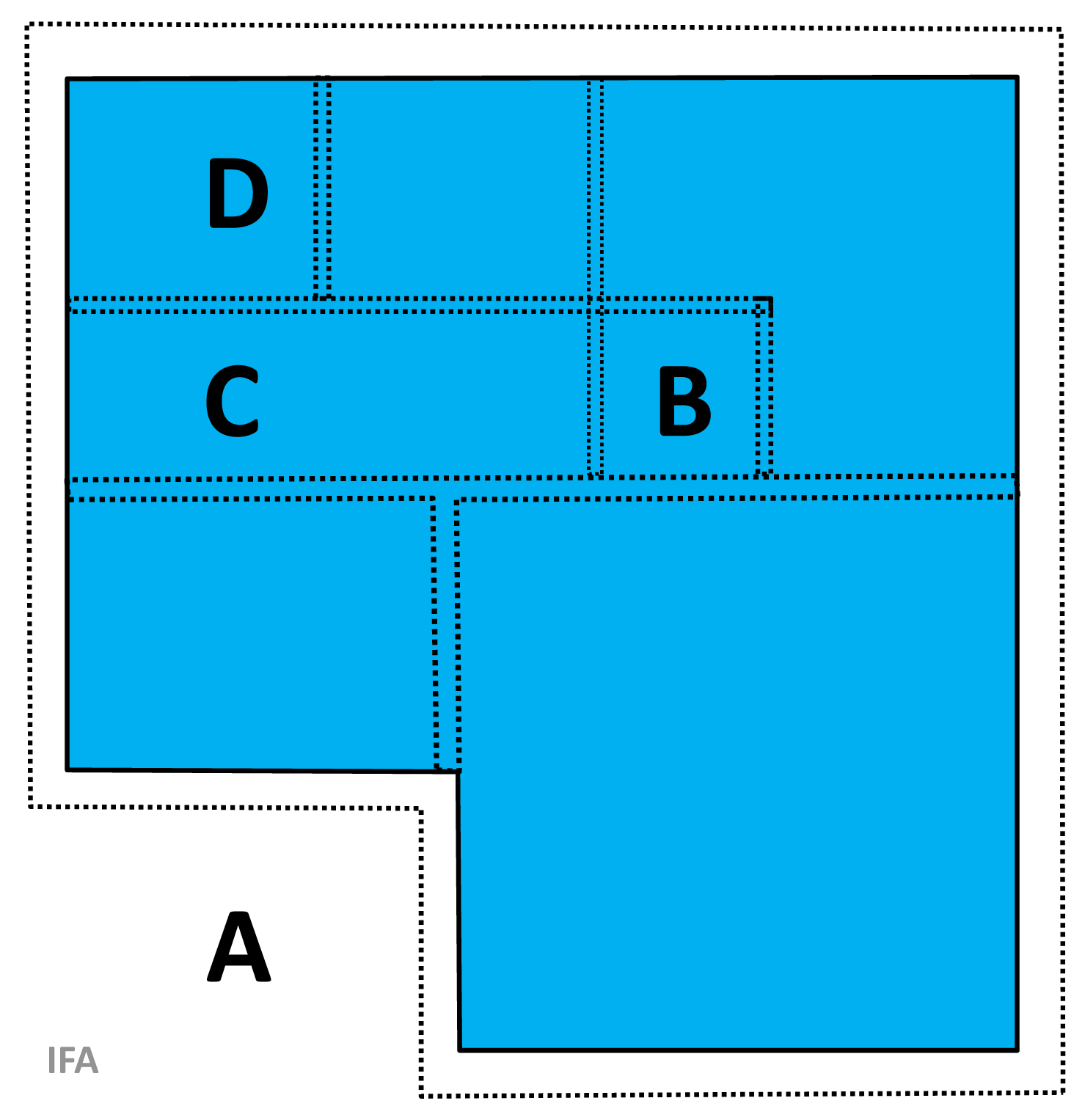
| 22:46, 9 September 2010 | Measuring Internal Floor Area (IFA).gif (file) | .gif) |
39 KB | {{Information |Description=Measuring area of building |Source={{own}} |Date=10.09.2010 |Author= Gryphonis |Permission= |other_versions= }} |
| 22:46, 9 September 2010 | Measuring Built Area (BUA).gif (file) | .gif) |
55 KB | {{Information |Description=Measuring area of building |Source={{own}} |Date=10.09.2010 |Author= Gryphonis |Permission= |other_versions= }} |
| 22:45, 9 September 2010 | Measuring Primary Area Restricted (RPA).gif (file) | .gif) |
34 KB | {{Information |Description=Measuring area of building |Source={{own}} |Date=10.09.2010 |Author= Gryphonis |Permission= |other_versions= }} |
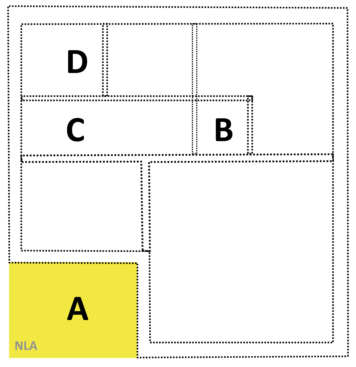
| 22:45, 9 September 2010 | Measuring Non-functional Level Area (NLA).gif (file) | .gif) |
37 KB | {{Information |Description=Measuring area of building |Source={{own}} |Date=10.09.2010 |Author= Gryphonis |Permission= |other_versions= }} |
| 22:45, 9 September 2010 | Measuring Interior Construction Area (ICA).gif (file) | .gif) |
28 KB | {{Information |Description=Measuring area of building |Source={{own}} |Date=10.09.2010 |Author= Gryphonis |Permission= |other_versions= }} |
| 22:44, 9 September 2010 | Measuring Amenity Area (AA).gif (file) | .gif) |
32 KB | {{Information |Description=Measuring area of building |Source={{own}} |Date=10.09.2010 |Author= Gryphonis |Permission= |other_versions= }} |
| 22:44, 9 September 2010 | Measuring Un-Built Area (UBA).gif (file) | .gif) |
12 KB | {{Information |Description=Measuring area of building |Source={{own}} |Date=10.09.2010 |Author= Gryphonis |Permission= |other_versions= }} |