Uploads by Monfornot
Jump to navigation
Jump to search
For Monfornot (talk · contributions · Move log · block log · uploads · Abuse filter log)
This special page shows all uploaded files that have not been deleted; for those see the upload log.
| Date | Name | Thumbnail | Size | Description |
|---|---|---|---|---|
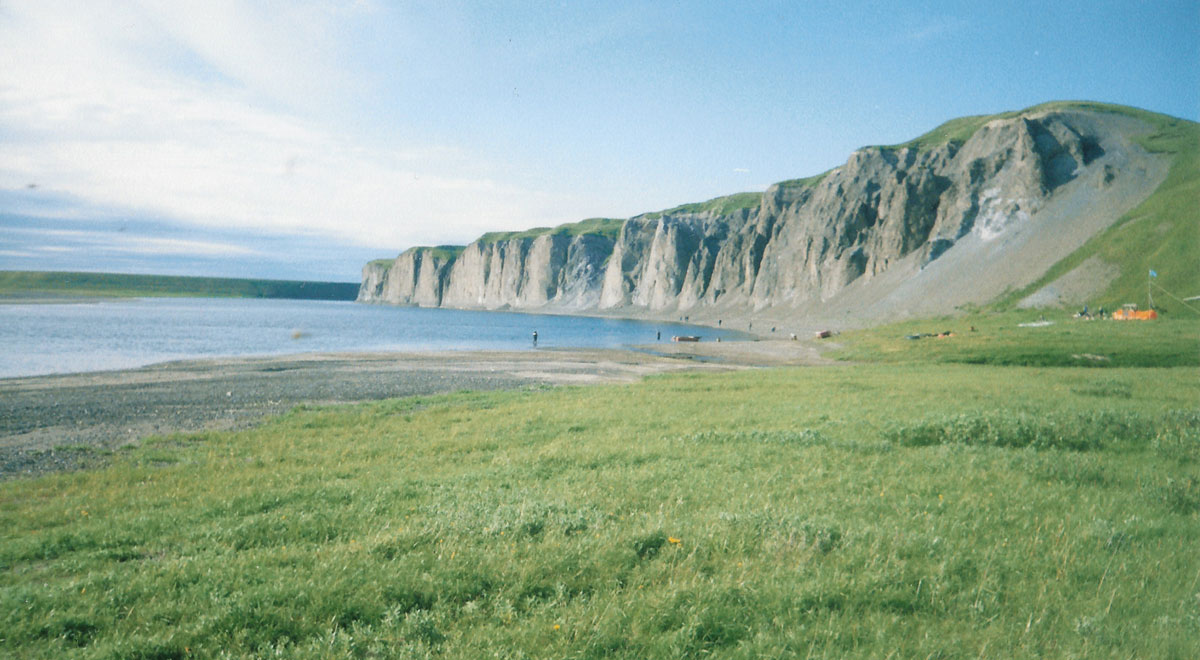
| 09:53, 31 January 2010 | Kara-river.jpg (file) |  |
166 KB | {{Information |Description={{en|1=The lower section of Kara River, Russia}} |Source={{own}} |Author=Monfornot |Date=1997-08-20 |Permission= |other_versions= }} {{coord|68.8674782|N|64.6620941|E|display=inline}} [[Category:Rivers of Nene |
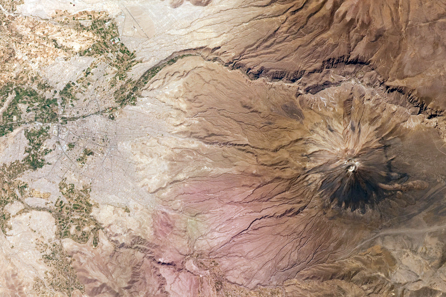
| 01:33, 10 January 2010 | El Misti Volcano and Arequipa, Peru.jpg (file) |  |
475 KB | bigger version |
| 18:40, 8 January 2010 | G06 s65 63158.jpg (file) |  |
469 KB | levels, cropped corners a bit |
| 21:36, 16 October 2009 | Kegon falls.jpg (file) |  |
377 KB | improved levels a bit |
| 11:00, 3 October 2009 | Alanya castle description.JPG (file) |  |
1.13 MB | {{Information |Description={{en|1=Information board in the Alanya Castle}} |Source={{own}} |Author=Monfornot |Date=2004-10-03 |Permission= |other_versions= }} Category:Alanya |
| 11:54, 27 June 2009 | Caribbean Sea labeled ru.jpg (file) |  |
264 KB | typo |
| 23:59, 26 June 2009 | Torre de Hércules plan.jpg (file) |  |
122 KB | {{Information |Description={{en|1=An illustration form the Don Joseph Cornide book "Investigaciones sobre la fundación y fábrica de la torre llamada de Hércules, situada a la entrada del puerto de La Coruña" with floor paln of the Tower of Hercules}} |
| 10:01, 23 June 2009 | Dunes of river ice, Húnaflói.jpg (file) | 491 KB | {{Information |Description={{en|Dunes of river ice, cast ashore by wind, surf, and tide from Húnaflói. Vatnsnes to the east, and Ballafjöll in the Westfjords to the northeast. November 21 13:07 Iceland, November 2007 Photo by me user debivort (or fri | |
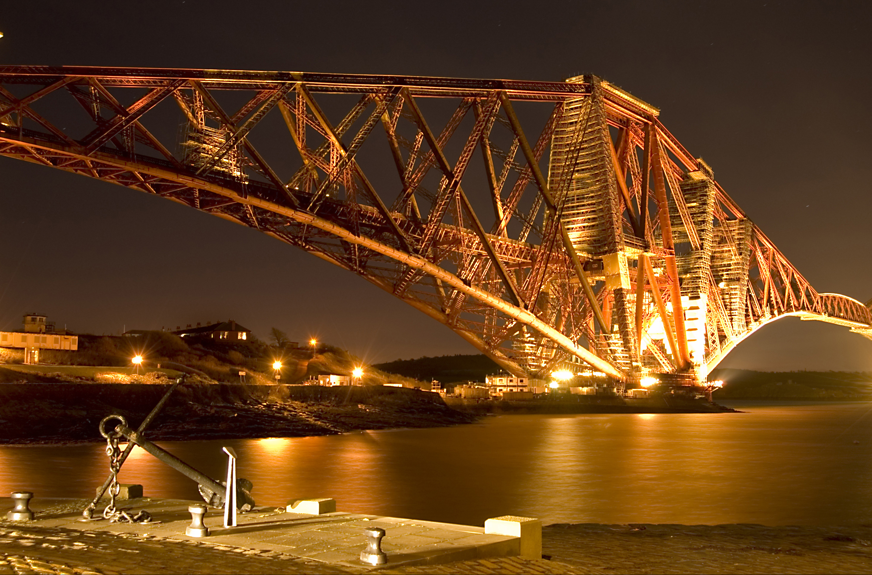
| 02:29, 19 June 2009 | Forth Rail Bridge with Anchor hdr.jpg (file) |  |
2.01 MB | Removed the borber |
| 22:31, 17 June 2009 | Wfm db forth bridges.jpg (file) |  |
281 KB | Improved levels |
| 23:15, 15 June 2009 | At the Lake of Skadar.jpg (file) |  |
483 KB | {{Information |Description= At the Lake of Skadar, Montenegro. |Source=[http://www.flickr.com/photos/29653764@N08/2787120692/ IMG_0613] |Date=2007-08-07 10:28 |Author=[http://www.flickr.com/people/29653764@N08 Darij & Ana] |Permission= |other_versions= } |
| 11:35, 12 June 2009 | Valvasor - Cerkniško jezero (1689).jpg (file) | .jpg) |
386 KB | auto levels |
| 17:54, 7 June 2009 | Škocjan, Divača - naravni most med Veliko in Malo dolino.jpg (file) |  |
4.22 MB | {{Information |Description= Also known as S%u030Ckocjanske Jame, reccognised as one of the most important caves in the world and listed by UNESCO since 1986. Was really disappointed that I did not get to take a tour inside it after making the trip there. |
| 17:48, 4 June 2009 | La Ceiba City Hall.jpg (file) |  |
989 KB | {{Information |Description={{en|La Ceiba City Hall along the main thoroughfare of the City}} |Source=Transferred from [http://en.wikipedia.org en.wikipedia]<br/> (Original text : ''self-made'') |Date=June 2007<br/> ({{Date|2008|04|22}} (original upload da |
| 20:01, 22 May 2009 | Aral sea 20090503.jpg (file) |  |
934 KB | {{Information |Description={{en|1=Dust Over the Aral Sea, approx. shoreline of 1960 outlined}} |Source=http://earthobservatory.nasa.gov/Features/WorldOfChange/aral_sea.php |Author=NASA’s Terra satellite |Date=2009-05-03 |Permission= |other_versions= }} |
| 10:45, 17 May 2009 | BalkhashPlaneTransaero.JPG (file) | 325 KB | improved colors | |
| 11:32, 13 April 2009 | Gibson Desert and moon from Alfred & Marie Range.jpg (file) |  |
845 KB | {{Information |Description={{en|Photo taken from one of the highest parts of the Alfred and Marie Range in the Gibson Desert and gives a typical idea of what the general landscape looks like (ie mostly spinifex)}} |Source=Transferred from [http://en.wikip |
| 11:29, 1 April 2009 | Map of USA with state names ru.svg (file) |  |
334 KB | moved west virginia further left |
| 07:48, 1 April 2009 | Reef 247.jpg (file) |  |
1.69 MB | Rotated |
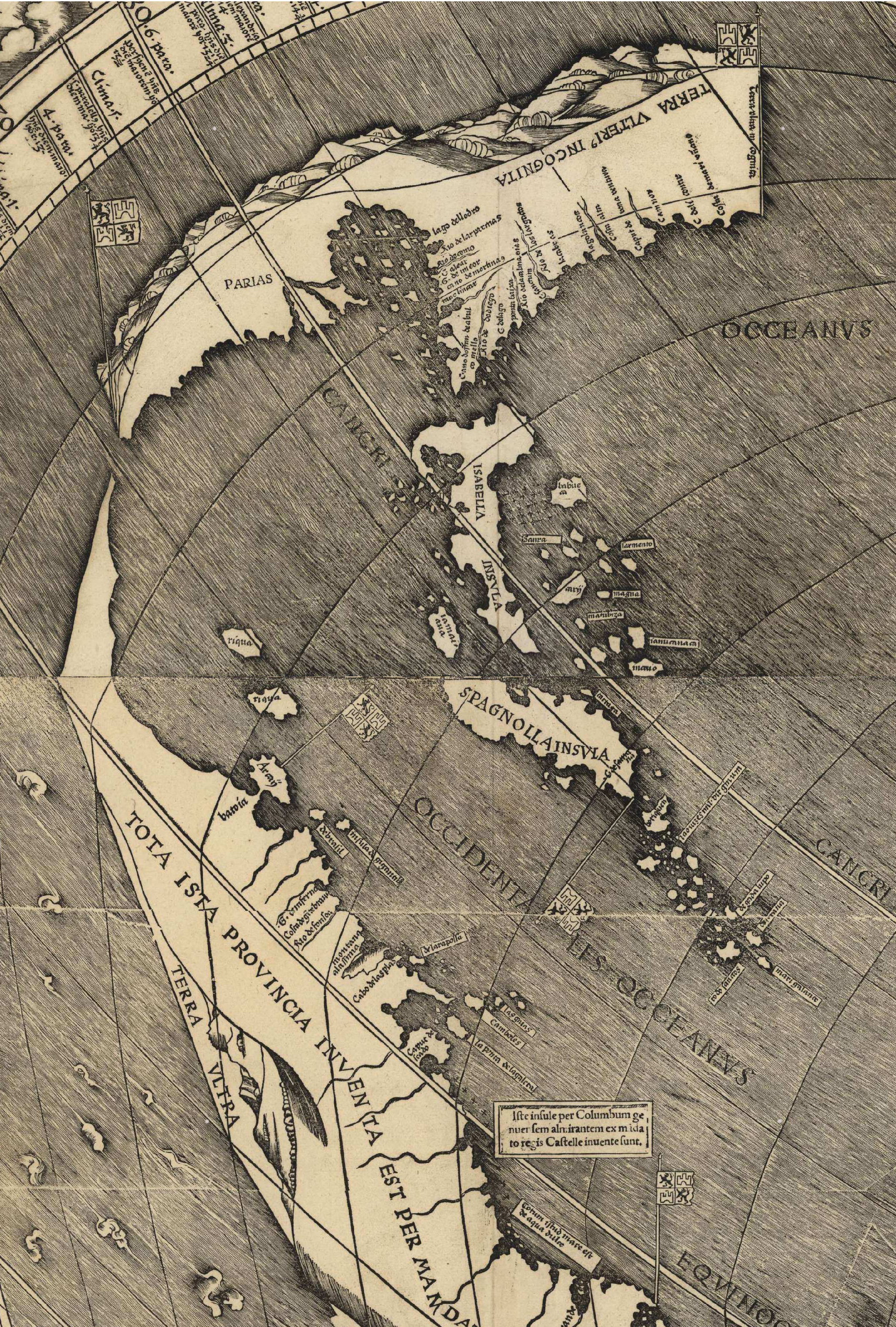
| 03:27, 1 April 2009 | Waldseemuller map Caribbean.jpg (file) |  |
3.89 MB | {{Information |Description=Fragment of the Waldseemüller map centered around the Caribbean region. |Source=*File:Waldseemuller_map_2.jpg |Date=2009-04-01 04:25 (UTC) |Author=*File:Waldseemuller_map_2.jpg: Waldseemul |
| 19:47, 21 March 2009 | Hedychium coronarium by Wilder.JPG (file) |  |
255 KB | {{Information |Description={{en|mine}} |Source=Transferred from [http://en.wikipedia.org en.wikipedia] |Date=2007-02-22 (original upload date) |Author=Original uploader was Lezumbalaberenjena at [http://en.wikipedia.org en. |
| 15:56, 16 March 2009 | Alto de Chavon - Dominican Republic.jpg (file) |  |
161 KB | {{Information |Description= Chavon River - Alto de Chavon at La Romana, Dominican Republic |Source=[http://www.flickr.com/photos/61077396@N00/418480161/ Alto de Chavon - Dominican Republic] |Date=March 02, 2007 at 15:01 |Author=[http://www.flickr.com/peop |
| 15:51, 16 March 2009 | Dominican Republic 5 005.jpg (file) |  |
284 KB | {{Information |Description= Plantation in the Dominican Republic |Source=[http://www.flickr.com/photos/61077396@N00/2101731083/ Dominican Republic 5 005] |Date=March 02, 2007 at 14:12 |Author=[http://www.flickr.com/people/61077396@N00 Bree] from Worcester |
| 23:41, 15 March 2009 | ValleyCamajuani.JPG (file) |  |
125 KB | {{Information |Description={{en|my own}} |Source=Transferred from [http://en.wikipedia.org en.wikipedia] |Date=2007-05-23 (original upload date) |Author=Original uploader was Lezumbalaberenjena at [http://en.wikipedia.org e |
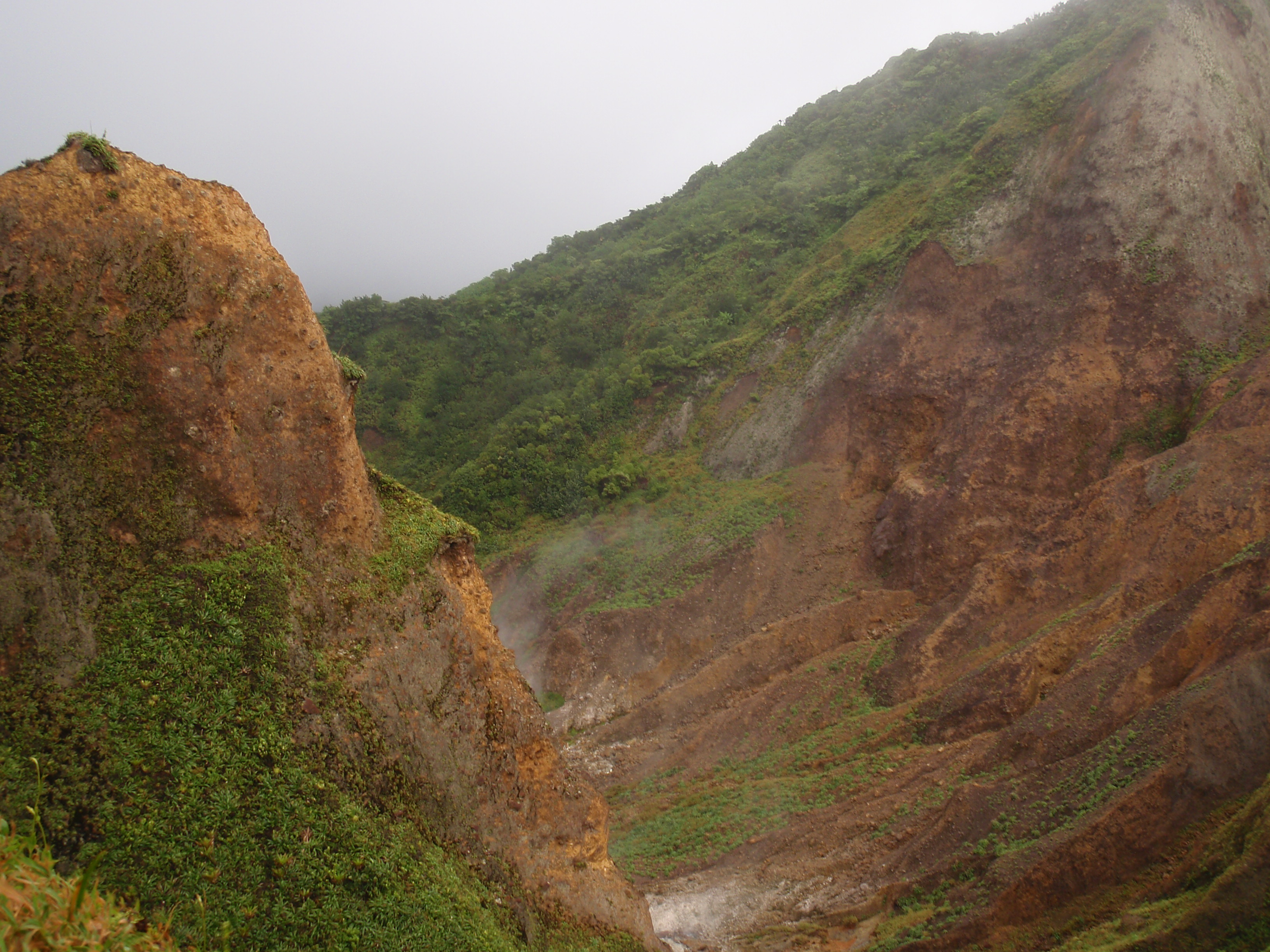
| 16:14, 12 March 2009 | Valley of desolation.jpg (file) |  |
1.97 MB | {{Information |Description=Valley of desolation in Morne Trois Pitons National Park |Source=Transferred from [http://en.wikipedia.org en.wikipedia]<br/> (Original text : ''I created this work entirely by myself.'') |Date=2009-01-16 (original upload date)< |
| 14:45, 12 March 2009 | Soufrerie rimlight.jpg (file) |  |
727 KB | {{Information |Description= The village of Soufriere lit up as night falls. the Pitons in the background are volcanic plugs rising straight out ogf the sea. St. Lucia W.I. the pitons are a world heritage site. |Source=[http://www.flickr.com/photos/8992212 |
| 14:43, 12 March 2009 | View north from Gros Piton.jpg (file) |  |
323 KB | {{Information |Description= View from the Gros Piton to the north |Source=[http://www.flickr.com/photos/19363660@N00/2537363539/ St- Lucia 480.jpg] |Date=March 08, 2008 at 13:14 |Author=[http://www.flickr.com/people/19363660@N00 Trent Foley] from Dallas, |
| 13:12, 12 March 2009 | Nevispeak1.jpg (file) |  |
47 KB | {{Information |Description={{en|Picture taken June 20 2007 on ferry trip to Nevis taken myself.}} |Source=Transferred from [http://en.wikipedia.org en.wikipedia] |Date=2007-06-27 (original upload date) |Author=Original uploader was [[:en:User:Jensonmorton |
| 12:05, 12 March 2009 | CienfuegosValle.JPG (file) |  |
158 KB | {{Information |Description={{en|My Own - Wilder}} |Source=Transferred from [http://en.wikipedia.org en.wikipedia] |Date=2007-05-23 (original upload date) |Author=Original uploader was Lezumbalaberenjena at [http://en.wikipe |
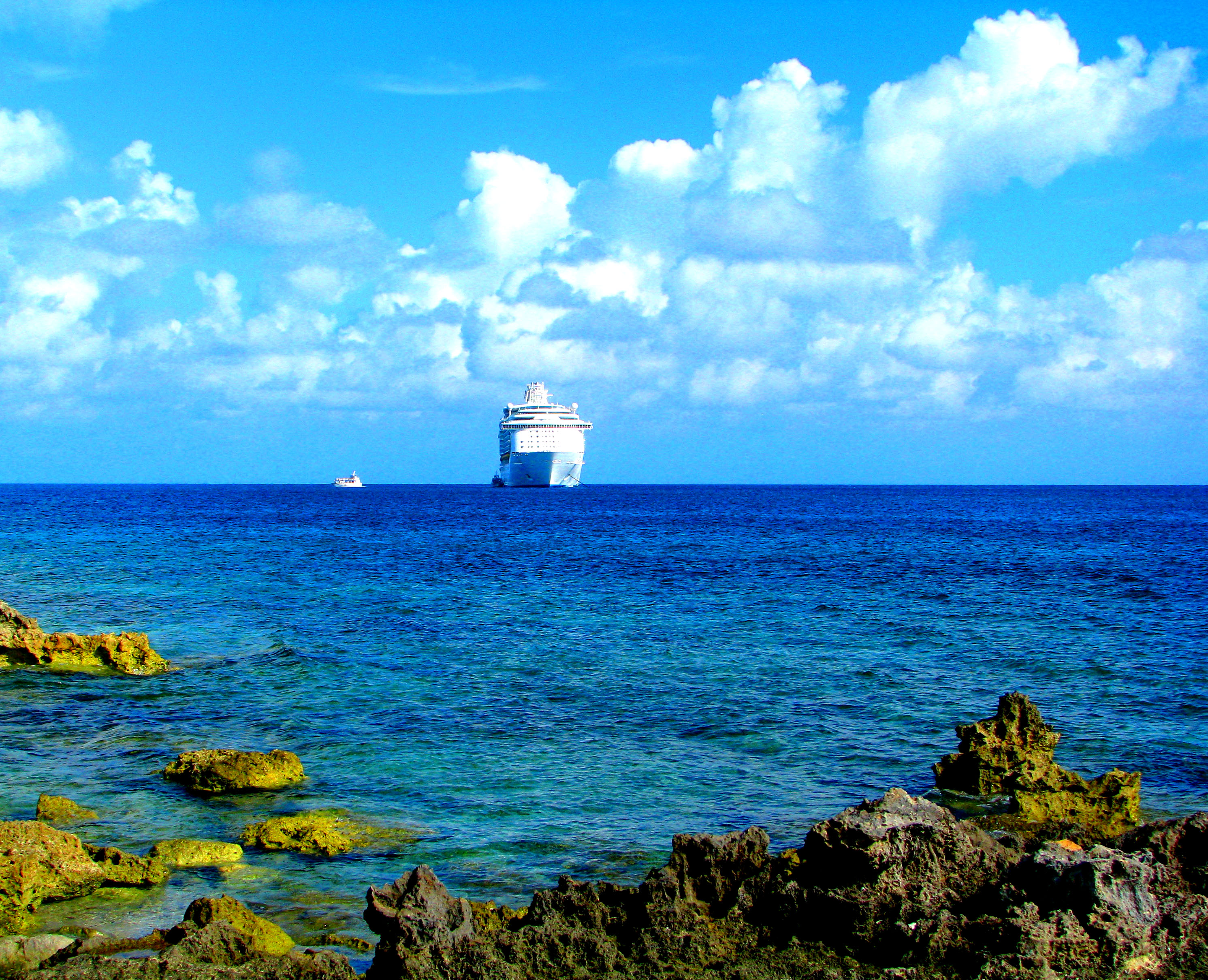
| 21:09, 9 March 2009 | Mariner of the Seas and Green Rocks.jpg (file) |  |
1.72 MB | {{Information |Description= Mariner of the Seas and Green Rocks, Caribbean sea |Source=[http://www.flickr.com/photos/10393601@N08/2883459287/ Mariner of the Seas and Green Rocks] |Date=September 23, 2008 at 20:37 |Author=[http://www.flickr.com/people/1039 |
| 23:34, 8 March 2009 | Tomas estrada palma.jpg (file) |  |
116 KB | {{Information |Description={{en|1=Tomás Estrada y Palma, the first President of Cuba}} |Source=http://www.cubaencuentro.com/es/opinion/articulos/la-guerrita-de-agosto-23435/(gnews)/1155787200 |Author=unknown |Date=before 1909 (year of death) |Permission= |
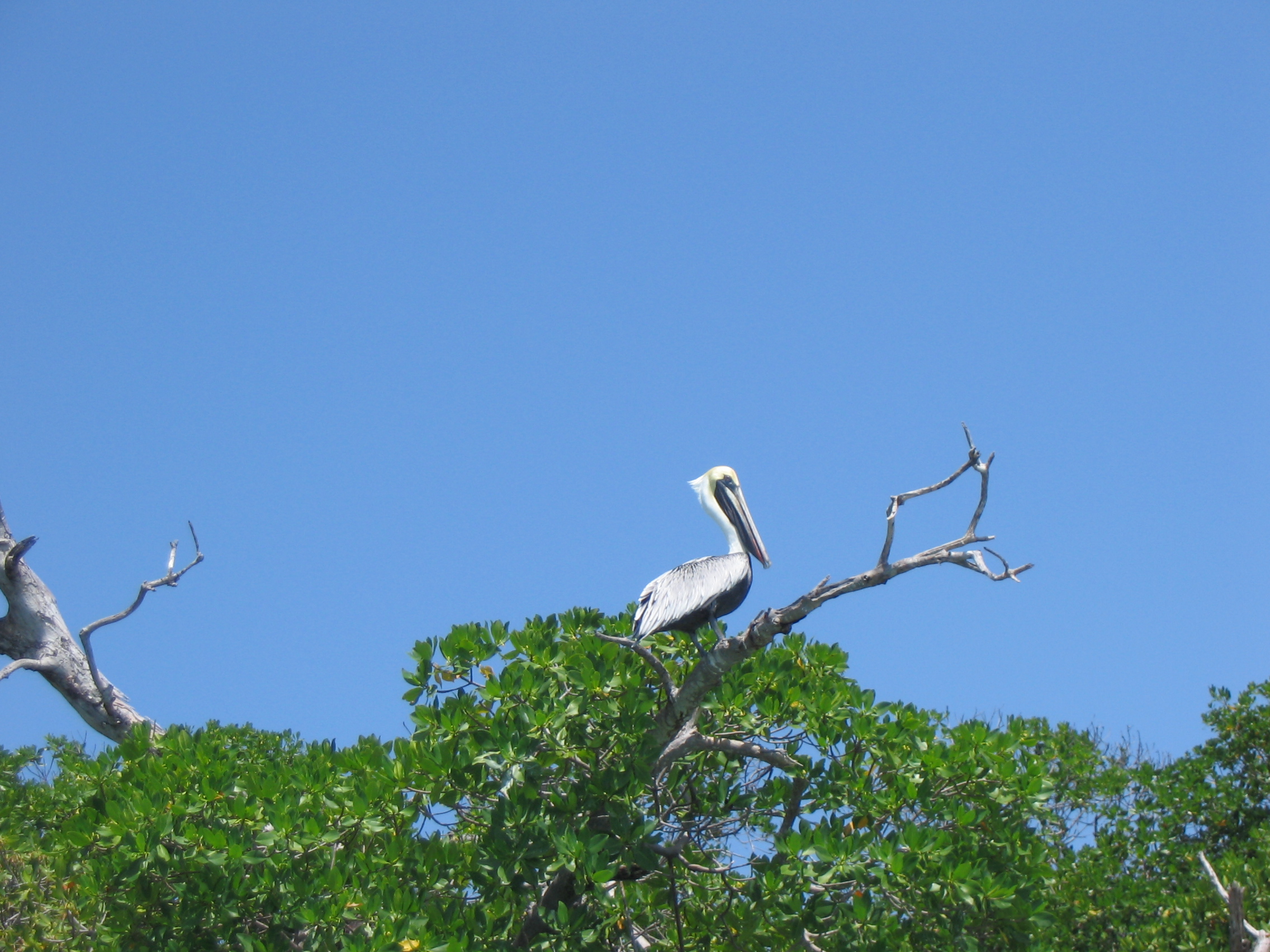
| 23:53, 4 March 2009 | Pelicano en Sian Ka'an.jpg (file) |  |
1.33 MB | {{Information |Description= Pelicano en Sian Ka'an |Source=[http://www.flickr.com/photos/12289625@N04/2799700126/ Pelicano en Sian Ka'an] |Date=August 15, 2008 at 16:31 |Author=[http://www.flickr.com/people/12289625@N04 ramonbaile] |Permission= |other_ve |
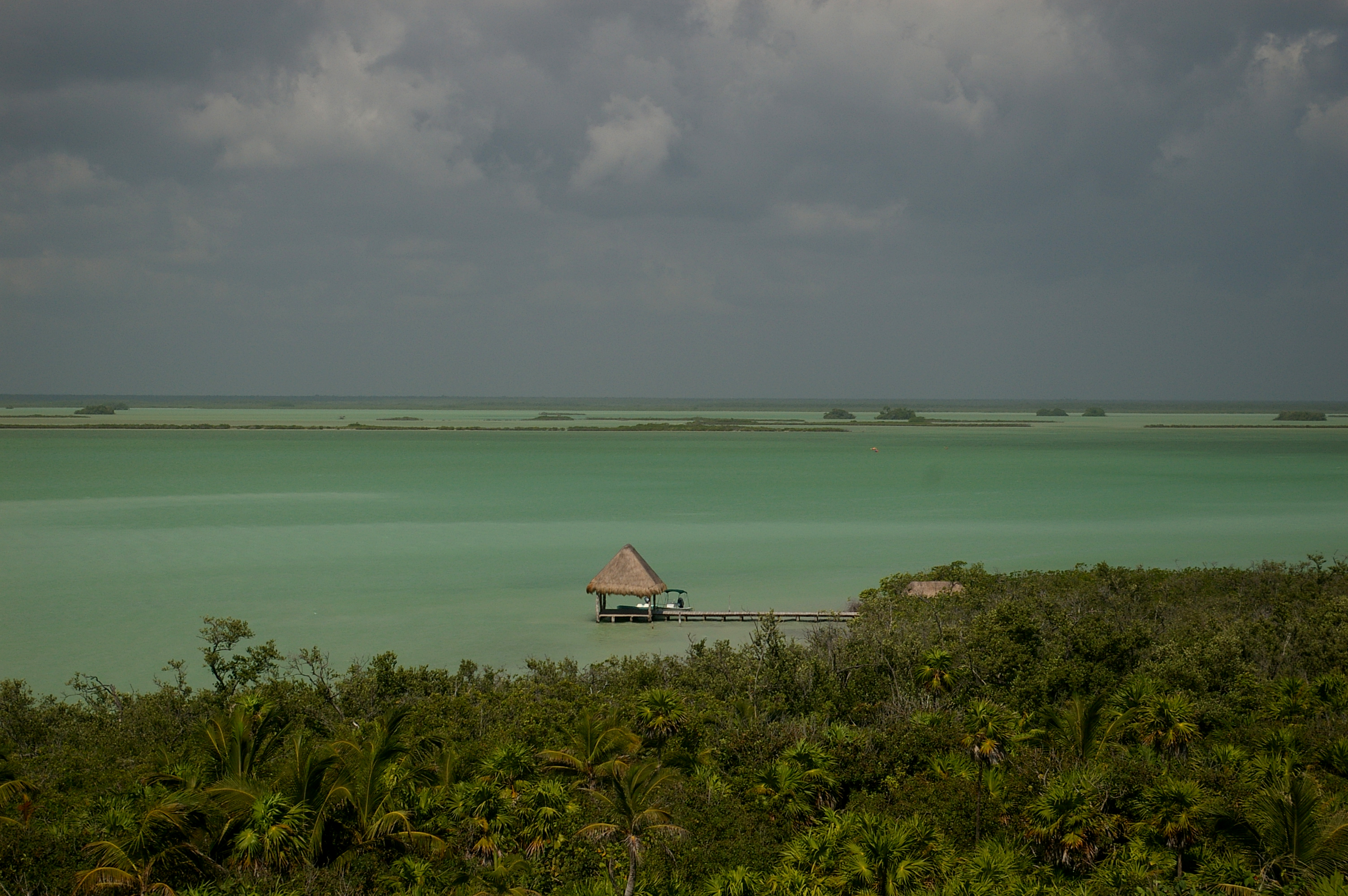
| 23:50, 4 March 2009 | Sian Ka'an Biosphere Reserve.jpg (file) |  |
3.47 MB | {{Information |Description= Sian Ka'an Biosphere Reserve |Source=[http://www.flickr.com/photos/16697023@N00/410645372/ Sian Ka'an Biosphere Reserve] |Date=March 04, 2007 at 16:25 |Author=[http://www.flickr.com/people/16697023@N00 Tim] |Permission= |other |
| 23:49, 4 March 2009 | Bridge in Sian Ka´an.jpg (file) |  |
3.23 MB | {{Information |Description= A bridge in Sian Ka´an |Source=[http://www.flickr.com/photos/16697023@N00/410654150/ IMGP4681 c] |Date=March 04, 2007 at 16:32 |Author=[http://www.flickr.com/people/16697023@N00 Tim] |Permission= |other_versions= }} ==Licens |
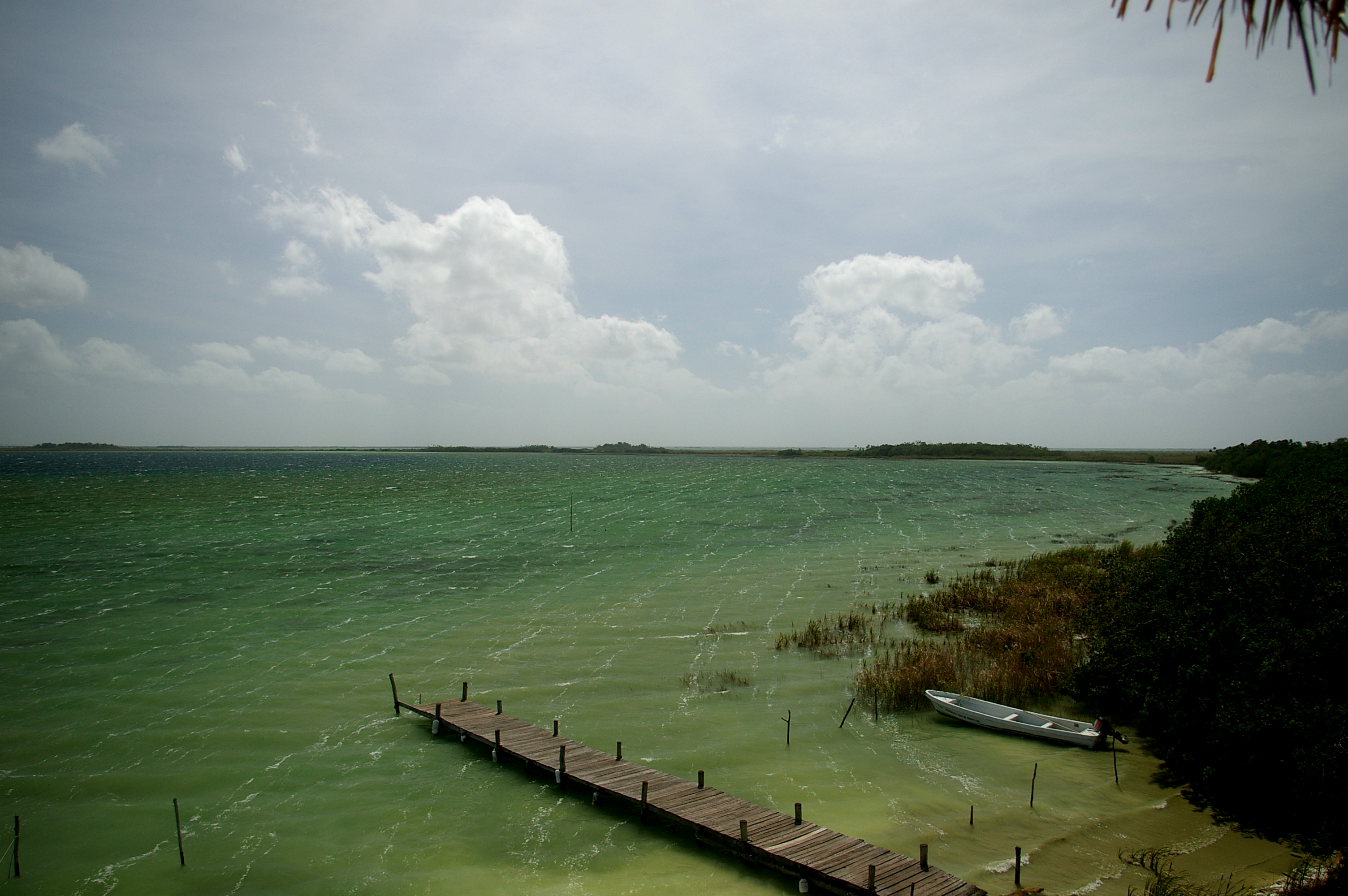
| 23:47, 4 March 2009 | Muyil Lagoon.jpg (file) |  |
2.85 MB | {{Information |Description= Muyil Lagoon, Sian Ka'an Biosphere Reserve |Source=[http://www.flickr.com/photos/16697023@N00/410676681/ Muyil Lagoon] |Date=March 04, 2007 at 16:52 |Author=[http://www.flickr.com/people/16697023@N00 Tim] |Permission= |other_v |
| 23:06, 2 March 2009 | Fort Portal View.jpg (file) |  |
880 KB | {{Information |Description= Scenic (in an urban sort of way) view from the Traveler's Inn in Fort Portal. It sure ain't Semliki Lodge. |Source=[http://www.flickr.com/photos/19814115@N00/289990820/ Fort Portal View] |Date=October 14, 2006 at 11:32 |Author= |
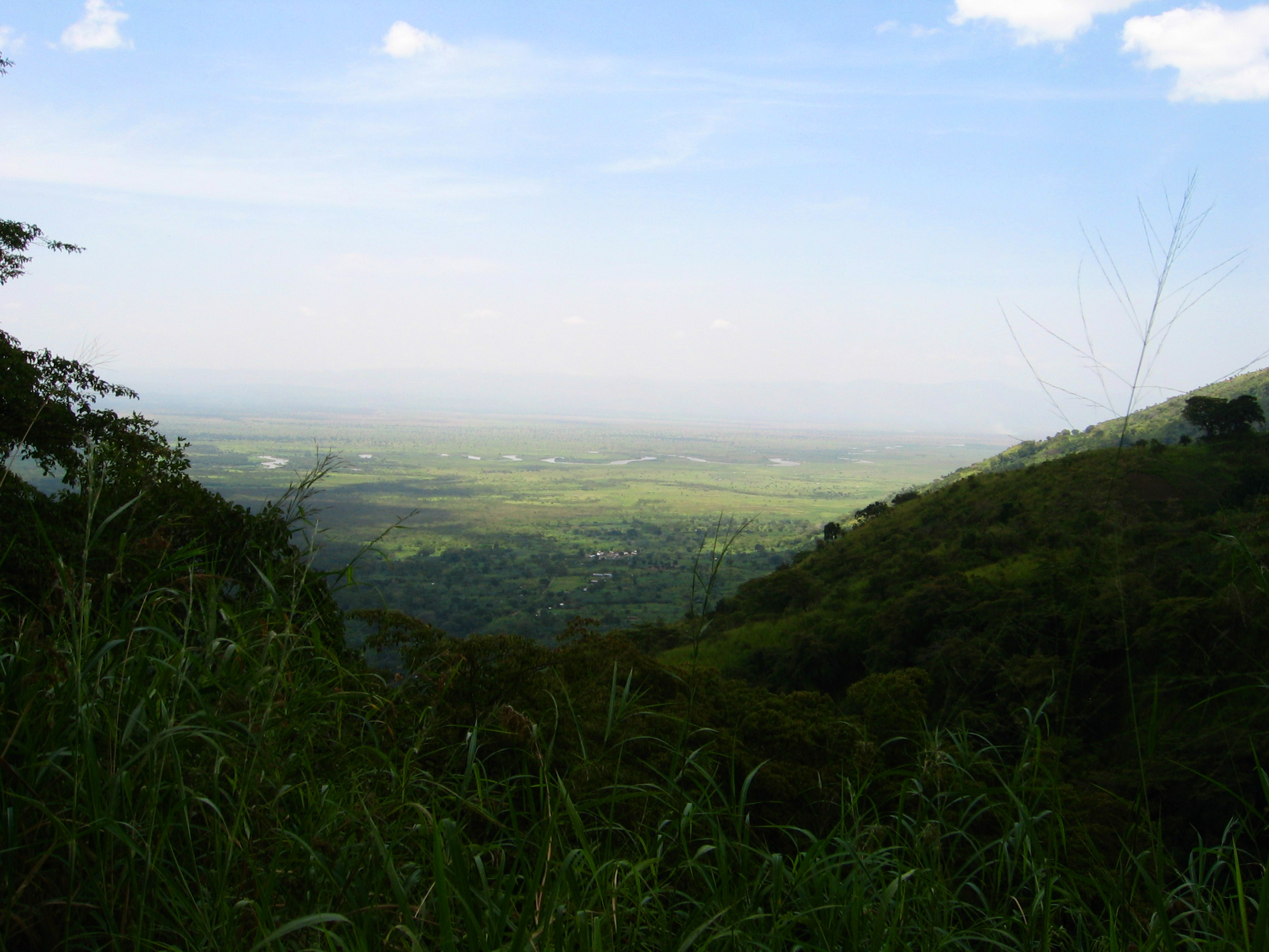
| 23:02, 2 March 2009 | Semliki River.jpg (file) |  |
990 KB | {{Information |Description= View of the Western Rift Valley and the twisting Semliki River |Source=[http://www.flickr.com/photos/19814115@N00/312053170/ Semliki River] |Date=October 13, 2006 at 06:08 |Author=[http://www.flickr.com/people/19814115@N00 sara |
| 10:04, 26 February 2009 | Puka Pukara.JPG (file) |  |
174 KB | {{Information |Description={{ja|2007年2月6日、ペルー共和国クスコ市近郊にて投稿者撮影。}} |Source=Transferred from [http://ja.wikipedia.org ja.wikipedia] |Date=2007-02-28 (original upload date) |Author=Original uploader was [[:ja:Us |
| 09:44, 26 February 2009 | Chicanna.jpg (file) |  |
329 KB | {{Information |Description={{en|2007 vargatamas}} |Source=Transferred from [http://en.wikipedia.org en.wikipedia] |Date=2007-08-29 (original upload date) |Author=Original uploader was Vargatamas at [http://en.wikipedia.org en.wikip |
| 00:52, 19 February 2009 | Indus River Delta.jpg (file) |  |
151 KB | {{Information |Description={{en|0}} |Source=Transferred from [http://en.wikipedia.org en.wikipedia] |Date=2005-12-01 (original upload date) |Author=Original uploader was Snowfalcon at [http://en.wikipedia.org en.wikipedia] |Permiss |
| 16:26, 17 February 2009 | Lake Balkhash.jpg (file) |  |
555 KB | Cropped out the figure to the left |
| 13:03, 13 February 2009 | Thai channel plans.jpg (file) |  |
103 KB | {{Information |Description=A blank map of Thailand with the provinces outlined. Copyright © en:User:Ahoerstemeier. |Source=*File:BlankMap_Thailand.png |Date=2009-02-13 12:40 (UTC) |Author=*en:User:Ahoerstemeier *derivative work: ~~~ |
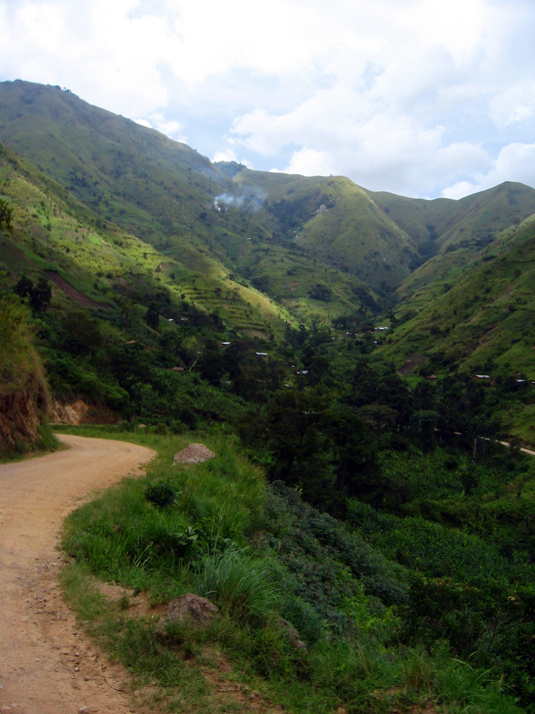
| 19:25, 12 February 2009 | Rwenzori road to Semilki National Park.jpg (file) |  |
1.16 MB | {{Information |Description= The winding road through the Rwenzori Foothills from Fort Portal to Semilki National Park. |Source=[http://www.flickr.com/photos/19814115@N00/312046161/ Rwenzori Foothills] |Date=October 13, 2006 at 05:16 |Author=[http://www.f |
| 19:16, 12 February 2009 | Rwenzori Foothills.jpg (file) |  |
934 KB | {{Information |Description= Lower slopes of the Rwenzori Mountain Range viewed from the crater lakes near Nyakasura Caves (Fort Portal) |Source=[http://www.flickr.com/photos/19814115@N00/290017755/ Rwenzori Foothills] |Date=October 16, 2006 at 10:43 |Auth |
| 19:01, 12 February 2009 | Explorer Chapin with Club Flag -4.JPG (file) |  |
967 KB | {{Information |Description={{en|Ornithologist James P. Chapin displays Flag #4 on expedition in the Ruwenzori Mountains, 1925.}} |Source=Transferred from [http://en.wikipedia.org en.wikipedia] |Date=2007-08-08 (original upload date) |Author=Original uploa |
| 18:55, 12 February 2009 | 1172 ruwenzori.jpg (file) |  |
140 KB | {{Information |Description={{en|Ruwenzori mountains Autor:Nick06}} |Source=Transferred from [http://en.wikipedia.org en.wikipedia] |Date=2008-11-22 (original upload date) |Author=Original uploader was Agripio at [http://en.wikipedia. |
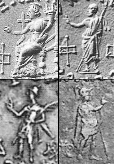
| 20:40, 10 February 2009 | IGMudras.jpg (file) |  |
153 KB | {{Information |Description=Indo-Greek mudras. Bopearachchi. Clockwise, from top left: *Detail of a coin of en:Amyntas *Detail of a coin of en:Peukolaos *Detail of a coin of en:Menander II *Detail of a coin of [[:en:King Nicia |
| 09:13, 6 February 2009 | SunriseAtThongNaiPan.jpg (file) |  |
1.82 MB | {{Information |Description={{en|Author: Mark Forster<br />Where?: Thong Nai Pan, Ko Pha Ngan, Thailand<br />When?: May 2006 This place really is paradise. It's like being in a movie.}} |Source=Transferred from [http://en.wikipedia.org en.wikipedia] |Date |
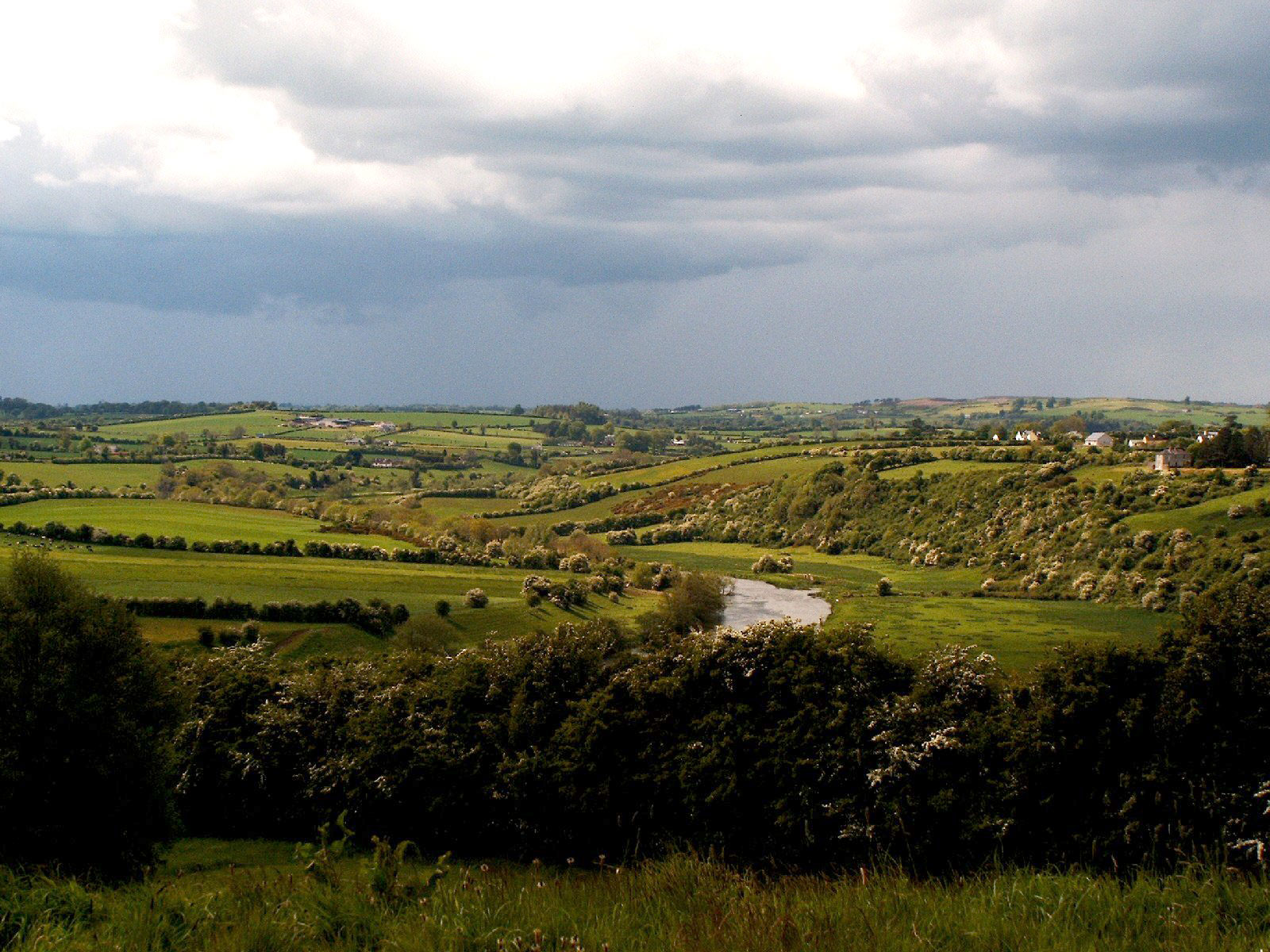
| 01:13, 2 February 2009 | Valley of the river Boyne.jpg (file) |  |
444 KB | Reverted to version as of 01:12, 2 February 2009 |
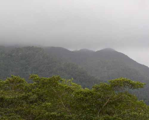
| 23:44, 30 January 2009 | Maya mtns fog.JPG (file) |  |
26 KB | {{Information |Description={{en|Maya Mtns Cayo District Belize Central America}} |Source=Transferred from [http://en.wikipedia.org en.wikipedia] |Date=2004-02-04 (original upload date) |Author=Original uploader was Belizian at [http: |