Uploads by Qllach
Jump to navigation
Jump to search
For Qllach (talk · contributions · Move log · block log · uploads · Abuse filter log)
This special page shows all uploaded files that have not been deleted; for those see the upload log.
| Date | Name | Thumbnail | Size | Description |
|---|---|---|---|---|
| 09:06, 21 May 2023 | Vista de Solivella.jpg (file) |  |
4.29 MB | Uploaded own work with UploadWizard |
| 10:15, 7 January 2023 | Horta Ca l'Alfonso de Montblanc.jpg (file) |  |
3.52 MB | Uploaded own work with UploadWizard |
| 14:08, 11 December 2021 | Creu de Terme Montblanc, ctra. Prenafeta.jpg (file) |  |
4.25 MB | Uploaded own work with UploadWizard |
| 16:09, 4 September 2020 | Lo Pont Alt, vista posterior.jpg (file) |  |
7.25 MB | Uploaded own work with UploadWizard |
| 16:09, 4 September 2020 | Lo Pont Alt, vista anterior.jpg (file) |  |
6.92 MB | Uploaded own work with UploadWizard |
| 21:04, 12 August 2020 | GR-5 CATALUNYA ca.jpg (file) |  |
258 KB | Uploaded own work with UploadWizard |
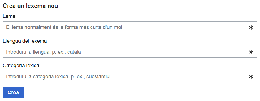
| 16:31, 29 December 2019 | Ca screenshot for Wikidata's New lexeme.png (file) |  |
9 KB | User created page with UploadWizard |
| 12:31, 28 December 2019 | Habitatge al carrer Major, 18-20. Montblanc.jpg (file) |  |
6.64 MB | User created page with UploadWizard |
| 09:03, 22 December 2019 | Barberà de la Conca, desembre 2019.jpg (file) |  |
4.22 MB | User created page with UploadWizard |
| 08:59, 22 December 2019 | Santa Maria de Barberà de la Conca.jpg (file) |  |
3.95 MB | User created page with UploadWizard |
| 10:51, 4 October 2019 | Ermita de Sant Josep de Montblanc.jpg (file) |  |
5.65 MB | User created page with UploadWizard |
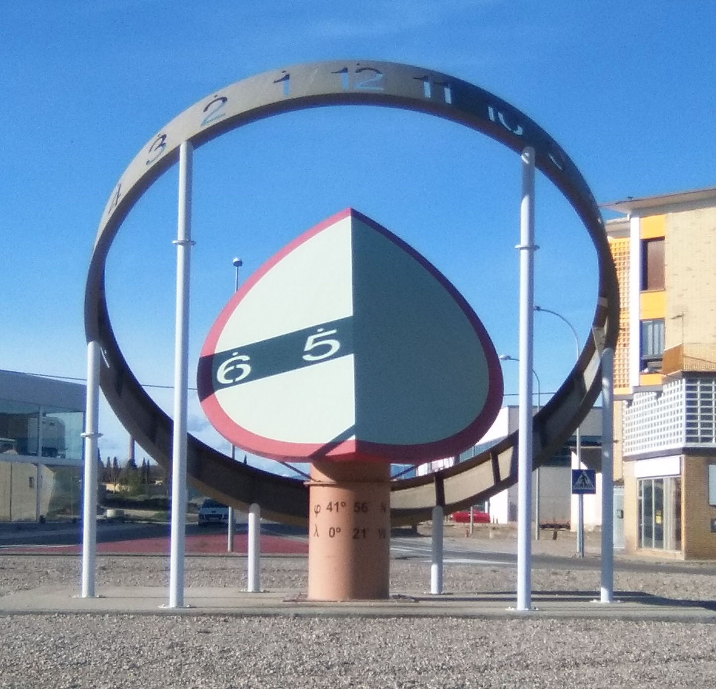
| 08:26, 10 April 2016 | Rellotge sol granen.jpeg (file) |  |
986 KB | User created page with UploadWizard |
| 20:27, 24 January 2015 | Wikidata label field ca.png (file) |  |
90 KB | User created page with UploadWizard |
| 16:06, 24 January 2015 | Simple statement - Earth ca.png (file) | 14 KB | User created page with UploadWizard | |
| 13:01, 24 January 2015 | Wikidata statement ca.svg (file) |  |
5 KB | User created page with UploadWizard |
| 00:40, 5 October 2013 | Alcanadre.JPG (file) |  |
1.75 MB | User created page with UploadWizard |
| 10:36, 14 July 2013 | Hadrians Wall map-ca.svg (file) |  |
217 KB | User created page with UploadWizard |
| 14:04, 19 May 2013 | Ls-map-CA.png (file) |  |
6 KB | User created page with UploadWizard |
| 20:23, 11 May 2013 | Wikidata layout Phase I-ca.png (file) |  |
99 KB | User created page with UploadWizard |
| 14:12, 3 March 2013 | Exoplanetes per any.svg (file) |  |
35 KB | User created page with UploadWizard |
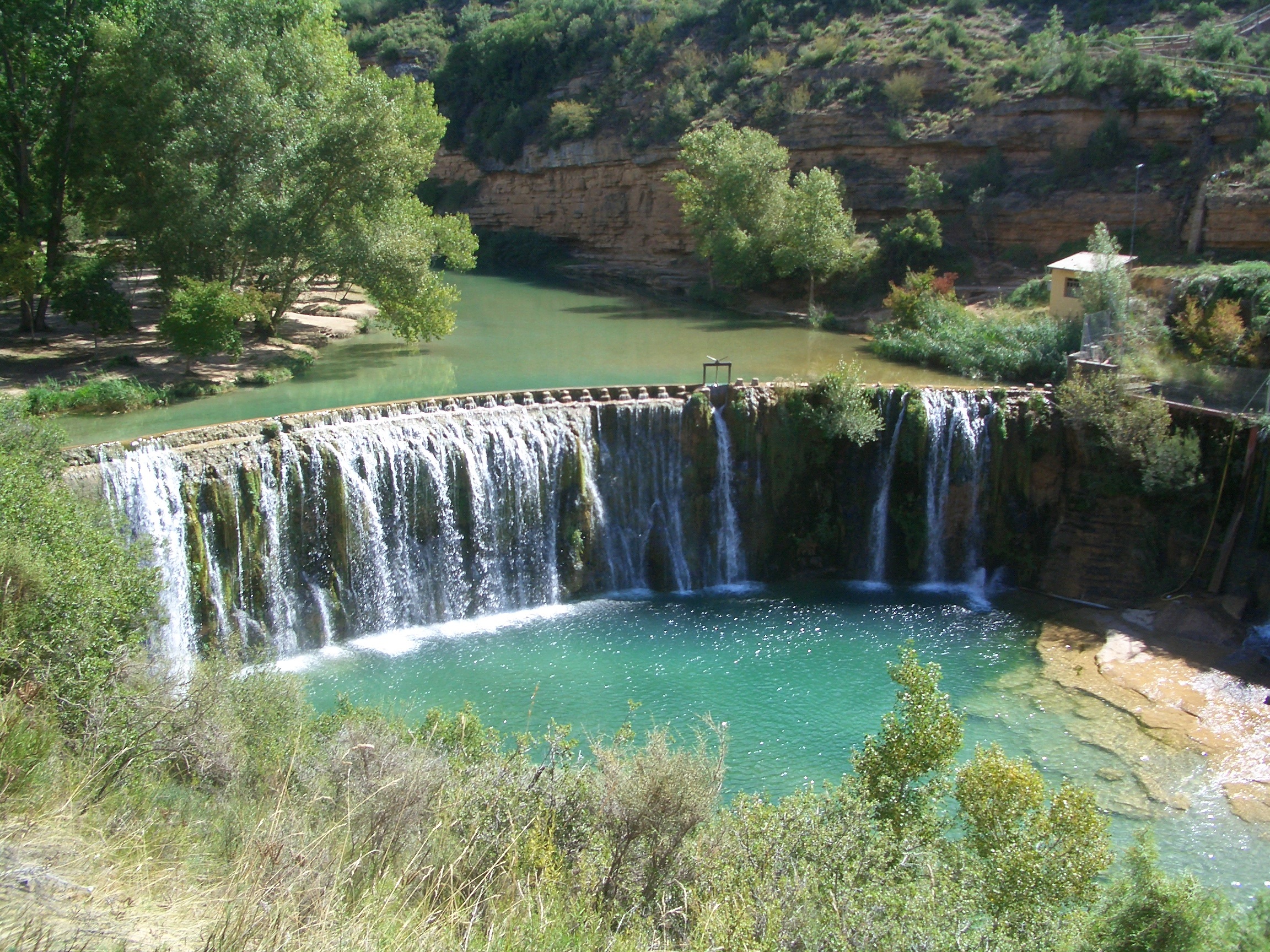
| 17:47, 22 February 2013 | EmbassamentLaSotonera.jpg (file) |  |
505 KB | User created page with UploadWizard |
| 18:34, 30 January 2013 | Catspaisatge.svg (file) |  |
195 KB | User created page with UploadWizard |
| 18:34, 29 January 2013 | LocalitzacióBaixaSegarra.svg (file) |  |
35 KB | User created page with UploadWizard |
| 14:04, 19 January 2013 | Compass Rose Catalan.svg (file) |  |
18 KB | User created page with UploadWizard |
| 19:28, 4 January 2013 | Isle of Man topographic map-ca.svg (file) |  |
642 KB | == {{int:filedesc}} == {{Information |Description={{en|Topographic map in English of the Isle of Man.<br/>''Note :'' The shaded relief is a raster image embedded in the SVG.}} {{fr|Carte topographique en anglais de l'[[:fr:Île de M... |
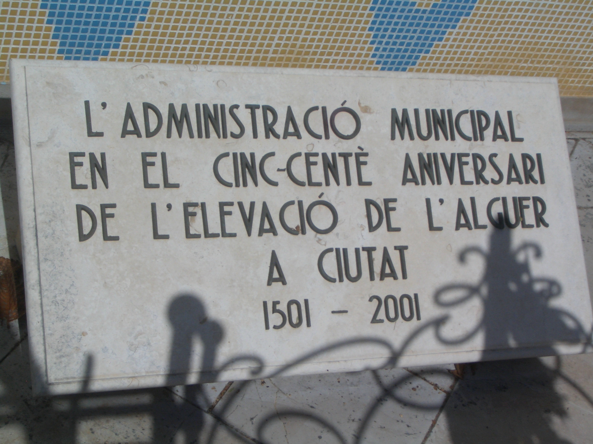
| 18:42, 4 January 2013 | Detall monument Alguer.JPG (file) |  |
1.04 MB | User created page with UploadWizard |
| 18:32, 4 January 2013 | Plaça Alguer.JPG (file) |  |
338 KB | User created page with UploadWizard |
| 21:47, 3 January 2013 | Canàries-retolat.png (file) |  |
396 KB | User created page with UploadWizard |
| 20:25, 4 December 2012 | Panoràmica Petrer.jpg (file) |  |
639 KB | User created page with UploadWizard |
| 10:20, 5 March 2012 | SantJoan.jpg (file) |  |
125 KB | {{Information |Description= Ermita de Sant Joan de la Muntanya, Montblanc, Catalonia |Source= Own work |Date= 1995 |Author= Quico Llach, scanned from own photo |Permission= Public Domain |other_versions= }} Category:Buildings in Montblanc |
| 19:32, 25 September 2010 | StGiorgioCuggiono.JPG (file) |  |
1.02 MB | {{Information |Description={{ca|1=Església de Sant Giorgio a Cuggiono, Itàlia}} {{en|1=St. Giorgio's church at Cuggiono, Italy}} |Source={{own}} |Author=Qllach |Date=2010-09-24 |Permission= |other_versions= }} [[Category:Churches in the |
| 12:37, 3 July 2010 | Llac d'Artouste.JPG (file) |  |
973 KB | {{Information |Description={{ca|1=El llac d'Artouste}} {{en|1=Lac d'Artouste}} |Source={{own}} |Author=Qllach |Date= |Permission= |other_versions= }} Category:Lakes of Pyrénées-Atlantiques |
| 15:10, 10 September 2009 | Subdivisions de França.svg (file) |  |
8 KB | {{Information |Description={{fr|Administration territoriale française}}{{de|Gebietsverwaltung Frankreichs}} |Source=*File:Administration_territoriale_française.svg |Date=2009-09-10 15:10 (UTC) |Author=*[[:File:Administration_territoriale_français |
| 09:55, 9 September 2009 | Tossals d'Almatret.png (file) |  |
38 KB | {{Information |Description={{en|1=Map of Tossals d'Almatret }} {{ca|1=Mapa dels Tossals d'Almatret}} |Source=Obra pròpia (own work) |Author=Qllach |Date=09.09.09 |Permission= |other_versions= }} Category:Almatret [[Category:Nature Re |
| 17:09, 21 August 2009 | Estacions de l'any.svg (file) |  |
1.23 MB | {{Information |Description=Seasons. ''Explanation:'' ''1.'' 21. March; ''2.'' 22. December; ''3.'' 21. June; ''4.'' 23 September. Green line = Equator, Blue line= line of apsides, Red line= line of solstice. |Source=*[[:File:Four_season_german_infotext.s |
| 18:03, 3 July 2009 | Obres A-27.jpg (file) |  |
985 KB | {{Information |Description={{ca|1=Estat de les obres a l'A-27, tram Valls - Montblanc (juliol 2009)}} |Source=Obra pròpia (own work) |Author=Qllach |Date=3 de juliol de 2009 |Permission= |other_versions= }} <!--{{ImageUpload|full}}--> |
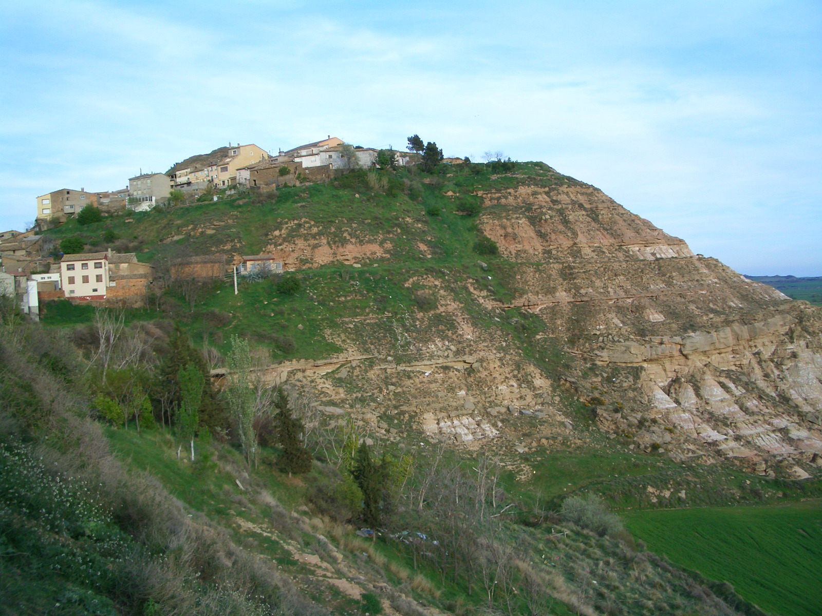
| 17:56, 3 July 2009 | Montblanquet.jpg (file) |  |
982 KB | Lighter picture |
| 17:44, 3 July 2009 | Sender PR.jpg (file) |  |
288 KB | {{Information |Description={{ca|1=Indicador d'un sender de petit recorregut (PR)}} |Source=Obra pròpia (own work) |Author=Qllach |Date= |Permission= |other_versions= }} <!--{{ImageUpload|full}}--> [[Category:Hiking and footpath signs in |
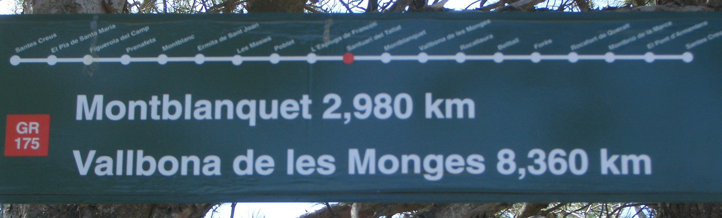
| 17:37, 3 July 2009 | GR 175 al Santuari del Tallat (detall).jpg (file) | .jpg) |
308 KB | {{Information |Description={{ca|1=Detall d'un indicador del GR 175}} |Source=Obra pròpia (own work) |Author=Qllach |Date=3 de juliol de 2009 |Permission= |other_versions= }} <!--{{ImageUpload|full}}--> [[Category:Hiking and footpath sign |
| 17:31, 3 July 2009 | GR 175 al Santuari del Tallat.jpg (file) |  |
1.69 MB | {{Information |Description={{ca|1=Cartell indicador del GR 175 al Santuari del Tallat}} |Source=Obra pròpia (own work) |Author=Qllach |Date=3 de juliol de 2009 |Permission= |other_versions= }} <!--{{ImageUpload|full}}--> [[Category:Hikin |
| 17:17, 3 July 2009 | Santuari del Tallat.jpg (file) |  |
1,016 KB | {{Information |Description={{ca|1=Santuari del Tallat (Urgell)}} |Source=Obra pròpia (own work) |Author=Qllach |Date=3 de juliol de 2009 |Permission= |other_versions= }} <!--{{ImageUpload|full}}--> Category:Urgell [[Category:Churches |
| 19:45, 27 May 2009 | Appendicular skeleton diagram blank.svg (file) | 1.33 MB | {{Information |Description=The appendicular skeleton is the part of the skeleton that includes the pectoral girdle, the upper limbs, the pelvic girdle, and the lower limbs. The appendicular skeleton and the axial skeleton together form the complete skelet | |
| 19:39, 27 May 2009 | Axial skeleton diagram blank.svg (file) | 1.14 MB | {{Information |Description=The axial skeleton consists of the bones in the head and trunk of the human body. It is composed of five parts; the human skull, the ossicles of the inner ear, the hyoid bone of the throat, the chest, and the vertebral column. T | |
| 23:16, 26 May 2009 | Human skeleton front ca.svg (file) |  |
843 KB | Untranslated string; text splitted |
| 09:04, 17 May 2009 | Desigualtat del triangle.svg (file) |  |
31 KB | {{Information |Description=Desigualtat del triangle |Source=*File:Desigualdad_del_triángulo.svg |Date=2009-05-17 10:03 (UTC) |Author=*File:Desigualdad_del_triángulo.svg: Drini *derivative work: ~~~ |Permission=see below |other |
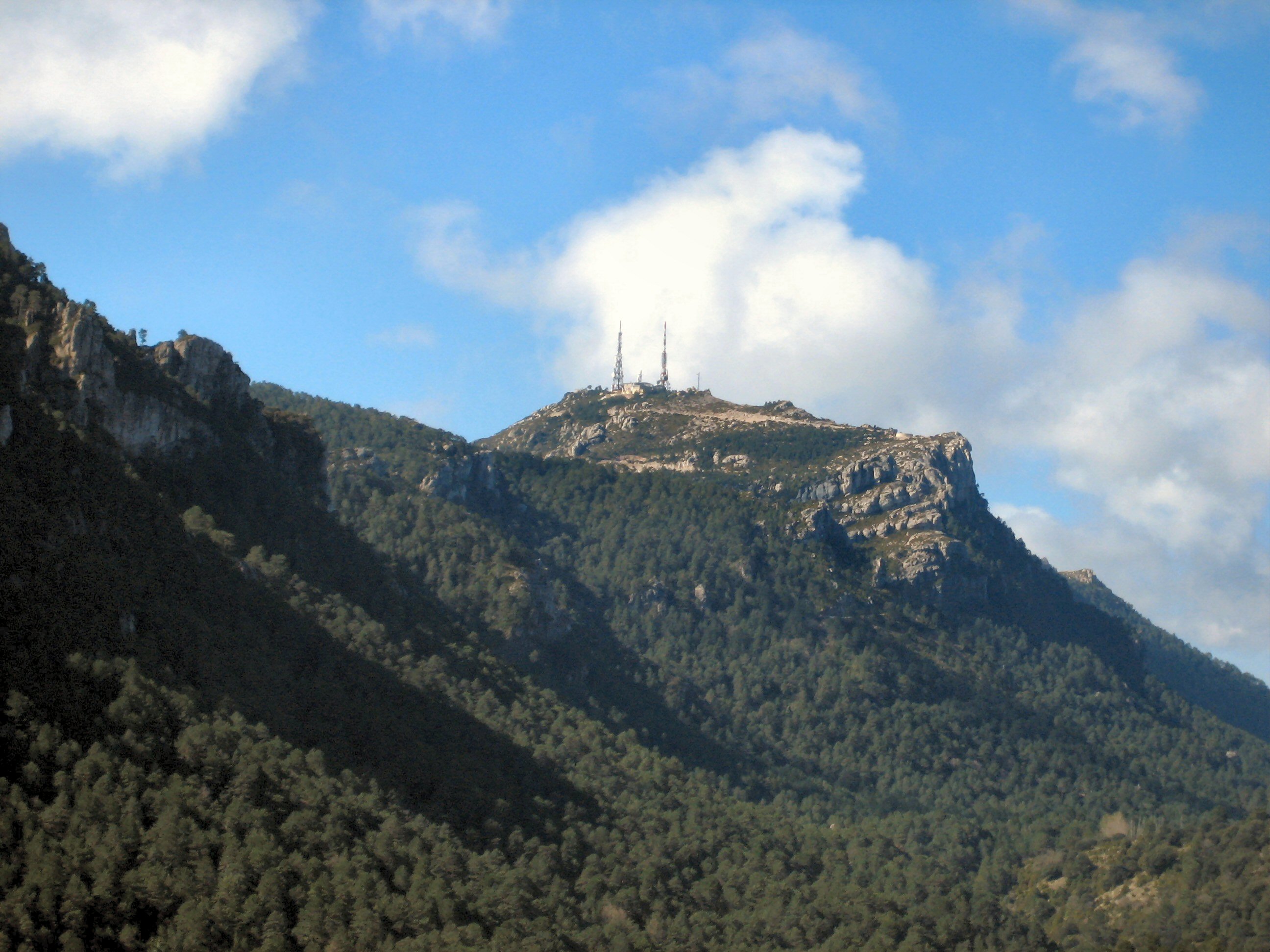
| 17:40, 8 May 2009 | Mont Caro (enhanced).jpg (file) | .jpg) |
710 KB | {{Information |Description={{en|1=Mount Caro (1,442 m), Ports de Tortosa Beseit, Tarragona, Catalonia, Spain ({{coor dms|40|48|11.18|N|0|20|35.13|E|type:mountain_region:ES-CT}})}} {{ca|1=Caro (1.442 m), Ports de Tortosa Beseit, Tarragona, Catalunya, Espan |
| 13:40, 2 May 2009 | Pirenarium.jpg (file) |  |
453 KB | {{Information |Description={{ca|1=Plaça d'entrada a Pirenarium}} {{en|1=Pirenarium square}} |Source=Obra pròpia (own work) |Author=Qllach |Date=09.04.09 |Permission= |other_versions= }} <!--{{ImageUpload|full}}--> [[Category:Pirenarium] |
| 13:34, 2 May 2009 | Bolea2.jpg (file) |  |
524 KB | {{Information |Description={{ca|1=Vista parcial de Bolea}} {{en|1=Partial view of Bolea}} |Source=Obra pròpia (own work) |Author=Qllach |Date=09.04.09 |Permission= |other_versions= }} <!--{{ImageUpload|full}}--> Category:Bolea |
| 13:15, 2 May 2009 | FoiaDOsca.jpg (file) |  |
522 KB | {{Information |Description={{ca|1=Vista parcial de la Foia d'Osca des de Bolea}} {{en|1=Partial view of Hoya de Huesca from Bolea}} |Source=Obra pròpia (own work) |Author=Qllach |Date=09.04.09 |Permission= |other_versions= }} <!--{{Image |
| 14:20, 25 April 2009 | Localització de La Sotonera.png (file) |  |
217 KB | {{Information |Description=Mapa del municipio de La Sotonera Creado el 08.12.2005 por Dionisio en base a Image:Huesca municipalities.png |Source=*File:La_Sotonera.png |Date=2009-04-25 15:16 (UTC) |Author=*[[:File:La_Sotonera. |