Category:Île Amsterdam
Pereiti į navigaciją
Jump to search
islands in the southern Indian Ocean  | |||||
| Įkelti mediją | |||||
| Tai yra | |||||
|---|---|---|---|---|---|
| Yra dalis | |||||
| Pavadintas pagal | |||||
| Vieta | Indijos vandenynas | ||||
| Yra prie arba vandens telkinyje | |||||
| Atradimo data |
| ||||
| Plotis |
| ||||
| Ilgis |
| ||||
| Aukščiausia vieta | |||||
| Gyventojų skaičius |
| ||||
| Plotas |
| ||||
| Aukštis virš jūros lygio |
| ||||
| Skiriasi nuo | |||||
 | |||||
Subkategorijos
Rodomos 26 subkategorijos (iš viso yra 26 subkategorijos).
B
- Baie des Loups Marins (22 F)
C
- Caldeira d'Amsterdam (31 F)
- Cratère Antonelli (17 F)
- Cratère de l'Olympe (21 F)
- Cratère Vulcain (2 F)
- Cratères Vénus (14 F)
D
- Del Cano hut (27 F)
E
- Entrecasteaux hut (59 F)
F
- Falaises d'Entrecasteaux (53 F)
- Falaises de la Pearl (2 F)
G
- Grandes Ravines (12 F)
H
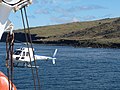
- Helicopters in Amsterdam Island (32 F)
L
M
- Mare aux Éléphants (6 F)
- Mont de la Dives (38 F)
- Mont Fernand (56 F)
- Museau de Tanche (10 F)
P
- Panoramics of Amsterdam Island (17 F)
- Phylica arborea (1 P, 28 F)
- Plateau des Tourbières (103 F)
- Pointe Bénédicte (11 F)
- Pointe d'Entrecasteaux (47 F)
- Pointe Del Cano (48 F)
S
- Ships in Amsterdam Island (48 F)
Daugialypės terpės rinkmenos kategorijoje „Île Amsterdam“
Rodoma 60 šios kategorijos rinkmenų (iš viso kategorijoje yra 60 rinkmenų).
-
 - panoramio (4618).jpg 3 648 × 2 736; 3,68 MiB
-
 - panoramio (4705).jpg 3 648 × 2 736; 4,72 MiB
-
 2020-04-12 Amsterdam Island, France M6.1 earthquake shakemap (USGS).jpg 787 × 1 002; 130 KiB
-
 Admiralty Chart No 1945 Amsterdam Island (uninhabited), Published 1874.jpg 5 910 × 4 080; 6,85 MiB
-
 Amsterdam ASTER.jpg 1 100 × 714; 129 KiB
-
 Amsterdam Gazelle.jpg 1 209 × 399; 289 KiB
-
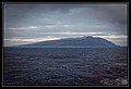
 Amsterdam vue du large - panoramio.jpg 3 648 × 2 736; 3,08 MiB
-
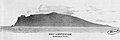
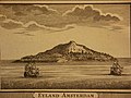
 Amsterdam-St. Paul views by Bellin 1760.jpg 1 676 × 2 187; 1,48 MiB
-
 AmsterdamIsl Map be.png 1 887 × 2 112; 593 KiB
-
 AmsterdamIsl Map.png 1 887 × 2 112; 732 KiB
-
 Cabane antonelli - panoramio.jpg 3 648 × 2 736; 4,62 MiB
-
 Cabane Antonelli - panoramio.jpg 3 648 × 2 736; 5,04 MiB
-
 Cabane BMG, phyllicas et agave - panoramio.jpg 3 648 × 2 736; 4,65 MiB
-
 Climatediagram-metric-english-MartindeVivies-France-1950-1990.png 1 000 × 685; 72 KiB
-
 Crateres Dumas - panoramio.jpg 3 648 × 2 736; 3,48 MiB
-
 Cratères Dumas - panoramio (1).jpg 3 648 × 2 736; 4,5 MiB
-
 Cratères Dumas - panoramio.jpg 3 648 × 2 736; 4,06 MiB
-
 Entrance to the crater of the island of Amsterdam, Indian Oc Wellcome V0025198.jpg 3 317 × 2 203; 3,06 MiB
-
 First Voyage Round The World Amsterdam.png 2 832 × 1 200; 785 KiB
-
 Fougères d'Amsterdam - panoramio.jpg 3 648 × 2 736; 5,13 MiB
-
 France, Ile Amsterdam.png 1 880 × 2 480; 5,34 MiB
-
 Klimadiagramm-metrisch-deutsch-MartindeVivies-Frankreich-1950-1990.png 1 000 × 685; 73 KiB
-
 La base - panoramio.jpg 3 648 × 2 736; 3,92 MiB
-
 La base depuis le Marion.jpg 3 648 × 2 736; 4,74 MiB
-
 Martin de Viviès depuis l'hélico.jpg 3 606 × 2 694; 2,44 MiB
-
 New Amsterdam Island.jpg 921 × 917; 293 KiB
-
 Orthographic projection centred over Ile Amsterdam.png 488 × 487; 37 KiB
-
 Otaries au pied des falaises - panoramio.jpg 3 648 × 2 736; 4,69 MiB
-
 Phylica arborea.JPG 2 351 × 2 656; 991 KiB
-
 Phyllica - panoramio.jpg 3 648 × 2 736; 5,04 MiB
-
 Phyllicas - panoramio.jpg 3 648 × 2 736; 4,75 MiB
-

-
 Pointe Entrecasteaux (vue éloignée) - panoramio.jpg 3 648 × 2 736; 4,92 MiB
-
 Pointe entrecasteaux - panoramio.jpg 2 225 × 1 669; 2,51 MiB
-
 Reliefkarte Amsterdam Insel.png 2 488 × 2 535; 751 KiB
-
 Scoria AmsterdamIsland 2 edit.jpg 2 114 × 1 947; 1,11 MiB
-
 Scoria AmsterdamIsland 2.jpg 2 114 × 1 947; 500 KiB
-
 Scoria AmsterdamIsland 5 edit.jpg 2 598 × 2 081; 503 KiB
-
 Scoria AmsterdamIsland 5.jpg 2 598 × 2 081; 476 KiB
-
 Scoria AmsterdamIsland.jpg 3 297 × 2 356; 737 KiB
-
 TAAF - Ile d'Amsterdam - base Martin de Viviès depuis l'océan.jpg 14 227 × 5 240; 52,31 MiB
-
 TAAF - Ile d'Amsterdam - base Martin de Viviès.jpg 14 198 × 4 810; 43,8 MiB
-
 TAAF - Ile d'Amsterdam - cratère Antonelli et sa cabane.jpg 8 994 × 6 155; 32,57 MiB
-
 TAAF - Ile d'Amsterdam - plateau des tourbières depuis hélicoptère.jpg 8 688 × 5 792; 43,06 MiB
-
 TAAF - Ile d'Amsterdam - plateau des tourbières et le mont du Fernand depuis hélicoptère.jpg 8 128 × 5 419; 32,63 MiB
-
 TAAF - Ile d'Amsterdam - pointe Bénédicte.jpg 8 450 × 5 643; 18,78 MiB
-
 TAAF - Ile d'Amsterdam - pointe d'Entrecasteaux 1.jpg 8 250 × 3 196; 20,89 MiB
-
 TAAF - Ile d'Amsterdam - pointe d'Entrecasteaux 2.jpg 5 403 × 3 602; 8,73 MiB
-
 TAAF - Ile d'Amsterdam - vue d'ensemble depuis le sud.jpg 9 178 × 6 282; 24,79 MiB
-
 Tunnel de lave - panoramio.jpg 3 648 × 2 736; 4,8 MiB
-
 Vue depuis le Marion - panoramio.jpg 3 648 × 2 736; 4,38 MiB
-
 Vue depuis le Marion Dufresne.jpg 3 648 × 2 736; 4,14 MiB
-
 Vue du Marion - panoramio.jpg 3 648 × 2 736; 3,44 MiB
-
 Vue éloignée, depuis le MD - panoramio.jpg 3 648 × 2 736; 3,56 MiB
-
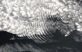 Wave cloud.jpg 1 919 × 1 215; 544 KiB
-
 Zamsterdamisland1.jpg 800 × 600; 142 KiB
-
 Zamsterdamisland2.jpg 800 × 1 067; 207 KiB
-
 Zamsterdamisland3.jpg 800 × 600; 130 KiB
-
 Zburningmtn.jpg 593 × 792; 80 KiB
-
 Île Amsterdam bannière.jpg 3 646 × 521; 907 KiB
.jpg)
.jpg)
.jpg)
,_Published_1874.jpg)


.jpg)


_-_panoramio.jpg)


