Category:1665
नेविगेशन पर जाएँ
खोज पर जाएँ
| ◀ 1660s ▶ (१७वीं शताब्दी, २वीं सहस्राब्दी) |
|---|
| ◀ 1660 · 1661 · 1662 · 1663 · 1664 · 1665 · 1666 · 1667 · 1668 · 1669 ▶ |

year | |||||
| मीडिया अपलोड करें | |||||
| जिसका उदाहरण है |
| ||||
|---|---|---|---|---|---|
| का भाग | |||||
| समय |
| ||||
| पिछला है | |||||
| अगला है | |||||
| |||||
उपश्रेणियाँ
इस श्रेणी की कुल ११ में से ११ उपश्रेणियाँ निम्नलिखित हैं।
*
+
E
O
"1665" श्रेणी में मीडिया
इस श्रेणी की कुल १२८ में से १२८ चित्र निम्नलिखित हैं।
-
 1665 journal des scavans p1.png २,५९२ × ३,५०८; १२६ KB
-
 1665 journal des scavans p2.png २,५९२ × ३,५०८; १३९ KB
-
 1665 journal des scavans title.jpg १,११० × १,८२७; ५३७ KB
-
 1665 phil trans vol i title.png १,५१२ × २,२७२; ५१७ KB
-
 22 High Street, Hale date.jpg ४,१६८ × ३,३८४; ६.२६ MB
-
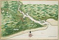
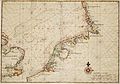
 A mapp of New England (2675735796).jpg २,००० × १,६६५; २.८३ MB
-
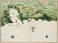
 AMH-2550-NA Ground plan of the Fort of Good Hope with the start of a new pentagon.jpg १,७९२ × २,४००; ५९८ KB
-
 AMH-5623-NA Map of the Malabar coast.jpg २,४०० × १,६६२; ७६२ KB
-
 AMH-5625-NA Map of Saldanha Bay, Table Bay, Hout Bay and False Bay.jpg २,४०० × १,६४५; ७७५ KB
-
 AMH-5626-NA Bird's eye view of the city of Judja.jpg २,४०० × १,५९१; ७९६ KB
-
 AMH-5649-KB Map depicting the journey by Joan Nieuhoff from Canton to Peking.jpg २,४०० × २,०२४; ६८२ KB
-
 AMH-6030-NA Bird's eye view of the city of Macao.jpg ६,९८५ × ५,००५; ६.६६ MB
-
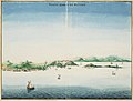
 AMH-6130-NA View of Ambon.jpg २,४०० × १,५७९; ४५७ KB
-
 AMH-6132-NA Bird's eye view of the city of Atjeh.jpg २,४०० × १,६७७; ५६४ KB
-
 AMH-6133-NA View of Batticaloa.jpg २,४०० × २,०२०; ६०४ KB
-
 AMH-6134-NA Bird's eye view of the fort of Batticaloa.jpg २,४०० × १,९३८; ८९५ KB
-
 AMH-6135-NA View of Batavia.jpg २,४०० × १,८८३; ७८७ KB
-
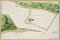
 AMH-6143-NA Map of Table Bay.jpg २,४०० × १,८१०; ७२७ KB
-
 AMH-6145-NA View of Canton.jpg २,४०० × १,६३६; ५१८ KB
-
 AMH-6148-NA Bird's eye view of the city of Cochin, India.jpg २,४०० × १,६८२; ६०२ KB
-
 AMH-6150-NA View of Dabul.jpg २,४०० × १,७२४; ४५५ KB
-
 AMH-6151-NA View of the city of Dabul.jpg २,४०० × १,८४८; ५१० KB
-
 AMH-6153-NA Bird's eye view of Negombo.jpg २,४०० × १,८९२; ९०९ KB
-
 AMH-6154-NA View of the city of Jaffna.jpg २,४०० × १,६४९; ६०६ KB
-
 AMH-6155-NA Map of the city of Macao.jpg २,४०० × १,७०१; ५८५ KB
-
 AMH-6156-NA Map of the city of Malakka.jpg २,४०० × १,११३; ३६८ KB
-
 AMH-6158-NA Picture of the Osacca castle.jpg २,४०० × १,६९६; ८४९ KB
-
 AMH-6159-NA View of Galle.jpg २,४०० × १,७४०; ४०८ KB
-
 AMH-6160-NA View of the city of Raiebaagh.jpg २,४०० × १,६५२; ४७७ KB
-
 AMH-6161-NA Bird's eye view of the city of Samboppe, Macassar.jpg २,४०० × १,७१५; ६३६ KB
-
 AMH-6162-NA Bird's eye view of the city of Samboppe, Macassar.jpg २,४०० × १,७५०; ५२४ KB
-
 AMH-6163-NA View of the castle of Visiapour.jpg २,४०० × १,६२६; ५२० KB
-
 AMH-6164-NA View of Visiapour (according to the title), depicted is Suratte.jpg २,४०० × १,८०२; ४७४ KB
-
 AMH-6166-NA Bird's eye view of Colombo and environs.jpg २,४०० × १,७१८; ६२० KB
-

-
 AMH-6732-NA Map of East Africa.jpg २,४०० × १,६५७; ८६५ KB
-
 AMH-6733-NA Map of the Indian Ocean.jpg २,४०० × १,६५६; ७०८ KB
-
 AMH-6734-NA Map of the coast of Venezuela.jpg २,४०० × १,६६२; ६७९ KB
-
 AMH-6735-NA Map of the Philippines.jpg २,४०० × १,६६८; ६३४ KB
-
 AMH-6736-NA Map of the Arabian peninsula.jpg २,४०० × १,६३७; ९८३ KB
-
 AMH-6737-NA Map of the Suratte river.jpg २,४०० × १,६५७; ७३५ KB
-
 AMH-6738-NA Map of the northern part of the Greek archipelago.jpg २,४०० × १,६८६; ४९७ KB
-
 AMH-6741-NA Map of Anjouan.jpg २,४०० × १,५६०; ७२९ KB
-
 AMH-6742-NA View of the bay at Acapulco.jpg २,४०० × १,८६५; ८३१ KB
-
 AMH-6743-NA View of Arguin castle.jpg २,४०० × १,८२०; ४०४ KB
-
 AMH-6746-NA Bird's eye view of the Baya Hondo, Venezuela.jpg २,४०० × १,७६०; ५१७ KB
-
 AMH-6747-NA Bird's eye view of St. Jago bay in Cuba.jpg २,४०० × १,७०९; ६५७ KB
-
 AMH-6750-NA Bird's eye view of the bay near Cabo de Tiburon on Hispaniola, Haïti.jpg २,४०० × १,७६८; ५३० KB
-
 AMH-6751-NA View of the castle of Cabita.jpg २,४०० × १,७०९; ३९८ KB
-
 AMH-6752-NA Bird's eye view of Groot Caymit, St. Domingo, Haïti.jpg २,४०० × १,७७२; ६३७ KB
-
 AMH-6753-NA Map of Cabo Verde and environs.jpg २,४०० × १,६४९; ५१३ KB
-
 AMH-6754-NA Bird's eye view of the city of Santo Domingo.jpg २,४०० × १,७७१; ५०८ KB
-
 AMH-6755-NA Map of the island of Goeree.jpg २,४०० × १,७११; ४९९ KB
-
 AMH-6756-NA View of the island of Gouree on Cape Verde.jpg २,४०० × १,७८४; ४५० KB
-
 AMH-6758-NA Map of the island of Hispaniola (Haïti and Dominican Republic).jpg २,४०० × १,२९७; ५२० KB
-
 AMH-6759-NA Map of Hispaniola and Puerto Rico.jpg २,४०० × १,६८०; ८१२ KB
-
 AMH-6761-NA Bird's eye view of the city of Loanda.jpg २,४०० × १,७०२; ५३२ KB
-
 AMH-6762-NA View of Loanda.jpg २,४०० × १,६०२; ३३१ KB
-
 AMH-6763-NA Bird's eye view of Manila.jpg २,४०० × १,७२०; ४७६ KB
-
 AMH-6764-NA Map of the bay of Manila.jpg २,४०० × १,७१९; ४०० KB
-
 AMH-6765-NA View of Sao Luis de Maranhao.jpg २,४०० × १,६०६; ४०८ KB
-
 AMH-6766-NA Map of Sao Luis de Marranhao.jpg २,४०० × १,६३१; ५७३ KB
-
 AMH-6767-NA Fort Mauritius at the river of St. Francisco.jpg २,४०० × १,६७७; ३६४ KB
-
 AMH-6777-NA Map of the harbour at Pernambuco.jpg २,४०० × १,७१८; ६५६ KB
-
 AMH-6778-NA View of El Mina Fort.jpg २,४०० × १,९१७; ४३५ KB
-
 AMH-6780-NA Map of El Mina Fort.jpg २,४०० × १,७३०; ६६३ KB
-
 AMH-6781-NA Map of the city of Mexico.jpg २,४०० × १,८७३; ७६६ KB
-
 AMH-6782-NA Floor plan of the fort of Mauritius on Rio San Francisco.jpg २,४०० × १,६७७; ५४७ KB
-
 AMH-6785-NA View of Paraiba.jpg २,४०० × १,६३३; ४०६ KB
-
 AMH-6786-NA Map of the mouth of the Paraiba River.jpg २,४०० × १,६१३; ६८२ KB
-
 AMH-6787-NA View of Porto Calvo.jpg २,४०० × १,६४०; ४४८ KB
-
 AMH-6788-NA Map of San Francisco on Santa Domingo.jpg २,४०० × १,७७३; ५३५ KB
-
 AMH-6789-NA Map of Puerto Rico.jpg २,४०० × १,७९५; ५५८ KB
-
 AMH-6790-NA View of Puerto Rico.jpg २,४०० × १,८१८; ३६१ KB
-
 AMH-6791-NA Map of the Powathan River.jpg २,४०० × १,६६२; ७२२ KB
-
 AMH-6792-NA Map of the mouth of the Rio Grande and Fort Ceulen.jpg २,४०० × १,५९८; ५५८ KB
-
 AMH-6793-NA Map of the mouth of the Pousioucq River.jpg २,४०० × १,६२४; ५२३ KB
-
 AMH-6794-NA View of Fort Ceulen on the Rio Grande.jpg २,४०० × १,९६३; ६३५ KB
-
 AMH-6795-NA View of Keulen Fort.jpg २,४०० × १,६२५; ३३४ KB
-
 AMH-6796-NA Bird's eye view of the mouth of the Senegal, Saint Louis.jpg २,४०० × १,४४६; ४५१ KB
-
 AMH-6797-NA Bird's eye view of Spirito Sancto bay.jpg २,४०० × १,७०६; ५८८ KB
-
 AMH-6798-NA Bird's eye view of the bay and the fort of Nieuw Vlissingen on Tobago.jpg २,४०० × १,७८६; ५०८ KB
-
 AMH-6799-NA Map of the island of Tamaraca.jpg २,४०० × १,६६३; ७८० KB
-
 AMH-6800-NA Map of the island of San Thomé.jpg ७,३२० × ५,३०४; ६.२४ MB
-
 AMH-6801-NA Chart of Isla da Vaca near Hispaniola, Haïti.jpg २,४०० × १,७७२; ५४८ KB
-
 AMH-6802-NA View of Angra on Tercera.jpg २,४०० × १,६४९; ६०० KB
-
 AMH-6803-NA Bird's eye view of Mozambique island.jpg २,४०० × १,६८९; ५२९ KB
-
 AMH-6804-NA Map of Olinda.jpg २,४०० × १,६९७; ६७७ KB
-
 AMH-6806-NA View of Bahia de todos os santos, All Saints bay.jpg २,४०० × १,६८७; ३३१ KB
-
 AMH-6807-NA View of unidentified fort.jpg २,४०० × १,६४४; ३३६ KB
-
 AMH-6808-NA View of Goa.jpg २,४०० × १,७२२; ५१४ KB
-
 AMH-6809-NA View of Tamaraca.jpg २,४०० × १,६३१; ३१७ KB
-
 AMH-6810-NA View of Calicut.jpg २,४०० × १,७२७; ५२४ KB
-
 AMH-6811-NA View of Porto Rico.jpg २,४०० × १,७५७; ५६५ KB
-
 AMH-6812-NA Map of countries around the North Sea.jpg २,४०० × १,६७६; ८६७ KB
-
 AMH-6813-NA Map of England, the south of Ireland and part of the French coast.jpg २,४०० × १,६६९; ८९६ KB
-
 AMH-6814-NA Map of Ireland.jpg २,४०० × १,६६९; ८४३ KB
-
 AMH-7710-NA View of Fort Elmina.jpg २,४०० × १,८८०; ४९१ KB
-
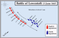 Battle of Lowestoft Map1.png ६४७ × ४१८; ६१ KB
-
 Bill of Mortality.jpg ५०० × ८३९; ३५९ KB
-
 Blokland1665.JPG ७१६ × ५५३; ११४ KB
-
 Charles II as a child.jpg २,३६२ × २,७८०; ६.४८ MB
-
 Dutch and Portuguese in Asia c 1665.png ६१७ × ४७३; ३० KB
-
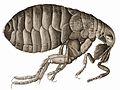
 Flea-Hooke.jpg १,१९५ × ८८१; ३०२ KB
-
 Fondamente maison 1665.JPG २,३०४ × ३,४५६; ३.७५ MB
-
 Gotha kamienica Hauptmarkt 28 2.jpg ५,१८४ × ३,४५६; ५.२९ MB
-
 Headless cross1.jpg ५०० × ४२९; २१ KB
-
 Hilarri Bustince.jpg २,१२४ × १,७१९; २.२४ MB
-
 Hooke-bluefly.jpg १,१७६ × १,७८६; १.९६ MB
-
 HookeFlea01.jpg १,९९२ × १,४९४; १.२८ MB
-

-
 Johannes Vingboons - D Stadt Loandas Pauli (1665).jpg १,२८० × ९०७; २३९ KB
-
 Johannes Vingboons - Oispito Santo (1665).jpg १,२८० × ९१०; २७६ KB
-

-
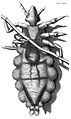 Louse diagram, Micrographia, Robert Hooke, 1667.jpg १,१०५ × १,८५३; १.०५ MB
-
 LowestoftMap1.png ६४७ × ४१८; ७३ KB
-
 MaximesLaRouchefoucauld.jpg ५३० × ९३१; १६३ KB
-
 Micrographia title page.gif १,०९८ × १,७३७; १,०१३ KB
-
 Middelpolder1665.JPG ६२१ × ४३१; ८४ KB
-
 Monforte Malagon Madrid 1666.jpg ५१३ × ७१४; २०५ KB
-
 MundusSubterraneus.jpg २,१०४ × २,२४०; १.२३ MB
-
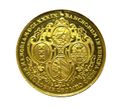 Münze Doppelte Dank-Portugalese.jpg १,२१५ × १,१०६; २३१ KB
-
 RobertHookeMicrographia1665.jpg १,२०० × १,६००; ९८५ KB
-
 Siegel der CAU.png २०० × २३५; १५ KB
-
 Siegel der CAU.svg ३९७ × ४६३; १५८ KB
-
 St.Oswald - Opferstock.jpg १,९२० × २,५६०; २.१३ MB
-
 Vermeer, Pracownia własna, 1665.jpg २,४३४ × २,९६७; १.४७ MB
-
 Zentralbibliothek Solothurn - Der Wyniger Vertrag von 1665 - aa0834.tif २,४१६ × २,८६८; १९.८६ MB


.jpg)


,_depicted_is_Suratte.jpg)


.jpg)


.jpg)
.jpg)


