Category:2014 in Panama
Saltar para a navegação
Saltar para a pesquisa
Países da América do Norte: Antígua e Barbuda · Bahamas · Barbados · Belize · Canadá · Costa Rica · Cuba · Dominica · El Salvador · Estados Unidos‡ · Granada · Guatemala · Haiti · Honduras · Jamaica · México · Nicarágua · Panamá · República Dominicana · Santa Lúcia · São Cristóvão e Neves · São Vicente e Granadinas · Trindade e Tobago‡
Outros territórios: Bermudas · Gronelândia · Ilhas Turcas e Caicos · Ilhas Virgens Americanas · Ilhas Virgens Britânicas · Martinica · Porto Rico
‡: parcialmente localizado na América do Norte
Outros territórios: Bermudas · Gronelândia · Ilhas Turcas e Caicos · Ilhas Virgens Americanas · Ilhas Virgens Britânicas · Martinica · Porto Rico
‡: parcialmente localizado na América do Norte

2014 in Panamá
This category includes works, events and everything related to the history of Panama in 2014.
Notes:
- This category is NOT intended ONLY for photographs taken in 2014, nor is it intended for media uploaded or scanned in 2014, as the parent Category:Panama by year goes in time past the invention of photography, scanners or computers. For the specific scope of photography, please see Category:Photographs by year.
- Media illustrating events of 2014 in Panama should be added into the subcategory Category:Events by country by year.
- Media illustrating works of 2014 in Panama should be added into the subcategory Category:Works by year by country.

Panama-related events during the year of 2014 | |||||
| Carregar ficheiro | |||||
| Instância de |
| ||||
|---|---|---|---|---|---|
| Vertente de | |||||
| Localização |
| ||||
| Data de ocorrência |
| ||||
| Sucedido por | |||||
| |||||
Subcategorias
Esta categoria contém as seguintes 20 subcategorias (de um total de 20).
*
- 2014 maps of Panama (4 F)
A
C
- Panama Canal in 2014 (13 F)
P
- PANAMAX 2014 (4 F)
V
- Vuelta a Chiriquí 2014 (11 F)
Multimédia na categoria "2014 in Panama"
Esta categoria contém os seguintes 28 ficheiros (de um total de 28).
-
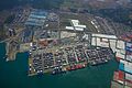
 Aerial view Colón Free Trade Zone.jpg 6 000 × 4 000; 7,28 MB
-
 Aerial view of Boquete, Panama.jpg 4 000 × 2 628; 8,65 MB
-
 Aerial view of the Province of Chiriqui, Republic of Panama 01.jpg 4 000 × 3 000; 7,75 MB
-
 Aerial view of the Province of Chiriqui, Republic of Panama 02.jpg 3 417 × 2 189; 7,11 MB
-
 Aerial view of the Province of Chiriqui, Republic of Panama 03.jpg 4 000 × 3 000; 9,22 MB
-
 Aerial view of the Province of Chiriqui, Republic of Panama 04.jpg 4 000 × 2 647; 8,9 MB
-
 Aerial view of the Province of Chiriqui, Republic of Panama 05.jpg 4 000 × 3 000; 9,18 MB
-
 Aerial view of the Province of Chiriqui, Republic of Panama 06.jpg 3 796 × 2 847; 7,81 MB
-
 Aerial view of the Province of Chiriqui, Republic of Panama 07.jpg 4 000 × 3 000; 9,52 MB
-
 Aerial view of the Province of Chiriqui, Republic of Panama 08.jpg 4 000 × 3 000; 10,49 MB
-
 Aerial view of the Province of Chiriqui, Republic of Panama 09.jpg 4 000 × 2 695; 5,55 MB
-
 Aerial view of the Province of Chiriqui, Republic of Panama 10.jpg 4 000 × 3 000; 6 MB
-
 Aerial view of the Province of Chiriqui, Republic of Panama 11.jpg 4 000 × 3 000; 8,75 MB
-
 Aerial view of the Province of Chiriqui, Republic of Panama 12.jpg 4 000 × 3 000; 5,69 MB
-
 Aerial view of the Province of Chiriqui, Republic of Panama 13.jpg 4 000 × 2 828; 8,33 MB
-
 Aerial view of the Province of Chiriqui, Republic of Panama 14.jpg 4 000 × 3 000; 5,9 MB
-
 Aerial view Zona Libre Colón.jpg 6 000 × 4 000; 7,29 MB
-
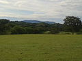
 Cerro La Teta en Las Guabas.jpg 480 × 640; 94 kB
-
 Colegio Moisés Castillo Ocaña, La Chorrera, Panamá.jpg 640 × 480; 114 kB
-

-
 Gente Ngäbe.jpg 2 048 × 1 536; 1,73 MB
-

-

-
 Picturebugabitadanza.jpg 1 504 × 1 004; 124 kB
-
 Tronco seco La Mochila.jpg 600 × 450; 105 kB
-
 Vista del Canajagua desde Las Guabas.jpg 640 × 480; 131 kB
-
 Volcan Baru up close and clouded.jpg 4 000 × 3 000; 7,01 MB
-
 Volcano Baru Forest.jpg 4 576 × 2 576; 7,28 MB


_-_Polic%C3%ADa_Nacional_de_Panam%C3%A1_-_2014_2014-03-24_17-51.jpg)


