Category:A66 road (England)
Salta a la navigazzion
Và a cercà
major road in Northern England    | |||||
| Carega su un fail audio / video | |||||
| L'è un(a) | |||||
|---|---|---|---|---|---|
| Sit |
| ||||
| Sistema autostradałe |
| ||||
| Conetesto co | |||||
| Mantegnesto da |
| ||||
| Formà da |
| ||||
| Longhesa |
| ||||
| Diferent de | |||||
 | |||||
Sotocategorie
Quella categoria chì la gh'ha 6 sot-categorie chì de sota, su un numer complessiv de 6.
A
- A66(M) motorway (4 F)
B
- Brick Train by David Mach (12 F)
L
- Ladle of Steel (3 F)
R
- Rey Cross (1 F)
S
- Scotch Corner (27 F)
Fail in la categoria "A66 road (England)"
Quella categoria chì la gh'ha denter 80 i fail riportad chì de sota, su un total de 80.
-
 A66 - geograph.org.uk - 1259554.jpg 640 × 427; 126 KByte
-
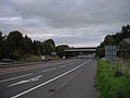 A66 and railway bridge across it - geograph.org.uk - 1560198.jpg 640 × 480; 48 KByte
-

-
 A66 Appleby by pass - geograph.org.uk - 3078174.jpg 640 × 475; 56 KByte
-
 A66 approaching B6542 bridge - geograph.org.uk - 3078188.jpg 640 × 487; 51 KByte
-
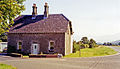
 A66 at Brockham Cottage - geograph.org.uk - 136474.jpg 640 × 480; 59 KByte
-
 A66 at lay by on Appleby by pass - geograph.org.uk - 3078181.jpg 640 × 420; 51 KByte
-
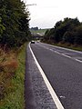
 A66 at Stainmore - geograph.org.uk - 132784.jpg 640 × 425; 71 KByte
-
 A66 bridge over the River Greta - geograph.org.uk - 1135722.jpg 640 × 480; 68 KByte
-
 A66 Bridge over the River Greta - geograph.org.uk - 28288.jpg 640 × 480; 86 KByte
-
 A66 Brough bypass becomes single carriageway. - geograph.org.uk - 401541.jpg 640 × 480; 83 KByte
-
 A66 Dual Carriageway - geograph.org.uk - 1411903.jpg 640 × 480; 47 KByte
-
 A66 Dubwath looking towards Bassenthwaite lake - geograph.org.uk - 545966.jpg 640 × 480; 89 KByte
-
 A66 exit to Mount Pleasant - geograph.org.uk - 1658678.jpg 640 × 512; 103 KByte
-
 A66 in England.png 877 × 924; 668 KByte
-
 A66 near Burns Farm - geograph.org.uk - 3209922.jpg 4 353 × 2 873; 2,68 MByte
-
 A66 over Lorton Road - geograph.org.uk - 78476.jpg 640 × 480; 53 KByte
-
 A66 pedestrian tunnel - geograph.org.uk - 262143.jpg 640 × 480; 130 KByte
-
 A66 road bridge over river Greta near Keswick - geograph.org.uk - 103506.jpg 480 × 640; 56 KByte
-
 A66 Road Bridge over the river Marron - geograph.org.uk - 78415.jpg 640 × 480; 67 KByte
-
 A66 Trunk Road England.jpg 3 872 × 2 592; 4,48 MByte
-
 A66 Trunk road looking north west - geograph.org.uk - 79958.jpg 640 × 480; 98 KByte
-
 A66 Under Barf - geograph.org.uk - 1551803.jpg 640 × 480; 67 KByte
-
 A66 Upgrade to Dual Carriageway - geograph.org.uk - 241161.jpg 640 × 479; 116 KByte
-
 A66(T) Ringroad - geograph.org.uk - 195585.jpg 640 × 479; 111 KByte
-
 A66, Approaching Cargo Fleet Island - geograph.org.uk - 623713.jpg 640 × 384; 38 KByte
-
 A66, south of Cockermouth - geograph.org.uk - 54830.jpg 480 × 640; 134 KByte
-
 A66, westbound - geograph.org.uk - 3134557.jpg 640 × 430; 53 KByte
-
 A66- Roman road looking towards Old Spital - geograph.org.uk - 401533.jpg 640 × 480; 68 KByte
-
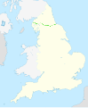 A66-Map.svg 816 × 991; 401 KByte
-
 A6610 Road.JPG 1 133 × 768; 296 KByte
-
 A66basenthwaite1.JPG 882 × 678; 337 KByte
-
 A66bassenthwaite2.JPG 1 087 × 678; 427 KByte
-
 A66mids.JPG 1 280 × 678; 276 KByte
-
 Advertising hoardings by the A66 - geograph.org.uk - 628706.jpg 640 × 480; 103 KByte
-
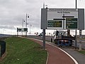 Approaching Middlehaven Interchange - geograph.org.uk - 658058.jpg 640 × 480; 87 KByte
-
 Bridge for Westbury Street over the A66 - geograph.org.uk - 3221684.jpg 3 648 × 2 736; 1,74 MByte
-
 National Cycleway Signpost - geograph.org.uk - 47706.jpg 640 × 480; 90 KByte
-
 Copse on roundabout at junction of A66, A1053 and A1085 - geograph.org.uk - 3221664.jpg 3 317 × 2 344; 1,24 MByte
-
 Cross Lanes - geograph.org.uk - 1241173.jpg 640 × 480; 82 KByte
-
 Cumbria.jpg 1 183 × 526; 69 KByte
-
 Cycle Path , Crossing the A66 Ring Road. - geograph.org.uk - 157331.jpg 640 × 479; 135 KByte
-

-
 Diddersley Hill - geograph.org.uk - 143838.jpg 640 × 479; 86 KByte
-
 Embleton station site geograph-3458081-by-Ben-Brooksbank.jpg 2 396 × 1 379; 2,77 MByte
-
 Greta bridges - A66 Bridge near Threlkeld - geograph.org.uk - 772015.jpg 640 × 426; 87 KByte
-
 Greta bridges - A66 Greta Bridge - geograph.org.uk - 771929.jpg 640 × 426; 73 KByte
-
 Greta bridges - A66 Greta Bridge plaque - geograph.org.uk - 771932.jpg 640 × 426; 75 KByte
-
 Hoardings Along the A66 Westbound - geograph.org.uk - 623854.jpg 640 × 427; 87 KByte
-
 Jumble - geograph.org.uk - 312927.jpg 640 × 426; 77 KByte
-
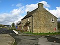
 Little Burdon Farm . - geograph.org.uk - 150921.jpg 640 × 479; 65 KByte
-
 Major Interchange between the A66 and the A19 - geograph.org.uk - 19209.jpg 640 × 480; 69 KByte
-
 New bypass, westbound - geograph.org.uk - 754246.jpg 640 × 480; 79 KByte
-
 New Temple Sowerby bypass, eastbound - geograph.org.uk - 754242.jpg 640 × 480; 60 KByte
-
 Not an everyday occurrence on the A66 - geograph.org.uk - 108640.jpg 640 × 480; 97 KByte
-
 Over the A66 towards the fells - geograph.org.uk - 754186.jpg 640 × 480; 76 KByte
-
 Pennine Way hits the A66 - geograph.org.uk - 1658568.jpg 640 × 530; 105 KByte
-
 Roadbridge crosses the A66 - geograph.org.uk - 3209931.jpg 3 521 × 2 966; 2,07 MByte
-
 Roadbridge over the A66 - geograph.org.uk - 3210758.jpg 4 480 × 2 376; 2,72 MByte
-
 Scotch98.JPG 800 × 310; 99 KByte
-
 Scotch99.JPG 1 067 × 600; 263 KByte
-

-
 Subway under the A66 on the Pennine way - geograph.org.uk - 1058245.jpg 427 × 640; 57 KByte
-
 Sunset on the A66 - geograph.org.uk - 754276.jpg 640 × 480; 124 KByte
-
 Surtees Bridge-pedestrian cycleway-1200.jpg 1 200 × 900; 162 KByte
-
 The A66 dual carriageway divided by trees. - geograph.org.uk - 401913.jpg 640 × 480; 108 KByte
-
 The A66 eastbound - geograph.org.uk - 3221657.jpg 2 918 × 2 094; 929 KByte
-
 The A66 near Keswick - geograph.org.uk - 1034316.jpg 640 × 480; 143 KByte
-
 The A66 near Scales - geograph.org.uk - 1039921.jpg 640 × 480; 128 KByte
-
 The A66 north of Keswick - geograph.org.uk - 838373.jpg 640 × 488; 172 KByte
-
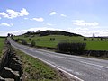
 The A66 south west of Scales - geograph.org.uk - 975637.jpg 640 × 480; 79 KByte
-
 The A66, Castlerigg - geograph.org.uk - 1039931.jpg 640 × 480; 142 KByte
-
 The A66, Hutton Moor End - geograph.org.uk - 1039925.jpg 640 × 480; 142 KByte
-
 The A66, Troutbeck - geograph.org.uk - 1039902.jpg 640 × 480; 109 KByte
-
 The A66, Troutbeck - geograph.org.uk - 1039903.jpg 640 × 480; 101 KByte
-
 The East bound A66 - geograph.org.uk - 754197.jpg 640 × 480; 72 KByte
-
 UK road A66.PNG 568 × 184; 6 KByte
-
 Westbound A66 - geograph.org.uk - 508041.jpg 640 × 480; 92 KByte
-
 A66, Middlesbrough - geograph.org.uk - 274831.jpg 640 × 480; 75 KByte
-
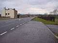
 South Stainmore - geograph.org.uk - 185765.jpg 640 × 480; 58 KByte


_Ringroad_-_geograph.org.uk_-_195585.jpg)


