Category:Abbeycwmhir
Aller à la navigation
Aller à la recherche
Cymraeg: Pentref a chymuned ym Mhowys yw Abaty Cwm-hir neu Abaty Cwm Hir (Saesneg: Abbeycwmhir neu Abbey Cwmhir). Saif ger Afon Clywedog, i'r gogledd o dref Llandrindod.
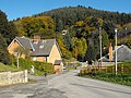
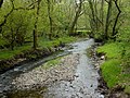
English: Abbeycwmhir or Abbey Cwmhir (, "Abbey in the Long Valley") is a village in the valley of the Clywedog brook in Powys, Wales.
| Position de l'objet | | Voir toutes les coordonnées en utilisant : OpenStreetMap |
|---|
village et communauté dans le Powys, au pays de Galles   | |||||
| Téléverser des médias | |||||
| Nature de l’élément | |||||
|---|---|---|---|---|---|
| Lieu | Powys, pays de Galles | ||||
| Population |
| ||||
| Superficie |
| ||||
 | |||||
Sous-catégories
Cette catégorie comprend 3 sous-catégories, dont les 3 ci-dessous.
Média dans la catégorie « Abbeycwmhir »
Cette catégorie comprend 365 fichiers, dont les 200 ci-dessous.
(page précédente) (page suivante)-
 A date for a time-traveller's diary... - geograph.org.uk - 2019572.jpg 640 × 480 ; 84 kio
-

-
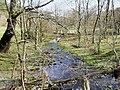
 A secluded valley north of Abbeycwmhir village - geograph.org.uk - 2019034.jpg 640 × 480 ; 125 kio
-
 A small rocky outcrop on Cwmcringlyn Bank - geograph.org.uk - 2019258.jpg 640 × 480 ; 101 kio
-
 A stile on Cwmcringlyn Bank - geograph.org.uk - 2019240.jpg 640 × 480 ; 97 kio
-
 A very minor road - geograph.org.uk - 3207490.jpg 1 152 × 768 ; 809 kio
-
 Abbey Cwm Hir - geograph.org.uk - 91618.jpg 640 × 480 ; 154 kio
-
 Abbey-Cwm-Hir (Abaty Cwm Hir) - geograph.org.uk - 5207605.jpg 640 × 480 ; 492 kio
-
 Abbey-Cwm-Hir - geograph.org.uk - 4910494.jpg 640 × 480 ; 541 kio
-
 Abbeycwmhir - geograph.org.uk - 2187016.jpg 640 × 480 ; 98 kio
-
 Abbeycwmhir Lake - geograph.org.uk - 4910694.jpg 640 × 480 ; 449 kio
-
 Abbeycwmhir Telephone Kiosk - geograph.org.uk - 4910651.jpg 640 × 480 ; 524 kio
-
 Abbeycwmhir Village Centre - geograph.org.uk - 4910498.jpg 640 × 480 ; 585 kio
-
 Abbeycwmhir, Cwm-poeth Cottage - geograph.org.uk - 1244215.jpg 640 × 480 ; 101 kio
-
 Abbeycwmhir, Happy Union - geograph.org.uk - 1244310.jpg 640 × 480 ; 61 kio
-
 Abbeycwmhir, post office - geograph.org.uk - 1244320.jpg 640 × 480 ; 66 kio
-
 Above Cwm-y-dea - geograph.org.uk - 2964390.jpg 1 024 × 768 ; 186 kio
-
 Across the lane to Bwlch-y-sarnau - geograph.org.uk - 2527084.jpg 950 × 713 ; 300 kio
-
 Acute track junction - geograph.org.uk - 2964106.jpg 1 024 × 768 ; 351 kio
-
 Agricultural Machinery in Field near Cwmfaerdy - geograph.org.uk - 5206757.jpg 640 × 480 ; 429 kio
-
 All aboard the skylark^ - geograph.org.uk - 2019483.jpg 640 × 480 ; 121 kio
-
 Approaching Llywy Cottage near Abbeycwmhir - geograph.org.uk - 5206777.jpg 640 × 480 ; 478 kio
-
 Bachell Brook - geograph.org.uk - 2963950.jpg 1 024 × 768 ; 382 kio
-
 Back road to Abbeycwmhir - geograph.org.uk - 4486195.jpg 640 × 427 ; 358 kio
-
 Baptist chapel at Bwlch-y-sarnau - geograph.org.uk - 2882845.jpg 640 × 480 ; 78 kio
-
 Baptist chapel, Bwlch-y-sarnau - geograph.org.uk - 2964618.jpg 1 024 × 696 ; 212 kio
-
 Bend in the lane - geograph.org.uk - 3975635.jpg 640 × 480 ; 87 kio
-
 Bend near the Ffrwd Wen - geograph.org.uk - 4486183.jpg 640 × 427 ; 430 kio
-
 Between Middle Marteg and Waun Marteg - geograph.org.uk - 2527077.jpg 950 × 713 ; 263 kio
-
 Blaentrinant - geograph.org.uk - 2135375.jpg 427 × 640 ; 196 kio
-
 Bluebells by the lane - geograph.org.uk - 2964000.jpg 1 024 × 791 ; 280 kio
-
 Boating lake at Abbey Cwmhir - geograph.org.uk - 2187345.jpg 640 × 480 ; 118 kio
-
 Boating lake at Abbey Cwmhir - geograph.org.uk - 2187352.jpg 480 × 640 ; 125 kio
-
 Boating lake at Abbey Cwmhir - geograph.org.uk - 2187357.jpg 640 × 480 ; 82 kio
-
 Boating lake at Abbey Cwmhir - geograph.org.uk - 2187363.jpg 640 × 480 ; 124 kio
-
 Boating lake at Abbey Cwmhir - geograph.org.uk - 2187369.jpg 640 × 480 ; 82 kio
-
 Bridge over Cwm Poeth brook - geograph.org.uk - 2186979.jpg 640 × 486 ; 113 kio
-
 Bridge over Cwm Poeth Brook at Abbeycwmhir - geograph.org.uk - 4910485.jpg 640 × 480 ; 679 kio
-
 Bridge over the Ffrwd Wen - geograph.org.uk - 4486189.jpg 640 × 427 ; 411 kio
-
 Bridge to The Hall from the churchyard - geograph.org.uk - 2187062.jpg 480 × 640 ; 132 kio
-
 Bridleway near Ty'n-y-berth - geograph.org.uk - 3583417.jpg 1 600 × 1 200 ; 894 kio
-
 Brondre Fawr farm - geograph.org.uk - 2963044.jpg 1 024 × 768 ; 205 kio
-
 Brondre Fawr farm track crossing the infant Marteg - geograph.org.uk - 2963012.jpg 1 024 × 768 ; 184 kio
-
 Brynmoel house - geograph.org.uk - 2186888.jpg 480 × 640 ; 111 kio
-
 Brynmoel House - geograph.org.uk - 2186923.jpg 480 × 640 ; 134 kio
-
 Brynmoel House - geograph.org.uk - 4975035.jpg 4 555 × 3 417 ; 3,78 Mio
-
 Bungalow near Clywedog Brook - geograph.org.uk - 5206769.jpg 640 × 480 ; 447 kio
-
 Bwthyn Cwm Poeth Cottage - geograph.org.uk - 3869468.jpg 640 × 480 ; 127 kio
-
 By the corner of the forest - geograph.org.uk - 2961658.jpg 1 024 × 768 ; 252 kio
-
 Castle Vale and Mealienydd hills - geograph.org.uk - 3285721.jpg 2 272 × 1 704 ; 881 kio
-
 Cefndyrys from Castle Vale Road - geograph.org.uk - 3285657.jpg 2 272 × 1 704 ; 871 kio
-
 Chucking it down on Camlo Hill - geograph.org.uk - 3079485.jpg 640 × 480 ; 307 kio
-
 Church of St Mary, Abbeycwmhir - Cwm Poeth - geograph.org.uk - 2187308.jpg 480 × 640 ; 142 kio
-
 Clear felling - geograph.org.uk - 148801.jpg 640 × 479 ; 107 kio
-
 Cleared forest - geograph.org.uk - 2963007.jpg 1 024 × 768 ; 159 kio
-
 Cleared forestry land - geograph.org.uk - 2964633.jpg 1 024 × 768 ; 209 kio
-
 Clywedog Brook at Abbey-Cwm-Hir - geograph.org.uk - 4910681.jpg 640 × 481 ; 689 kio
-
 Clywedog Brook from the Glyndwr's Way footbridge - geograph.org.uk - 2964184.jpg 1 024 × 768 ; 400 kio
-
 Clywedog Brook, Abbey-Cwm-Hir - geograph.org.uk - 4910701.jpg 640 × 481 ; 683 kio
-
 Construction site, Abbeycwmhir - geograph.org.uk - 3074099.jpg 640 × 480 ; 275 kio
-
 Cultivated fields, Abbeycwmhir - geograph.org.uk - 3079493.jpg 640 × 480 ; 228 kio
-
 Curve of Poplars near Abbeycwmhir - geograph.org.uk - 2019045.jpg 640 × 480 ; 138 kio
-

-
 Cwm Cyncoed - geograph.org.uk - 3869527.jpg 640 × 480 ; 138 kio
-
 Cwm Cynydd - geograph.org.uk - 3869485.jpg 640 × 480 ; 112 kio
-
 Cwm Hir - geograph.org.uk - 3207473.jpg 1 152 × 768 ; 514 kio
-
 Cwm Poeth - geograph.org.uk - 3869474.jpg 640 × 480 ; 79 kio
-
 Cwm Poeth brook runs through the churchyard - geograph.org.uk - 2187068.jpg 480 × 640 ; 112 kio
-
 Cwm-chwarel barn - geograph.org.uk - 2882093.jpg 640 × 480 ; 92 kio
-
 Cwm-cwarel Barn - geograph.org.uk - 2019219.jpg 640 × 480 ; 115 kio
-
 Cwm-farsley Wood from the west - geograph.org.uk - 4486271.jpg 640 × 427 ; 344 kio
-
 Cwm-poeth, cwm - geograph.org.uk - 1244246.jpg 640 × 480 ; 64 kio
-
 Cwmcynydd Bank, clear fell - geograph.org.uk - 1244273.jpg 640 × 480 ; 89 kio
-
 Cwmcynydd Bank, plantation - geograph.org.uk - 1244296.jpg 640 × 480 ; 102 kio
-
 Cwmcynydd Bank, track - geograph.org.uk - 1244255.jpg 640 × 480 ; 115 kio
-
 Dam, Abbeycwmhir Lake - geograph.org.uk - 4910690.jpg 640 × 481 ; 678 kio
-
 Disused Quarry - geograph.org.uk - 148919.jpg 640 × 479 ; 141 kio
-
 Doorway Detail, The Hall at Abbey-Cwm-Hir - geograph.org.uk - 4910789.jpg 640 × 480 ; 524 kio
-
 Dyfaenor - geograph.org.uk - 2882129.jpg 640 × 480 ; 65 kio
-
 Dyfaenor - geograph.org.uk - 2882133.jpg 640 × 480 ; 102 kio
-
 Eastern approach to Abbey Cwm-hir - geograph.org.uk - 3207484.jpg 1 152 × 768 ; 725 kio
-
 Edge of old woodland - geograph.org.uk - 1172630.jpg 640 × 480 ; 163 kio
-
 Entrance gates to The Hall, Abbeycwmhir - geograph.org.uk - 2882042.jpg 640 × 480 ; 118 kio
-
 Entrance to Bwlch-y-Sarnau - geograph.org.uk - 3241568.jpg 640 × 460 ; 42 kio
-
 Entrance to The Hall at Abbey-Cwm-Hir - geograph.org.uk - 4910778.jpg 640 × 481 ; 652 kio
-
 Erosion in action - geograph.org.uk - 3079489.jpg 640 × 480 ; 297 kio
-
 Excavation, Abbeycwmhir (1293665).jpg 1 000 × 713 ; 104 kio
-

-
 Farmland near Clywedod Brook - geograph.org.uk - 5206753.jpg 567 × 640 ; 423 kio
-
 Farmland on Bailey Hill - geograph.org.uk - 1392094.jpg 640 × 428 ; 90 kio
-
 Ffordd Glyndwr Way - geograph.org.uk - 3869522.jpg 640 × 480 ; 62 kio
-
 Ffordd Glyndwr Way - geograph.org.uk - 3869524.jpg 640 × 480 ; 60 kio
-
 Field and forest north west from Bwlch-y-sarnau - geograph.org.uk - 4486136.jpg 640 × 427 ; 370 kio
-
 Field by the Clywedog Brook - geograph.org.uk - 3207507.jpg 1 152 × 768 ; 431 kio
-
 Field near Cwmysgawen farm - geograph.org.uk - 4486275.jpg 640 × 427 ; 367 kio
-
 Fields and trees above the Bachell Brook - geograph.org.uk - 4486224.jpg 640 × 427 ; 325 kio
-
 Fields and trees above the Bachell Brook - geograph.org.uk - 4486226.jpg 640 × 427 ; 378 kio
-
 Fields by the corner of the forest - geograph.org.uk - 2964620.jpg 1 024 × 768 ; 197 kio
-
 Fields in the valley of the Clywedog Brook - geograph.org.uk - 4486245.jpg 640 × 427 ; 345 kio
-
 Fishing lake, Abbeycwmhir - geograph.org.uk - 2961751.jpg 1 024 × 768 ; 220 kio
-
-
 Footbridge over Clywedog Brook - geograph.org.uk - 2964175.jpg 768 × 1 024 ; 375 kio
-
 Footpath sign and lichen covered wall - geograph.org.uk - 2964239.jpg 768 × 1 024 ; 386 kio
-
 Footprints in the snow - geograph.org.uk - 1161852.jpg 640 × 480 ; 12 kio
-
 Forest and track above Brondre Fawr farm - geograph.org.uk - 2963026.jpg 1 024 × 768 ; 225 kio
-
 Forest lane in the upper Marteg valley - geograph.org.uk - 2963006.jpg 1 024 × 753 ; 230 kio
-
 Forest track - geograph.org.uk - 2527081.jpg 713 × 950 ; 315 kio
-
 Forest track - geograph.org.uk - 2963073.jpg 1 024 × 768 ; 250 kio
-
 Forest track across the Marteg valley - geograph.org.uk - 2964635.jpg 1 024 × 569 ; 140 kio
-
 Forest track and forest trees - geograph.org.uk - 2963065.jpg 1 024 × 768 ; 256 kio
-
 Forest track in mist - geograph.org.uk - 1779763.jpg 640 × 480 ; 48 kio
-
 Forest track in spruce plantation - geograph.org.uk - 1779781.jpg 640 × 480 ; 63 kio
-
 Forest track near Bwlch-y-sarnau - geograph.org.uk - 4102312.jpg 1 024 × 768 ; 234 kio
-
 Forest track, upper Marteg valley - geograph.org.uk - 2963003.jpg 1 024 × 768 ; 202 kio
-
 Forest track, upper Marteg valley - geograph.org.uk - 4102321.jpg 1 024 × 768 ; 190 kio
-
 Forestry at Brondre Fawr - geograph.org.uk - 2135321.jpg 640 × 426 ; 219 kio
-
 Forestry operations, Brondre-fawr Hill - geograph.org.uk - 2963077.jpg 1 024 × 699 ; 173 kio
-

-
 Forestry plantation near Abbeycwmhir - geograph.org.uk - 2882082.jpg 640 × 480 ; 65 kio
-
 Forestry track near Cwmcynydd Bank, - geograph.org.uk - 3583429.jpg 1 600 × 1 200 ; 660 kio
-
 Forestry workings at the corner of the track - geograph.org.uk - 2963050.jpg 1 024 × 757 ; 259 kio
-
 Fox gone - geograph.org.uk - 2882070.jpg 640 × 480 ; 86 kio
-
 Fox on the run - geograph.org.uk - 2882065.jpg 640 × 480 ; 54 kio
-
 Glyndwr's Way in forestry - geograph.org.uk - 3975668.jpg 640 × 480 ; 105 kio
-
 Glyndwr's Way in Neuadd-fach wood - geograph.org.uk - 4676849.jpg 3 456 × 4 608 ; 6,05 Mio
-
 Glyndwr's Way in the forest - geograph.org.uk - 2964622.jpg 768 × 1 024 ; 253 kio
-
 Glyndwr's Way leaving Bwlch-y-sarnau - geograph.org.uk - 2964619.jpg 768 × 1 024 ; 192 kio
-
 Glyndwr's Way near Abbeycwmhir - geograph.org.uk - 4664819.jpg 4 608 × 3 456 ; 5,02 Mio
-
 Glyndwr's Way near Bwlch-y-Sarnau - geograph.org.uk - 4664848.jpg 4 608 × 3 456 ; 5,4 Mio
-
 Glyndwr's Way near Bwlch-y-Sarnau - geograph.org.uk - 4664855.jpg 4 608 × 3 456 ; 5,26 Mio
-
 Glyndwr's Way near Bwlch-y-Sarnau - geograph.org.uk - 4664860.jpg 4 608 × 3 456 ; 5,12 Mio
-
 Glyndwr's Way near Cwmysgawen - geograph.org.uk - 4664822.jpg 4 608 × 3 456 ; 5,17 Mio
-
 Glyndwr's Way near Prysgduon - geograph.org.uk - 4664868.jpg 4 608 × 3 456 ; 5,16 Mio
-
 Glyndwr's Way near Prysgduon - geograph.org.uk - 4664869.jpg 4 608 × 3 456 ; 5,17 Mio
-
 Glyndwr's Way near Trinnant - geograph.org.uk - 4664872.jpg 4 608 × 3 456 ; 3,96 Mio
-
 Glyndwr's Way near Tyfaenor Park - geograph.org.uk - 4664810.jpg 4 608 × 3 456 ; 5,07 Mio
-
 Glyndwr's Way near Upper Esgair Hill - geograph.org.uk - 4664841.jpg 4 608 × 3 456 ; 5,35 Mio
-

-
 Grassy hillside - geograph.org.uk - 2964370.jpg 1 024 × 768 ; 176 kio
-
 Grazing below Wenallt Cottages - geograph.org.uk - 4486266.jpg 640 × 521 ; 326 kio
-
 Grazing by the Bachell Brook - geograph.org.uk - 4486231.jpg 640 × 427 ; 389 kio
-
 Grazing land and a view to the hills - geograph.org.uk - 2964307.jpg 1 024 × 768 ; 132 kio
-
 Grazing near the Ffrwd Wen - geograph.org.uk - 4486204.jpg 640 × 427 ; 349 kio
-
 Grazing on Cefndyrys - geograph.org.uk - 4486277.jpg 640 × 427 ; 372 kio
-
 Great Park, quarry - geograph.org.uk - 1244300.jpg 640 × 480 ; 113 kio
-
 Green Hut next to the Road to Abbeycwmhir - geograph.org.uk - 5206767.jpg 640 × 480 ; 399 kio
-
 Happy Union Inn, Abbeycwmhir - geograph.org.uk - 2187027.jpg 640 × 480 ; 106 kio
-
 Hazy morning light in the forest - geograph.org.uk - 2963048.jpg 768 × 1 024 ; 255 kio
-
 Hedging works - geograph.org.uk - 781009.jpg 640 × 480 ; 133 kio
-
 Henfryn, bridge - geograph.org.uk - 1244328.jpg 640 × 480 ; 99 kio
-
 Henfryn, Clywedog Brook - geograph.org.uk - 1244333.jpg 640 × 480 ; 127 kio
-
 Heol Cwmcringlyn Road - geograph.org.uk - 3869512.jpg 640 × 480 ; 91 kio
-
 Heol ger Cwmcringlyn - road near Cwmcringlyn - geograph.org.uk - 3869518.jpg 640 × 480 ; 91 kio
-
 Heol Tyn y Berth Road - geograph.org.uk - 3869504.jpg 640 × 480 ; 69 kio
-
 Hidden Mast - geograph.org.uk - 1811453.jpg 3 072 × 2 304 ; 2,3 Mio
-
 High meadow in August - geograph.org.uk - 2019365.jpg 640 × 480 ; 105 kio
-
 Hillside east of Bwlch-y-sarnau - geograph.org.uk - 2961678.jpg 1 024 × 768 ; 143 kio
-
 Hillside forest after clearance - geograph.org.uk - 2963036.jpg 1 024 × 768 ; 187 kio
-
 Hillside grazing and small plantation - geograph.org.uk - 2961668.jpg 1 024 × 768 ; 293 kio
-
 Home Farm, Abbeycwmhir - geograph.org.uk - 4399842.jpg 600 × 404 ; 109 kio
-
 House at Abbey Cwmhir - geograph.org.uk - 1582084.jpg 640 × 479 ; 93 kio
-
 Infant River Marteg from the Brondre Fawr farm track - geograph.org.uk - 2963013.jpg 768 × 1 024 ; 280 kio
-
 Junction for track to Neuadd-fach - geograph.org.uk - 2963960.jpg 1 024 × 768 ; 199 kio
-
 Keeper's Lodge - geograph.org.uk - 4975021.jpg 3 396 × 2 975 ; 2,47 Mio
-
 Lake at Abaty Cwm Hir - geograph.org.uk - 1581874.jpg 640 × 479 ; 126 kio
-
 Lake at Abbey-Cwm-Hir - geograph.org.uk - 4910675.jpg 640 × 481 ; 510 kio
-
 Lane along the valley of Bachell Brook - geograph.org.uk - 2963971.jpg 1 024 × 768 ; 225 kio
-
 Lane along wooded valley side - geograph.org.uk - 2964070.jpg 1 024 × 804 ; 420 kio
-
 Lane by Llywy Cottage - geograph.org.uk - 2961787.jpg 1 024 × 730 ; 210 kio
-

-
 Lane corner with bluebells on the bank - geograph.org.uk - 2963989.jpg 1 024 × 757 ; 339 kio
-
 Lane east of Abbeycwmhir - geograph.org.uk - 2961687.jpg 1 024 × 768 ; 334 kio
-
 Lane in the valley of Bachell Brook - geograph.org.uk - 2964050.jpg 1 024 × 768 ; 226 kio
-
 Lane in the valley of the Clywedog Brook - geograph.org.uk - 2961681.jpg 1 024 × 768 ; 183 kio
-
 Lane junction - geograph.org.uk - 2963005.jpg 1 024 × 746 ; 149 kio
-
 Lane near Fishpool Farm - geograph.org.uk - 2964227.jpg 1 024 × 768 ; 251 kio
-
 Lane near Fishpool farm - geograph.org.uk - 3976270.jpg 640 × 480 ; 98 kio
-
 Lane near the top of Bwlch-y-sarnau Hill - geograph.org.uk - 2963081.jpg 1 024 × 768 ; 200 kio
-
 Lane near Waun - geograph.org.uk - 3975647.jpg 640 × 480 ; 99 kio
-
 Lane north of Bwlch-y-sarnau Hill - geograph.org.uk - 2963088.jpg 1 024 × 768 ; 141 kio
-
 Lane south of Bwlch-y-sarnau - geograph.org.uk - 2527087.jpg 950 × 713 ; 301 kio
-
 Lane to Cwmcringlyn - geograph.org.uk - 4486207.jpg 640 × 427 ; 416 kio
-
 Lane to Neuadd Fach farm - geograph.org.uk - 4486217.jpg 640 × 427 ; 351 kio
-
 Larch on the hillside - geograph.org.uk - 2186942.jpg 478 × 640 ; 123 kio
-

-
 Lions outside The Hall at Abbey-Cwm-Hir - geograph.org.uk - 4910786.jpg 640 × 480 ; 527 kio
-
 Llwybr ceffyl Cwm Cynydd Bridleway - geograph.org.uk - 3869491.jpg 640 × 480 ; 65 kio
-
 Logging - geograph.org.uk - 1779788.jpg 640 × 480 ; 61 kio
-
 Logging road - geograph.org.uk - 3079438.jpg 640 × 480 ; 280 kio
-

-
 Looking Into Victoria's Garden - geograph.org.uk - 4910921.jpg 481 × 640 ; 580 kio
-
 Looking up the valley of the Clywedog Brook - geograph.org.uk - 4486289.jpg 640 × 427 ; 308 kio
-
 Lower Cwmhir, bridge - geograph.org.uk - 1244147.jpg 640 × 480 ; 95 kio
-
 Lower Cwmhir, cwm - geograph.org.uk - 1244142.jpg 640 × 480 ; 83 kio
-
 Lower Cwmhir, Cwm Hir - geograph.org.uk - 1244152.jpg 640 × 480 ; 95 kio
-
 Meadow by Upper Esgair Farm - geograph.org.uk - 2964318.jpg 1 024 × 513 ; 114 kio
-
 Minor Road Junction near Cefn-pawl - geograph.org.uk - 5207632.jpg 640 × 480 ; 503 kio
-
 Minor Road near Cwmfaerdy - geograph.org.uk - 5207636.jpg 640 × 480 ; 509 kio
-
 Minor Road near Henfryn - geograph.org.uk - 5202962.jpg 640 × 480 ; 415 kio
-
 Minor road through forestry - geograph.org.uk - 1392076.jpg 640 × 428 ; 106 kio


_-_geograph.org.uk_-_5207605.jpg)


.jpg)


