Category:Abbots Leigh
Vai alla navigazione
Vai alla ricerca
English: Abbots Leigh is a village and civil parish in Somerset, England. It is within the unitary authority of North Somerset and has a population of 810.
village and civil parish in Somerset, England  | |||||
| Carica un file multimediale | |||||
| Istanza di | |||||
|---|---|---|---|---|---|
| Luogo | North Somerset, Somerset, Sud Ovest dell'Inghilterra, Inghilterra | ||||
| Popolazione |
| ||||
| sito web ufficiale | |||||
 | |||||
Sottocategorie
Questa categoria contiene le 4 sottocategorie indicate di seguito, su un totale di 4.
File nella categoria "Abbots Leigh"
Questa categoria contiene 200 file, indicati di seguito, su un totale di 217.
(pagina precedente) (pagina successiva)-
 10k race in Ashton Court Estate - geograph.org.uk - 570727.jpg 640 × 427; 364 KB
-
 1GL Bolt on Holy Trinity - geograph.org.uk - 5973334.jpg 2 304 × 1 704; 1,67 MB
-
 A face to greet the worshippers - geograph.org.uk - 5973283.jpg 1 704 × 2 304; 1,61 MB
-
 A gate on Church Road - geograph.org.uk - 5961870.jpg 2 304 × 1 704; 1,63 MB
-
 A green bridge in Abbot's Pool - geograph.org.uk - 5682525.jpg 2 304 × 1 704; 1,65 MB
-
 A green healing - geograph.org.uk - 5682041.jpg 2 304 × 1 704; 1,67 MB
-
 A leafy lane near Bristol. - geograph.org.uk - 4142920.jpg 3 204 × 1 896; 4,18 MB
-
 A natural bridge - geograph.org.uk - 5682063.jpg 1 704 × 2 304; 2,13 MB
-
 A short path to the other paths - geograph.org.uk - 5681801.jpg 1 704 × 2 304; 2,02 MB
-
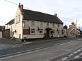 Abbot's Leigh - The George - geograph.org.uk - 107331.jpg 640 × 480; 90 KB
-
 Abbot's Leigh village hall - geograph.org.uk - 4241030.jpg 800 × 450; 170 KB
-
 Abbot's Leigh village hall - geograph.org.uk - 5973301.jpg 2 304 × 1 704; 1,48 MB
-
 Abbot's Pool car park - geograph.org.uk - 5682051.jpg 2 304 × 1 704; 1,69 MB
-
 Abbot's Pool Plantation - panoramio.jpg 2 304 × 1 728; 1,8 MB
-
 Abbots Leigh cricket club - geograph.org.uk - 5827322.jpg 3 264 × 2 448; 1,86 MB
-
 Abbots Leigh House - geograph.org.uk - 4511025.jpg 3 558 × 2 348; 539 KB
-
 Abbots Leigh, above Paradise Bottom - geograph.org.uk - 2674619.jpg 640 × 427; 523 KB
-

-
 Abbots Leigh, by Miles Dock - geograph.org.uk - 2674668.jpg 640 × 427; 554 KB
-
 Abbots Leigh, by the river Avon - geograph.org.uk - 2674686.jpg 640 × 427; 469 KB
-
 Abbots Leigh, head of old inclined plane - geograph.org.uk - 2674643.jpg 640 × 427; 524 KB
-

-

-
 Abbots Leigh, Miles Dock - geograph.org.uk - 2674679.jpg 427 × 640; 520 KB
-
 Abbots Leigh, Miles Dock, silted up - geograph.org.uk - 2674672.jpg 640 × 427; 518 KB
-
 Abbots Leigh, River Avon on the ebb - geograph.org.uk - 2674702.jpg 640 × 427; 424 KB
-
 Abbots Pool - panoramio.jpg 2 304 × 1 728; 1,74 MB
-
 Along Pill Road - geograph.org.uk - 5973323.jpg 2 304 × 1 704; 1,8 MB
-
 Ashton Court - geograph.org.uk - 113640.jpg 640 × 480; 107 KB
-
 Autumn Light over the River Avon - geograph.org.uk - 5585551.jpg 3 264 × 2 448; 4,78 MB
-
 Avon Gorge - geograph.org.uk - 4511348.jpg 1 920 × 1 314; 788 KB
-
 Avonmouth and the Bristol Channel - geograph.org.uk - 5961873.jpg 2 304 × 1 704; 1,18 MB
-
 Beech avenue, Leigh Woods - geograph.org.uk - 5446356.jpg 1 280 × 960; 410 KB
-
 Beginning of Sandy Lane, Abbots Leigh - geograph.org.uk - 2395222.jpg 4 000 × 3 000; 6,15 MB
-
 Big slide, Avon Gorge - geograph.org.uk - 5446369.jpg 1 280 × 960; 489 KB
-
 Black Rocks - geograph.org.uk - 4509969.jpg 3 443 × 2 111; 821 KB
-
 Bridleway nearing Upper Farm - geograph.org.uk - 4511218.jpg 1 920 × 1 440; 819 KB
-
 Bridleway to Upper Farm - geograph.org.uk - 4511203.jpg 1 920 × 1 329; 605 KB
-
 Broomrape - geograph.org.uk - 5445998.jpg 310 × 640; 266 KB
-
 By the Monarch's Way - geograph.org.uk - 4511144.jpg 1 920 × 1 376; 636 KB
-
 Capstan by the Avon - geograph.org.uk - 4509429.jpg 1 920 × 2 182; 1,08 MB
-
 Cascade in Abbot's Pool - geograph.org.uk - 5682460.jpg 2 304 × 1 704; 1,75 MB
-
 Climbers on Black Rocks - geograph.org.uk - 4509977.jpg 1 670 × 2 170; 572 KB
-
 Coronation Avenue - geograph.org.uk - 4186038.jpg 1 920 × 1 306; 958 KB
-
 Coronation Avenue - geograph.org.uk - 4510961.jpg 4 000 × 3 000; 1,84 MB
-
 Cycle path number 26 from Bristol to Portishead - geograph.org.uk - 3521149.jpg 3 648 × 2 736; 2,89 MB
-
 Descending paths - geograph.org.uk - 5453826.jpg 427 × 640; 325 KB
-
 Difficulty in shooting - geograph.org.uk - 5973280.jpg 2 304 × 1 704; 1,72 MB
-

-
 Drive to Kingcott Farm - geograph.org.uk - 2473989.jpg 640 × 480; 92 KB
-
 Driveway into Leigh Court - geograph.org.uk - 3521199.jpg 3 648 × 2 736; 4,28 MB
-
 Emerging beneath the car park - geograph.org.uk - 5682056.jpg 1 704 × 2 304; 2,33 MB
-
 Failand Coombe - geograph.org.uk - 329734.jpg 640 × 480; 88 KB
-
 Familiar in the town but not the country - geograph.org.uk - 5682433.jpg 1 704 × 2 304; 1,98 MB
-
 Field by Beggar Bush Lane - geograph.org.uk - 4511250.jpg 1 920 × 1 440; 850 KB
-
 Field by Warren House Plantation - geograph.org.uk - 4511194.jpg 1 920 × 1 133; 486 KB
-
 Fields near Abbots Leigh - geograph.org.uk - 2579863.jpg 640 × 480; 53 KB
-
 Flowering on the roof - geograph.org.uk - 5681800.jpg 2 304 × 1 704; 1,62 MB
-
 Former Quarry - geograph.org.uk - 5446097.jpg 640 × 421; 344 KB
-
 From Snake's Well Wood - geograph.org.uk - 5682531.jpg 1 704 × 2 304; 2,02 MB
-
 Fungi by the river - geograph.org.uk - 5457533.jpg 4 320 × 3 240; 3,68 MB
-
 Gatehouse, Leigh Court - geograph.org.uk - 4241060.jpg 800 × 451; 177 KB
-
 Going straight through - geograph.org.uk - 5682045.jpg 2 304 × 1 704; 1,73 MB
-
 Grazing land adjacent to Leigh Court Farm - geograph.org.uk - 3521194.jpg 3 648 × 2 736; 3,12 MB
-
 Grazing land below Poundbatch Farm - geograph.org.uk - 3521201.jpg 3 648 × 2 736; 3,24 MB
-
 Ham Green freshwater fishing lake - geograph.org.uk - 3521140.jpg 3 648 × 2 736; 2,86 MB
-
 Heron in the mud - geograph.org.uk - 4510029.jpg 1 920 × 2 575; 496 KB
-
 Holy Trinity cross - geograph.org.uk - 5973250.jpg 1 704 × 2 304; 2,24 MB
-
 Holy Trinity welcomes you - geograph.org.uk - 5973286.jpg 1 704 × 2 304; 1,75 MB
-
 Holy Trinity, Abbot's Leigh - geograph.org.uk - 4241069.jpg 598 × 800; 290 KB
-
 Houses at the corner of Pill Road and A369 - geograph.org.uk - 2395202.jpg 3 897 × 2 923; 4,05 MB
-
 In Leigh Woods - geograph.org.uk - 5442062.jpg 1 280 × 960; 830 KB
-
 Junction on the A369 - geograph.org.uk - 4513835.jpg 1 920 × 1 407; 597 KB
-
 Just off the top - geograph.org.uk - 5440793.jpg 1 704 × 2 304; 1,57 MB
-
 Kingcott Farm - geograph.org.uk - 5054692.jpg 1 920 × 884; 288 KB
-
 Leafy lane - geograph.org.uk - 4142936.jpg 3 431 × 2 532; 4,96 MB
-
 Leigh Woods (1) - geograph.org.uk - 5192737.jpg 4 175 × 3 131; 3,25 MB
-
 Leigh Woods (10) - geograph.org.uk - 5192754.jpg 4 043 × 3 033; 3,63 MB
-
 Leigh Woods (11) - geograph.org.uk - 5192755.jpg 4 223 × 3 167; 3,81 MB
-
 Leigh Woods (12) - geograph.org.uk - 5192756.jpg 4 293 × 3 219; 3,62 MB
-
 Leigh Woods (13) - geograph.org.uk - 5192758.jpg 4 299 × 3 223; 3,26 MB
-
 Leigh Woods (14) - geograph.org.uk - 5192761.jpg 3 235 × 4 315; 3,92 MB
-
 Leigh Woods (15) - geograph.org.uk - 5192764.jpg 4 320 × 3 240; 3,83 MB
-
 Leigh Woods (16) - geograph.org.uk - 5192765.jpg 4 320 × 3 240; 4,15 MB
-
 Leigh Woods (17) - geograph.org.uk - 5192767.jpg 3 240 × 4 320; 3,93 MB
-
 Leigh Woods (18) - geograph.org.uk - 5192769.jpg 4 320 × 3 240; 4,32 MB
-
 Leigh Woods (2) - geograph.org.uk - 5192741.jpg 4 320 × 3 240; 3,14 MB
-
 Leigh Woods (3) - geograph.org.uk - 5192743.jpg 4 133 × 3 099; 3,3 MB
-
 Leigh Woods (4) - geograph.org.uk - 5192746.jpg 4 320 × 3 240; 4,41 MB
-
 Leigh Woods (5) - geograph.org.uk - 5192748.jpg 4 320 × 3 240; 4,75 MB
-
 Leigh Woods (6) - geograph.org.uk - 5192749.jpg 4 137 × 3 103; 3,5 MB
-
 Leigh Woods (7) - geograph.org.uk - 5192751.jpg 4 320 × 3 240; 4,22 MB
-
 Leigh Woods (8) - geograph.org.uk - 5192752.jpg 4 297 × 3 223; 3,7 MB
-
 Leigh Woods (9) - geograph.org.uk - 5192753.jpg 4 141 × 3 105; 3,05 MB
-
 Leigh Woods - geograph.org.uk - 5445931.jpg 640 × 440; 544 KB
-
 Leigh Woods - geograph.org.uk - 5453747.jpg 640 × 427; 318 KB
-
 Leigh Woods Upper River Light - geograph.org.uk - 5446362.jpg 960 × 1 280; 519 KB
-
 Leigh Woods, Forestry Commission - geograph.org.uk - 1051685.jpg 640 × 480; 96 KB
-
 Lighting the way - geograph.org.uk - 4717755.jpg 4 714 × 3 144; 5,64 MB
-
 Looking upstream over the Markham Brook - geograph.org.uk - 4777817.jpg 2 048 × 3 648; 2,38 MB
-
 Lost our ball - geograph.org.uk - 5442849.jpg 1 704 × 2 304; 1,97 MB
-
 Manipulated pic of the Abbot’s Pool, Abbots Leigh. - panoramio (1).jpg 3 408 × 2 272; 8,06 MB
-
 Manipulated pic of the Abbot’s Pool, Abbots Leigh. - panoramio.jpg 3 408 × 2 272; 7,94 MB
-
 Manor Lane, Abbot's Leigh - geograph.org.uk - 4241066.jpg 800 × 534; 245 KB
-
 Manor Road - geograph.org.uk - 4142926.jpg 4 000 × 2 664; 6,4 MB
-
 Manor Road and Route 334 - geograph.org.uk - 5681805.jpg 2 304 × 1 704; 1,78 MB
-
 Manor Road, Abbot's Leigh - geograph.org.uk - 4241063.jpg 800 × 534; 238 KB
-
 Manor Road, Abbot's Leigh - geograph.org.uk - 4511079.jpg 1 920 × 1 330; 988 KB
-
 Miles Dock - geograph.org.uk - 4509798.jpg 1 920 × 1 422; 1,04 MB
-
 Monarch's Way approaching Abbots Leigh - geograph.org.uk - 4510090.jpg 1 920 × 1 379; 762 KB
-
 Monarch's Way near Abbots Leigh - geograph.org.uk - 4510968.jpg 3 988 × 2 609; 1,68 MB
-
 Monarch's Way near Abbots Leigh - geograph.org.uk - 4510983.jpg 1 920 × 1 170; 840 KB
-
 Muddy Inlet - geograph.org.uk - 5446045.jpg 640 × 480; 414 KB
-
 Narrow and not very high - geograph.org.uk - 5682543.jpg 2 304 × 1 704; 1,77 MB
-
 Nothing holds fast like a beech tree - geograph.org.uk - 5682526.jpg 1 704 × 2 304; 2,44 MB
-
 Oak Wood Lodge - geograph.org.uk - 5457525.jpg 4 320 × 3 240; 2,63 MB
-
 Oak Wood, in Leigh Woods - geograph.org.uk - 5446358.jpg 1 280 × 960; 492 KB
-
 Old deer fence in Leigh Woods - geograph.org.uk - 1592234.jpg 640 × 480; 150 KB
-
 Old school field - geograph.org.uk - 5961877.jpg 2 304 × 1 704; 1,59 MB
-
 Old school field - geograph.org.uk - 5973274.jpg 2 304 × 1 704; 1,66 MB
-
 Orchard - geograph.org.uk - 2473963.jpg 640 × 480; 140 KB
-
 Orchard - geograph.org.uk - 2473972.jpg 640 × 454; 128 KB
-
 Orchard below Manor Road - geograph.org.uk - 5682059.jpg 2 304 × 1 704; 1,74 MB
-
 Orchid - geograph.org.uk - 5446103.jpg 305 × 640; 233 KB
-
 Ordnance Survey 1GL Bolt - geograph.org.uk - 4570672.jpg 640 × 480; 113 KB
-
 Outfall from The Gulley - geograph.org.uk - 5634955.jpg 1 024 × 768; 220 KB
-
 Path descending through Leigh Woods - geograph.org.uk - 5634575.jpg 1 024 × 768; 352 KB
-
 Path in Leigh Woods - geograph.org.uk - 5528672.jpg 3 072 × 2 048; 1,52 MB
-
 Path in Leigh Woods - geograph.org.uk - 5585542.jpg 3 264 × 2 448; 4,14 MB
-
 Path in the woods - geograph.org.uk - 5453749.jpg 427 × 640; 330 KB
-
 Path through Snake's Well Wood - geograph.org.uk - 5682537.jpg 2 304 × 1 704; 1,8 MB
-
 Path to Abbot's Pool - geograph.org.uk - 5681806.jpg 1 704 × 2 304; 1,99 MB
-
 Path to Paradise Bottom - geograph.org.uk - 5453818.jpg 427 × 640; 316 KB
-
 Path, Leigh Woods - geograph.org.uk - 4186012.jpg 1 920 × 2 560; 1,48 MB
-
 Paths in Abbot's Pool - geograph.org.uk - 5682039.jpg 1 704 × 2 304; 1,74 MB
-
 Pill - Lake by Chapel Pill Farm - geograph.org.uk - 4755251.jpg 1 024 × 768; 212 KB
-
 Pill Rd - geograph.org.uk - 2474063.jpg 640 × 459; 60 KB
-
 Pill Road - geograph.org.uk - 4513813.jpg 1 920 × 1 398; 691 KB
-
 Prepared path in Abbot's Pool - geograph.org.uk - 5682049.jpg 1 704 × 2 304; 2,06 MB
-
 Pride of the village - geograph.org.uk - 5973304.jpg 2 304 × 1 704; 1,6 MB
-
 Private road in Leigh Woods - geograph.org.uk - 5634571.jpg 1 024 × 768; 321 KB
-
 Public Foot Path near Upper Farm - geograph.org.uk - 950117.jpg 640 × 427; 104 KB
-
 Quarry Plantation - geograph.org.uk - 4511209.jpg 4 000 × 3 000; 2,13 MB
-
 Railway arch by River Avon Trail - geograph.org.uk - 4509919.jpg 1 920 × 2 560; 1,52 MB
-
 Railway arch by River Avon Trail - geograph.org.uk - 4510002.jpg 1 920 × 1 440; 957 KB
-
 Railway bridge beside the Avon - geograph.org.uk - 5454139.jpg 427 × 640; 292 KB
-
 Railway protection - geograph.org.uk - 5457529.jpg 4 320 × 3 240; 4,04 MB
-
 Railway to Portishead - geograph.org.uk - 5446361.jpg 1 280 × 960; 541 KB
-
 Railway underpass in Leigh Woods (1) - geograph.org.uk - 5634573.jpg 1 024 × 768; 336 KB
-
 Railway underpass in Leigh Woods (2) - geograph.org.uk - 5634574.jpg 1 024 × 768; 330 KB
-
 Railway viaduct, Miles Dock - geograph.org.uk - 4510936.jpg 1 920 × 2 560; 1,68 MB
-
 Repaired wall - geograph.org.uk - 5634952.jpg 768 × 1 024; 321 KB
-
 Ring another phone for help - geograph.org.uk - 5973314.jpg 2 304 × 1 704; 1,82 MB
-
 River Avon below Leigh Woods - geograph.org.uk - 5442065.jpg 1 280 × 960; 408 KB
-
 River Avon below Leigh Woods - geograph.org.uk - 5446365.jpg 1 280 × 882; 286 KB
-
 River Avon below Old Sneed Park - geograph.org.uk - 4509788.jpg 1 920 × 1 440; 760 KB
-

-
 River Avon mud - geograph.org.uk - 5446364.jpg 1 280 × 960; 512 KB
-
 River Avon Trail - geograph.org.uk - 4186304.jpg 1 920 × 1 440; 850 KB
-
 River Avon Trail - geograph.org.uk - 4509958.jpg 1 920 × 1 394; 972 KB
-
 River path in woodland - geograph.org.uk - 5453827.jpg 640 × 427; 315 KB
-
 Riverside path in Leigh Woods - geograph.org.uk - 5634572.jpg 800 × 600; 282 KB
-
 Rockfall protection in the Avon Gorge - geograph.org.uk - 5634959.jpg 1 024 × 768; 284 KB
-
 Rocky gorge - geograph.org.uk - 5457552.jpg 4 320 × 3 240; 3,8 MB
-
 Sandy Lane, Abbots Leigh - panoramio.jpg 2 304 × 1 728; 1,73 MB
-
 Sea Mills - geograph.org.uk - 4509784.jpg 1 920 × 1 293; 882 KB
-
 Snake's Well - geograph.org.uk - 5682535.jpg 2 304 × 1 704; 1,66 MB
-
 Sunshine over Gordano - geograph.org.uk - 4241057.jpg 800 × 534; 258 KB
-
 The end of Church Lane, Abbot's Leigh - geograph.org.uk - 4241067.jpg 800 × 534; 224 KB
-
 The entrance to Chapel Pill Farm - geograph.org.uk - 3521143.jpg 3 648 × 2 736; 2,68 MB
-
 The George Inn, Abbot's Leigh - geograph.org.uk - 5973330.jpg 1 704 × 2 304; 1,43 MB
-
 The magic wood sepia - panoramio.jpg 3 408 × 2 272; 7,05 MB
-
 The Magic Wood-1 - panoramio.jpg 3 408 × 2 272; 8,12 MB
-
 The Magic Wood-2 - panoramio.jpg 3 408 × 2 272; 8,68 MB
-

-
 The Priory Abbots Leigh - geograph.org.uk - 2461507.jpg 640 × 476; 82 KB
-
 The Priory, Abbots Leigh - geograph.org.uk - 1051708.jpg 640 × 480; 101 KB
-
 The south end of the hall - geograph.org.uk - 5973309.jpg 1 704 × 2 304; 1,87 MB
-
 The start of the fish ponds - geograph.org.uk - 5682052.jpg 2 304 × 1 704; 1,75 MB
-
 The stream that flows to the fish ponds - geograph.org.uk - 5682061.jpg 2 304 × 1 704; 1,59 MB
-
 The traditional view of Holy Trinity - geograph.org.uk - 5961871.jpg 2 304 × 1 704; 1,6 MB
-
 Three faces on Holy Trinity church tower - geograph.org.uk - 5973289.jpg 2 304 × 1 704; 1,62 MB
-
 Towerhirst - geograph.org.uk - 5457536.jpg 4 320 × 3 240; 2,57 MB
-
 Track junction, Leigh Woods - geograph.org.uk - 4186130.jpg 1 920 × 2 213; 1,33 MB
-
 Track, Leigh Woods - geograph.org.uk - 4186142.jpg 1 920 × 2 560; 1,99 MB
-
 Track, Leigh Woods - geograph.org.uk - 4186145.jpg 1 920 × 1 440; 1,14 MB
-
 Traffic lights on Abbot's Leigh Road, Bristol - geograph.org.uk - 2136132.jpg 1 024 × 768; 237 KB
-
 Tree Lined Road - geograph.org.uk - 5585537.jpg 3 264 × 2 448; 3,48 MB
-
 Trees by Coronation Avenue - geograph.org.uk - 4185998.jpg 1 920 × 2 560; 1,59 MB
-
 Trig point above Chapel Pill Farm, Pill - geograph.org.uk - 4755252.jpg 1 024 × 768; 285 KB
-
 Twixt river and railway (1) - geograph.org.uk - 5457526.jpg 4 320 × 3 240; 4,35 MB
-
 Twixt river and railway (2) - geograph.org.uk - 5457532.jpg 4 320 × 3 240; 4,15 MB
-
 Upper Farm, Beggar Bush Lane, Bristol - geograph.org.uk - 2395584.jpg 4 000 × 3 000; 5,54 MB
-
 Utility marker on the A369 - geograph.org.uk - 5973321.jpg 1 704 × 2 304; 1,54 MB
-
 Variously scattered branches - geograph.org.uk - 5682427.jpg 2 304 × 1 704; 1,6 MB
-

-
 View NW along Avon Walkway near Paradise Bottom - geograph.org.uk - 4755259.jpg 1 024 × 768; 188 KB
-
 View to The George, Abbot's Leigh - geograph.org.uk - 4241027.jpg 800 × 534; 219 KB
-
 Village notice board on the Gordano Round path - geograph.org.uk - 5681803.jpg 2 304 × 1 704; 1,63 MB
-
 Walcombe Slade - geograph.org.uk - 5634577.jpg 800 × 600; 126 KB


_-_geograph.org.uk_-_5192737.jpg)
_-_geograph.org.uk_-_5192754.jpg)
_-_geograph.org.uk_-_5192755.jpg)
_-_geograph.org.uk_-_5192756.jpg)
_-_geograph.org.uk_-_5192758.jpg)
_-_geograph.org.uk_-_5192761.jpg)
_-_geograph.org.uk_-_5192764.jpg)
_-_geograph.org.uk_-_5192765.jpg)
_-_geograph.org.uk_-_5192767.jpg)
_-_geograph.org.uk_-_5192769.jpg)
_-_geograph.org.uk_-_5192741.jpg)
_-_geograph.org.uk_-_5192743.jpg)
_-_geograph.org.uk_-_5192746.jpg)
_-_geograph.org.uk_-_5192748.jpg)
_-_geograph.org.uk_-_5192749.jpg)
_-_geograph.org.uk_-_5192751.jpg)
_-_geograph.org.uk_-_5192752.jpg)
_-_geograph.org.uk_-_5192753.jpg)


.jpg)


_-_geograph.org.uk_-_5634573.jpg)
_-_geograph.org.uk_-_5634574.jpg)


_-_geograph.org.uk_-_5457526.jpg)
_-_geograph.org.uk_-_5457532.jpg)


