Category:Aikton
Aller à la navigation
Aller à la recherche
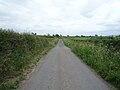
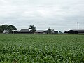
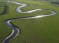
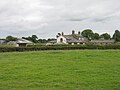
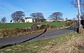
English: Aikton is a small village in the north of the English county of Cumbria. There is a pub, phonebox and postbox; but no shops. The local church, St Andrew's, is over 900 years old, and is one of the oldest in the region. Many houses there have views of the Lake District. The surrounding area is almost entirely farmland, containing cows usually. The nearest town is Wigton, and the nearest city is Carlisle.
localité britannique du comté anglais de Cumbria  | |||||
| Téléverser des médias | |||||
| Nature de l’élément | |||||
|---|---|---|---|---|---|
| Lieu | Allerdale, Cumbria, Angleterre du Nord-Ouest, Angleterre | ||||
| Population |
| ||||
| site officiel | |||||
 | |||||
Sous-catégories
Cette catégorie comprend 4 sous-catégories, dont les 4 ci-dessous.
Média dans la catégorie « Aikton »
Cette catégorie comprend 161 fichiers, dont les 161 ci-dessous.
-
 Aikton - geograph.org.uk - 4361936.jpg 800 × 533 ; 329 kio
-
 Aikton - geograph.org.uk - 4361943.jpg 800 × 533 ; 363 kio
-
 Aikton Arms, Aikton, Cumbria - August 2017 (1) - geograph.org.uk - 5501734.jpg 1 250 × 672 ; 894 kio
-
 Aikton Arms, Aikton, Cumbria - August 2017 (2) - geograph.org.uk - 5501738.jpg 1 250 × 662 ; 791 kio
-
 Aikton Arms, Aikton, Cumbria - August 2017 (3) - geograph.org.uk - 5501741.jpg 1 074 × 1 250 ; 1,11 Mio
-
 Aikton Church ^ Graveyard - geograph.org.uk - 4004184.jpg 3 296 × 2 472 ; 3,43 Mio
-
 Aikton village - geograph.org.uk - 6205039.jpg 2 592 × 1 944 ; 1,46 Mio
-
 Aikton War Memorial - August 2017 - geograph.org.uk - 5501759.jpg 551 × 1 250 ; 940 kio
-
 Alpaca at Croft Farm - geograph.org.uk - 5021351.jpg 3 264 × 2 448 ; 4,13 Mio
-
 B5307 at Howwath Bridge - geograph.org.uk - 4406470.jpg 640 × 481 ; 44 kio
-
 B5307 lane junction - geograph.org.uk - 4406480.jpg 640 × 481 ; 48 kio
-
 B5307 towards Fingland - geograph.org.uk - 4976275.jpg 640 × 480 ; 117 kio
-
 B5307, Whitrigglees - geograph.org.uk - 4976034.jpg 640 × 480 ; 63 kio
-
 Barn near Wiggonby - geograph.org.uk - 5001613.jpg 640 × 493 ; 52 kio
-
 Barns at the Laythes Farm - geograph.org.uk - 5345614.jpg 640 × 480 ; 228 kio
-
 Benchmark at 136.7ft on barn at Hardcake Hall - geograph.org.uk - 4004201.jpg 2 472 × 3 296 ; 3,26 Mio
-
 Bend in the road towards Wiggonby - geograph.org.uk - 5001614.jpg 640 × 480 ; 45 kio
-
 Brunt Hill Farm - geograph.org.uk - 1143468.jpg 640 × 480 ; 56 kio
-
 Bungalow, Ashleigh Farm - geograph.org.uk - 5001616.jpg 640 × 480 ; 59 kio
-
 Bungalow, Drumleaning - geograph.org.uk - 5002423.jpg 640 × 480 ; 75 kio
-
 Cattle grazing near Park House Farm - geograph.org.uk - 5001641.jpg 640 × 480 ; 61 kio
-
 Close up, Elizabeth II postbox, Biglands - geograph.org.uk - 5002825.jpg 1 343 × 2 837 ; 750 kio
-
 Close up, Elizabeth II postbox, Whitrigglees - geograph.org.uk - 4976025.jpg 1 478 × 2 477 ; 715 kio
-
 Close up, Elizabeth II postbox, Wiggonby - geograph.org.uk - 5002744.jpg 1 066 × 2 000 ; 527 kio
-

-
 Croft Farm, Thornby - geograph.org.uk - 5021569.jpg 2 448 × 3 264 ; 3,6 Mio
-
 Crop field north of Aikton - geograph.org.uk - 5001673.jpg 640 × 480 ; 77 kio
-
 Crop field north of Wiggonby - geograph.org.uk - 5001630.jpg 640 × 480 ; 62 kio
-
 Crossroads to Bigland - geograph.org.uk - 4216654.jpg 640 × 480 ; 80 kio
-
 Cut grass and hedgerow - geograph.org.uk - 5002359.jpg 640 × 480 ; 79 kio
-
 Disused railway track - geograph.org.uk - 3492992.jpg 2 592 × 1 944 ; 1,63 Mio
-
 Elizabeth II postbox and phonebox, Wiggonby - geograph.org.uk - 5002742.jpg 640 × 491 ; 98 kio
-
 Elizabeth II postbox, Biglands - geograph.org.uk - 5002819.jpg 640 × 480 ; 64 kio
-
 Elizabeth II postbox, Gamelsby - geograph.org.uk - 5002788.jpg 1 368 × 2 423 ; 793 kio
-
 Elizabeth II postbox, Whitrigglees - geograph.org.uk - 4976022.jpg 640 × 480 ; 92 kio
-
 Entering Biglands - geograph.org.uk - 5002339.jpg 640 × 480 ; 70 kio
-
 Farm buildings, Ashleigh Farm - geograph.org.uk - 5001617.jpg 640 × 480 ; 46 kio
-
 Farm buildings, Drumleaning - geograph.org.uk - 5002429.jpg 640 × 480 ; 58 kio
-
 Farm buildings, former Great Orton Airfield - geograph.org.uk - 5001610.jpg 640 × 480 ; 60 kio
-
 Farm track near Quarry Gill - geograph.org.uk - 5001657.jpg 640 × 480 ; 62 kio
-
 Farmhouse at Hardcakes Hall - geograph.org.uk - 4004192.jpg 3 296 × 2 472 ; 3,44 Mio
-
 Farmland east of Aikton - geograph.org.uk - 6205020.jpg 2 592 × 1 944 ; 1,64 Mio
-
 Farmland near Biglands - geograph.org.uk - 5002342.jpg 640 × 480 ; 65 kio
-
 Farmland near Biglands Bog Nature Reserve - geograph.org.uk - 5002335.jpg 640 × 480 ; 69 kio
-
 Farmland near Roblaw Hall - geograph.org.uk - 5001637.jpg 640 × 480 ; 63 kio
-
 Farmland south of Aikton - geograph.org.uk - 6205091.jpg 2 592 × 1 944 ; 1,68 Mio
-
 Field edge, Aikton - geograph.org.uk - 4347923.jpg 800 × 533 ; 436 kio
-
 Field entrance (footpath), Wiggonby - geograph.org.uk - 5001626.jpg 640 × 480 ; 89 kio
-
 Field entrance near Biglands - geograph.org.uk - 5002327.jpg 640 × 480 ; 80 kio
-
 Field entrance, Aikton - geograph.org.uk - 5001662.jpg 640 × 480 ; 116 kio
-
 Field near Wiggonby - geograph.org.uk - 4347898.jpg 800 × 533 ; 309 kio
-
 Fields east of Gamelsby - geograph.org.uk - 3493017.jpg 2 592 × 1 944 ; 1,61 Mio
-
 Fields near Whitrigglees - geograph.org.uk - 3492996.jpg 2 592 × 1 944 ; 2,06 Mio
-
 Footpath goes either way. - geograph.org.uk - 119892.jpg 640 × 480 ; 72 kio
-
 Former control tower for Great Orton Airfield - geograph.org.uk - 5344515.jpg 1 024 × 682 ; 168 kio
-
 Former railway east of Kirkbride - geograph.org.uk - 4197813.jpg 1 280 × 851 ; 339 kio
-
 Former railway line at Whitrigglees - geograph.org.uk - 5345629.jpg 640 × 480 ; 239 kio
-
 Gated farm track south of Biglands - geograph.org.uk - 5002347.jpg 640 × 480 ; 70 kio
-
 Grassland near Quarry Gill - geograph.org.uk - 5001659.jpg 640 × 480 ; 61 kio
-
 Grazing and hedgerow - geograph.org.uk - 5002414.jpg 640 × 480 ; 86 kio
-
 Grazing and hedgerow west of Aikton - geograph.org.uk - 5001694.jpg 640 × 480 ; 65 kio
-
 Grazing near Drumleaning - geograph.org.uk - 5002420.jpg 640 × 480 ; 71 kio
-
 Grazing near Firtree House - geograph.org.uk - 4976277.jpg 640 × 480 ; 75 kio
-
 Grazing near New Bampton Farm - geograph.org.uk - 5001702.jpg 640 × 480 ; 77 kio
-
 Grazing near the River Wampool - geograph.org.uk - 4976268.jpg 640 × 480 ; 63 kio
-
 Grazing south of Wiggonby - geograph.org.uk - 5001629.jpg 640 × 480 ; 51 kio
-
 Grazing, Whitrigglees - geograph.org.uk - 4976271.jpg 640 × 480 ; 69 kio
-
 Great Orton Wind Farm - geograph.org.uk - 1143487.jpg 640 × 480 ; 46 kio
-
 Great Orton Wind Farm - geograph.org.uk - 206148.jpg 640 × 480 ; 73 kio
-
 Great Orton Windfarm and Watchtree Nature Reserve - geograph.org.uk - 5344468.jpg 1 024 × 682 ; 219 kio
-
 Great Orton Windfarm and Watchtree Nature Reserve - geograph.org.uk - 5344472.jpg 1 024 × 682 ; 155 kio
-
 Grove Farm - geograph.org.uk - 4976272.jpg 640 × 480 ; 61 kio
-
 Heading east from Gamelsby - geograph.org.uk - 5002406.jpg 640 × 480 ; 54 kio
-
 Heading north near Lanshaw House - geograph.org.uk - 5001677.jpg 640 × 480 ; 50 kio
-
 Heading north towards Oughterby - geograph.org.uk - 5001648.jpg 640 × 480 ; 44 kio
-
 Heading north west from Wiggonby - geograph.org.uk - 5001635.jpg 640 × 480 ; 45 kio
-
 Heading north west into Wiggonby - geograph.org.uk - 5001623.jpg 640 × 480 ; 43 kio
-
 Hedgerow near Whitrigglees - geograph.org.uk - 5345620.jpg 640 × 480 ; 334 kio
-
 Hedgerow oak - geograph.org.uk - 4347911.jpg 800 × 533 ; 340 kio
-
 Holly House, Wiggonby - geograph.org.uk - 5001620.jpg 640 × 480 ; 67 kio
-
 Interior of Victorian privy - geograph.org.uk - 5021561.jpg 2 448 × 3 264 ; 4,8 Mio
-
 Lake at Watchtree Nature Reserve - geograph.org.uk - 3320702.jpg 640 × 480 ; 299 kio
-
 Line of the former Carlisle to Silloth railway - geograph.org.uk - 5345635.jpg 640 × 480 ; 341 kio
-
 Lintel of Croft Farm house - geograph.org.uk - 5021579.jpg 3 264 × 2 448 ; 5,04 Mio
-
 Manor House Farm - geograph.org.uk - 5002355.jpg 640 × 480 ; 51 kio
-
 Minor road at Lomglands Moor - geograph.org.uk - 3493005.jpg 2 592 × 1 944 ; 1,71 Mio
-
 Minor road at The Laythes - geograph.org.uk - 3493000.jpg 2 592 × 1 944 ; 1,53 Mio
-
 Minor road heading north from Wiggonby - geograph.org.uk - 5001631.jpg 640 × 480 ; 64 kio
-
 Minor road heading west towards Roblaw Hall - geograph.org.uk - 5001639.jpg 640 × 480 ; 54 kio
-
 Minor road into Aikton - geograph.org.uk - 5001666.jpg 640 × 480 ; 74 kio
-
 Minor road towards Aikton - geograph.org.uk - 5001661.jpg 640 × 480 ; 58 kio
-
 Minor road towards Aikton - geograph.org.uk - 5001695.jpg 640 × 480 ; 60 kio
-
 Minor road towards Biglands - geograph.org.uk - 5002330.jpg 640 × 480 ; 69 kio
-
 Minor road towards Gamelsby - geograph.org.uk - 5002351.jpg 640 × 480 ; 50 kio
-
 Minor road towards Oughterby - geograph.org.uk - 5001644.jpg 640 × 480 ; 51 kio
-
 Minor road towards Wampool - geograph.org.uk - 4976281.jpg 640 × 480 ; 75 kio
-
 Minor road towards Wampool - geograph.org.uk - 5002321.jpg 640 × 480 ; 62 kio
-
 Minor road towards Wiggonby - geograph.org.uk - 5001611.jpg 640 × 480 ; 59 kio
-
 Minor road, Drumleaning - geograph.org.uk - 5002427.jpg 640 × 480 ; 74 kio
-
 Moordyke - geograph.org.uk - 5001674.jpg 640 × 480 ; 68 kio
-
 New-mown hay field east of Gamelsby - geograph.org.uk - 5002366.jpg 640 × 480 ; 69 kio
-
 Ordnance Survey Cut Mark - geograph.org.uk - 4233595.jpg 4 000 × 3 000 ; 4,29 Mio
-
 Overgrown farm track north of Wiggonby - geograph.org.uk - 5001634.jpg 640 × 480 ; 98 kio
-
 Pasture and hedges - geograph.org.uk - 4347918.jpg 800 × 533 ; 297 kio
-
 Pasture House - geograph.org.uk - 5001645.jpg 640 × 472 ; 57 kio
-

-
 Pond in Pond Wood, Watchtree Nature Reserve - geograph.org.uk - 3320696.jpg 640 × 480 ; 377 kio
-
 Red barn and windfarm - geograph.org.uk - 1861693.jpg 640 × 482 ; 303 kio
-
 River Wampool at the Laythes - geograph.org.uk - 5345611.jpg 640 × 480 ; 245 kio
-
 River Wampool on a winter afternoon - geograph.org.uk - 2228946.jpg 640 × 483 ; 280 kio
-
 River Wampool, downstream from Howwath Bridge - geograph.org.uk - 2228938.jpg 640 × 482 ; 267 kio
-
 RiverWampool(SimonLedingham)Sep2004.jpg 640 × 468 ; 116 kio
-
 Road heading west from Wiggonby - geograph.org.uk - 5001627.jpg 640 × 480 ; 62 kio
-
 Road junction at Hardcake Hall - geograph.org.uk - 4189214.jpg 4 000 × 3 000 ; 2,81 Mio
-
 Road to Quarry Gill - geograph.org.uk - 5001660.jpg 640 × 480 ; 77 kio
-
 Road to Wiggonrigg - geograph.org.uk - 4347857.jpg 800 × 533 ; 338 kio
-
 Sheep and pasture - geograph.org.uk - 4347915.jpg 800 × 533 ; 288 kio
-
 Sheep by Howwath Bridge - geograph.org.uk - 2226310.jpg 640 × 480 ; 302 kio
-
 Sheep, Aikton - geograph.org.uk - 4347932.jpg 800 × 533 ; 419 kio
-
 Sign for the Aikton Arms public house - geograph.org.uk - 5001671.jpg 576 × 640 ; 141 kio
-
 Signpost, Aikton - geograph.org.uk - 4347927.jpg 800 × 1 201 ; 829 kio
-
 St Andrew's church and graveyard, Aikton - geograph.org.uk - 6205034.jpg 2 592 × 1 944 ; 1,81 Mio
-
 St Andrew's church, Aikton - geograph.org.uk - 6205033.jpg 2 592 × 1 944 ; 1,84 Mio
-
 Stone Barn. - geograph.org.uk - 119881.jpg 640 × 419 ; 67 kio
-
 Stone farm building, Gamelsby - geograph.org.uk - 5002790.jpg 3 648 × 2 736 ; 1,94 Mio
-
 Stoneleigh at Thornby - geograph.org.uk - 5021360.jpg 3 264 × 2 448 ; 3,95 Mio
-
 The Aikton Arms public house - geograph.org.uk - 5001668.jpg 640 × 480 ; 69 kio
-
 The lane from Park House to Moordyke - geograph.org.uk - 6205008.jpg 2 592 × 1 944 ; 1,42 Mio
-
 The lane to Wiggonby - geograph.org.uk - 6205016.jpg 2 592 × 1 944 ; 1,42 Mio
-
 The Rectory. - geograph.org.uk - 119913.jpg 640 × 424 ; 57 kio
-
 The River Wampool - geograph.org.uk - 4976264.jpg 640 × 480 ; 67 kio
-
 Track joining the fields. - geograph.org.uk - 119918.jpg 640 × 469 ; 76 kio
-
 Tranquil scene, former RAF Great Orton Airfield - geograph.org.uk - 5024126.jpg 640 × 427 ; 309 kio
-
 Ventilation shafts on Watchtree Nature Reserve - geograph.org.uk - 5344507.jpg 1 024 × 682 ; 273 kio
-
 Victorian privy - geograph.org.uk - 5021372.jpg 3 264 × 2 448 ; 5,03 Mio
-

-
 View over the lake at Watchtree Nature Reserve - geograph.org.uk - 5344477.jpg 1 024 × 682 ; 268 kio
-
 View over the lake at Watchtree Nature Reserve - geograph.org.uk - 5344483.jpg 1 024 × 682 ; 243 kio
-
 Visitor centre at Watchtree Nature Reserve - geograph.org.uk - 5344520.jpg 1 024 × 682 ; 110 kio
-
 Wampool Farm - geograph.org.uk - 3493004.jpg 2 592 × 1 944 ; 1,81 Mio
-
 Wetland in the woods at Watchtree Nature Reserve - geograph.org.uk - 5344501.jpg 1 024 × 682 ; 226 kio
-
 Wiggonby House Farm - geograph.org.uk - 5001621.jpg 640 × 480 ; 57 kio
-
 Wiggonby to Down Hall road - geograph.org.uk - 4347905.jpg 800 × 533 ; 324 kio
-
 Wind turbines, Great Orton - geograph.org.uk - 4347269.jpg 640 × 426 ; 21 kio
-
 Winter cereals, Wiggonby - geograph.org.uk - 4347890.jpg 800 × 533 ; 333 kio
-

-
 Aikton Arms. - geograph.org.uk - 119908.jpg 640 × 346 ; 43 kio
-
 Aikton. - geograph.org.uk - 119890.jpg 640 × 396 ; 43 kio
-
 Biglands. - geograph.org.uk - 119898.jpg 640 × 344 ; 34 kio
-
 Cat in the sunshine. - geograph.org.uk - 119878.jpg 640 × 420 ; 48 kio
-
 Dividing Ditch. - geograph.org.uk - 119916.jpg 640 × 416 ; 54 kio
-
 Drumleaning. - geograph.org.uk - 119884.jpg 640 × 408 ; 55 kio
-
 Fenced Footpath. - geograph.org.uk - 119896.jpg 640 × 480 ; 94 kio
-
 Field near Oughterby - geograph.org.uk - 206133.jpg 640 × 480 ; 88 kio
-
 Field near Oughterby - geograph.org.uk - 206140.jpg 640 × 480 ; 106 kio
-
 Field Stile. - geograph.org.uk - 119893.jpg 640 × 408 ; 61 kio
-
 Field with a contour. - geograph.org.uk - 119886.jpg 640 × 402 ; 59 kio
-
 Hedge gate stile. - geograph.org.uk - 119887.jpg 640 × 383 ; 45 kio
-
 Moordyke Farm. - geograph.org.uk - 119906.jpg 640 × 393 ; 76 kio
-
 Muddy footpath and Beware of the Bull. - geograph.org.uk - 119895.jpg 640 × 391 ; 87 kio
-
 Roblaw Farm. - geograph.org.uk - 119910.jpg 640 × 485 ; 76 kio


_-_geograph.org.uk_-_5501734.jpg)
_-_geograph.org.uk_-_5501738.jpg)
_-_geograph.org.uk_-_5501741.jpg)


,_Wiggonby_-_geograph.org.uk_-_5001626.jpg)


Sep2004.jpg)


,_Great_Orton_Airfield_-_geograph.org.uk_-_5024125.jpg)


