Category:Ailsworth
Aller à la navigation
Aller à la recherche
English: Ailsworth (formerly Ægeleswurth) is a village in the English county of Cambridgeshire. It is known as Eglesworde in the Domesday Book.
localité britannique du comté anglais de Cambridgeshire  | |||||
| Téléverser des médias | |||||
| Nature de l’élément | |||||
|---|---|---|---|---|---|
| Lieu | City of Peterborough, Cambridgeshire, Angleterre de l'Est, Angleterre | ||||
| Population |
| ||||
| site officiel | |||||
 | |||||
Média dans la catégorie « Ailsworth »
Cette catégorie comprend 148 fichiers, dont les 148 ci-dessous.
-
 A47 - Helpston Road overbridge - geograph.org.uk - 3586168.jpg 640 × 480 ; 74 kio
-
 A47 approaching Helpston Road Bridge - geograph.org.uk - 4700757.jpg 593 × 640 ; 94 kio
-
 A47 curving near Ailsworth - geograph.org.uk - 3586164.jpg 640 × 480 ; 70 kio
-
 A47 curving north of Ailsworth - geograph.org.uk - 3586170.jpg 640 × 480 ; 62 kio
-
 A47 from Peterborough - geograph.org.uk - 2647895.jpg 640 × 414 ; 61 kio
-
 A47 lay-by - geograph.org.uk - 5966454.jpg 640 × 396 ; 45 kio
-
 A47 towards Leicester - geograph.org.uk - 2647896.jpg 640 × 434 ; 66 kio
-
 A47 westbound - geograph.org.uk - 5966449.jpg 640 × 480 ; 63 kio
-
 A47, westbound - geograph.org.uk - 4700759.jpg 640 × 426 ; 46 kio
-
 Ailsworth Cambridgeshire post box PE5 7EA.jpg 3 271 × 3 451 ; 1,71 Mio
-
 Ailsworth image.jpg 4 032 × 3 024 ; 5,64 Mio
-
 Ailsworth Methodist Chapel - geograph.org.uk - 6515605.jpg 3 776 × 2 520 ; 4 Mio
-
 Ailsworth street scene - geograph.org.uk - 2308183.jpg 640 × 480 ; 65 kio
-
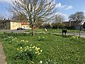
 Ailsworth Village Green - geograph.org.uk - 162305.jpg 640 × 480 ; 90 kio
-
 Ailsworth village green - geograph.org.uk - 2308194.jpg 640 × 480 ; 70 kio
-
 Ailsworth Village Sign - geograph.org.uk - 6708107.jpg 600 × 900 ; 970 kio
-
 Andrew Close, Ailsworth - geograph.org.uk - 6145614.jpg 1 892 × 1 236 ; 1,56 Mio
-

-
 Baled hay along field edge - geograph.org.uk - 2304349.jpg 1 280 × 960 ; 617 kio
-
 Basket weaver on Station Road, Ailsworth - geograph.org.uk - 3880912.jpg 4 320 × 3 240 ; 5,46 Mio
-
 Bench mark on the former pub in Ailsworth - geograph.org.uk - 2308172.jpg 640 × 480 ; 143 kio
-
 Bridge over River Nene - geograph.org.uk - 3478702.jpg 2 000 × 1 500 ; 539 kio
-
 Bridleway from Milton Park approaching Helpston Road - geograph.org.uk - 6515601.jpg 3 776 × 2 520 ; 4,28 Mio
-
 Bridleway heading west towards Upton - geograph.org.uk - 3020500.jpg 640 × 480 ; 78 kio
-
 Bridleway to Castor Hanglands - geograph.org.uk - 3876123.jpg 4 320 × 3 240 ; 5,65 Mio
-
 Bridleways in all directions - geograph.org.uk - 3876101.jpg 4 320 × 3 240 ; 5,4 Mio
-
 Buttercups, daisies and hawthorn blossom - geograph.org.uk - 3972191.jpg 4 320 × 3 240 ; 5,85 Mio
-
 Byway - geograph.org.uk - 2471189.jpg 640 × 480 ; 93 kio
-
 Castor Hanglands National Nature Reserve - geograph.org.uk - 6570120.jpg 3 776 × 2 520 ; 3,17 Mio
-
 Castor Hanglands nature reserve - geograph.org.uk - 2471239.jpg 640 × 480 ; 69 kio
-
 Castor Hanglands, from the road north of Castor - geograph.org.uk - 6515598.jpg 3 776 × 2 520 ; 2,99 Mio
-
 Castor railway station (site), Cambridgeshire - geograph.org.uk - 4833043.jpg 1 600 × 1 200 ; 338 kio
-
 Colourful caravans on Station Road, Ailsworth - geograph.org.uk - 3880931.jpg 4 320 × 3 240 ; 5,76 Mio
-
 Cottages in Ailsworth - geograph.org.uk - 2318579.jpg 1 280 × 960 ; 596 kio
-
 Countryside scene on Helpston Road - geograph.org.uk - 2307280.jpg 1 280 × 960 ; 637 kio
-
 Crop field north of Ailsworth - geograph.org.uk - 3020492.jpg 640 × 480 ; 98 kio
-
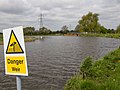 Danger Weir - geograph.org.uk - 3459715.jpg 2 000 × 1 500 ; 548 kio
-
 Entering Castor Hanglands - geograph.org.uk - 6570085.jpg 3 776 × 2 520 ; 4,28 Mio
-
 Ermine Street - geograph.org.uk - 1923029.jpg 640 × 427 ; 83 kio
-
 Ermine Street - geograph.org.uk - 2446247.jpg 4 000 × 3 000 ; 4,33 Mio
-
 Ermine Street at Sutton Cross - geograph.org.uk - 2446250.jpg 4 000 × 3 000 ; 4,21 Mio
-
 Ermine Street at Sutton Cross - geograph.org.uk - 3879205.jpg 4 320 × 3 240 ; 5,95 Mio
-
 Farm track (bridleway) near Ailsworth - geograph.org.uk - 3020487.jpg 640 × 480 ; 104 kio
-
 Farmland near Ailsworth - geograph.org.uk - 3020447.jpg 640 × 480 ; 82 kio
-
 Farmland near Ailsworth - geograph.org.uk - 3020459.jpg 640 × 480 ; 69 kio
-
 Farmland towards Moore Wood - geograph.org.uk - 3020499.jpg 640 × 480 ; 98 kio
-
 Field by Helpston Road - geograph.org.uk - 6135593.jpg 1 920 × 1 280 ; 921 kio
-
 Fields near Ailsworth Heath - geograph.org.uk - 2317739.jpg 1 280 × 960 ; 624 kio
-
 Flooded bridleway near Upton - geograph.org.uk - 3876075.jpg 4 320 × 3 240 ; 5,85 Mio
-
 Footpath east of Helpston Road - geograph.org.uk - 2307268.jpg 1 280 × 960 ; 639 kio
-
 Footpath near Ailsworth - geograph.org.uk - 2471183.jpg 640 × 480 ; 50 kio
-
 Footpath to Ailsworth at Water Newton - 2 - geograph.org.uk - 3385891.jpg 1 280 × 960 ; 185 kio
-
 Footpath to Castor Hanglands and Ailsworth Heath - geograph.org.uk - 3968811.jpg 4 320 × 3 240 ; 5,37 Mio
-
 Footpath to Upton - geograph.org.uk - 2307234.jpg 1 280 × 960 ; 655 kio
-
 Footpath to Water Newton - geograph.org.uk - 3478518.jpg 2 000 × 1 500 ; 510 kio
-
 Former public house in Peterborough Road, Ailsworth - geograph.org.uk - 2446335.jpg 4 000 × 3 000 ; 3,95 Mio
-
 Gated track to Bushy Wood near Castor Hanglands - geograph.org.uk - 3875809.jpg 4 320 × 3 240 ; 5,61 Mio
-
 Gnarled oaks along Helpston Road - geograph.org.uk - 2304334.jpg 1 280 × 960 ; 649 kio
-
 Helpston Road - geograph.org.uk - 2471222.jpg 640 × 480 ; 68 kio
-
 Helpston Road - geograph.org.uk - 6708269.jpg 1 200 × 800 ; 1,09 Mio
-
 Helpston Road crossing the A47 - geograph.org.uk - 6141590.jpg 1 892 × 1 236 ; 1,57 Mio
-

-
 Helpston Road near Ailsworth - geograph.org.uk - 2304326.jpg 1 280 × 960 ; 648 kio
-
 Helpston Road near Ailsworth - geograph.org.uk - 2307214.jpg 1 280 × 960 ; 654 kio
-
 Helpston Road near Castor Hanglands - geograph.org.uk - 2304330.jpg 1 280 × 960 ; 628 kio
-
 Helpston Road near Castor Hanglands - geograph.org.uk - 2307263.jpg 1 280 × 960 ; 624 kio
-
 Helpston Road north of Ailsworth - geograph.org.uk - 6135594.jpg 1 920 × 1 280 ; 989 kio
-
 Helpston Road north of Ailsworth - geograph.org.uk - 6159010.jpg 1 920 × 1 280 ; 1,73 Mio
-
 Helpston Road, Ailsworth - geograph.org.uk - 3876142.jpg 4 320 × 3 240 ; 5,34 Mio
-
 Helpston Road, Ailsworth, late June 2016 - geograph.org.uk - 5012901.jpg 640 × 480 ; 93 kio
-
 Helpston this way - geograph.org.uk - 2308202.jpg 640 × 480 ; 97 kio
-
 Hereward Way - geograph.org.uk - 3478485.jpg 1 500 × 2 000 ; 583 kio
-
 Horse-drawn caravans on Station Road, Ailsworth - geograph.org.uk - 3880925.jpg 4 320 × 3 240 ; 5,4 Mio
-
 House on Main Street, Ailsworth - geograph.org.uk - 6141583.jpg 1 920 × 1 280 ; 1,26 Mio
-
 Information about Sutton Cross - geograph.org.uk - 2446256.jpg 4 000 × 3 000 ; 4,28 Mio
-
 Information plaque about Langley Bush - geograph.org.uk - 2306562.jpg 1 280 × 960 ; 653 kio
-
 King's Acre, Ailsworth, late June 2016 - geograph.org.uk - 5012914.jpg 640 × 480 ; 67 kio
-
 Langley Bush - geograph.org.uk - 2306561.jpg 1 280 × 960 ; 642 kio
-
 Layby on the A47, Ailsworth - geograph.org.uk - 6118881.jpg 1 920 × 1 280 ; 960 kio
-
 Layby on the A47, Ailsworth - geograph.org.uk - 6118897.jpg 1 920 × 1 280 ; 875 kio
-
 Lone tree and Bushy Wood near Castor Hanglands - geograph.org.uk - 3875815.jpg 4 320 × 3 240 ; 5,48 Mio
-
 Looking south east along Ermine Street - geograph.org.uk - 1923043.jpg 640 × 427 ; 107 kio
-
 Lucky horse shoes for sale on Station Road, Ailsworth - geograph.org.uk - 3880936.jpg 4 320 × 3 240 ; 5,63 Mio
-
 Maffit road, Ailsworth - geograph.org.uk - 2308201.jpg 640 × 480 ; 68 kio
-
 Main Street at the junction of Helpston Road, Ailsworth - geograph.org.uk - 6134406.jpg 1 886 × 1 228 ; 1,34 Mio
-
 Main Street, Ailsworth - geograph.org.uk - 2304321.jpg 1 280 × 960 ; 631 kio
-
 Main Street, Ailsworth - geograph.org.uk - 3020485.jpg 640 × 480 ; 86 kio
-
 Main Street, Ailsworth - geograph.org.uk - 6141586.jpg 1 920 × 1 280 ; 1,85 Mio
-
 Minor road heading north towards Helpston - geograph.org.uk - 3020490.jpg 640 × 480 ; 89 kio
-
 Minor road heading north towards Helpston - geograph.org.uk - 3020495.jpg 640 × 480 ; 61 kio
-
 Minor road heading north towards Helpston - geograph.org.uk - 3020507.jpg 640 × 480 ; 87 kio
-
 Narrow boat on the River Nene - geograph.org.uk - 3478548.jpg 2 000 × 1 500 ; 525 kio
-
 Nene Valley Railway heading to Peterborough - geograph.org.uk - 3880775.jpg 4 320 × 3 240 ; 5,96 Mio
-
 Nene Valley Railway heading to Wansford - geograph.org.uk - 3880770.jpg 4 320 × 3 240 ; 5,86 Mio
-
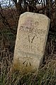
 Old Milestone - geograph.org.uk - 3252452.jpg 1 024 × 768 ; 259 kio
-
 Old Milestone - geograph.org.uk - 3252454.jpg 768 × 1 024 ; 369 kio
-
 Old Milestone by the former A47, west of Ailsworth (geograph 5622648).jpg 295 × 448 ; 99 kio
-
 Ordnance Survey Flush Bracket 1035 - geograph.org.uk - 4109850.jpg 4 000 × 3 000 ; 3,75 Mio
-
 Path to Moore Wood - geograph.org.uk - 2471247.jpg 640 × 480 ; 67 kio
-
 Peterborough Road, Ailsworth - geograph.org.uk - 2446331.jpg 4 000 × 3 000 ; 3,88 Mio
-
 Phone box and pillar box in Ailsworth, Peterborough - geograph.org.uk - 3876170.jpg 4 320 × 3 240 ; 6,05 Mio
-
 Public bridleway to Upton - geograph.org.uk - 3875834.jpg 4 320 × 3 240 ; 5,5 Mio
-
 Public footpath near Ailsworth - geograph.org.uk - 3876703.jpg 4 320 × 3 240 ; 5,56 Mio
-
 Pylons in a field - geograph.org.uk - 4431014.jpg 2 048 × 1 536 ; 216 kio
-
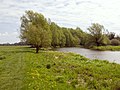
 River Nene - geograph.org.uk - 6708106.jpg 1 200 × 1 789 ; 2,87 Mio
-
 River Nene from footbridge - geograph.org.uk - 3450671.jpg 2 000 × 1 500 ; 535 kio
-
 River Nene looking towards Water Newton - geograph.org.uk - 2490421.jpg 4 000 × 3 000 ; 4,4 Mio
-
 River Nene near Durobrivae (ancient Water Newton) - geograph.org.uk - 6300773.jpg 1 024 × 768 ; 132 kio
-
 River Nene near Water Newton - geograph.org.uk - 6300771.jpg 1 024 × 768 ; 182 kio
-
 Road and path junction near Castor Hanglands - geograph.org.uk - 5012883.jpg 640 × 480 ; 79 kio
-
 Road heading east towards Ailsworth - geograph.org.uk - 3020450.jpg 640 × 480 ; 70 kio
-
 Road into Ailsworth - geograph.org.uk - 3020462.jpg 640 × 480 ; 65 kio
-
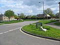
 Road to Castor ^ Ailsworth - geograph.org.uk - 4910147.jpg 800 × 517 ; 115 kio
-
 Saxon meeting place at Sutton Cross - geograph.org.uk - 1923036.jpg 640 × 427 ; 100 kio
-
 Station Road, Ailsworth - geograph.org.uk - 2460895.jpg 640 × 480 ; 95 kio
-
 Station Road, Castor - geograph.org.uk - 3478816.jpg 2 000 × 1 500 ; 581 kio
-
 Street scene in Ailsworth - geograph.org.uk - 2308165.jpg 640 × 480 ; 53 kio
-
 Sutton Cross - geograph.org.uk - 1923010.jpg 640 × 480 ; 134 kio
-
 Sutton Cross - geograph.org.uk - 2446270.jpg 4 000 × 3 000 ; 3,97 Mio
-
 Sutton Cross - geograph.org.uk - 3879231.jpg 4 320 × 3 240 ; 5,68 Mio
-
 Sutton Crossways (track) - geograph.org.uk - 3020444.jpg 640 × 480 ; 88 kio
-
 Sutton Crossways - geograph.org.uk - 2460891.jpg 640 × 480 ; 59 kio
-
 Thatched cottage, Main Street, Ailsworth - geograph.org.uk - 3020466.jpg 640 × 480 ; 103 kio
-
 The A47 bypassing Ailsworth and Castor - geograph.org.uk - 6515603.jpg 3 776 × 2 520 ; 3,96 Mio
-
 The A47 from Helpston Road - geograph.org.uk - 6141593.jpg 1 920 × 1 280 ; 1,48 Mio
-
 The A47, Ailsworth - geograph.org.uk - 6118880.jpg 1 920 × 1 280 ; 897 kio
-
 The A47, Ailsworth - geograph.org.uk - 6134409.jpg 1 920 × 1 280 ; 1,28 Mio
-
 The line of Sutton Crossways - geograph.org.uk - 1923023.jpg 640 × 427 ; 78 kio
-
 The Nene Valley Railway near Castor - geograph.org.uk - 2490398.jpg 4 000 × 3 000 ; 4,02 Mio
-
 The Nene Way near Water Newton - geograph.org.uk - 2490443.jpg 4 000 × 3 000 ; 3,9 Mio
-
 The River Nene near Water Newton - geograph.org.uk - 2490433.jpg 4 000 × 3 000 ; 4,02 Mio
-
 The River Nene near Water Newton - geograph.org.uk - 2490453.jpg 4 000 × 3 000 ; 4 Mio
-
 The River Nene near Water Newton - geograph.org.uk - 2490458.jpg 4 000 × 3 000 ; 4,06 Mio
-
 The road to Helpston, north of Castor - geograph.org.uk - 6515600.jpg 3 776 × 2 520 ; 2,96 Mio
-
 The site of Castor station - geograph.org.uk - 2490375.jpg 4 000 × 3 000 ; 4,12 Mio
-

-

-
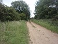
 Track to Castor Hanglands - geograph.org.uk - 2471252.jpg 640 × 480 ; 65 kio
-
 Tractor at work near Castor - geograph.org.uk - 2647897.jpg 640 × 480 ; 71 kio
-
 Travelling Post Office apparatus on the Nene Valley Railway - geograph.org.uk - 4833281.jpg 1 600 × 1 200 ; 384 kio
-
 Tree on Main Street, Ailsworth - geograph.org.uk - 6134401.jpg 1 920 × 1 280 ; 1,84 Mio
-
 Trees by Helpston Road - geograph.org.uk - 6140337.jpg 1 872 × 1 204 ; 1,66 Mio
-
 UK Ailesworth.jpg 701 × 1 813 ; 370 kio
-
 Water meadow at Water Newton - geograph.org.uk - 6300776.jpg 1 024 × 768 ; 113 kio
-
 Water Newton Church - geograph.org.uk - 2061940.jpg 640 × 480 ; 96 kio
-
 Western end of Normangate Field - geograph.org.uk - 3084723.jpg 1 024 × 768 ; 98 kio
-
 Where there's muck there's money - geograph.org.uk - 3876767.jpg 4 320 × 3 240 ; 5,79 Mio
-
 Wild flowers at the edge of a cereal field - geograph.org.uk - 3084715.jpg 1 024 × 768 ; 119 kio


,_Cambridgeshire_-_geograph.org.uk_-_4833043.jpg)


_near_Ailsworth_-_geograph.org.uk_-_3020487.jpg)


.jpg)


_-_geograph.org.uk_-_6300773.jpg)


_-_geograph.org.uk_-_3020444.jpg)


_-_geograph.org.uk_-_6300781.jpg)
_-_geograph.org.uk_-_6300788.jpg)


