Category:Airmyn
Aller à la navigation
Aller à la recherche
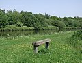
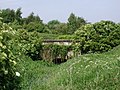
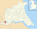
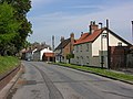
English: Airmyn is a village and civil parish in the East Riding of Yorkshire, England. It is situated at the mouth of the River Aire with the River Ouse, approximately 2 miles (3.2 km) north west of Goole. It lies to the west of the M62 motorway and the A614 road.
village britannique  | |||||
| Téléverser des médias | |||||
| Nature de l’élément | |||||
|---|---|---|---|---|---|
| Lieu | East Riding of Yorkshire, Yorkshire de l'Est, Yorkshire-et-Humber, Angleterre | ||||
| Réputé identique à | Airmyn (page en doublon, paroisse civile) | ||||
 | |||||
Sous-catégories
Cette catégorie comprend 5 sous-catégories, dont les 5 ci-dessous.
A
- St Davids Church, Airmyn (3 F)
B
- Boothferry Bridge, River Ouse (24 F)
C
G
- Guardian Glass, Goole (5 F)
O
- Ouse Bridge (M62) (38 F)
Média dans la catégorie « Airmyn »
Cette catégorie comprend 330 fichiers, dont les 200 ci-dessous.
(page précédente) (page suivante)-
 1 mile to J36, M62 - geograph.org.uk - 5435900.jpg 640 × 426 ; 41 kio
-
 A 614 Rawcliffe Road - geograph.org.uk - 4280197.jpg 800 × 600 ; 93 kio
-
 A pane to work for^ - geograph.org.uk - 1978211.jpg 800 × 600 ; 96 kio
-
 A walk from Goole ^10 - geograph.org.uk - 1991703.jpg 800 × 600 ; 200 kio
-
 A walk from Goole ^11 - geograph.org.uk - 1991710.jpg 800 × 600 ; 244 kio
-
 A walk from Goole ^12 - geograph.org.uk - 1991717.jpg 800 × 600 ; 302 kio
-
 A walk from Goole ^13 - geograph.org.uk - 1991721.jpg 800 × 600 ; 237 kio
-
 A walk from Goole ^14 - geograph.org.uk - 1991728.jpg 800 × 600 ; 251 kio
-
 A walk from Goole ^15 - geograph.org.uk - 1991734.jpg 800 × 600 ; 222 kio
-
 A walk from Goole ^16 - geograph.org.uk - 1991739.jpg 800 × 600 ; 210 kio
-
 A walk from Goole ^17 - geograph.org.uk - 1991745.jpg 800 × 600 ; 227 kio
-
 A walk from Goole ^18 - geograph.org.uk - 1991750.jpg 800 × 600 ; 217 kio
-
 A walk from Goole ^19 - geograph.org.uk - 1991753.jpg 800 × 600 ; 224 kio
-
 A walk from Goole ^20 - geograph.org.uk - 1991802.jpg 800 × 600 ; 198 kio
-
 A walk from Goole ^49 - geograph.org.uk - 1992000.jpg 800 × 600 ; 211 kio
-
 A walk from Goole ^5 - geograph.org.uk - 1991672.jpg 800 × 600 ; 205 kio
-
 A walk from Goole ^50 - geograph.org.uk - 1992007.jpg 800 × 600 ; 246 kio
-
 A walk from Goole ^50 - geograph.org.uk - 1992016.jpg 800 × 600 ; 238 kio
-
 A walk from Goole ^51 - geograph.org.uk - 1992019.jpg 800 × 600 ; 224 kio
-
 A walk from Goole ^52 - geograph.org.uk - 1992022.jpg 800 × 600 ; 288 kio
-
 A walk from Goole ^54 - geograph.org.uk - 1992027.jpg 800 × 600 ; 300 kio
-
 A walk from Goole ^6 - geograph.org.uk - 1991677.jpg 800 × 600 ; 164 kio
-
 A walk from Goole ^7 - geograph.org.uk - 1991683.jpg 800 × 600 ; 183 kio
-
 A walk from Goole ^8 - geograph.org.uk - 1991690.jpg 800 × 600 ; 246 kio
-
 A walk from Goole ^9 - geograph.org.uk - 1991695.jpg 800 × 600 ; 305 kio
-
 A614 at Airmyn Road Roundabout - geograph.org.uk - 5921575.jpg 1 024 × 766 ; 89 kio
-
 A614 at Hook Lane roundabout - geograph.org.uk - 5922688.jpg 1 024 × 746 ; 155 kio
-
 A614 junction, Airmyn - geograph.org.uk - 412876.jpg 640 × 455 ; 92 kio
-
 A614 near Airmyn Grange - geograph.org.uk - 5921574.jpg 1 024 × 730 ; 139 kio
-
 A614 Rawcliffe Road at Goole boundary - geograph.org.uk - 5922668.jpg 1 024 × 776 ; 105 kio
-
 A614 Tanglewood roundabout - geograph.org.uk - 1287197.jpg 640 × 480 ; 42 kio
-
 A645 towards Selby - geograph.org.uk - 2274978.jpg 640 × 480 ; 68 kio
-
 A645 towards Selby - geograph.org.uk - 2275037.jpg 1 600 × 1 200 ; 381 kio
-
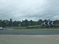
 A645-614 roundabout - geograph.org.uk - 6127335.jpg 1 024 × 683 ; 439 kio
-
 Access Road - geograph.org.uk - 193249.jpg 640 × 480 ; 65 kio
-
 Access road for North Airmyn Grange - geograph.org.uk - 3365959.jpg 1 500 × 971 ; 1,27 Mio
-
 Aire and Calder Navigation approaching Goole - geograph.org.uk - 5147148.jpg 1 600 × 1 200 ; 584 kio
-
 Aire and Calder Navigation dismantled crossing point - geograph.org.uk - 4997495.jpg 3 071 × 2 301 ; 2,18 Mio
-
 Aire and Calder Navigation nearing Goole docks - geograph.org.uk - 4997760.jpg 4 402 × 3 162 ; 4,58 Mio
-
 Aire and Calder Navigation toward Goole - geograph.org.uk - 4997479.jpg 4 608 × 3 456 ; 4,48 Mio
-
 Aire and Calder Navigation under Bridge 24 - geograph.org.uk - 4997767.jpg 4 606 × 3 452 ; 4,94 Mio
-
 Aire and Calder Navigation, Airmyn - geograph.org.uk - 456276.jpg 640 × 491 ; 125 kio
-
 Aire Mouth, the confluence of the Ouse and the Aire - geograph.org.uk - 5131912.jpg 1 024 × 768 ; 122 kio
-
 Aire ^ Calder Navigation, just east of Old Drain - geograph.org.uk - 3919684.jpg 1 024 × 614 ; 57 kio
-
 Aire ^ Calder Navigation, just west of Goole - geograph.org.uk - 3919665.jpg 1 024 × 614 ; 68 kio
-
 Aire ^ Calder Navigation, north of Decoy Farm - geograph.org.uk - 3919886.jpg 1 024 × 768 ; 108 kio
-
 Airmyn A614 nr Goole, Woodside transport café - geograph.org.uk - 78318.jpg 640 × 319 ; 54 kio
-
 Airmyn A614 Roundabout - geograph.org.uk - 1214868.jpg 640 × 480 ; 66 kio
-
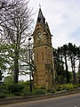
 Airmyn Clock Tower - geograph.org.uk - 1844261.jpg 426 × 640 ; 119 kio
-
 Airmyn clock tower - geograph.org.uk - 4280620.jpg 600 × 800 ; 151 kio
-
 Airmyn Clock Tower Sunset.jpg 680 × 1 024 ; 243 kio
-
 Airmyn Clock Tower.jpg 640 × 480 ; 97 kio
-
 Airmyn Crossings path towards Goole - geograph.org.uk - 6205896.jpg 1 600 × 1 200 ; 678 kio
-
 Airmyn First School - geograph.org.uk - 1844340.jpg 640 × 426 ; 97 kio
-
 Airmyn Garage - geograph.org.uk - 5263641.jpg 1 024 × 768 ; 173 kio
-
 Airmyn Hall - geograph.org.uk - 1844335.jpg 640 × 426 ; 105 kio
-
 Airmyn High Street - geograph.org.uk - 6127352.jpg 1 024 × 683 ; 570 kio
-
 Airmyn Old Drain - geograph.org.uk - 456294.jpg 640 × 478 ; 139 kio
-
 Airmyn Road - geograph.org.uk - 6127339.jpg 1 024 × 683 ; 436 kio
-
 Airmyn south of the Dutch River - geograph.org.uk - 2533187.jpg 1 024 × 768 ; 176 kio
-
 Airmyn UK parish locator map.svg 1 425 × 1 107 ; 1,68 Mio
-
 Airmyn, North End - geograph.org.uk - 412827.jpg 640 × 480 ; 108 kio
-
 Airmyn, South End - geograph.org.uk - 412787.jpg 640 × 480 ; 91 kio
-
 Airmyn, White City on the A614 to Goole - geograph.org.uk - 123054.jpg 640 × 480 ; 93 kio
-
 Along Rawcliffe Road - geograph.org.uk - 6127337.jpg 1 024 × 683 ; 481 kio
-
 Alongside Airmyn New Wood - geograph.org.uk - 5263408.jpg 1 024 × 743 ; 149 kio
-
 An entrance to Oakhill nature reserve, Goole - geograph.org.uk - 6265159.jpg 1 845 × 1 230 ; 681 kio
-
 Approaching Boothferry Bridge from the South - geograph.org.uk - 4891871.jpg 4 547 × 3 318 ; 3,85 Mio
-
 Approaching J36 on M62 eastbound - geograph.org.uk - 5024026.jpg 2 040 × 1 526 ; 838 kio
-
 Arable land east of Airmyn - geograph.org.uk - 2249622.jpg 2 608 × 1 952 ; 1,19 Mio
-
 Bare field south of Percy Lodge - geograph.org.uk - 6265544.jpg 1 916 × 1 277 ; 1,04 Mio
-
 Barns west of Decoy Farm - geograph.org.uk - 3919883.jpg 1 024 × 768 ; 146 kio
-
 Beech Avenue, Airmyn - geograph.org.uk - 2023591.jpg 640 × 385 ; 51 kio
-
 Bend in the River Aire - geograph.org.uk - 5263176.jpg 1 024 × 768 ; 124 kio
-
 Beneath the railway bridge - geograph.org.uk - 2533169.jpg 1 024 × 768 ; 183 kio
-
 Bob Jones on Hook Lane - geograph.org.uk - 2392729.jpg 800 × 600 ; 258 kio
-
 Boothferry Bridge, taking A614 across the River Ouse - geograph.org.uk - 5131906.jpg 1 024 × 768 ; 138 kio
-
 Boothferry Road bridge crossing over M62 eastbound - geograph.org.uk - 5024054.jpg 3 010 × 2 221 ; 1,94 Mio
-
 Bridge ahead closed - geograph.org.uk - 2392734.jpg 800 × 600 ; 263 kio
-
 Bridge over M62 motorway near Goole - geograph.org.uk - 1996260.jpg 640 × 423 ; 44 kio
-
 Bridge Road - geograph.org.uk - 6127359.jpg 1 024 × 683 ; 480 kio
-
 Bridge Road, Airmyn - geograph.org.uk - 2023594.jpg 640 × 480 ; 94 kio
-
 Building at the end of Key Lane - geograph.org.uk - 5263416.jpg 1 024 × 768 ; 196 kio
-
 Bus stop on Rawcliffe Road - geograph.org.uk - 6127338.jpg 1 024 × 683 ; 389 kio
-
 Canalside nature trail, Aire ^ Calder Navigation - geograph.org.uk - 3919630.jpg 1 024 × 768 ; 147 kio
-
 Carolean Airmyn - geograph.org.uk - 1844373.jpg 640 × 426 ; 114 kio
-
 Checking out the flood defences - geograph.org.uk - 5263171.jpg 1 024 × 768 ; 216 kio
-
 Clock Tower - geograph.org.uk - 1049802.jpg 480 × 640 ; 88 kio
-
 Clock Tower Airmyn.jpg 480 × 640 ; 139 kio
-
 Clock tower in Airmyn - geograph.org.uk - 6127355.jpg 683 × 1 024 ; 500 kio
-
 Clock Tower, Airmyn - geograph.org.uk - 3437474.jpg 3 942 × 2 138 ; 1,9 Mio
-
 Confluence of Rivers Aire and Ouse - geograph.org.uk - 4807671.jpg 3 072 × 1 728 ; 1,72 Mio
-
 Confluence of the rivers Aire and Ouse - geograph.org.uk - 1214878.jpg 640 × 480 ; 62 kio
-
 Course of the old railway - geograph.org.uk - 3020227.jpg 1 024 × 768 ; 191 kio
-
 Daffodils by the Boothferry Road - geograph.org.uk - 4891859.jpg 4 483 × 3 225 ; 3,41 Mio
-

-
 Decoy Farm - geograph.org.uk - 343266.jpg 640 × 480 ; 52 kio
-
 Decoy Farm across Dutch River - geograph.org.uk - 6343497.jpg 2 000 × 941 ; 1,29 Mio
-
 Decoy Farm, on the south side of the Dutch River - geograph.org.uk - 3919878.jpg 1 024 × 615 ; 112 kio
-
 Distant Ouse bridge on M62 - geograph.org.uk - 4807919.jpg 3 072 × 1 728 ; 1,47 Mio
-
 Ditch along south side of A614 - geograph.org.uk - 5819922.jpg 1 500 × 1 125 ; 1,55 Mio
-
 Divided house, Airmyn - geograph.org.uk - 5263639.jpg 1 024 × 768 ; 195 kio
-
 Drain on Hook Moor - geograph.org.uk - 1331671.jpg 640 × 480 ; 201 kio
-
 Drainage ditch adjacent to Rawcliffe Road - geograph.org.uk - 4283235.jpg 1 500 × 1 125 ; 1,57 Mio
-
 Drainage ditch beside the A614 - geograph.org.uk - 2274970.jpg 1 600 × 1 200 ; 471 kio
-
 Drained meadowland near Oakhill nature reserve, Goole - geograph.org.uk - 6265187.jpg 1 916 × 1 277 ; 1,26 Mio
-

-
 Dutch River - geograph.org.uk - 343257.jpg 640 × 480 ; 65 kio
-
 Dutch River and Decoy Farm - geograph.org.uk - 456306.jpg 474 × 640 ; 119 kio
-
 Dutch River at Low Tide - geograph.org.uk - 1638118.jpg 640 × 480 ; 57 kio
-
 Dutch River Bridge - geograph.org.uk - 6342258.jpg 2 000 × 1 091 ; 1,8 Mio
-
 Dutch River near Goole - geograph.org.uk - 2426041.jpg 1 600 × 1 081 ; 212 kio
-
 Dutch River Railway Bridge - geograph.org.uk - 397436.jpg 640 × 480 ; 89 kio
-
 Dutch River, Airmyn - geograph.org.uk - 456289.jpg 470 × 640 ; 103 kio
-
 Earthen field with wind turbine - geograph.org.uk - 5564949.jpg 1 500 × 1 125 ; 1,06 Mio
-
 Electricity sub-station near Hook - geograph.org.uk - 775422.jpg 640 × 480 ; 68 kio
-
 Embankment between Dutch River and the Aire and Calder Navigation - geograph.org.uk - 6343403.jpg 2 000 × 1 143 ; 2,14 Mio
-
 Embankment between Dutch River and the Aire and Calder Navigation, 2 - geograph.org.uk - 6343487.jpg 2 000 × 1 155 ; 2,24 Mio
-
 Entering Airmyn - geograph.org.uk - 6127345.jpg 1 024 × 683 ; 463 kio
-
 Farm Track - geograph.org.uk - 1215021.jpg 640 × 480 ; 30 kio
-
 Farm track on Hook Moor - geograph.org.uk - 1323217.jpg 640 × 480 ; 232 kio
-
 Farm track through ploughed fields - geograph.org.uk - 6309076.jpg 640 × 480 ; 80 kio
-
 Farmland near Dutch River - geograph.org.uk - 2426050.jpg 1 600 × 1 200 ; 342 kio
-
 Farmland near North Airmyn Grange - geograph.org.uk - 2274958.jpg 1 600 × 1 200 ; 322 kio
-
 Farmland off Airmyn Road - geograph.org.uk - 6127343.jpg 1 024 × 683 ; 464 kio
-
 Farmland south of Dutch River - geograph.org.uk - 2426059.jpg 1 600 × 1 120 ; 178 kio
-
 Farmland south of North Airmyn Grange - geograph.org.uk - 5737948.jpg 5 067 × 3 630 ; 4,1 Mio
-
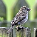 Female House Sparrow with insect (7728662094).jpg 1 632 × 1 635 ; 1,98 Mio
-
 Ferry Lane - geograph.org.uk - 2930492.jpg 1 024 × 768 ; 258 kio
-
 Ferry Lane - geograph.org.uk - 6205890.jpg 1 600 × 1 200 ; 501 kio
-
 Field access - geograph.org.uk - 2930486.jpg 1 024 × 768 ; 142 kio
-
 Field adjacent to A645 - geograph.org.uk - 4283582.jpg 1 500 × 960 ; 1,15 Mio
-
 Field beside A645 - geograph.org.uk - 6127328.jpg 1 024 × 683 ; 494 kio
-
 Field on north side of Hook Lane - geograph.org.uk - 2741700.jpg 1 500 × 835 ; 1 004 kio
-
 Fields beside the A645 - geograph.org.uk - 6127326.jpg 1 024 × 683 ; 491 kio
-
 Fields to Downe's Ground - geograph.org.uk - 1255019.jpg 640 × 480 ; 32 kio
-
 Fields towards the M62 - geograph.org.uk - 1214903.jpg 640 × 480 ; 53 kio
-
 Flood bank, Airmyn - geograph.org.uk - 5263648.jpg 1 024 × 768 ; 164 kio
-
 Flood bank, Airmyn Butts - geograph.org.uk - 5263462.jpg 1 024 × 768 ; 155 kio
-
 Footpath by the River Aire - geograph.org.uk - 1844322.jpg 426 × 640 ; 129 kio
-
 Footpath near Airmyn - geograph.org.uk - 6082489.jpg 1 024 × 768 ; 340 kio
-
 Footpath to Airmyn - geograph.org.uk - 5263413.jpg 1 024 × 768 ; 129 kio
-
 Footpath to Airmyn - geograph.org.uk - 5263470.jpg 1 024 × 686 ; 127 kio
-
 Footpath to Airmyn beside the River Ouse - geograph.org.uk - 2023598.jpg 640 × 480 ; 73 kio
-
 Fringilla coelebs -Airmyn, East Riding of Yorkshire, England -male-8 (1).jpg 3 191 × 2 279 ; 2,48 Mio
-
 Fringilla coelebs -Airmyn, East Riding of Yorkshire, England -male-8.jpg 2 283 × 1 631 ; 1,16 Mio
-
 From one bridge to another - geograph.org.uk - 4280612.jpg 800 × 600 ; 111 kio
-
 Goole Bio Fuel Production Plant.jpg 640 × 480 ; 62 kio
-
 Goole Railway Bridge over the Aire and Calder Navigation - geograph.org.uk - 5147151.jpg 1 600 × 1 200 ; 508 kio
-
 Guardian Glass Factory - geograph.org.uk - 5435909.jpg 640 × 426 ; 26 kio
-
 High Street, Airmyn - geograph.org.uk - 1844344.jpg 640 × 426 ; 98 kio
-
 High Street, Airmyn - geograph.org.uk - 1844350.jpg 640 × 426 ; 79 kio
-
 High Street, Airmyn - geograph.org.uk - 6127346.jpg 1 024 × 683 ; 492 kio
-
 High Street, Airmyn - geograph.org.uk - 6225524.jpg 1 600 × 1 065 ; 562 kio
-
 Hook Lane and M62 Ouse Bridge in distance - geograph.org.uk - 3136737.jpg 4 000 × 3 000 ; 2,33 Mio
-
-
 Houses near Newland - geograph.org.uk - 6214170.jpg 1 600 × 1 065 ; 595 kio
-
 I've got my eye on you, mate - geograph.org.uk - 2533195.jpg 1 024 × 768 ; 141 kio
-
 Instructions at the Guardian Glass level crossing - geograph.org.uk - 6266661.jpg 1 600 × 1 066 ; 634 kio
-
 J36 overbridge, M62 - geograph.org.uk - 5435904.jpg 640 × 406 ; 45 kio
-
 Junction 36 of the M62 heading eastwards - geograph.org.uk - 2095117.jpg 2 608 × 1 952 ; 734 kio
-
 Junction 36 roundabout - geograph.org.uk - 1287194.jpg 640 × 480 ; 36 kio
-
 Kestrel box, south bank, Aire ^ Calder Navigation - geograph.org.uk - 3919875.jpg 1 024 × 768 ; 99 kio
-
 Land on the north side of Oakhill nature reserve - geograph.org.uk - 6265168.jpg 1 600 × 1 066 ; 653 kio
-
 Landdrain - geograph.org.uk - 344253.jpg 640 × 480 ; 116 kio
-
 Level crossing, the Guardian Glass freight line, Goole - geograph.org.uk - 6265205.jpg 1 916 × 1 277 ; 1,17 Mio
-
 Looking along the A645 - geograph.org.uk - 6127330.jpg 1 024 × 683 ; 542 kio
-
 Looking towards Decoy Farm - geograph.org.uk - 2533192.jpg 1 024 × 768 ; 140 kio
-
 M62 East Bound towards the Ouse Bridge - geograph.org.uk - 2112134.jpg 800 × 600 ; 166 kio
-
 M62 eastbound - geograph.org.uk - 1287163.jpg 640 × 399 ; 27 kio
-
 M62 eastbound - geograph.org.uk - 1287165.jpg 640 × 480 ; 28 kio
-
 M62 eastbound - geograph.org.uk - 2271345.jpg 640 × 365 ; 30 kio
-
 M62 eastbound climbing up to the Ouse Bridge - geograph.org.uk - 5024061.jpg 3 722 × 2 724 ; 2,73 Mio
-
 M62 junction 36 eastbound - geograph.org.uk - 2271355.jpg 640 × 385 ; 29 kio
-
 M62 Junction 36 slip road to A614 - geograph.org.uk - 5024041.jpg 2 406 × 1 733 ; 1,11 Mio
-
 M62 motorway towards Manchester - geograph.org.uk - 1996252.jpg 640 × 418 ; 28 kio
-
 M62 motorway, Ouse Bridge - geograph.org.uk - 1996247.jpg 640 × 460 ; 27 kio
-
 M62 Ouse Bridge - geograph.org.uk - 4280606.jpg 800 × 600 ; 66 kio
-
 M62 westbound - geograph.org.uk - 2274949.jpg 1 600 × 1 200 ; 270 kio
-
 M62 westbound from Hook Lane - geograph.org.uk - 3136747.jpg 4 000 × 3 000 ; 2,3 Mio
-
 M62, Ouse Bridge - geograph.org.uk - 5435898.jpg 640 × 426 ; 38 kio
-
 Main Street Airmyn.jpg 640 × 480 ; 93 kio
-
 Mc Donalds Restaurant, J36, M62 Services - geograph.org.uk - 1633207.jpg 640 × 480 ; 71 kio
-
 McDonald's restaurant - geograph.org.uk - 4280836.jpg 800 × 600 ; 104 kio
-
 Minor road towards Airmyn - geograph.org.uk - 2274960.jpg 640 × 480 ; 51 kio
-
 Mors Janua Vitae - geograph.org.uk - 1844268.jpg 640 × 426 ; 143 kio
-
 Motorway Services - geograph.org.uk - 193250.jpg 640 × 480 ; 79 kio
-
 Nature trail bench, south bank, Aire ^ Calder - geograph.org.uk - 3919680.jpg 1 024 × 768 ; 83 kio
-
 Nature trail trees, reflected in the canal - geograph.org.uk - 3919673.jpg 1 024 × 768 ; 116 kio
-
 New power - geograph.org.uk - 1977889.jpg 800 × 600 ; 90 kio
-
 Newland Village - geograph.org.uk - 1198636.jpg 640 × 480 ; 69 kio
-
 North End - geograph.org.uk - 1844363.jpg 640 × 426 ; 119 kio
-
 Oakhill Pond, from the west bank - geograph.org.uk - 6265724.jpg 1 600 × 1 067 ; 407 kio
-
 Oakhill Pond, Oakhill nature reserve - geograph.org.uk - 6265221.jpg 1 067 × 1 600 ; 693 kio
-
 Old Drain, looking north from Oakhill nature reserve, Goole - geograph.org.uk - 6265208.jpg 1 536 × 1 025 ; 768 kio
-
 Old store, St. David's, Airmyn - geograph.org.uk - 5263628.jpg 1 024 × 768 ; 271 kio
-
 Old store, St. David's, Airmyn - geograph.org.uk - 5263854.jpg 1 024 × 768 ; 187 kio
-
 Old winding gear and slipway - geograph.org.uk - 5263457.jpg 1 024 × 768 ; 217 kio
-
 Ouse Bridge (M62) - geograph.org.uk - 412881.jpg 640 × 411 ; 40 kio
-
 Ouse Bridge - geograph.org.uk - 1612731.jpg 640 × 426 ; 50 kio


.jpg)


.jpg)


_-_geograph.org.uk_-_412881.jpg)
