Category:Aiskew and Leeming Bar
Aller à la navigation
Aller à la recherche
English: Aiskew and Leeming Bar is a civil parish in the Hambleton district, in the county of North Yorkshire, England.
Paroisse civile dans le North Yorkshire, Angleterre | |||||
| Téléverser des médias | |||||
| Nature de l’élément | |||||
|---|---|---|---|---|---|
| Lieu | Hambleton, Yorkshire du Nord, Yorkshire-et-Humber, Angleterre | ||||
| Population |
| ||||
| Superficie |
| ||||
 | |||||
Sous-catégories
Cette catégorie comprend 4 sous-catégories, dont les 4 ci-dessous.
A
L
- Leeming Bar Services (12 F)
Média dans la catégorie « Aiskew and Leeming Bar »
Cette catégorie comprend 210 fichiers, dont les 200 ci-dessous.
(page précédente) (page suivante)-
 0-6-0 J72 tank engine, 69023 Joem, at Leeming Bar - geograph.org.uk - 4730380.jpg 2 509 × 1 662 ; 2,84 Mio
-
 A long way from home - geograph.org.uk - 2565847.jpg 480 × 682 ; 144 kio
-
 A1(M) at Leeming Bar - geograph.org.uk - 5825590.jpg 1 024 × 716 ; 81 kio
-

-
 A1(M) near Leases Hall - geograph.org.uk - 5825597.jpg 1 024 × 742 ; 77 kio
-
 A1(M) near Leases Hall - geograph.org.uk - 5874503.jpg 3 756 × 1 590 ; 1,99 Mio
-
 A1(M) near Leeming - geograph.org.uk - 3091235.jpg 640 × 430 ; 26 kio
-
 A1(M) near the Bedale turning - geograph.org.uk - 3089761.jpg 640 × 430 ; 26 kio
-
 A6055 approach to junction 51 - geograph.org.uk - 5084772.jpg 3 107 × 2 331 ; 1,14 Mio
-
 A6055 from farm entrance - geograph.org.uk - 5123538.jpg 1 024 × 683 ; 178 kio
-
 A6055 View - geograph.org.uk - 4137338.jpg 800 × 600 ; 66 kio
-
 A684 Bedale by pass - geograph.org.uk - 5096893.jpg 3 264 × 1 884 ; 1,14 Mio
-
 A684 in Aiskew - geograph.org.uk - 4876266.jpg 1 600 × 1 067 ; 481 kio
-
 A684 towards Northallerton - geograph.org.uk - 5415256.jpg 640 × 480 ; 49 kio
-
 A684 towards Northallerton, Leeming Bar - geograph.org.uk - 5415249.jpg 640 × 480 ; 51 kio
-
 A684 towards the A1(M) - geograph.org.uk - 5415236.jpg 640 × 480 ; 47 kio
-
 A684 towards the A1(M) Motorway - geograph.org.uk - 5415223.jpg 640 × 480 ; 56 kio
-
 A684 towards the A1(M) Motorway - geograph.org.uk - 5415240.jpg 640 × 480 ; 50 kio
-
 A684-Leases Road junction - geograph.org.uk - 5084761.jpg 3 113 × 1 899 ; 1,09 Mio
-
 After the harvest - geograph.org.uk - 2032151.jpg 1 024 × 768 ; 146 kio
-
 Aiskew Crossing, Wensleydale Railway crosses the A684 - geograph.org.uk - 3239038.jpg 1 024 × 683 ; 210 kio
-
 Aiskew Grange Farm Cottage - geograph.org.uk - 3100978.jpg 800 × 600 ; 102 kio
-
 Aiskew Grange, Back Lane - geograph.org.uk - 5123528.jpg 1 024 × 683 ; 219 kio
-
 Allotment gardens - geograph.org.uk - 4017137.jpg 1 280 × 960 ; 645 kio
-
 Approach to junction 51 - geograph.org.uk - 5084767.jpg 3 177 × 1 970 ; 1,02 Mio
-
 Approaching Junction 51 A1(M) Motorway - geograph.org.uk - 5415241.jpg 640 × 413 ; 42 kio
-

-
 Ashgrove, ^89 Bedale Road - geograph.org.uk - 3238933.jpg 683 × 1 024 ; 156 kio
-
 Back Lane at the A6055 - geograph.org.uk - 3100991.jpg 800 × 600 ; 119 kio
-
 Back Lane Near Micklebrack - geograph.org.uk - 3100981.jpg 800 × 600 ; 103 kio
-
 Barley field beside A6055 - geograph.org.uk - 5123545.jpg 1 024 × 683 ; 172 kio
-
 Bedale - old road sign - geograph.org.uk - 5854319.jpg 1 024 × 768 ; 224 kio
-
 Bedale Beck - geograph.org.uk - 5535335.jpg 640 × 427 ; 118 kio
-
 Bedale Beck - geograph.org.uk - 5968204.jpg 3 239 × 4 319 ; 4,34 Mio
-
 Bedale Beck - geograph.org.uk - 5968216.jpg 4 320 × 3 240 ; 2,29 Mio
-
 Bedale Beck at Leeming Lock - geograph.org.uk - 5858094.jpg 4 000 × 3 000 ; 2,9 Mio
-
 Bedale Beck from Leeming Bridge - geograph.org.uk - 5974545.jpg 4 299 × 3 005 ; 3,61 Mio
-
 Bedale Beck near Floodbridge Farm - geograph.org.uk - 5968192.jpg 3 240 × 4 319 ; 3,25 Mio
-
 Bedale Railway Station - geograph.org.uk - 5535330.jpg 640 × 427 ; 46 kio
-
 Bedale Railway Station - geograph.org.uk - 5535355.jpg 640 × 427 ; 79 kio
-
 Bedale Road at the Leeming Bar slip road - geograph.org.uk - 2251580.jpg 800 × 600 ; 162 kio
-
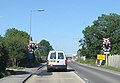
 Bedale Road level crossing - geograph.org.uk - 5858050.jpg 1 024 × 768 ; 166 kio
-
 Bedale Road, Aiskew - geograph.org.uk - 5415209.jpg 640 × 480 ; 61 kio
-
 Bedale Signal Box - geograph.org.uk - 5415937.jpg 640 × 480 ; 61 kio
-
 Bedale signal box - geograph.org.uk - 5854357.jpg 1 024 × 768 ; 180 kio
-
 Bedale signal box, North Yorkshire.jpg 2 700 × 1 800 ; 3,85 Mio
-
 Bedale station - cycle parking - geograph.org.uk - 5854309.jpg 1 024 × 768 ; 188 kio
-
 Bedale station - defibrillator - geograph.org.uk - 5854311.jpg 1 024 × 768 ; 326 kio
-
 Bedale station - eastbound train - geograph.org.uk - 5854314.jpg 1 024 × 768 ; 237 kio
-
 Bedale station - geograph.org.uk - 4723136.jpg 3 072 × 1 728 ; 1,69 Mio
-
 Bedale Station - geograph.org.uk - 5950443.jpg 800 × 532 ; 187 kio
-
 Bedale station - staff entrance - geograph.org.uk - 5854302.jpg 1 024 × 768 ; 202 kio
-
 Bedale station building (end) - geograph.org.uk - 5854307.jpg 1 024 × 768 ; 147 kio
-
 Bedale station building (front) - geograph.org.uk - 5854306.jpg 1 024 × 768 ; 158 kio
-
 Bedale station building - geograph.org.uk - 5853395.jpg 1 024 × 768 ; 174 kio
-
 Bedale station on the Wensleydale Railway - geograph.org.uk - 4555928.jpg 1 024 × 683 ; 140 kio
-
 Bedale station sign - geograph.org.uk - 5853394.jpg 1 024 × 768 ; 305 kio
-
 Benchmark on Church of St Mary ^ St Joseph - geograph.org.uk - 3026667.jpg 683 × 1 024 ; 255 kio
-
 Benchmark on garage of ^89 Bedale Road - geograph.org.uk - 3238895.jpg 683 × 1 024 ; 262 kio
-
 Benchmark on John H Gill ^ Sons' building - geograph.org.uk - 3239237.jpg 683 × 1 024 ; 286 kio
-
 Benchmark on Leases Farm - geograph.org.uk - 3174746.jpg 683 × 1 024 ; 265 kio
-
 Benchmark on police house - geograph.org.uk - 3532743.jpg 683 × 1 024 ; 270 kio
-
 Benchmark on the Manor House entrance - geograph.org.uk - 3238847.jpg 1 024 × 683 ; 303 kio
-
 Benchmark on ^25 Leases Road - geograph.org.uk - 3133019.jpg 645 × 1 024 ; 204 kio
-
 Benchmark on ^3 Potlands - geograph.org.uk - 5123418.jpg 1 024 × 683 ; 243 kio
-
 Braithwaites' Nursery, Bedale Road - geograph.org.uk - 5123486.jpg 1 024 × 683 ; 246 kio
-
 Brick bridge over Bedale Beck - geograph.org.uk - 3810857.jpg 3 920 × 2 204 ; 2,88 Mio
-
 Buildings by the A1(M) - geograph.org.uk - 5874501.jpg 2 580 × 1 278 ; 1,1 Mio
-
 Cereal crop north of Aiskew - geograph.org.uk - 5415232.jpg 640 × 480 ; 72 kio
-
 Cereal crop, Leeming Bar - geograph.org.uk - 5415254.jpg 640 × 480 ; 56 kio
-
 Church of St Mary ^ St Joseph beside A684 - geograph.org.uk - 3026672.jpg 683 × 1 024 ; 120 kio
-
 Class 37, 37250 at Leeming on Wensleydale Railway - geograph.org.uk - 6231786.jpg 3 048 × 1 713 ; 1,35 Mio
-
 Class 37, 37250 prepares to leave Bedale for Redmire - geograph.org.uk - 6231782.jpg 2 724 × 1 492 ; 1,23 Mio
-
 Class J72, No 69023 at Bedale Railway Station - geograph.org.uk - 5535358.jpg 640 × 427 ; 108 kio
-
 Corner House Hotel, Northallerton Road - geograph.org.uk - 3026698.jpg 1 024 × 683 ; 130 kio
-

-
 Cottages at Aiskew Crossing - geograph.org.uk - 3026693.jpg 1 024 × 683 ; 201 kio
-
 Council depot, Leeming Bar - geograph.org.uk - 5858413.jpg 1 027 × 768 ; 177 kio
-
 Engines awaiting restoration at Leeming Bar - geograph.org.uk - 5555734.jpg 2 160 × 2 160 ; 2,59 Mio
-
 Fairfield Farm - geograph.org.uk - 3174792.jpg 1 024 × 683 ; 133 kio
-
 Farm crossing near Leeming Bar - geograph.org.uk - 5858066.jpg 1 024 × 768 ; 312 kio
-
 Farm Track Near Bedale - geograph.org.uk - 5954272.jpg 640 × 461 ; 134 kio
-
 Farmland and trees, south of Little Fencote - geograph.org.uk - 5718164.jpg 1 024 × 768 ; 219 kio
-
 Farmland north of Roughley Corner - geograph.org.uk - 5718113.jpg 1 024 × 768 ; 163 kio
-
 Farmland NW of Aiskew - geograph.org.uk - 5123561.jpg 1 024 × 683 ; 265 kio
-
 Farmland south of Little Fencote - geograph.org.uk - 5718149.jpg 1 024 × 768 ; 266 kio
-
 Fiddler's Field Lorry Park - geograph.org.uk - 2476203.jpg 1 280 × 960 ; 784 kio
-

-
 Field with sheep outside Leeming Bar - geograph.org.uk - 5858398.jpg 1 027 × 768 ; 151 kio
-
 Footpath and road junctions with Low Street - geograph.org.uk - 3175075.jpg 1 024 × 683 ; 226 kio
-
 Footpath to Scruton - geograph.org.uk - 2030852.jpg 1 024 × 768 ; 237 kio
-
 Formerly The Malt Shovel Inn - geograph.org.uk - 3789142.jpg 2 854 × 2 044 ; 1,51 Mio
-
 Getting ready to depart for Redmire - geograph.org.uk - 2565866.jpg 640 × 480 ; 122 kio
-
 Green field, green hedgerows - geograph.org.uk - 2030844.jpg 1 024 × 768 ; 187 kio
-
 Guess what they called the new street^ - geograph.org.uk - 2077260.jpg 1 024 × 768 ; 152 kio
-
 Heavy rain on the A1 - geograph.org.uk - 3096304.jpg 640 × 430 ; 22 kio
-
 Hemelvaart Bier Cafe - geograph.org.uk - 4016416.jpg 1 024 × 691 ; 549 kio
-
 Hemelvaart Bier Cafe - geograph.org.uk - 4060882.jpg 1 024 × 768 ; 206 kio
-
 Houses on Bedale Road, Aiskew - geograph.org.uk - 5415205.jpg 640 × 480 ; 57 kio
-
 John H Gill ^ Sons' factory, Northallerton Road - geograph.org.uk - 3239256.jpg 1 024 × 683 ; 160 kio
-
 John H Gill ^ Sons, Northallerton Road, Leeming Bar - geograph.org.uk - 5853335.jpg 1 024 × 768 ; 124 kio
-
 Junction 51 - geograph.org.uk - 3885445.jpg 800 × 600 ; 67 kio
-
 Large crop field off the A684 - geograph.org.uk - 5415239.jpg 640 × 480 ; 45 kio
-
 Leases Farm - geograph.org.uk - 3174770.jpg 1 024 × 683 ; 165 kio
-
 Leases Road level crossing, Leeming Bar - geograph.org.uk - 5858061.jpg 1 024 × 768 ; 183 kio
-
 Leech house ^1 - geograph.org.uk - 4017111.jpg 3 264 × 2 448 ; 2,41 Mio
-
 Leech house ^2 - geograph.org.uk - 4017113.jpg 1 280 × 1 018 ; 807 kio
-
 Leeming Bar - old railway station - geograph.org.uk - 5853362.jpg 1 024 × 768 ; 140 kio
-
 Leeming Bar level crossing - geograph.org.uk - 5853346.jpg 1 024 × 768 ; 134 kio
-
 Leeming Bar play area (1) - geograph.org.uk - 6042360.jpg 1 024 × 768 ; 330 kio
-
 Leeming Bar play area (2) - geograph.org.uk - 6042361.jpg 923 × 768 ; 355 kio
-
 Leeming Bar Railway Station - geograph.org.uk - 5874178.jpg 1 024 × 683 ; 156 kio
-
 Leeming Bar Services - geograph.org.uk - 5950440.jpg 800 × 513 ; 100 kio
-
 Leeming Bar station - a sick "teddy bear" - geograph.org.uk - 5853388.jpg 1 024 × 768 ; 200 kio
-
 Leeming Bar station - buffet and shop - geograph.org.uk - 5853371.jpg 1 024 × 768 ; 167 kio
-
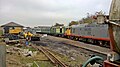
 Leeming Bar station - diesel loco and carriages - geograph.org.uk - 5853379.jpg 1 024 × 768 ; 157 kio
-
 Leeming Bar station - fuel gauge - geograph.org.uk - 5853391.jpg 1 024 × 768 ; 186 kio
-
 Leeming Bar station - fuelling point - geograph.org.uk - 5853389.jpg 1 024 × 768 ; 183 kio
-
 Leeming Bar Station - geograph.org.uk - 4875498.jpg 1 600 × 1 067 ; 360 kio
-
 Leeming Bar Station - geograph.org.uk - 5629812.jpg 640 × 427 ; 51 kio
-
 Leeming Bar Station - geograph.org.uk - 5629813.jpg 640 × 427 ; 66 kio
-
 Leeming Bar Station - geograph.org.uk - 5629819.jpg 640 × 427 ; 55 kio
-
 Leeming Bar station - maintenance area - geograph.org.uk - 5853370.jpg 1 024 × 768 ; 192 kio
-
 Leeming Bar station - shunter and carriage - geograph.org.uk - 5853376.jpg 1 024 × 768 ; 136 kio
-
 Leeming Bar station - signal box - geograph.org.uk - 5853383.jpg 1 024 × 768 ; 181 kio
-
 Leeming Bar station - trackwork to the west - geograph.org.uk - 5853385.jpg 1 024 × 768 ; 152 kio
-
 Leeming Bridge - geograph.org.uk - 5974528.jpg 4 320 × 3 240 ; 2,32 Mio
-
 Leeming Bridge, Leeming Lane - geograph.org.uk - 3532737.jpg 1 024 × 683 ; 179 kio
-
 Leeming Garth Care Home - geograph.org.uk - 4737988.jpg 640 × 480 ; 108 kio
-
 Leeming Garth Care Home - geograph.org.uk - 4875476.jpg 1 600 × 1 067 ; 679 kio
-
 Leeming Garth grounds - geograph.org.uk - 4737989.jpg 640 × 480 ; 105 kio
-
 Level crossing and signal box on Bedale Road - geograph.org.uk - 5535352.jpg 640 × 427 ; 89 kio
-
 Level crossing and signal box, Bedale - geograph.org.uk - 5251070.jpg 640 × 480 ; 189 kio
-
 Level Crossing At Bedale - geograph.org.uk - 5954281.jpg 640 × 454 ; 105 kio
-
 Level crossing on Bedale Road - geograph.org.uk - 5415932.jpg 640 × 480 ; 58 kio
-
 Level crossing on Bedale Road - geograph.org.uk - 5415938.jpg 640 × 480 ; 52 kio
-
 Level crossing, Bedale - geograph.org.uk - 2552233.jpg 640 × 445 ; 95 kio
-
 Litter on farmland near Warren House - geograph.org.uk - 5718138.jpg 1 024 × 768 ; 231 kio
-
 Love Lane crossing, Bedale - geograph.org.uk - 5853393.jpg 1 024 × 768 ; 331 kio
-
 Low Street - geograph.org.uk - 2030835.jpg 1 024 × 768 ; 127 kio
-
 Low Street heading north to a 42 metre spot height - geograph.org.uk - 5718127.jpg 1 024 × 768 ; 141 kio
-
 Low Street, heading south to Leeming Bar - geograph.org.uk - 5718134.jpg 1 024 × 768 ; 203 kio
-
 Lynx Fuels, Leeming Bar - geograph.org.uk - 5853351.jpg 1 024 × 768 ; 183 kio
-
 McDonald's Tables - geograph.org.uk - 4137323.jpg 800 × 584 ; 77 kio
-
 McDonald's View - geograph.org.uk - 3885435.jpg 800 × 600 ; 79 kio
-
 Milburn Terrace, Leeming Bar - geograph.org.uk - 6042364.jpg 1 024 × 768 ; 239 kio
-
 Motorchoice, Leeming Bar - geograph.org.uk - 5858059.jpg 1 024 × 768 ; 204 kio
-
 Muck heap, north of Roughley Corner - geograph.org.uk - 5718123.jpg 1 024 × 768 ; 201 kio
-
 New service station at Leeming Bar - geograph.org.uk - 5084754.jpg 3 191 × 2 037 ; 1,02 Mio
-
 No kingfishers here - geograph.org.uk - 2077262.jpg 1 024 × 768 ; 129 kio
-

-
 Old road sign on Bedale Road - geograph.org.uk - 5535334.jpg 640 × 427 ; 84 kio
-
 Police House, Leeming Lane - geograph.org.uk - 3532751.jpg 1 024 × 755 ; 234 kio
-
 Public footpath at Aiskew - geograph.org.uk - 5968170.jpg 3 240 × 4 319 ; 3,03 Mio
-
 Pyracantha hedge, Sandhill Lane - geograph.org.uk - 2077268.jpg 1 024 × 768 ; 203 kio
-
 Railway heading towards Leeming Bar - geograph.org.uk - 4875477.jpg 1 600 × 1 067 ; 858 kio
-
 Railway line at Aiskew - geograph.org.uk - 5968178.jpg 3 239 × 4 319 ; 3,37 Mio
-
 Reconditioned Bridge over Bedale Beck - geograph.org.uk - 3810839.jpg 3 920 × 2 204 ; 1,95 Mio
-
 Regency Pizza (closed), Northallerton Road, Leeming Bar - geograph.org.uk - 5853336.jpg 1 024 × 768 ; 111 kio
-
 Road works adjacent to Leases Road - geograph.org.uk - 4764384.jpg 1 499 × 920 ; 1,05 Mio
-
 Rolling Stock at Leeming Bar Station - geograph.org.uk - 4876241.jpg 1 600 × 1 067 ; 545 kio
-
 Roundabout on new section of A684 - geograph.org.uk - 5084759.jpg 3 141 × 2 355 ; 1,35 Mio
-
 Sand Hill from Back Lane - geograph.org.uk - 5123548.jpg 1 024 × 683 ; 278 kio
-
 Signal box near Leeming Bar Station - geograph.org.uk - 5629832.jpg 427 × 640 ; 50 kio
-
 Signal box near Leeming Bar Station - geograph.org.uk - 5630052.jpg 427 × 640 ; 50 kio
-
 Simply Dutch, Leeming Bar - geograph.org.uk - 5853340.jpg 1 024 × 768 ; 154 kio
-
 Sport cyclist, Leeming Bar - geograph.org.uk - 5853356.jpg 1 024 × 768 ; 164 kio
-

-
 St Mary and St Joseph Parish Centre Aiskew - geograph.org.uk - 5415207.jpg 640 × 480 ; 56 kio
-
 Station yard at Leeming Bar - geograph.org.uk - 4723144.jpg 3 072 × 1 728 ; 1,58 Mio
-
 Sustrans Bridleway under new A1(M) - geograph.org.uk - 3810832.jpg 3 920 × 2 204 ; 1,95 Mio
-
 Swiss rolls in a field off Low Street - geograph.org.uk - 2032160.jpg 1 024 × 768 ; 155 kio
-
 The A1 from the north end of Leases Road - geograph.org.uk - 3174718.jpg 1 024 × 683 ; 177 kio
-
 The A684, Northallerton Road - geograph.org.uk - 2524597.jpg 800 × 600 ; 176 kio
-
 The Bridge Beer Cafe, Bedale - geograph.org.uk - 5535351.jpg 427 × 640 ; 94 kio
-
 The Craft Yard - geograph.org.uk - 4016488.jpg 1 280 × 924 ; 650 kio
-
 The Craft Yard, Bedale - datestone - geograph.org.uk - 5854359.jpg 864 × 768 ; 136 kio
-
 The Craft Yard, Bedale - geograph.org.uk - 5854358.jpg 1 024 × 739 ; 182 kio
-
 The end of the A1(M) - geograph.org.uk - 3096287.jpg 640 × 430 ; 30 kio
-
 The former St Augustine's church, Leeming Bar (detail) - geograph.org.uk - 5853330.jpg 1 024 × 768 ; 133 kio
-
 The former St Augustine's church, Leeming Bar - geograph.org.uk - 5853328.jpg 1 024 × 768 ; 181 kio
-
 The original Pacer - geograph.org.uk - 5858056.jpg 1 024 × 768 ; 282 kio
-
 The sidings west of Leeming Bar Station - geograph.org.uk - 4480909.jpg 1 024 × 768 ; 188 kio
-
 The Wensleydale Railway - geograph.org.uk - 5629825.jpg 640 × 427 ; 81 kio
-
 The White Rose Hotel, Leeming Bar - geograph.org.uk - 5853323.jpg 1 024 × 768 ; 142 kio
-
 Three trees on a field boundary outside Leeming Bar - geograph.org.uk - 5858419.jpg 1 024 × 768 ; 147 kio
-
 Track of the A684 Bedale by-pass - geograph.org.uk - 5415227.jpg 640 × 480 ; 89 kio
-
 Trackbed at Bedale - geograph.org.uk - 4723138.jpg 3 072 × 1 728 ; 1,88 Mio
-
 Trains in the siding at Leeming Bar station - geograph.org.uk - 4628066.jpg 1 024 × 768 ; 120 kio
-
 Two bridges over Bedale Beck - geograph.org.uk - 5970859.jpg 4 320 × 3 240 ; 1,84 Mio
-
 Underbridge for the A1(M) junction 51 - geograph.org.uk - 3614291.jpg 3 402 × 2 366 ; 1,93 Mio
-
 Unsurfaced track across a field - geograph.org.uk - 5858435.jpg 1 024 × 768 ; 242 kio
-
 Vale of Mowbray Bakery - geograph.org.uk - 5950430.jpg 800 × 515 ; 110 kio
-
 View of Micklebrack from Back Lane - geograph.org.uk - 5123516.jpg 1 024 × 683 ; 251 kio
-
 View west towards Leases Farm - geograph.org.uk - 5718116.jpg 1 024 × 768 ; 194 kio
-
 Warren House, near Little Fencote - geograph.org.uk - 5718131.jpg 1 024 × 615 ; 154 kio
-
 Welcome to Leeming Bar's Co-op - geograph.org.uk - 5950433.jpg 800 × 530 ; 111 kio
-
 Wensleydale Railway - geograph.org.uk - 4555905.jpg 1 024 × 683 ; 169 kio
-
 Wensleydale Railway - geograph.org.uk - 4555916.jpg 1 024 × 683 ; 104 kio
-
 Wensleydale Railway - geograph.org.uk - 5415935.jpg 640 × 480 ; 77 kio


_at_Leeming_Bar_-_geograph.org.uk_-_5825590.jpg)
_Motorway_bridge_over_the_A684,_Junction_51_-_geograph.org.uk_-_5415244.jpg)
_near_Leases_Hall_-_geograph.org.uk_-_5825597.jpg)
_near_Leases_Hall_-_geograph.org.uk_-_5874503.jpg)
_near_Leeming_-_geograph.org.uk_-_3091235.jpg)
_near_the_Bedale_turning_-_geograph.org.uk_-_3089761.jpg)


_-_geograph.org.uk_-_5415236.jpg)
_Motorway_-_geograph.org.uk_-_5415223.jpg)
_Motorway_-_geograph.org.uk_-_5415240.jpg)


_Motorway_-_geograph.org.uk_-_5415241.jpg)


_-_geograph.org.uk_-_5854307.jpg)
_-_geograph.org.uk_-_5854306.jpg)


_-_geograph.org.uk_-_5874501.jpg)


_-_geograph.org.uk_-_6042360.jpg)
_-_geograph.org.uk_-_6042361.jpg)


,_Northallerton_Road,_Leeming_Bar_-_geograph.org.uk_-_5853336.jpg)


_-_geograph.org.uk_-_3096287.jpg)
_-_geograph.org.uk_-_5853330.jpg)


_junction_51_-_geograph.org.uk_-_3614291.jpg)


_-_geograph.org.uk_-_3810832.jpg)