Category:Aislaby, Scarborough
Aller à la navigation
Aller à la recherche
localité britannique du comté anglais de North Yorkshire  | |||||
| Téléverser des médias | |||||
| Nature de l’élément | |||||
|---|---|---|---|---|---|
| Lieu | Scarborough (district), Yorkshire du Nord, Yorkshire-et-Humber, Angleterre | ||||
 | |||||
English: Aislaby (pronounced "ais-el-bee") is a village and civil parish in the Scarborough district of North Yorkshire, England. It is situated near the town of Whitby.
Sous-catégories
Cette catégorie comprend 5 sous-catégories, dont les 5 ci-dessous.
Média dans la catégorie « Aislaby, Scarborough »
Cette catégorie comprend 84 fichiers, dont les 84 ci-dessous.
-
 A169 from A171 junction - geograph.org.uk - 3989143.jpg 640 × 389 ; 51 kio
-
 A171 heading west - geograph.org.uk - 2481422.jpg 1 600 × 1 200 ; 318 kio
-
 Access track to Selly Cottage - geograph.org.uk - 1886716.jpg 2 048 × 1 536 ; 1,09 Mio
-
 Aislaby, nr Whitby.jpg 640 × 480 ; 79 kio
-
 Aislaby, Scarborough UK parish locator map.svg 1 425 × 1 037 ; 4,3 Mio
-
 Barns west of Briggswath - geograph.org.uk - 3733536.jpg 640 × 480 ; 196 kio
-
 Bridge near Woodlands Hall - geograph.org.uk - 3281150.jpg 640 × 480 ; 124 kio
-
 Bridleway between Aislaby and Briggswath - geograph.org.uk - 804711.jpg 480 × 640 ; 153 kio
-
 Bridleway junction, Lodge Farm - geograph.org.uk - 3292707.jpg 640 × 413 ; 74 kio
-
 Bridleway near Woodlands Hall - geograph.org.uk - 3281206.jpg 640 × 480 ; 107 kio
-
 Bridleway south of Lodge Farm - geograph.org.uk - 810330.jpg 640 × 480 ; 156 kio
-
 Bridleway to Aislaby - geograph.org.uk - 3292485.jpg 480 × 640 ; 137 kio
-
 Bridleway towards Thistle Grove - geograph.org.uk - 5317771.jpg 1 600 × 1 200 ; 1,03 Mio
-
 Car park alongside the A171 at Skelder Hill - geograph.org.uk - 2909874.jpg 1 024 × 768 ; 144 kio
-
 Car park, A171 - geograph.org.uk - 4734569.jpg 640 × 480 ; 39 kio
-
 Cows and sheep near Lodge Farm - geograph.org.uk - 4178598.jpg 3 872 × 2 592 ; 2,05 Mio
-
 Egton Road - geograph.org.uk - 1177965.jpg 640 × 480 ; 239 kio
-
 End of the A169 - geograph.org.uk - 3686082.jpg 1 024 × 643 ; 695 kio
-
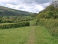
 Esk valley - geograph.org.uk - 3281315.jpg 640 × 426 ; 68 kio
-
 Esk Valley Walk - geograph.org.uk - 3293139.jpg 640 × 480 ; 117 kio
-
 Esk Valley Walk - geograph.org.uk - 3293208.jpg 640 × 444 ; 75 kio
-
 Esk Valley Walk approaching Thistle Grove - geograph.org.uk - 3281395.jpg 640 × 461 ; 88 kio
-
 Esk Valley Walk approaching Thistle Grove - geograph.org.uk - 3281636.jpg 640 × 464 ; 98 kio
-
 Esk Valley Walk approaching Thistle Grove - geograph.org.uk - 3281646.jpg 640 × 423 ; 79 kio
-
 Esk Valley Walk approaching Thistle Grove - geograph.org.uk - 3292727.jpg 640 × 424 ; 78 kio
-
 Esk Valley Walk at Thistle Grove - geograph.org.uk - 3281758.jpg 640 × 420 ; 81 kio
-
 Esk Valley Walk south of Lodge Farm - geograph.org.uk - 3293130.jpg 640 × 428 ; 79 kio
-
 Esk Valley Walk south of Lodge Farm - geograph.org.uk - 3293174.jpg 640 × 480 ; 126 kio
-
 Eskdale from the train - geograph.org.uk - 4176370.jpg 3 872 × 2 592 ; 3,33 Mio
-
 Farm in the Esk Valley - geograph.org.uk - 3714511.jpg 1 600 × 1 200 ; 910 kio
-
 Field rising beside woodland edge - geograph.org.uk - 3733482.jpg 1 500 × 1 125 ; 2,21 Mio
-
 Footpath from Selly Cottage - geograph.org.uk - 1886729.jpg 2 048 × 1 536 ; 1,43 Mio
-
 Former stables at Woodlands Hall - geograph.org.uk - 3281281.jpg 640 × 467 ; 85 kio
-
 Gate on Esk Valley Walk - geograph.org.uk - 3281375.jpg 471 × 640 ; 98 kio
-
 Gate on Esk Valley Walk - geograph.org.uk - 3281832.jpg 640 × 480 ; 114 kio
-
 Gate on Public Bridleway Near Spot Height 73 - geograph.org.uk - 120504.jpg 640 × 480 ; 92 kio
-
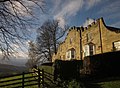
 Groves Hall - geograph.org.uk - 3292466.jpg 640 × 446 ; 58 kio
-
 Inside the men's toilets at Aislaby - geograph.org.uk - 5722167.jpg 6 000 × 4 000 ; 5,98 Mio
-
 Inside the women's toilet at Aislaby - geograph.org.uk - 5722102.jpg 6 000 × 4 000 ; 7,1 Mio
-
 Laid stone path of the Esk Valley Walk - geograph.org.uk - 3733516.jpg 1 125 × 1 500 ; 2,15 Mio
-
 Lane by entrance to Lodge Farm - geograph.org.uk - 810328.jpg 640 × 480 ; 188 kio
-
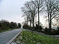
 Main Road Aislaby - geograph.org.uk - 1327749.jpg 640 × 480 ; 100 kio
-
 Milepost Near Skelder Wood Car Park - geograph.org.uk - 120508.jpg 640 × 480 ; 77 kio
-
 Moor Lane - geograph.org.uk - 2909872.jpg 1 024 × 768 ; 97 kio
-
 NCN165 to Aislaby - geograph.org.uk - 3281164.jpg 640 × 480 ; 126 kio
-
 Newbiggin farm aislaby whitby.jpg 3 008 × 2 000 ; 6,46 Mio
-
 Old Mile Post - geograph.org.uk - 1897667.jpg 1 600 × 1 200 ; 665 kio
-
 Old Mile Post - geograph.org.uk - 1897674.jpg 1 600 × 1 200 ; 573 kio
-
 Plastic Bag Farm - geograph.org.uk - 266792.jpg 640 × 480 ; 68 kio
-
 Public toilets at Aislaby - geograph.org.uk - 5722225.jpg 1 600 × 1 067 ; 324 kio
-
 River Esk near Sleights - geograph.org.uk - 2671427.jpg 800 × 600 ; 83 kio
-
 River Esk valley - geograph.org.uk - 5973749.jpg 3 000 × 1 436 ; 3,08 Mio
-
 River Esk Valley - geograph.org.uk - 5973759.jpg 3 000 × 1 938 ; 4,71 Mio
-
 Royal Blue to Kathmandu - geograph.org.uk - 3714540.jpg 1 024 × 715 ; 729 kio
-
 Sheep pasture, Thistle Grove - geograph.org.uk - 3281401.jpg 640 × 420 ; 76 kio
-
 Skelder Hill A171 - geograph.org.uk - 1920739.jpg 4 000 × 3 000 ; 2,89 Mio
-

-
 St Margaret Aislaby - geograph.org.uk - 5780620.jpg 1 600 × 1 067 ; 444 kio
-
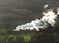
 Steam train in Eskdale - geograph.org.uk - 4178616.jpg 3 872 × 2 592 ; 1,08 Mio
-
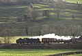
 Steam train, Esk valley - geograph.org.uk - 3281784.jpg 640 × 466 ; 69 kio
-
 Steam train, Esk valley - geograph.org.uk - 3281809.jpg 640 × 435 ; 57 kio
-
 Steam train, Esk valley - geograph.org.uk - 3281821.jpg 640 × 444 ; 70 kio
-
 Stone trod above Thistle Grove - geograph.org.uk - 4178622.jpg 3 872 × 2 592 ; 5,89 Mio
-
 The A171 Guisborough Road from Aislaby Lane - geograph.org.uk - 3104778.jpg 800 × 600 ; 86 kio
-
 The Forge, Aislaby - geograph.org.uk - 4173989.jpg 3 872 × 2 592 ; 2,51 Mio
-
 The Huntsman public house, Aislaby - geograph.org.uk - 3104785.jpg 800 × 600 ; 110 kio
-
 The main street through Aislaby - geograph.org.uk - 4173991.jpg 3 872 × 2 592 ; 2,67 Mio
-
 The River Esk from the A169 - geograph.org.uk - 6278611.jpg 5 456 × 3 632 ; 1,38 Mio
-
 The River Esk near Sleights - geograph.org.uk - 4467773.jpg 1 024 × 768 ; 226 kio
-
 The River Esk near Sleights - geograph.org.uk - 4686347.jpg 1 024 × 768 ; 191 kio
-
 The River Esk, west of Sleights - geograph.org.uk - 4453589.jpg 1 024 × 768 ; 135 kio
-
 Thistle Grove - geograph.org.uk - 3281371.jpg 640 × 454 ; 71 kio
-
 Thistle Grove, Eskdale - geograph.org.uk - 4309517.jpg 640 × 480 ; 151 kio
-
 Track from Low Newbiggin - geograph.org.uk - 3293193.jpg 640 × 391 ; 61 kio
-
 Track onto moorland from Moor Lane - geograph.org.uk - 2909873.jpg 1 024 × 768 ; 133 kio
-
 Track to Dunsley Moor - geograph.org.uk - 266082.jpg 640 × 447 ; 55 kio
-
 Track to Lodge Farm - geograph.org.uk - 3281778.jpg 640 × 431 ; 73 kio
-
 Tree by the Esk Valley Walk - geograph.org.uk - 3293182.jpg 640 × 475 ; 84 kio
-
 View towards Thistle Grove - geograph.org.uk - 4467778.jpg 1 024 × 768 ; 134 kio
-
 Wheatfield with the Esk Valley beyond - geograph.org.uk - 1964098.jpg 2 816 × 2 112 ; 2,95 Mio
-
 Woodland beside the A171 - geograph.org.uk - 2481414.jpg 1 600 × 1 200 ; 598 kio
-
 Woodland near St Oswald's Pastoral Centre - geograph.org.uk - 3292491.jpg 500 × 640 ; 136 kio
-
 Woodland on Oak Hill - geograph.org.uk - 4178637.jpg 3 872 × 2 592 ; 6,06 Mio
-
 Woodlands, Sleights - geograph.org.uk - 4178631.jpg 3 872 × 2 592 ; 1,64 Mio


