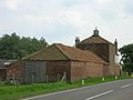
Category:Aldbrough, East Riding of Yorkshire
Vai alla navigazione
Vai alla ricerca
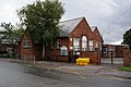
English: Aldbrough is a village and civil parish in the East Riding of Yorkshire, England, in an area known as Holderness. It is situated near to the North Sea coast, about 12 miles (19 km) north-east of Hull city centre. It lies on the B1242 road at its junction with the B1238 road.
villaggio e parrocchia civile dell'East Riding of Yorkshire   | |||||
| Carica un file multimediale | |||||
| Istanza di | |||||
|---|---|---|---|---|---|
| Luogo | East Riding of Yorkshire, Yorkshire e Humber, Inghilterra | ||||
| sito web ufficiale | |||||
 | |||||
Sottocategorie
Questa categoria contiene le 12 sottocategorie indicate di seguito, su un totale di 12.
A
- St Bartholomew Church, Aldbrough (15 F)
- Aldbrough War Memorial (7 F)
E
- East Newton (12 F)
- Etherdwick (4 F)
R
- RAF Cowden (7 F)
T
- Tansterne (6 F)
File nella categoria "Aldbrough, East Riding of Yorkshire"
Questa categoria contiene 200 file, indicati di seguito, su un totale di 383.
(pagina precedente) (pagina successiva)-
 A bend in Seaside Road, Aldbrough - geograph.org.uk - 4797444.jpg 640 × 480; 44 KB
-
 A bridge across the moat - geograph.org.uk - 2100520.jpg 800 × 600; 376 KB
-
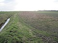
 A drain goes under the B1242 - geograph.org.uk - 2096547.jpg 800 × 600; 282 KB
-

-
 A footpath near Owsthill Farm, Aldbrough - geograph.org.uk - 2259225.jpg 800 × 600; 278 KB
-
 A Pill Box near East Newton - geograph.org.uk - 2096441.jpg 800 × 600; 234 KB
-

-
 A storage pond to the south of Aldbrough - geograph.org.uk - 2259219.jpg 800 × 600; 238 KB
-
 A track to East Hill - geograph.org.uk - 2096552.jpg 800 × 600; 247 KB
-
 Aldborough Cemetery - geograph.org.uk - 4909791.jpg 551 × 640; 555 KB
-
 Aldbrough - geograph.org.uk - 1260485.jpg 640 × 428; 76 KB
-
 Aldbrough caravan site - geograph.org.uk - 2096489.jpg 800 × 600; 199 KB
-
 Aldbrough Cemetery - geograph.org.uk - 560355.jpg 480 × 640; 108 KB
-
 Aldbrough Fisheries on Hornsea Road, Aldbrough - geograph.org.uk - 4134101.jpg 1 600 × 1 064; 508 KB
-

-

-
 Aldbrough Gas Storage, Bail Bridge - geograph.org.uk - 524159.jpg 640 × 468; 98 KB
-
 Aldbrough Post Office and stores - geograph.org.uk - 4797432.jpg 640 × 480; 52 KB
-
 Aldbrough Primary School - geograph.org.uk - 4133869.jpg 1 600 × 1 064; 491 KB
-
 Aldbrough Primary School - geograph.org.uk - 4133870.jpg 1 600 × 1 064; 809 KB
-
 Aldbrough Primary School - geograph.org.uk - 4133873.jpg 1 600 × 1 540; 1,22 MB
-
 Aldbrough Primary School - geograph.org.uk - 4133968.jpg 1 600 × 1 064; 732 KB
-
 Aldbrough Sands - geograph.org.uk - 4798727.jpg 640 × 480; 49 KB
-
 Aldbrough Sands - geograph.org.uk - 4798729.jpg 640 × 480; 48 KB
-
 Aldbrough village sign - geograph.org.uk - 2097801.jpg 800 × 600; 331 KB
-
 Aldbrough Youth Club - geograph.org.uk - 4797424.jpg 640 × 480; 54 KB
-
 Aldbrough, Cemetery - geograph.org.uk - 72100.jpg 640 × 480; 147 KB
-
 Aldbrough, East Riding of Yorkshire UK parish locator map.svg 1 425 × 1 107; 1,68 MB
-
 Approaching the end of Seaside Road - geograph.org.uk - 4798692.jpg 640 × 480; 41 KB
-
 Approaching West Carlton - geograph.org.uk - 4909747.jpg 640 × 480; 511 KB
-
 Autumn sown crop and plantation near Westhill Bridge (geograph 5603037).jpg 1 024 × 768; 165 KB
-
 B1242 approaching Aldbrough - geograph.org.uk - 4797421.jpg 640 × 480; 82 KB
-
 B1242 towards Aldbrough - geograph.org.uk - 1442455.jpg 640 × 480; 56 KB
-
 B1242 towards Aldbrough - geograph.org.uk - 1442465.jpg 640 × 480; 47 KB
-
 B1242 towards Aldbrough - geograph.org.uk - 1442472.jpg 640 × 480; 71 KB
-
 B1242 towards Aldbrough - geograph.org.uk - 4797420.jpg 640 × 480; 67 KB
-
 B1242 towards Hornsea - geograph.org.uk - 1442499.jpg 640 × 480; 71 KB
-
 B1242 towards Hornsea - geograph.org.uk - 1442508.jpg 640 × 480; 62 KB
-
 Bail Wood - geograph.org.uk - 524100.jpg 640 × 468; 113 KB
-
 Bail Wood - geograph.org.uk - 524108.jpg 484 × 640; 132 KB
-
 Bail Wood - geograph.org.uk - 524116.jpg 480 × 640; 116 KB
-
 Beach at Mount Pleasant, Aldbrough - geograph.org.uk - 4798697.jpg 480 × 640; 57 KB
-
 Beach, Mount Pleasant, Aldbrough - geograph.org.uk - 4798721.jpg 640 × 480; 53 KB
-
 Between East and West Carlton - geograph.org.uk - 4909770.jpg 524 × 640; 444 KB
-
 Bewick Hall and farm - geograph.org.uk - 5603038.jpg 1 024 × 768; 148 KB
-
 Black Bush - geograph.org.uk - 561075.jpg 640 × 445; 103 KB
-
 Black Bush - geograph.org.uk - 561076.jpg 473 × 640; 126 KB
-
 Black Bush at High Fosham (geograph 5668597).jpg 1 024 × 768; 164 KB
-
 Both paths lead to the caravan site - geograph.org.uk - 2096476.jpg 800 × 600; 202 KB
-
 Brewery Cottage, Hornsea Road, Aldbrough - geograph.org.uk - 4134092.jpg 1 600 × 1 064; 589 KB
-
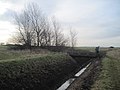
 Bridge over East Newton Drain - geograph.org.uk - 1442383.jpg 640 × 480; 74 KB
-
 Bridleway Footbridge - geograph.org.uk - 204039.jpg 640 × 480; 137 KB
-
 Bridleway near East Hill, Aldbrough - geograph.org.uk - 1840505.jpg 640 × 480; 106 KB
-
 Bridleway through a field of beans - geograph.org.uk - 5478924.jpg 1 024 × 768; 168 KB
-
 Bridleway to East Newton - geograph.org.uk - 5478955.jpg 1 024 × 768; 230 KB
-
 Bridleway to Garton - geograph.org.uk - 5478915.jpg 1 024 × 768; 210 KB
-
 Bridleway towards Garton - geograph.org.uk - 1442372.jpg 640 × 480; 65 KB
-
 Building Foundations - geograph.org.uk - 326898.jpg 640 × 480; 113 KB
-
 Building, Headlands Farm - geograph.org.uk - 3525628.jpg 640 × 480; 48 KB
-
 Bungalows on Seaside Road - geograph.org.uk - 4798684.jpg 640 × 480; 59 KB
-
 Bungalows on Seaside Road, Aldbrough - geograph.org.uk - 2096497.jpg 800 × 600; 262 KB
-
 Carlton Lane in Aldbrough - geograph.org.uk - 2414103.jpg 3 648 × 2 736; 2,17 MB
-
 Carlton Lane, Aldbrough - geograph.org.uk - 560365.jpg 487 × 640; 158 KB
-
 Carlton Road - geograph.org.uk - 5605116.jpg 1 024 × 768; 156 KB
-
 Carlton Road - geograph.org.uk - 5605214.jpg 1 024 × 768; 163 KB
-
 Carlton Road - geograph.org.uk - 5605217.jpg 1 024 × 768; 155 KB
-
 Carlton Road at East Carlton (farmhouse) - geograph.org.uk - 2199303.jpg 800 × 600; 286 KB
-
 Cemetery Gateway - geograph.org.uk - 2240806.jpg 3 264 × 2 448; 2,23 MB
-
 Church Street becomes Seaside Road - geograph.org.uk - 2239966.jpg 3 264 × 2 448; 1,36 MB
-
 Church Street, Aldbrough - geograph.org.uk - 1442303.jpg 640 × 480; 64 KB
-
 Church Street, Aldbrough - geograph.org.uk - 4797428.jpg 640 × 480; 67 KB
-
 Citizenlink on Headlands Road, Aldbrough - geograph.org.uk - 4133979.jpg 1 600 × 1 064; 567 KB
-
 Clay cliffs, Aldbrough - geograph.org.uk - 4909854.jpg 640 × 480; 372 KB
-
 Cliff Killers - geograph.org.uk - 2152486.jpg 3 648 × 2 736; 1,87 MB
-
 Cliff path north of Aldbrough - geograph.org.uk - 326887.jpg 640 × 480; 130 KB
-
 Cliff path north of Aldbrough - geograph.org.uk - 326903.jpg 640 × 480; 128 KB
-
 Cliff top caravan site, Aldbrough - geograph.org.uk - 5452763.jpg 1 024 × 768; 212 KB
-
 Cliff top view towards Ringborough Farm - geograph.org.uk - 5478928.jpg 1 024 × 768; 173 KB
-
 Cliff top, Aldbrough - geograph.org.uk - 5452765.jpg 1 024 × 768; 207 KB
-
 Clifftop Path, but not for long - geograph.org.uk - 2239989.jpg 3 264 × 2 448; 1,97 MB
-

-
 Coastal Erosion at Seaside Road end, Aldbrough - geograph.org.uk - 4022408.jpg 3 072 × 2 304; 1,78 MB
-
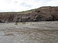
 Coastal erosion near Aldbrough - geograph.org.uk - 4798720.jpg 640 × 480; 55 KB
-
 Coastal erosion, Aldbrough Cliffs - geograph.org.uk - 4798726.jpg 640 × 480; 58 KB
-
 Coastal erosion, Aldbrough Cliffs - geograph.org.uk - 4798731.jpg 640 × 480; 50 KB
-

-
 Coastal field and fence line - geograph.org.uk - 4798730.jpg 640 × 480; 67 KB
-

-
 Coastal Path, near Aldbrough - geograph.org.uk - 1442179.jpg 640 × 480; 60 KB
-
 Coastal Path, near Low Farm - geograph.org.uk - 1442197.jpg 640 × 480; 53 KB
-
 Coming out at Moat Farm - geograph.org.uk - 2100523.jpg 800 × 600; 293 KB
-
 Cowden Drain (geograph 1840489).jpg 640 × 480; 110 KB
-
 Crop field north of Seaside Road - geograph.org.uk - 4798681.jpg 640 × 480; 64 KB
-
 Crop field north of Seaside Road - geograph.org.uk - 4798685.jpg 640 × 480; 90 KB
-

-
 Crop field off Withernwick Road (geograph 4797411).jpg 640 × 480; 55 KB
-
 Crop field towards Bewick Hall - geograph.org.uk - 4797417.jpg 640 × 480; 77 KB
-
 Crop field, Castle Hill - geograph.org.uk - 4797422.jpg 640 × 482; 86 KB
-
 Crossmere Hill - geograph.org.uk - 524014.jpg 466 × 640; 107 KB
-
 Crossmere Hill Farm - geograph.org.uk - 1442477.jpg 640 × 480; 57 KB
-
 Crossmere Hill Farm - geograph.org.uk - 72101.jpg 640 × 480; 89 KB
-
 Crumbling cliffs, Aldbrough - geograph.org.uk - 4909853.jpg 640 × 480; 437 KB
-
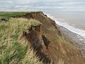 Crumbling cliffs, Aldbrough - geograph.org.uk - 4909856.jpg 640 × 480; 426 KB
-
 Current end of Seaside Road - geograph.org.uk - 4798696.jpg 640 × 480; 40 KB
-

-

-
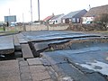 Death of a Road - geograph.org.uk - 2239979.jpg 3 264 × 2 448; 1,85 MB
-
 Defences on the beach - geograph.org.uk - 5478852.jpg 1 024 × 768; 169 KB
-
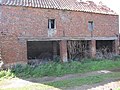 Derelict farm building at Black Bush (geograph 2937728).jpg 3 648 × 2 736; 1,59 MB
-
 Derelict Farmhouse at Black Bush (geograph 2937720).jpg 3 648 × 2 736; 1,91 MB
-
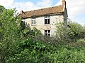
 Derelict house at Low Fosham - geograph.org.uk - 5605111.jpg 1 024 × 768; 142 KB
-
 Derelict house, Low Fosham - geograph.org.uk - 5605099.jpg 1 024 × 768; 234 KB
-
 Disappearing land, Aldbrough Cliffs - geograph.org.uk - 4798734.jpg 640 × 480; 66 KB
-
 Dothams Road, Cess Dale - geograph.org.uk - 524078.jpg 640 × 469; 114 KB
-
 Double Danger - geograph.org.uk - 2152531.jpg 3 354 × 2 511; 1,15 MB
-
 Drain beside Seaside Road - geograph.org.uk - 4798683.jpg 640 × 480; 79 KB
-
 Drain beside Seaside Road - geograph.org.uk - 4798686.jpg 640 × 480; 98 KB
-
 Drain off Seaside Road, Aldbrough - geograph.org.uk - 4797445.jpg 640 × 480; 96 KB
-
 East Carlton - geograph.org.uk - 560662.jpg 640 × 457; 72 KB
-
 East Carlton - geograph.org.uk - 560688.jpg 480 × 640; 101 KB
-
 East Coast Farmland - geograph.org.uk - 72102.jpg 640 × 480; 54 KB
-
 East Hill, Aldbrough - geograph.org.uk - 432804.jpg 640 × 479; 124 KB
-

-

-

-
 East Newton Drain - geograph.org.uk - 2240361.jpg 3 264 × 2 448; 2,4 MB
-
 East Newton Road - geograph.org.uk - 1442308.jpg 640 × 480; 49 KB
-
 East of Aldbrough - geograph.org.uk - 523984.jpg 640 × 435; 108 KB
-

-
 Elm Tree, Aldbrough - geograph.org.uk - 2281549.jpg 800 × 600; 192 KB
-
 Elsome Road (track) - geograph.org.uk - 203817.jpg 640 × 480; 65 KB
-
 Elsome Road (Track) - geograph.org.uk - 2240743.jpg 3 264 × 2 448; 2,19 MB
-
 Elsome Road - geograph.org.uk - 5830317.jpg 1 024 × 768; 157 KB
-
 Elsome Road - geograph.org.uk - 5830326.jpg 1 024 × 768; 152 KB
-
 Elsome Road, Bail Hill - geograph.org.uk - 524075.jpg 480 × 640; 89 KB
-
 Empty House at Low Fosham - geograph.org.uk - 2240944.jpg 3 264 × 2 448; 1,92 MB
-
 End of the road, Aldbrough - geograph.org.uk - 4909850.jpg 480 × 640; 455 KB
-
 Entering Aldbrough - geograph.org.uk - 4797423.jpg 640 × 480; 71 KB
-
 Entrance to Aldbrough Caravan Park - geograph.org.uk - 4798689.jpg 640 × 480; 55 KB
-
 Entrance to West Hill (geograph 6685283).jpg 1 024 × 768; 200 KB
-
 Erosion at Aldbrough Cliffs, Holderness - geograph.org.uk - 5784355.jpg 1 600 × 1 065; 644 KB
-
 Erosion at Aldbrough Cliffs, Holderness - geograph.org.uk - 5784359.jpg 1 600 × 1 065; 719 KB
-
 Erosion, The stark reality - geograph.org.uk - 2239998.jpg 3 264 × 2 448; 1,83 MB
-
 Farm buildings at Bewick Hall - geograph.org.uk - 5455212.jpg 640 × 488; 311 KB
-
 Farm Road through Fields - geograph.org.uk - 2240917.jpg 3 264 × 2 448; 1,77 MB
-
 Farm track near Low Fosham (geograph 1791405).jpg 640 × 480; 64 KB
-
 Farm Track off the B1242 - geograph.org.uk - 1442462.jpg 640 × 480; 78 KB
-
 Farm track on Lambwath Hill (geograph 5605105).jpg 1 024 × 768; 167 KB
-
 Farm track to Ringbrough - geograph.org.uk - 5449647.jpg 1 024 × 768; 208 KB
-
 Farmhouse at Low Fosham - geograph.org.uk - 5605108.jpg 1 024 × 768; 157 KB
-
 Farmland East of Aldbrough - geograph.org.uk - 1442311.jpg 640 × 480; 63 KB
-
 Farmland near Aldbrough - geograph.org.uk - 1442523.jpg 640 × 480; 62 KB
-
 Farmland near Aldbrough - geograph.org.uk - 1442545.jpg 640 × 480; 77 KB
-
 Farmland near Low Fosham (geograph 1791397).jpg 640 × 480; 61 KB
-
 Farmland near Low Fosham (geograph 1791415).jpg 640 × 480; 61 KB
-
 Farmland near West Carlton (geograph 1791423).jpg 640 × 480; 55 KB
-
 Field Drain to Fox Covert - geograph.org.uk - 2240877.jpg 3 264 × 2 448; 2,1 MB
-
 Field Drain toward Transterne Grange - geograph.org.uk - 2240885.jpg 3 264 × 2 448; 1,69 MB
-
 Field Edge and Drain - geograph.org.uk - 2240845.jpg 3 264 × 2 448; 1,93 MB
-
 Field entrance off Seaside Road - geograph.org.uk - 4798687.jpg 640 × 480; 81 KB
-
 Field entrance off Withernwick Road (geograph 4797409).jpg 640 × 480; 97 KB
-
 Field of oilseed rape off Garton Road - geograph.org.uk - 5830310.jpg 1 024 × 768; 180 KB
-
 Field view - geograph.org.uk - 203819.jpg 640 × 480; 114 KB
-
 Field View - geograph.org.uk - 203836.jpg 640 × 480; 94 KB
-
 Fields by Seaside Road - geograph.org.uk - 5973347.jpg 1 600 × 1 200; 728 KB
-

-
 Flat Fields are the norm in this area - geograph.org.uk - 2240794.jpg 3 264 × 2 448; 1,75 MB
-
 Flinton Road - geograph.org.uk - 5605225.jpg 1 024 × 768; 136 KB
-
 Flinton Road at West Carlton - geograph.org.uk - 2199300.jpg 800 × 600; 292 KB
-
 Font in St Bartholomew's Church, Aldborough - geograph.org.uk - 5260067.jpg 1 200 × 1 200; 337 KB
-
 Font in St Bartholomew's Church, Aldborough - geograph.org.uk - 5260069.jpg 1 200 × 1 200; 337 KB
-
 Font in St Bartholomew's Church, Aldborough - geograph.org.uk - 5260071.jpg 1 200 × 1 199; 260 KB
-
 Footbridge over Bail Drain - geograph.org.uk - 2240732.jpg 3 264 × 2 448; 3,03 MB
-
 Footbridge over Field Drain - geograph.org.uk - 2240769.jpg 3 264 × 2 448; 1,79 MB
-
 Footbridge over Lambwath Stream - geograph.org.uk - 5830280.jpg 1 024 × 768; 339 KB
-
 Footpath to Aldbrough - geograph.org.uk - 5830307.jpg 1 024 × 768; 129 KB
-
 Former Garage on Hull Road, Aldbrough. - geograph.org.uk - 4134046.jpg 1 600 × 1 064; 803 KB
-
 Former Methodist Chapel, Aldbrough - geograph.org.uk - 3018998.jpg 3 072 × 2 304; 1,76 MB
-
 Former Primitive Methodist Chapel - geograph.org.uk - 4133805.jpg 1 600 × 1 064; 713 KB
-
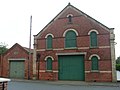
 Former Sabbath School - geograph.org.uk - 4134017.jpg 1 600 × 1 064; 561 KB
-
 Former Sabbath School - geograph.org.uk - 4134021.jpg 1 600 × 969; 678 KB
-
 Former Wesleyan Chapel on High Street, Aldbrough. - geograph.org.uk - 4134025.jpg 1 600 × 1 064; 477 KB
-
 Former WW2 Pillbox - geograph.org.uk - 5784341.jpg 1 600 × 1 065; 568 KB
-
 Fosham Bridge - geograph.org.uk - 5602983.jpg 1 024 × 768; 295 KB
-
 Fosham Garth Farm - geograph.org.uk - 561082.jpg 640 × 482; 107 KB
-
 Fosham Road, towards High Fosham Farm (geograph 2281101).jpg 800 × 600; 200 KB
-
 From Elsome Road (track) - geograph.org.uk - 204258.jpg 640 × 480; 82 KB
-

-
 Garden equipment and DIY store in Aldbrough - geograph.org.uk - 2414110.jpg 3 648 × 2 736; 2 MB
-
 Garton Road towards Aldbrough - geograph.org.uk - 2257087.jpg 800 × 600; 167 KB
-
 Garton to Aldbrough Bridleway - geograph.org.uk - 203800.jpg 640 × 480; 110 KB
-
 General Dealer in Hornsea Road, Aldbrough - geograph.org.uk - 2414107.jpg 3 648 × 2 736; 2,07 MB
-
 Going, going, soon gone - geograph.org.uk - 5449632.jpg 1 024 × 768; 247 KB
-

-
 Heading towards Aldbrough caravan site - geograph.org.uk - 2096485.jpg 800 × 600; 222 KB
-

-
 Headlands Farm from the West - geograph.org.uk - 2240775.jpg 3 264 × 2 448; 1,94 MB
-
 Hedgerow and field near Low Fosham (geograph 1791411).jpg 640 × 480; 77 KB
-
 Here today, gone tomorrow - geograph.org.uk - 2297850.jpg 800 × 600; 301 KB
-
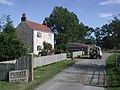
 Hill Cottage on Seaside Road, Aldbrough - geograph.org.uk - 4133853.jpg 1 600 × 1 064; 696 KB


_-_geograph.org.uk_-_5719827.jpg)


.jpg)


.jpg)


_-_geograph.org.uk_-_2199303.jpg)


.jpg)


.jpg)


.jpg)
.jpg)


_-_geograph.org.uk_-_5719830.jpg)
_-_geograph.org.uk_-_5719841.jpg)


_-_geograph.org.uk_-_203817.jpg)
_-_geograph.org.uk_-_2240743.jpg)


.jpg)


.jpg)

.jpg)


.jpg)
.jpg)
.jpg)


.jpg)


.jpg)
_-_geograph.org.uk_-_204258.jpg)


.jpg)

