Category:Allenton
Перайсці да навігацыі
Перайсці да пошуку
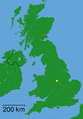
suburb of the city of Derby, England  | |||||
| Запампаваць медыя | |||||
| Гэта | |||||
|---|---|---|---|---|---|
| Месцазнаходжанне | Дэрбі, Дэрбішыр, Усходні Мідленд, Англія | ||||
 | |||||
Падкатэгорыі
Паказаны 3 падкатэгорыі з 3.
A
- Allenton hippopotamus (16 F)
- Allenton War Memorial (3 F)
D
- Derby War Memorial Village (1 F)
Мультымедыя ў катэгорыі "Allenton"
У гэтай катэгорыі ёсць 71 файл.
-
 Allen Park Centre and Allenton Library - geograph.org.uk - 2794701.jpg 3 648 × 2 736; 4,94 MB
-
 Allenton - City of Derby dot.png 1 802 × 2 589; 189 KB
-
 Allenton Library - geograph.org.uk - 2943329.jpg 1 200 × 900; 227 KB
-
 Allenton Royal British Legion - geograph.org.uk - 3557585.jpg 640 × 480; 50 KB
-
 Allenton tower - panoramio.jpg 3 072 × 2 304; 1,28 MB
-
 Allenton23.JPG 1 280 × 960; 188 KB
-
 Allenton324.JPG 1 280 × 960; 257 KB
-
 Bargain Booze attracts seagulls - geograph.org.uk - 2794699.jpg 3 648 × 2 736; 4,61 MB
-
 Boulton Lane crossing - geograph.org.uk - 3642342.jpg 1 280 × 960; 434 KB
-

-
 Building a new Aldi - geograph.org.uk - 4273938.jpg 1 200 × 900; 156 KB
-
 Bus stop, Boulton Lane, Alvaston - geograph.org.uk - 6191618.jpg 1 024 × 768; 190 KB
-
 Bus stop, Chellaston Road - geograph.org.uk - 3645059.jpg 1 280 × 946; 275 KB
-
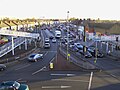
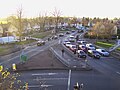
 Busy Crossroads in Allenton - geograph.org.uk - 4294480.jpg 4 000 × 3 000; 3,37 MB
-
 Chellaston Road (A514) - geograph.org.uk - 3557587.jpg 640 × 480; 71 KB
-
 Convenience store, Boulton Lane - geograph.org.uk - 3645007.jpg 1 280 × 960; 231 KB
-
 Crown and Arrows - geograph.org.uk - 2794717.jpg 3 648 × 2 736; 4,35 MB
-
 Crown and Arrows - geograph.org.uk - 3596261.jpg 640 × 427; 330 KB
-
 Cycle path and signs - geograph.org.uk - 3598210.jpg 640 × 427; 130 KB
-
 Cycle Route 6 through Osmaton, Derby - geograph.org.uk - 2933934.jpg 4 000 × 3 000; 4,69 MB
-
 Cycleway junction - geograph.org.uk - 3642338.jpg 1 280 × 960; 299 KB
-
 Derby Allenton Hippo.jpg 1 024 × 1 280; 102 KB
-
 Derby Canal footpath and cycleway - geograph.org.uk - 3642361.jpg 1 280 × 960; 378 KB
-

-

-
 Derby Canal path, Allenton (1) - geograph.org.uk - 6191625.jpg 1 024 × 768; 241 KB
-
 Derby Canal path, Allenton (2) - geograph.org.uk - 6191628.jpg 1 024 × 768; 269 KB
-
 Derby War Memorial Village - geograph.org.uk - 2794706.jpg 3 648 × 2 736; 5,74 MB
-
 Derby War Memorial Village - geograph.org.uk - 3645028.jpg 1 280 × 960; 418 KB
-

-

-
 Harvey Road - geograph.org.uk - 5341174.jpg 2 000 × 1 333; 2,27 MB
-
 Harvey Road entering Alvaston - geograph.org.uk - 6191646.jpg 1 024 × 768; 161 KB
-
 Hippo sign.jpg 3 264 × 2 448; 3,42 MB
-
 Housing alongside the Derby Canal path - geograph.org.uk - 3642335.jpg 1 280 × 946; 241 KB
-
 Location of Boulton Lane Canal Bridge (2) - geograph.org.uk - 1975902.jpg 1 280 × 960; 374 KB
-
 Location of Boulton Lane Canal Bridge - geograph.org.uk - 1975895.jpg 1 280 × 960; 344 KB
-
 Merrill Way in Allenton - geograph.org.uk - 4294450.jpg 4 000 × 3 000; 2,96 MB
-
 Merrill Way, Allenton - geograph.org.uk - 3645044.jpg 1 280 × 960; 392 KB
-

-

-
 Old Cast Iron Milepost - geograph.org.uk - 3274159.jpg 768 × 1 024; 298 KB
-
 Old Milepost - geograph.org.uk - 3274162.jpg 1 024 × 768; 298 KB
-

-
 Old section of Sinfin Avenue - geograph.org.uk - 3245205.jpg 1 200 × 900; 415 KB
-
 Old Upper Moor Practice - geograph.org.uk - 2943318.jpg 1 200 × 900; 266 KB
-
 Pavement, Boulton Lane, Alvaston - geograph.org.uk - 6191621.jpg 1 024 × 768; 186 KB
-
 Penalton Close, Allenton - geograph.org.uk - 6191640.jpg 1 024 × 768; 205 KB
-
 Presco - geograph.org.uk - 3598181.jpg 640 × 427; 166 KB
-
 PSM V74 D247 August fendler home in allenton missouri.png 1 201 × 1 598; 1,37 MB
-
 Rolls Royce Exhibition Centre - geograph.org.uk - 4916298.jpg 2 000 × 866; 1,49 MB
-
 Shelton Lock - geograph.org.uk - 5445496.jpg 2 000 × 1 333; 2,42 MB
-
 Sinfin Avenue - geograph.org.uk - 3640755.jpg 1 280 × 960; 299 KB
-
 Site of Former Boulton Lane Post Office - geograph.org.uk - 1975710.jpg 1 280 × 960; 194 KB
-
 Site of the demolished Merrill School - geograph.org.uk - 1977614.jpg 1 280 × 960; 359 KB
-
 Spencer Avenue, Allenton - geograph.org.uk - 3645040.jpg 1 280 × 960; 233 KB
-
 Spider Bridge - geograph.org.uk - 5341170.jpg 2 000 × 1 333; 1,99 MB
-
 SpiderE.JPG 2 576 × 1 932; 907 KB
-
 SpiderN.JPG 2 576 × 1 932; 1,09 MB
-
 SpiderNE.JPG 2 576 × 1 932; 975 KB
-
 SpiderNW.JPG 2 576 × 1 932; 1,14 MB
-
 SpiderS.JPG 2 576 × 1 932; 1,03 MB
-
 SpiderSE.JPG 2 576 × 1 932; 1 MB
-
 SpiderSW.JPG 2 576 × 1 932; 971 KB
-
 SpiderW.JPG 2 576 × 1 932; 1,04 MB
-
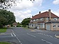
 The Crown - Allenton - geograph.org.uk - 2920439.jpg 3 538 × 2 168; 2,03 MB
-
 The Crown - geograph.org.uk - 5341164.jpg 2 000 × 1 333; 1,99 MB
-
 The Crown pub - geograph.org.uk - 3557589.jpg 640 × 480; 60 KB
-
 Walton Avenue, Allenton - geograph.org.uk - 3645037.jpg 1 280 × 960; 246 KB
-
 West end of Brackens Lane, Alvaston - geograph.org.uk - 6191632.jpg 1 024 × 768; 210 KB
-
 Wilmore Road - geograph.org.uk - 4915660.jpg 2 000 × 1 333; 1,08 MB


_-_geograph.org.uk_-_3557587.jpg)


_-_geograph.org.uk_-_6191625.jpg)
_-_geograph.org.uk_-_6191628.jpg)


_-_geograph.org.uk_-_3196268.jpg)


_-_geograph.org.uk_-_1975902.jpg)


