Category:Allerton Bywater
Aller à la navigation
Aller à la recherche
village britannique  | |||||
| Téléverser des médias | |||||
| Nature de l’élément | |||||
|---|---|---|---|---|---|
| Lieu | cité de Leeds, Yorkshire de l'Ouest, Yorkshire-et-Humber, Angleterre | ||||
 | |||||
English: Allerton Bywater is a semi-rural village and civil parish in the south-east of City of Leeds metropolitan borough in West Yorkshire, England. The village itself is north of Castleford and lies in the WF10 Castleford postcode area. The River Aire flows through the village to the south-west.
Nederlands: Allerton Bywater is een dorp (village) en civil parish in het bestuurlijke gebied City of Leeds, in het Engelse graafschap West Yorkshire. De civil parish telt
Sous-catégories
Cette catégorie comprend 8 sous-catégories, dont les 8 ci-dessous.
Média dans la catégorie « Allerton Bywater »
Cette catégorie comprend 246 fichiers, dont les 200 ci-dessous.
(page précédente) (page suivante)-
 A missing bridge at Doctor's Lane - geograph.org.uk - 3284242.jpg 1 024 × 768 ; 255 kio
-
 A place to pause, Allerton Bywater - geograph.org.uk - 3284325.jpg 1 024 × 768 ; 107 kio
-
 A walk from Glass Houghton ^67 - geograph.org.uk - 1997061.jpg 800 × 600 ; 213 kio
-
 A656 (Roman road) heading north - geograph.org.uk - 2627721.jpg 1 600 × 1 200 ; 506 kio
-
 A656 Junction - geograph.org.uk - 258895.jpg 640 × 386 ; 34 kio
-
 ABC Children's Daycare Centre - Park Lane - geograph.org.uk - 5137712.jpg 640 × 408 ; 60 kio
-
 Access to Hollinhurst - off Leeds Road - geograph.org.uk - 5057803.jpg 640 × 480 ; 68 kio
-
 After the deluge - geograph.org.uk - 952570.jpg 640 × 444 ; 242 kio
-
 Agriculture and industry - geograph.org.uk - 1056362.jpg 640 × 453 ; 228 kio
-
 Aire and Calder Confluence - geograph.org.uk - 2344968.jpg 640 × 433 ; 34 kio
-
 Aire and Calder Navigation - geograph.org.uk - 2627723.jpg 1 600 × 1 200 ; 286 kio
-
 Aire ^ Calder Navigation at Castleford - geograph.org.uk - 4446033.jpg 1 600 × 1 062 ; 507 kio
-
 ALLERTON 10.jpg 1 186 × 1 384 ; 382 kio
-
 ALLERTON 11.jpg 1 299 × 924 ; 259 kio
-
 ALLERTON 12.jpg 1 181 × 653 ; 265 kio
-
 ALLERTON 13.jpg 1 653 × 1 170 ; 218 kio
-
 ALLERTON 14.jpg 1 655 × 1 177 ; 174 kio
-
 ALLERTON 15.jpg 1 647 × 1 173 ; 156 kio
-
 ALLERTON 2.jpg 1 379 × 952 ; 125 kio
-
 ALLERTON 3.jpg 1 677 × 1 077 ; 220 kio
-
 ALLERTON 4.jpg 4 117 × 2 744 ; 3,35 Mio
-
 ALLERTON 5.jpg 4 961 × 3 528 ; 2,62 Mio
-
 ALLERTON 6.jpg 2 046 × 1 490 ; 703 kio
-
 ALLERTON 7.jpg 1 429 × 564 ; 216 kio
-
 ALLERTON 8.jpg 1 589 × 981 ; 605 kio
-
 ALLERTON 9.jpg 1 628 × 1 147 ; 276 kio
-
 Allerton Bywater - Allerton Ings.jpg 640 × 457 ; 356 kio
-
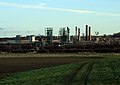
 Allerton Bywater Colliery Memorial - geograph.org.uk - 3662732.jpg 640 × 480 ; 95 kio
-

-

-
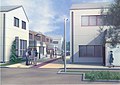
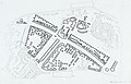
 Allerton Bywater Millennium Community - geograph.org.uk - 3284298.jpg 1 024 × 768 ; 116 kio
-
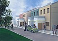
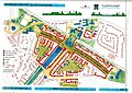
 ALLERTON BYWATER MILLENNIUM COMMUNITY.jpg 4 154 × 2 848 ; 3,47 Mio
-
 Allerton Bywater Millennium Village - geograph.org.uk - 2301597.jpg 1 024 × 768 ; 114 kio
-
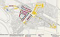
 Allerton Bywater Networkcentre (sic) - geograph.org.uk - 2301621.jpg 1 024 × 768 ; 118 kio
-
 Allerton Bywater Service Station on Bransdale Road - geograph.org.uk - 4447920.jpg 1 600 × 1 062 ; 604 kio
-
 Allerton Bywater, an old K8 phone box - geograph.org.uk - 3257975.jpg 480 × 640 ; 103 kio
-

-
 Allerton Bywater, the post office - geograph.org.uk - 3257974.jpg 480 × 640 ; 56 kio
-
 Allerton Ings - geograph.org.uk - 900777.jpg 640 × 463 ; 248 kio
-
 Allotments - Leeds Road, Allerton Bywater - geograph.org.uk - 741082.jpg 640 × 420 ; 57 kio
-
 Back Lane - looking towards Station Road - geograph.org.uk - 5136844.jpg 640 × 463 ; 64 kio
-
 Back Lane - Station Road - geograph.org.uk - 5136850.jpg 640 × 480 ; 68 kio
-
 Barnsdale Road towards Allerton Bywater - geograph.org.uk - 1481289.jpg 640 × 480 ; 54 kio
-
 Barnsdale Road towards Allerton Bywater - geograph.org.uk - 1481296.jpg 640 × 480 ; 64 kio
-
 Beeston Way - Station Road - geograph.org.uk - 5136789.jpg 640 × 450 ; 81 kio
-
 Beeston Way Allerton Bywater - geograph.org.uk - 2775833.jpg 3 821 × 2 771 ; 2,16 Mio
-
 Boat Lane - geograph.org.uk - 667501.jpg 640 × 460 ; 109 kio
-
 Boat Lane - viewed from Main Street - geograph.org.uk - 5136843.jpg 640 × 480 ; 81 kio
-
 Boundary stone, Great ^ Little Preston parish - geograph.org.uk - 3284145.jpg 1 024 × 768 ; 194 kio
-
 Bowers Junction (once Bowers Halt) - geograph.org.uk - 3283247.jpg 1 024 × 768 ; 153 kio
-
 Bridge carrying Brigshaw Lane over The Lines - geograph.org.uk - 3284196.jpg 1 024 × 768 ; 204 kio
-
 Brigshaw Drive - Brigshaw Lane - geograph.org.uk - 5057771.jpg 640 × 480 ; 51 kio
-
 Brigshaw Drive - Preston Lane - geograph.org.uk - 5057774.jpg 640 × 480 ; 68 kio
-
 Brigshaw Lane - geograph.org.uk - 963969.jpg 640 × 480 ; 67 kio
-
 Brigshaw Lane - Preston Lane - geograph.org.uk - 5057762.jpg 640 × 480 ; 68 kio
-
 Brigshaw Lane towards Kippax - geograph.org.uk - 5794596.jpg 1 600 × 1 200 ; 437 kio
-
 Bus stops on Park Lane - geograph.org.uk - 2301504.jpg 1 024 × 768 ; 123 kio
-
 Buttress of a former railway bridge, along The Lines - geograph.org.uk - 3283261.jpg 1 024 × 768 ; 233 kio
-
 Bywater Walk, Allerton Bywater Millennium Village - geograph.org.uk - 2301608.jpg 1 024 × 768 ; 146 kio
-
 Canal Boats at Castleford - geograph.org.uk - 4445968.jpg 1 600 × 1 062 ; 656 kio
-
 Carlton View, Woodend - geograph.org.uk - 2628187.jpg 1 600 × 1 200 ; 373 kio
-
 Castleford Junction, looking north - geograph.org.uk - 4580381.jpg 1 024 × 768 ; 170 kio
-
 Castleford Packet Office - geograph.org.uk - 2784365.jpg 2 420 × 1 618 ; 563 kio
-

-
 Children's play area, Boat Inn, Allerton Bywater - geograph.org.uk - 3021728.jpg 4 320 × 3 240 ; 4,65 Mio
-
 Community corner - geograph.org.uk - 2301557.jpg 1 024 × 768 ; 141 kio
-
 Confluence of Rivers Calder and Aire - geograph.org.uk - 2120685.jpg 3 160 × 2 329 ; 1,08 Mio
-
 Confluence of the river Aire ^ river Calder at Castleford - geograph.org.uk - 2775783.jpg 4 288 × 3 216 ; 2,68 Mio
-
 Construction Site - Haigh Moor Way - geograph.org.uk - 5137439.jpg 640 × 480 ; 72 kio
-
 Cricket Ground - Back Lane - geograph.org.uk - 5136847.jpg 640 × 480 ; 97 kio
-
 Cruising down the River - geograph.org.uk - 3041571.jpg 3 045 × 2 039 ; 1,6 Mio
-
 Cycle way - Leeds Road - geograph.org.uk - 5058063.jpg 640 × 480 ; 78 kio
-
 Cyclist heading south along The Lines - geograph.org.uk - 3283276.jpg 1 024 × 768 ; 188 kio
-
 Darby Way - Haigh Moor Way - geograph.org.uk - 5137440.jpg 640 × 480 ; 85 kio
-
 Davy Road - viewed from Watt Avenue - geograph.org.uk - 5137457.jpg 640 × 480 ; 73 kio
-
 Davy Road - viewed from Watt Avenue - geograph.org.uk - 5137492.jpg 640 × 480 ; 91 kio
-
 Decision time, north-east of The Lines - geograph.org.uk - 3284235.jpg 1 024 × 768 ; 119 kio
-
 Disused railway line - Allerton Bywater - geograph.org.uk - 121899.jpg 640 × 479 ; 136 kio
-
 Doctor's Lane, north of The Lines - geograph.org.uk - 3284253.jpg 1 024 × 768 ; 215 kio
-
 Electricity Substation No 3580 - Leeds Road - geograph.org.uk - 5057844.jpg 640 × 480 ; 86 kio
-

-

-
 Electricity Substation No 4252 - Station Road - geograph.org.uk - 5136871.jpg 640 × 502 ; 134 kio
-
-

-
 Extension of The Lines, south of Park Lane - geograph.org.uk - 3284313.jpg 1 024 × 768 ; 187 kio
-
 Farmland north-east of The Lines - geograph.org.uk - 3283252.jpg 1 024 × 768 ; 137 kio
-
 Farmland north-east of The Lines - geograph.org.uk - 3284285.jpg 1 024 × 768 ; 160 kio
-
 Farmland south-east of Great Preston - geograph.org.uk - 3284116.jpg 1 024 × 768 ; 158 kio
-
 Field on Roman Ridge - geograph.org.uk - 2301569.jpg 1 024 × 768 ; 172 kio
-
 Fieldfare Drive - Goldcrest Road - geograph.org.uk - 5137501.jpg 640 × 480 ; 68 kio
-
 Flockton Road - Beeston Way - geograph.org.uk - 5137498.jpg 640 × 480 ; 67 kio
-
 Flockton Road - viewed from Redpoll Drive - geograph.org.uk - 5137507.jpg 640 × 480 ; 76 kio
-
 Flood defences, Allerton Bywater - geograph.org.uk - 3021716.jpg 4 320 × 3 240 ; 4,52 Mio
-
 Flooded stubble field - geograph.org.uk - 952633.jpg 640 × 428 ; 213 kio
-
 Flooding alongside The Lines at Woodend - geograph.org.uk - 3283271.jpg 1 024 × 768 ; 187 kio
-
 Flooding on The Lines, north of Brigshaw Lane - geograph.org.uk - 3284186.jpg 1 024 × 768 ; 193 kio
-
 Footpath - Leeds Road - geograph.org.uk - 5057847.jpg 480 × 640 ; 86 kio
-
 Footpath - Main Street - geograph.org.uk - 5136835.jpg 640 × 480 ; 91 kio
-
 Footpath - Main Street - geograph.org.uk - 5136837.jpg 640 × 480 ; 103 kio
-
 Footpath - Station Road - geograph.org.uk - 5136787.jpg 640 × 480 ; 115 kio
-
 Footpath - Station Road - geograph.org.uk - 5136886.jpg 640 × 480 ; 142 kio
-
 Footpath from Flood Defence Bank to Allerton Bywater - geograph.org.uk - 3021740.jpg 4 320 × 3 240 ; 4,59 Mio
-
 Footpath from Letchmire Pastures to Barnsdale Road, Allerton Bywater - geograph.org.uk - 3021759.jpg 4 320 × 3 240 ; 4,78 Mio
-
 Footpath to Queen Street from former railway line - geograph.org.uk - 3283205.jpg 1 024 × 768 ; 169 kio
-
 Footpath towards Allerton Bywater - geograph.org.uk - 4974709.jpg 1 600 × 1 200 ; 634 kio
-
 Former wharf, off Boat Lane, Allerton Bywater - geograph.org.uk - 4580762.jpg 1 024 × 768 ; 127 kio
-
 Gadwall Drive - Flockton Road - geograph.org.uk - 5137699.jpg 640 × 480 ; 76 kio
-
 Gadwall Drive - Siskin Way - geograph.org.uk - 5137503.jpg 640 × 480 ; 89 kio
-
 Goldcrest Road - Beeston Way - geograph.org.uk - 5137499.jpg 640 × 480 ; 80 kio
-
 Grazing land off the A656 - geograph.org.uk - 2627718.jpg 1 600 × 1 200 ; 444 kio
-
 Haigh Moor Way - viewed from Letchmire Road - geograph.org.uk - 5137438.jpg 640 × 480 ; 75 kio
-
 Heading for Castleford - geograph.org.uk - 5655651.jpg 4 608 × 3 456 ; 3,97 Mio
-
 Highfield Crescent - Leeds Road - geograph.org.uk - 5058075.jpg 640 × 480 ; 66 kio
-
 Highfield Green - Highfield Crescent - geograph.org.uk - 5058079.jpg 640 × 480 ; 64 kio
-

-

-

-
 Highfield Place - Highfield Crescent - geograph.org.uk - 5058085.jpg 640 × 480 ; 61 kio
-
 Hirst Street - Brigshaw Lane - geograph.org.uk - 5057767.jpg 640 × 480 ; 66 kio
-
 Holling Grove - Leeds Road - geograph.org.uk - 5057799.jpg 640 × 480 ; 64 kio
-
 Houses in Glencoe Gardens, Great Preston - geograph.org.uk - 3284158.jpg 1 024 × 768 ; 102 kio
-
 Houses on Blands Terrace - geograph.org.uk - 3284263.jpg 1 024 × 768 ; 182 kio
-
 Houses on Westfield Grove - geograph.org.uk - 3284220.jpg 1 024 × 768 ; 162 kio
-
 Jogger on The Lines - geograph.org.uk - 3284276.jpg 1 024 × 768 ; 219 kio
-
 King Edward Avenue - Leeds Road - geograph.org.uk - 5058056.jpg 640 × 480 ; 65 kio
-
 Lady Teal Hotel Boat - geograph.org.uk - 5653245.jpg 4 608 × 3 456 ; 3,73 Mio
-
 Lake near the River Aire - geograph.org.uk - 2628180.jpg 1 600 × 1 200 ; 541 kio
-
 Leeds Road - viewed from Highfield Crescent - geograph.org.uk - 5058102.jpg 640 × 480 ; 49 kio
-
 Leeds Road - viewed from Highfield Crescent - geograph.org.uk - 5058106.jpg 640 × 480 ; 69 kio
-
 Leeds Road - viewed from near Preston Lane - geograph.org.uk - 5057798.jpg 640 × 480 ; 74 kio
-
 Leeds Road - viewed from Preston Lane - geograph.org.uk - 5057797.jpg 640 × 480 ; 61 kio
-
 Leeds Road, Allerton Bywater - geograph.org.uk - 4447927.jpg 1 600 × 1 051 ; 585 kio
-
 Leeds Road, Allerton Bywater - geograph.org.uk - 4447931.jpg 1 600 × 1 062 ; 528 kio
-
 Leeds Road, Woodend - geograph.org.uk - 4447933.jpg 1 600 × 1 062 ; 604 kio
-
 Leeds Road, Woodend - geograph.org.uk - 4448090.jpg 1 600 × 1 113 ; 736 kio
-
 Letchmire Pastures Nature Reserve - geograph.org.uk - 3021559.jpg 4 320 × 3 240 ; 4,6 Mio
-

-
 Letchmire Road - Station Road - geograph.org.uk - 5137434.jpg 640 × 480 ; 68 kio
-
 Line of pylons towards Allerton Bywater - geograph.org.uk - 4974732.jpg 1 600 × 1 200 ; 343 kio
-
 Lock Lane canal bridge Castleford - geograph.org.uk - 2775806.jpg 4 067 × 2 906 ; 1,89 Mio
-
 Lockside angling club - geograph.org.uk - 5663764.jpg 3 804 × 2 670 ; 1,73 Mio
-
 Main Street - viewed from Robinson Street - geograph.org.uk - 5136797.jpg 640 × 459 ; 86 kio
-
 Main Street - viewed from Station Road - geograph.org.uk - 5136773.jpg 640 × 480 ; 62 kio
-
 Manor Park Avenue - Leeds Road - geograph.org.uk - 741077.jpg 640 × 427 ; 42 kio
-
 Middleton Road - Park Lane - geograph.org.uk - 5137705.jpg 640 × 480 ; 75 kio
-
 Middleton Road - viewed from Flockton Road - geograph.org.uk - 5137701.jpg 640 × 480 ; 93 kio
-
 Millennium Village Allerton Bywater Castleford - geograph.org.uk - 2775821.jpg 4 288 × 3 216 ; 2,12 Mio
-
 Millennium Village Play Area at Allerton Bywater - geograph.org.uk - 2775837.jpg 4 288 × 3 216 ; 2,09 Mio
-
 Narrowboat at Allerton Bywater - geograph.org.uk - 5655653.jpg 4 608 × 3 456 ; 3,74 Mio
-
 Narrowboat Petronella - geograph.org.uk - 3041564.jpg 4 063 × 2 900 ; 2,41 Mio
-
 Newton Ings - geograph.org.uk - 827170.jpg 640 × 472 ; 60 kio
-
 Ninevah Lane - Leeds Road - geograph.org.uk - 5058065.jpg 640 × 480 ; 77 kio
-
 Ninevah Lane - looking towards Leeds Road - geograph.org.uk - 5058071.jpg 640 × 480 ; 67 kio
-
 Nova Scotia Medical Centre - Leeds Road - geograph.org.uk - 741074.jpg 640 × 450 ; 52 kio
-
 Old milestone (geograph 6823103).jpg 1 200 × 1 600 ; 631 kio
-
 Park Avenue, east side - geograph.org.uk - 2301518.jpg 1 024 × 768 ; 111 kio
-
 Park Avenue, north side - geograph.org.uk - 2301514.jpg 1 024 × 768 ; 136 kio
-
 Park Avenue, south side - geograph.org.uk - 2301525.jpg 1 024 × 768 ; 114 kio
-
 Park Avenue, west side - geograph.org.uk - 2301533.jpg 1 024 × 768 ; 121 kio
-
 Park Lane - viewed from Middleton Road - geograph.org.uk - 5137707.jpg 640 × 480 ; 60 kio
-
 Park Lane - viewed from Middleton Road - geograph.org.uk - 5137709.jpg 640 × 480 ; 69 kio
-
 Path to the Boat - geograph.org.uk - 667527.jpg 640 × 446 ; 95 kio
-
 Pharmacy on Leeds Road - geograph.org.uk - 2628185.jpg 1 600 × 1 200 ; 367 kio
-
 Play Area - Beeston Way - geograph.org.uk - 5137497.jpg 640 × 480 ; 91 kio
-
 Playing field, off Park Lane - geograph.org.uk - 2301563.jpg 1 024 × 768 ; 100 kio
-
 Pond and carr, south of Great Preston - geograph.org.uk - 3284125.jpg 1 024 × 768 ; 235 kio
-
-
 Power line across the River Aire - geograph.org.uk - 5691339.jpg 3 990 × 2 661 ; 2,31 Mio
-
 Premier Convenience Store - Leeds Road - geograph.org.uk - 5057796.jpg 640 × 426 ; 50 kio
-
 Preston Lane - viewed from Brigshaw Lane - geograph.org.uk - 5057764.jpg 640 × 480 ; 82 kio
-
 Preston Lane - viewed from Brigshaw Lane - geograph.org.uk - 5057765.jpg 640 × 480 ; 66 kio
-
 Preston Lane, Woodend - geograph.org.uk - 2628191.jpg 1 600 × 1 200 ; 369 kio
-
 Prince Street - Brigshaw Lane - geograph.org.uk - 5057769.jpg 640 × 480 ; 53 kio
-
 Pumping Station - Station Road - geograph.org.uk - 5136881.jpg 640 × 480 ; 114 kio
-
 Radiance M on the Aire ^ Calder Navigation at Castleford - geograph.org.uk - 4445925.jpg 1 600 × 1 062 ; 1,12 Mio
-
 Redpoll Drive - Flockton Road - geograph.org.uk - 5137698.jpg 640 × 480 ; 77 kio
-
 Redpoll Drive - Siskin Way - geograph.org.uk - 5137504.jpg 640 × 480 ; 80 kio
-
 Redpoll Drive - Siskin Way - geograph.org.uk - 5137505.jpg 640 × 404 ; 54 kio
-
 River Confluence - geograph.org.uk - 5655647.jpg 4 608 × 3 456 ; 3,66 Mio
-

-
 Robinson Street - Station Road - geograph.org.uk - 5136792.jpg 640 × 457 ; 56 kio
-
 Route of a drain, east of Lowther lake - geograph.org.uk - 6130922.jpg 1 600 × 1 200 ; 560 kio
-
 Sirocco Avenue - Darby Way - geograph.org.uk - 5137448.jpg 640 × 480 ; 87 kio
-
 Sirocco Avenue - Warren House Road - geograph.org.uk - 5137495.jpg 640 × 480 ; 70 kio
-
 Siskin Way - Fieldfare Drive - geograph.org.uk - 5137502.jpg 640 × 480 ; 81 kio
-
 Soggy summer - geograph.org.uk - 952644.jpg 640 × 472 ; 232 kio
-
 Southern entry to "The Lines" - geograph.org.uk - 259633.jpg 540 × 640 ; 88 kio
-
 St Aidan's RSPB Reserve.jpg 4 000 × 2 248 ; 2 Mio
-
 St Aidan's RSPB reserve.jpg 4 000 × 2 248 ; 1,83 Mio
-

-

-
 Station Road - viewed from Main Street - geograph.org.uk - 5136775.jpg 640 × 480 ; 62 kio
-
 Station Terrace - Station Road - geograph.org.uk - 5136889.jpg 640 × 480 ; 72 kio
-
 Substation and garage - geograph.org.uk - 2301544.jpg 1 024 × 768 ; 196 kio
-
 Summer evening strollers - geograph.org.uk - 900808.jpg 640 × 468 ; 270 kio
-
 The Aire and Calder Navigation Canal Castleford - geograph.org.uk - 3041550.jpg 2 002 × 1 435 ; 537 kio
-
 The Anchor - Victoria Street - geograph.org.uk - 5136786.jpg 640 × 469 ; 59 kio
-
 The Boat Inn Allerton Bywater - geograph.org.uk - 3041575.jpg 3 716 × 2 936 ; 1,73 Mio
-
 The Boat inn Allerton Bywater - geograph.org.uk - 5691332.jpg 3 733 × 2 377 ; 2,46 Mio


_heading_north_-_geograph.org.uk_-_2627721.jpg)


_-_geograph.org.uk_-_2301621.jpg)


_-_geograph.org.uk_-_3283247.jpg)


.jpg)


