Category:Amenthes quadrangle
Zur Navigation springen
Zur Suche springen
English: The Amenthes quadrangle is one of a series of 30 quadrangle maps of Mars used by the United States Geological Survey (USGS) Astrogeology Research Program. The Amenthes quadrangle is also referred to as MC-14 (Mars Chart-14). See link for map of this area.

gehört zu den 30 Gradfeldern des Mars  | |||||
| Medium hochladen | |||||
| Ist ein(e) |
| ||||
|---|---|---|---|---|---|
| Auf astronomischem Körper | |||||
| |||||
Unterkategorien
Es werden 23 von insgesamt 23 Unterkategorien in dieser Kategorie angezeigt:
In Klammern die Anzahl der enthaltenen Kategorien (K), Seiten (S), Dateien (D)
!
- Maps of Amenthes quadrangle (6 D)
*
A
- Amenthes Cavi (1 D)
- Amenthes Fossae (6 D)
- Amenthes Planum (13 D)
- Amenthes Rupes (1 D)
E
G
- Granicus Valles (38 D)
H
- Hebrus Valles (11 D)
- Hephaestus Fossae (20 D)
- Hephaestus Rupes (2 D)
- Hyblaeus Dorsa (2 D)
- Hyblaeus Fossae (5 D)
L
- Libya Montes (28 D)
N
- Nepenthes Mensae (16 D)
- Nepenthes Planum (1 D)
T
U
- Utopia Rupes (3 D)
Medien in der Kategorie „Amenthes quadrangle“
Folgende 14 Dateien sind in dieser Kategorie, von 14 insgesamt.
-
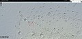
 570770 2100cones.jpg 1.307 × 618; 430 KB
-
 Chafe crater.jpg 1.915 × 922; 280 KB
-
 ESP 045860 2085streamlinedbottom.jpg 1.894 × 835; 338 KB
-
 ESP 045860 2085streamlinedmiddle.jpg 1.909 × 832; 343 KB
-
 ESP 045860 2085streamlinedtop.jpg 1.905 × 840; 338 KB
-
 ESP 045860 2085streamlineduppertop.jpg 1.897 × 842; 315 KB
-
 ESP 048023 2040conestroughs.jpg 2.048 × 5.080; 2,61 MB
-
 ESP 048050 2025cones.jpg 2.048 × 4.560; 2,25 MB
-
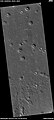
 Onon Crater.JPG 617 × 460; 33 KB
-
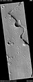
 PIA00174-MC-14-AmenthesRegion-19980605 granicus and tinjar valles.jpg 823 × 572; 173 KB
-
 PIA00174-MC-14-AmenthesRegion-19980605 nakhlite crater.jpg 98 × 116; 5 KB
-
 PIA00174-MC-14-AmenthesRegion-19980605.jpg 7.170 × 4.991; 2,76 MB
-
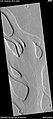 Streamlined shapes in channel ESP 054919 2015.jpg 1.367 × 3.065; 816 KB
-
 USGS-Mars-MC-14-AmenthesRegion-mola.png 2.499 × 1.999; 5,19 MB


