Category:Amenthes quadrangle
नेविगेशन पर जाएँ
खोज पर जाएँ
English: The Amenthes quadrangle is one of a series of 30 quadrangle maps of Mars used by the United States Geological Survey (USGS) Astrogeology Research Program. The Amenthes quadrangle is also referred to as MC-14 (Mars Chart-14). See link for map of this area.

one of a series of 30 quadrangle maps of Mars used by the United States Geological Survey Astrogeology Research Program  | |||||
| मीडिया अपलोड करें | |||||
| जिसका उदाहरण है |
| ||||
|---|---|---|---|---|---|
| Located on astronomical body | |||||
| |||||
उपश्रेणियाँ
इस श्रेणी की कुल २३ में से २३ उपश्रेणियाँ निम्नलिखित हैं।
!
- Maps of Amenthes quadrangle (6 F)
*
A
- Amenthes Cavi (1 F)
- Amenthes Fossae (6 F)
- Amenthes Planum (13 F)
- Amenthes Rupes (1 F)
E
G
- Granicus Valles (38 F)
H
- Hebrus Valles (11 F)
- Hephaestus Fossae (20 F)
- Hephaestus Rupes (2 F)
- Hyblaeus Dorsa (2 F)
- Hyblaeus Fossae (5 F)
L
- Libya Montes (28 F)
N
- Nepenthes Mensae (16 F)
- Nepenthes Planum (1 F)
T
U
- Utopia Rupes (3 F)
"Amenthes quadrangle" श्रेणी में मीडिया
इस श्रेणी की कुल १४ में से १४ चित्र निम्नलिखित हैं।
-
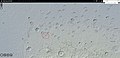
 570770 2100cones.jpg १,३०७ × ६१८; ४३० KB
-
 Chafe crater.jpg १,९१५ × ९२२; २८० KB
-
 ESP 045860 2085streamlinedbottom.jpg १,८९४ × ८३५; ३३८ KB
-
 ESP 045860 2085streamlinedmiddle.jpg १,९०९ × ८३२; ३४३ KB
-
 ESP 045860 2085streamlinedtop.jpg १,९०५ × ८४०; ३३८ KB
-
 ESP 045860 2085streamlineduppertop.jpg १,८९७ × ८४२; ३१५ KB
-
 ESP 048023 2040conestroughs.jpg २,०४८ × ५,०८०; २.६१ MB
-
 ESP 048050 2025cones.jpg २,०४८ × ४,५६०; २.२५ MB
-
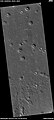
 Onon Crater.JPG ६१७ × ४६०; ३३ KB
-
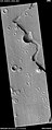
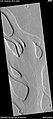
 PIA00174-MC-14-AmenthesRegion-19980605 granicus and tinjar valles.jpg ८२३ × ५७२; १७३ KB
-
 PIA00174-MC-14-AmenthesRegion-19980605 nakhlite crater.jpg ९८ × ११६; ५ KB
-
 PIA00174-MC-14-AmenthesRegion-19980605.jpg ७,१७० × ४,९९१; २.७६ MB
-
 Streamlined shapes in channel ESP 054919 2015.jpg १,३६७ × ३,०६५; ८१६ KB
-
 USGS-Mars-MC-14-AmenthesRegion-mola.png २,४९९ × १,९९९; ५.१९ MB


