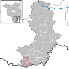
Category:Amt Ortrand
Salti al navigilo
Salti al serĉilo
| Pozicio de la objekto | | Mapo de cxiuj koordinatoj per: OpenStreetMap |
|---|
Collective municipality in Brandenburg state, Germany | |||||
| Alŝuti plurmedion | |||||
| Estas |
| ||||
|---|---|---|---|---|---|
| Loko | Distrikto Oberspreewald-Lausitz, Brandenburgio, Germanio | ||||
| Loĝantaro |
| ||||
| oficiala retejo | |||||
 | |||||
Subkategorioj
Ĉi tiu kategorio havas la 7 jenajn subkategoriojn, el 7 entute.
F
G
K
L
O
S
T
Dosieroj en kategorio “Amt Ortrand”
La jenaj 2 dosieroj estas en ĉi tiu kategorio, el 2 entute.
-
Amt Ortrand in OSL.svg 2 813 × 2 813; 765 KB
-
Rathaus Ortrand 2020-07-04 3.jpg 3 648 × 2 736; 2,45 MB


