Category:Ancrum
Zur Navigation springen
Zur Suche springen
Dorf im Vereinigten Königreich  | |||||
| Medium hochladen | |||||
| Ist ein(e) | |||||
|---|---|---|---|---|---|
| Ort |
| ||||
| Einwohnerzahl |
| ||||
 | |||||
English: Ancrum is a village in the Scottish Borders, 4 miles north of Jedburgh. The village — which currently has a population of around 300 — is situated just off the A68 trunk road on the B6400 which runs through Ancrum. Lilliesleaf lies 7 miles further along the B6400 and Denholm can be reached along the unclassified road which runs parallel to the River Teviot.
Gàidhlig: 'S e baile ann an Alba a Deas a tha ann Alan Crom (Beurla: Ancrum). Tha 300 daoine a' fuireach ann.
Unterkategorien
Es werden 8 von insgesamt 8 Unterkategorien in dieser Kategorie angezeigt:
In Klammern die Anzahl der enthaltenen Kategorien (K), Seiten (S), Dateien (D)
A
- Old Ancrum Church (23 D)
- Ancrum parish church (3 D)
C
- COVID-19 pandemic in Ancrum (2 D)
F
- Fatlips Castle (19 D)
H
- Harestanes (12 D)
M
- Mantle Walls in Ancrum (20 D)
W
- Waterloo Monument, Peniel Heugh (25 D)
Medien in der Kategorie „Ancrum“
Folgende 99 Dateien sind in dieser Kategorie, von 99 insgesamt.
-

-
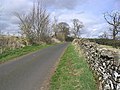
 A farm road on Lanton Hill - geograph.org.uk - 370298.jpg 640 × 480; 117 KB
-
 A misty Old Ancrum Bridge - geograph.org.uk - 1619237.jpg 640 × 480; 79 KB
-
 Alebank House Ancrum.jpeg 4.864 × 2.736; 4,02 MB
-
 Ancrum - geograph.org.uk - 1438721.jpg 640 × 480; 107 KB
-

-
 Ancrum from the air (geograph 6780107).jpg 1.024 × 768; 282 KB
-
 Ancrum green and cross keys pub in 2018.jpg 4.160 × 3.120; 4,66 MB
-
 Ancrum Market Cross - geograph.org.uk - 586950.jpg 615 × 450; 102 KB
-
 Ancrum market cross and the pub.jpg 4.160 × 3.120; 5,02 MB
-
 Ancrum Post Office.jpeg 4.864 × 2.736; 3,57 MB
-
 Ancrum Primary School clock in 2018.jpg 3.120 × 4.160; 3,19 MB
-
 Ancrum primary.jpg 2.272 × 1.704; 935 KB
-
 Ancrum Smithy House in 2018.jpg 4.160 × 3.120; 4,43 MB
-
 Ancrum village green.jpg 640 × 480; 334 KB
-
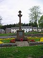
 Ancrum War Memorial - geograph.org.uk - 586964.jpg 640 × 480; 100 KB
-
 Ancrum war memorial and the pub.jpg 4.160 × 3.120; 5 MB
-
 Ancrum, Kirklands.jpg 4.608 × 3.456; 7,12 MB
-
 Ancrum, Market Cross on 5 november.jpg 8.000 × 6.000; 9,4 MB
-
 Ancrum, Market Cross on Guy Fawkes Night 2021.jpg 8.000 × 6.000; 9,76 MB
-
 Ancrum, War Memorial 2022.jpg 6.000 × 8.000; 12,45 MB
-
 Ancrum, War Memorial on fifth nov.jpg 6.000 × 8.000; 6,8 MB
-
 AncrumWarMemorial.jpg 1.704 × 2.272; 864 KB
-
 Bridge over the Ale Water - geograph.org.uk - 1519238.jpg 640 × 480; 101 KB
-
 Bridge over the Ale Water at Ancrum - geograph.org.uk - 1519231.jpg 640 × 480; 139 KB
-
 Castle Hill Ancrum.jpg 3.456 × 4.608; 4,71 MB
-
 Cottages by the B6400 at Bewlie Mains - geograph.org.uk - 258774.jpg 640 × 395; 37 KB
-
 Country Road - geograph.org.uk - 396377.jpg 640 × 480; 107 KB
-
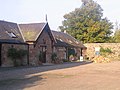 Craft Centre at Harestanes - geograph.org.uk - 577013.jpg 640 × 480; 93 KB
-
 Farm road - geograph.org.uk - 401722.jpg 640 × 480; 109 KB
-
 Farmland - geograph.org.uk - 394852.jpg 640 × 480; 112 KB
-
 Farmland at Lantonhall - geograph.org.uk - 391962.jpg 640 × 480; 116 KB
-
 Ford at foot of hill fort, ancrum 02.jpg 1.920 × 2.560; 2,46 MB
-
 Glacial Deposits near Ancrum Park - geograph.org.uk - 764082.jpg 640 × 480; 85 KB
-
 Green View, 2022 Ancrum.jpg 6.000 × 8.000; 13,51 MB
-
 Green View, Ancrum is on the left (cropped).jpg 1.894 × 1.894; 899 KB
-
 Green View, Ancrum is on the left.jpg 4.608 × 3.456; 4,15 MB
-
 Greenmount, Ancrum has an umbrella.jpg 1.996 × 1.996; 1,09 MB
-
 Harestanes Countryside Visitors Centre - geograph.org.uk - 577008.jpg 640 × 480; 128 KB
-
 Houses at Bewlie - geograph.org.uk - 258595.jpg 640 × 480; 76 KB
-
 Kirkland Ancrum.jpg 2.189 × 2.189; 1,26 MB
-
 Kirkland's at ancrum.jpg 2.560 × 1.920; 2,1 MB
-
 Kirkland's, Àncrum from drive.jpg 2.560 × 1.920; 2,06 MB
-
 Livingstonslivi00unkngoog 0108.png 2.408 × 3.008; 722 KB
-
 Lodge And Gatepiers, Kirklands, Ancrum 2021.jpg 4.608 × 3.456; 6,69 MB
-
 Model T in Ancrum.jpg 4.608 × 3.456; 5,9 MB
-
 New Ancrum Bridge from Old Ancrum Bridge - geograph.org.uk - 238974.jpg 640 × 480; 114 KB
-
 Rawflat house.jpg 4.864 × 2.736; 3,04 MB
-
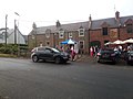
 Rideout scores of riders from Jedburgh welcomed in Ancrum.jpg 4.608 × 3.456; 5,55 MB
-
 River Ale Ancrun.jpeg 4.864 × 2.736; 6,34 MB
-
 Road Junction - geograph.org.uk - 251872.jpg 640 × 480; 94 KB
-
 Ruined building at foot of hill fort, ancrum 01.jpg 2.560 × 1.920; 2,01 MB
-
 Scaw Knowe Quarry - geograph.org.uk - 764077.jpg 640 × 413; 60 KB
-
 South View, Ancrum is white on the right.jpg 2.765 × 2.765; 2,15 MB
-
 St. Cuthbert's Way near Ancrum - geograph.org.uk - 395410.jpg 640 × 480; 95 KB
-
 Sunnyside Cottage Ancrum.jpg 596 × 572; 182 KB
-
 Surprise parking manoeuvre^ - geograph.org.uk - 1519253.jpg 640 × 480; 96 KB
-
 The A698 at Knowesouth - geograph.org.uk - 427615.jpg 640 × 480; 113 KB
-
 The Ancrum A.F.C, Football Pavilion - geograph.org.uk - 1619262.jpg 640 × 480; 81 KB
-
 The Cross Keys, Ancrum on bonfire night.jpg 8.000 × 6.000; 8,59 MB
-
 The Cross Keys, Ancrum.jpg 4.608 × 3.456; 3,8 MB
-
 The domed roof of the Monteath Mausoleum - geograph.org.uk - 891733.jpg 580 × 422; 133 KB
-
 The new Ancrum Bridge - geograph.org.uk - 1519228.jpg 640 × 480; 95 KB
-
 View from the St. Cuthbert's Way - geograph.org.uk - 395389.jpg 640 × 480; 133 KB
-
 A barley field on Gersit Law - geograph.org.uk - 891692.jpg 640 × 427; 129 KB
-
 A plantation on arable land - geograph.org.uk - 1032274.jpg 640 × 427; 172 KB
-
 A roadside well. - geograph.org.uk - 774775.jpg 640 × 480; 125 KB
-
 A stubble field at Lilliardsedge - geograph.org.uk - 1022893.jpg 640 × 427; 188 KB
-
 An inside wall of Barnhills Tower - geograph.org.uk - 753162.jpg 480 × 640; 139 KB
-
 Ancrum Market Cross - geograph.org.uk - 775743.jpg 640 × 480; 46 KB
-
 Ancrum Village Green - geograph.org.uk - 586960.jpg 638 × 464; 124 KB
-
 Arable farmland near Lanton - geograph.org.uk - 255035.jpg 640 × 480; 72 KB
-
 Arable field at Barnhills Farm - geograph.org.uk - 251857.jpg 640 × 480; 112 KB
-
 Bales ready for storage at Broom Farm - geograph.org.uk - 251865.jpg 640 × 480; 127 KB
-
 Barnhills Tower - geograph.org.uk - 753152.jpg 640 × 480; 184 KB
-
 Border Landscape - geograph.org.uk - 370291.jpg 640 × 480; 102 KB
-
 Calderwood Wood - geograph.org.uk - 371400.jpg 640 × 480; 120 KB
-
 Coronation seat by Ancrum - geograph.org.uk - 753136.jpg 640 × 480; 164 KB
-
 Country track - geograph.org.uk - 396372.jpg 459 × 640; 158 KB
-
 Dead elm trees by the Lanton Road - geograph.org.uk - 255031.jpg 640 × 480; 61 KB
-
 Farm track - geograph.org.uk - 494696.jpg 480 × 640; 125 KB
-
 Farmland near The Whinny - geograph.org.uk - 370278.jpg 640 × 480; 96 KB
-
 Field-woodland boundary - geograph.org.uk - 394066.jpg 640 × 480; 106 KB
-
 Grazing field - geograph.org.uk - 352830.jpg 640 × 477; 102 KB
-
 Hay shed at Broom Farm - geograph.org.uk - 251861.jpg 640 × 480; 152 KB
-
 Hill pasture - geograph.org.uk - 429009.jpg 640 × 480; 96 KB
-
 Oil seed rape field - geograph.org.uk - 428604.jpg 636 × 438; 119 KB
-
 Pasture field - geograph.org.uk - 394828.jpg 640 × 480; 118 KB
-
 Pasture field at Deanfoot Farm - geograph.org.uk - 253722.jpg 640 × 428; 52 KB
-
 Road junction north of Pond Wood - geograph.org.uk - 396629.jpg 640 × 480; 148 KB
-
 Snow on Ancrum Moor - geograph.org.uk - 652051.jpg 640 × 480; 63 KB
-
 Snow on Ancrum Moor - geograph.org.uk - 652060.jpg 639 × 441; 68 KB
-
 Stone steps at Ale Bridge, Ancrum - geograph.org.uk - 238977.jpg 480 × 640; 141 KB
-

-
 The artist's fungus - geograph.org.uk - 577031.jpg 640 × 480; 145 KB
-
 The B6358 - geograph.org.uk - 391959.jpg 640 × 480; 130 KB
-
 The entrance to Bewlie Mains Farm - geograph.org.uk - 258592.jpg 640 × 480; 52 KB
-
 The River Teviot - geograph.org.uk - 394812.jpg 627 × 444; 99 KB
-
 Walking route at Ancrum by the Ale Water - geograph.org.uk - 241020.jpg 640 × 480; 155 KB


.jpg)


.jpg)


