Category:Angerton, South Lakeland
Aller à la navigation
Aller à la recherche
English: Angerton is a place in the civil parish of Broughton West, in the South Lakeland district, in the county of Cumbria, England.
Média dans la catégorie « Angerton, South Lakeland »
Cette catégorie comprend 19 fichiers, dont les 19 ci-dessous.
-
 Across the Duddon towards Whelpshead Crag - geograph.org.uk - 2997184.jpg 4 000 × 3 000 ; 6,13 Mio
-
 Another from the Duddon Estuary - geograph.org.uk - 2997101.jpg 4 000 × 3 000 ; 7,38 Mio
-
 Bridge over Kirkby Pool - geograph.org.uk - 2496619.jpg 640 × 427 ; 162 kio
-
 Byroad from Foxfield to Angerton Hall - geograph.org.uk - 2496690.jpg 640 × 427 ; 155 kio
-
 Duddon Sands from the air - geograph.org.uk - 4604040.jpg 640 × 480 ; 126 kio
-
 Flock of seabirds near Kirkby-in-Furness - geograph.org.uk - 6422792.jpg 1 024 × 768 ; 66 kio
-
 Flooded field near Kirkby-in-Furness - geograph.org.uk - 6422789.jpg 1 024 × 768 ; 94 kio
-
 Following the receding tide - geograph.org.uk - 2997140.jpg 4 000 × 3 000 ; 5,83 Mio
-
 From the centre of the Duddon Estuary....... - geograph.org.uk - 2997071.jpg 3 918 × 2 924 ; 5,19 Mio
-
 Kirby Pool - geograph.org.uk - 4879525.jpg 640 × 361 ; 50 kio
-
 Kirkby Pool, near Kirkby-in-Furness - geograph.org.uk - 6422801.jpg 1 024 × 768 ; 109 kio
-
 Large barn near Kirkby-in-Furness - geograph.org.uk - 6422785.jpg 1 024 × 768 ; 91 kio
-
 Nothing but wet sand - geograph.org.uk - 2997157.jpg 3 944 × 2 938 ; 5,9 Mio
-
 Railway Bridge at Kirkby in Furness - geograph.org.uk - 3865139.jpg 1 200 × 803 ; 1 022 kio
-
 Salt marsh and mud flats - geograph.org.uk - 4365803.jpg 3 976 × 1 652 ; 3,16 Mio
-
 Tide's In At Duddon Sands - geograph.org.uk - 4879536.jpg 640 × 358 ; 36 kio
-
 View of the Duddon estuary - geograph.org.uk - 5774118.jpg 640 × 360 ; 183 kio
-
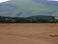
 Waitham Hill - geograph.org.uk - 2496797.jpg 640 × 427 ; 169 kio
-
 The Road to Angerton - geograph.org.uk - 250154.jpg 640 × 480 ; 247 kio


