Category:Anglezarke
Zur Navigation springen
Zur Suche springen
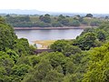
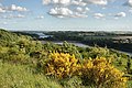
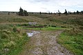
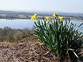
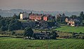
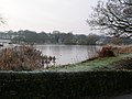
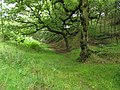
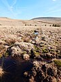
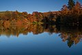
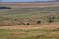
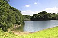
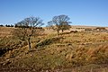
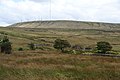
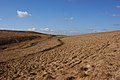
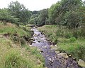
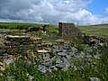
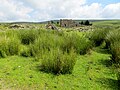
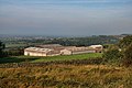
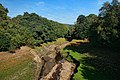
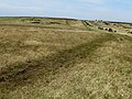
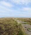
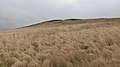
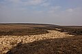
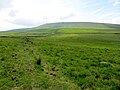
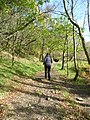
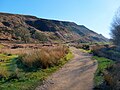
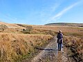
English: Anglezarke is a civil parish of the Borough of Chorley in Lancashire, England. It is dominated by a series of reservoirs that supply water primarily to Liverpool, and a large expanse of moorland with much evidence of Bronze Age settlements.
Gemeinde in der englischen Grafschaft Lancashire  | |||||
| Medium hochladen | |||||
| Ist ein(e) | |||||
|---|---|---|---|---|---|
| Ort | Borough of Chorley, Lancashire, North West England, England | ||||
| Verschieden von | |||||
 | |||||
Unterkategorien
Es werden 3 von insgesamt 3 Unterkategorien in dieser Kategorie angezeigt:
In Klammern die Anzahl der enthaltenen Kategorien (K), Seiten (S), Dateien (D)
A
- Anglezarke Reservoir (31 D)
Medien in der Kategorie „Anglezarke“
Folgende 200 Dateien sind in dieser Kategorie, von 328 insgesamt.
(vorherige Seite) (nächste Seite)-
 A field full of rams - geograph.org.uk - 3576615.jpg 2.560 × 1.920; 2,88 MB
-

-
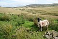 A sheep at Simms - geograph.org.uk - 2599502.jpg 3.872 × 2.592; 6,17 MB
-
 Across the Yarrow valley from Simms - geograph.org.uk - 5729543.jpg 1.024 × 770; 410 KB
-
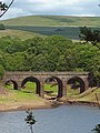
 Alance Bridge - geograph.org.uk - 1907675.jpg 1.365 × 1.024; 686 KB
-
 Alance Bridge - geograph.org.uk - 1907685.jpg 1.365 × 1.024; 724 KB
-
 Alance Bridge - geograph.org.uk - 2324318.jpg 4.592 × 3.056; 5,79 MB
-
 Alance Bridge - geograph.org.uk - 3674563.jpg 3.888 × 2.413; 1,48 MB
-
 Alance Bridge - high and dry - geograph.org.uk - 4052176.jpg 480 × 642; 149 KB
-
 Alance Bridge from Hodge Brow - geograph.org.uk - 1907678.jpg 1.365 × 1.024; 456 KB
-
 An easy track to follow - geograph.org.uk - 2324466.jpg 4.592 × 3.056; 5,54 MB
-
 Anglezarke - geograph.org.uk - 1907573.jpg 1.365 × 1.024; 511 KB
-
 Anglezarke - geograph.org.uk - 1907580.jpg 1.365 × 1.024; 327 KB
-
 Anglezarke - geograph.org.uk - 1907582.jpg 1.365 × 1.024; 390 KB
-
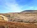
 Anglezarke Moor - geograph.org.uk - 2312948.jpg 4.592 × 3.056; 5,66 MB
-
 Anglezarke Moor - geograph.org.uk - 4516600.jpg 1.024 × 768; 623 KB
-
 Anglezarke Quarry - geograph.org.uk - 1845307.jpg 480 × 640; 98 KB
-
 Anglezarke Reservoir - geograph.org.uk - 1907533.jpg 1.365 × 1.024; 323 KB
-
 Anglezarke Reservoir - geograph.org.uk - 2324240.jpg 4.592 × 3.056; 5,58 MB
-
 Anglezarke Reservoir - geograph.org.uk - 2665907.jpg 4.000 × 3.000; 4 MB
-
 Anglezarke Reservoir - geograph.org.uk - 2762154.jpg 4.000 × 3.000; 4,03 MB
-
 Anglezarke Reservoir - geograph.org.uk - 3393465.jpg 1.024 × 682; 648 KB
-
 Anglezarke Reservoir - geograph.org.uk - 3675172.jpg 3.888 × 2.154; 1,16 MB
-
 Anglezarke Reservoir - geograph.org.uk - 3675376.jpg 3.432 × 2.110; 1,09 MB
-
 Anglezarke Reservoir from Knowsley Embankment - geograph.org.uk - 1907539.jpg 1.365 × 1.024; 580 KB
-
 Anglezarke Reservoir from Knowsley Lane - geograph.org.uk - 1907548.jpg 1.365 × 1.024; 147 KB
-
 Anglezarke Reservoir from Yarrow Embankment - geograph.org.uk - 1907647.jpg 1.365 × 1.024; 329 KB
-
 Anglezarke View - geograph.org.uk - 1534184.jpg 640 × 428; 104 KB
-
 Animal feeder at the track junction - geograph.org.uk - 2599632.jpg 3.872 × 2.592; 4,92 MB
-
 Anklezarke Reservoir - geograph.org.uk - 4867191.jpg 1.280 × 960; 1,19 MB
-
 Approaching Higher Hempshaw's - geograph.org.uk - 4050481.jpg 800 × 600; 124 KB
-
 Approaching the stone bridge over the Yarrow - geograph.org.uk - 5729753.jpg 1.024 × 768; 292 KB
-
 At Anglezarke - geograph.org.uk - 3749533.jpg 5.184 × 3.456; 1,6 MB
-
 At Will Narr - geograph.org.uk - 3953390.jpg 1.024 × 768; 547 KB
-
 Barn at Siddlow Fold Farm - geograph.org.uk - 4513630.jpg 1.024 × 765; 857 KB
-
 Below the dam, High Bullough - geograph.org.uk - 3749546.jpg 5.184 × 3.456; 7,23 MB
-
 Black Brook, White Coppice - geograph.org.uk - 6073688.jpg 1.024 × 768; 1,46 MB
-
 Black Hill Upper - geograph.org.uk - 2312929.jpg 4.592 × 3.056; 5,58 MB
-
 Blasted trees - geograph.org.uk - 2330486.jpg 4.000 × 3.000; 6,18 MB
-
 Blindhurst - geograph.org.uk - 3675333.jpg 2.444 × 1.436; 602 KB
-
 Boggy Moorland - geograph.org.uk - 3953398.jpg 1.024 × 768; 598 KB
-
 Boundary wall near Lower Hempshaw's Ruin - geograph.org.uk - 5729744.jpg 1.024 × 768; 348 KB
-
 Bridge across The Goit - geograph.org.uk - 3336469.jpg 1.024 × 682; 804 KB
-

-
 Bridge over Lead Mines Clough - geograph.org.uk - 2324365.jpg 4.592 × 3.056; 6,94 MB
-
 Bridleway to Lead Mines Clough - geograph.org.uk - 1077094.jpg 640 × 452; 71 KB
-
 Broken down dry stone walling - geograph.org.uk - 4032249.jpg 4.000 × 3.000; 5,63 MB
-
 Broken down wall on Spitlers Edge - geograph.org.uk - 3982244.jpg 1.024 × 768; 579 KB
-
 Bromiley Pasture - geograph.org.uk - 2312916.jpg 4.592 × 3.056; 5,08 MB
-
 Bromiley Pastures - geograph.org.uk - 3389634.jpg 1.600 × 1.200; 424 KB
-
 Bromiley Pastures - geograph.org.uk - 3982266.jpg 1.024 × 768; 340 KB
-
 Cairn on Round Loaf - geograph.org.uk - 3982841.jpg 1.024 × 821; 397 KB
-
 Car Park Above Anglezarke Reservoir - geograph.org.uk - 2665903.jpg 3.914 × 2.038; 3,45 MB
-
 Constituency and Civil Parish boundary - geograph.org.uk - 3393529.jpg 1.024 × 682; 492 KB
-
 Coppice Lane - geograph.org.uk - 6074624.jpg 1.024 × 767; 1,36 MB
-
 Cottages at White Coppice - geograph.org.uk - 2328544.jpg 4.000 × 3.000; 6,05 MB
-
 Cottages at White Coppice - geograph.org.uk - 6463831.jpg 2.592 × 1.944; 1,55 MB
-
 Cows waiting at the gate - geograph.org.uk - 2599488.jpg 3.872 × 2.592; 4,92 MB
-
 Curlew on a dry stone wall - geograph.org.uk - 4032285.jpg 4.000 × 3.000; 4,22 MB
-
 Curlew on the wing - geograph.org.uk - 4032256.jpg 4.000 × 3.000; 2,36 MB
-
 Dashing through the snow.... - geograph.org.uk - 4053740.jpg 4.320 × 3.240; 5,69 MB
-
 Dean Black Brook - geograph.org.uk - 2325417.jpg 4.592 × 3.056; 5,33 MB
-
 Dean Black Brook - geograph.org.uk - 3675370.jpg 3.888 × 2.362; 1,17 MB
-
 Dean Black Brook - geograph.org.uk - 4569324.jpg 4.176 × 2.784; 5,04 MB
-
 Deanhead Lane South of Alance Bridge - geograph.org.uk - 5729843.jpg 1.024 × 768; 321 KB
-
 Depth Markers on High Bullough Reservoir - geograph.org.uk - 1273812.jpg 640 × 424; 105 KB
-
 Devil's Ditch - geograph.org.uk - 2324541.jpg 4.592 × 3.056; 6,47 MB
-
 Devil's Ditch looks more impressive from further away - geograph.org.uk - 2324583.jpg 4.592 × 3.056; 4,94 MB
-
 Downstream from Shooting Huts - geograph.org.uk - 1892523.jpg 1.600 × 1.200; 1,48 MB
-
 Dried up pond - geograph.org.uk - 2330469.jpg 2.773 × 2.008; 2,42 MB
-
 Drystone wall on snowy Spitlers Edge - geograph.org.uk - 3308354.jpg 4.320 × 3.240; 5,38 MB
-
 Easier going ahead^ - geograph.org.uk - 2313102.jpg 4.592 × 3.056; 5,21 MB
-
 Farm buildings at Manor House - geograph.org.uk - 3308362.jpg 4.320 × 3.240; 5,35 MB
-
 Fenced off area - geograph.org.uk - 5208348.jpg 1.280 × 960; 1,07 MB
-
 Fenced square on the moors near Hurst Hill - geograph.org.uk - 1892032.jpg 1.600 × 1.200; 1,55 MB
-
 Field and small reservoir - geograph.org.uk - 2778392.jpg 4.000 × 2.425; 3,15 MB
-
 Flag bridge - geograph.org.uk - 2458304.jpg 2.592 × 1.944; 1,54 MB
-
 Flag Stone - geograph.org.uk - 1251094.jpg 640 × 480; 127 KB
-
 Flagged footpath leading to Redmonds Edge - geograph.org.uk - 2458291.jpg 2.592 × 1.944; 1,7 MB
-
 Footbridge - geograph.org.uk - 4565890.jpg 4.176 × 2.784; 4,86 MB
-
 Footbridge in Lead Mines Clough - geograph.org.uk - 2599438.jpg 3.872 × 2.592; 6,5 MB
-
 Footbridge on an Anglezarke path - geograph.org.uk - 4513625.jpg 1.024 × 767; 921 KB
-
 Footbridge on the path at Stronstrey Bank - geograph.org.uk - 2328632.jpg 4.000 × 3.000; 7,5 MB
-
 Footbridge over brook at White Coppice - geograph.org.uk - 2426660.jpg 1.600 × 1.198; 571 KB
-
 Footbridge over Limestone Brook - geograph.org.uk - 1318988.jpg 640 × 480; 133 KB
-
 Footbridge, Lead Mines Clough - geograph.org.uk - 4565880.jpg 2.784 × 4.176; 4,17 MB
-
 Footbridges to Cottages - geograph.org.uk - 2328673.jpg 4.000 × 3.000; 5,58 MB
-
 Footpath at Stronstrey Bank - geograph.org.uk - 2328642.jpg 3.656 × 2.643; 4,6 MB
-
 Footpath below Stronstrey Bank - geograph.org.uk - 3336478.jpg 1.024 × 644; 490 KB
-
 Footpath near Anglezarke reservoir - geograph.org.uk - 3387678.jpg 1.600 × 1.200; 687 KB
-
 Ford at White Coppice - geograph.org.uk - 2328555.jpg 3.469 × 2.504; 4,49 MB
-
 Ford at White Coppice - geograph.org.uk - 3564721.jpg 3.699 × 2.510; 2,11 MB
-
 From Redmonds Edge - geograph.org.uk - 3982284.jpg 909 × 1.024; 687 KB
-
 Frozen Reservoir at White Coppice - geograph.org.uk - 1100696.jpg 640 × 480; 82 KB
-
 Gamekeeper's Cottage, Anglezarke.jpg 1.990 × 1.406; 2,44 MB
-
 Gate at the north west corner of Yarrow Reservoir - geograph.org.uk - 2596382.jpg 3.872 × 2.592; 6,56 MB
-
 Gate in moorland fence south of Standing Stones Hill - geograph.org.uk - 4980273.jpg 3.264 × 2.448; 2,03 MB
-
 Gate on an Anglezarke path - geograph.org.uk - 4513624.jpg 1.024 × 768; 1 MB
-
 Gate on the West Pennine Way at White Coppice - geograph.org.uk - 6073670.jpg 1.024 × 768; 1,41 MB
-
 Gate to wilder country - geograph.org.uk - 2599750.jpg 3.872 × 2.592; 5,63 MB
-
 Grassy dell in Lead Mines Clough - geograph.org.uk - 3063527.jpg 4.000 × 3.000; 5 MB
-
 Gravel track on Anglezarke Moor - geograph.org.uk - 4051099.jpg 800 × 600; 102 KB
-
 Grip block on moorland north of Hempshaw's - geograph.org.uk - 5729634.jpg 1.200 × 1.600; 787 KB
-
 Heapey Reservoir no. 4 - geograph.org.uk - 3750613.jpg 5.184 × 3.456; 2,72 MB
-
 Heapey Reservoir no. 5, autumn - geograph.org.uk - 3750584.jpg 4.639 × 3.148; 2,22 MB
-
 Heapy No. 3 reservoir - geograph.org.uk - 4771757.jpg 1.280 × 960; 1,29 MB
-
 Heapy No.3 reservoir - geograph.org.uk - 4771755.jpg 1.280 × 960; 1,38 MB
-
 Heather burning at White Coppice - geograph.org.uk - 2327302.jpg 1.600 × 926; 1,11 MB
-
 Hempshaw's - geograph.org.uk - 3675174.jpg 3.888 × 2.592; 1,8 MB
-
 Hempshaw's Ruins - geograph.org.uk - 1247758.jpg 640 × 480; 101 KB
-
 High Bullough dam - geograph.org.uk - 3749536.jpg 5.184 × 3.456; 2,73 MB
-
 High Bullough Reservoir - geograph.org.uk - 303626.jpg 640 × 426; 124 KB
-
 High Bullough reservoir - geograph.org.uk - 3749542.jpg 5.184 × 3.456; 7,64 MB
-
 High Hempshaws - geograph.org.uk - 2312956.jpg 4.592 × 3.056; 6,86 MB
-
 Higher Anshaw - geograph.org.uk - 2312799.jpg 4.592 × 3.056; 5,86 MB
-
 Higher Hempshaw's - geograph.org.uk - 2599759.jpg 3.872 × 2.592; 3,68 MB
-
 Higher Hempshaw's - geograph.org.uk - 4032260.jpg 4.000 × 3.000; 4,86 MB
-
 Higher Hempshaw's - geograph.org.uk - 5729741.jpg 1.024 × 769; 258 KB
-
 Higher Hempshaw's and Winter Hill - geograph.org.uk - 4051037.jpg 800 × 600; 98 KB
-
 Higher Hempshaw.jpg 2.687 × 1.444; 1,18 MB
-
 Hollin Lane, White Coppice - geograph.org.uk - 2778321.jpg 4.000 × 3.000; 6,45 MB
-
 Hordern Pasture - geograph.org.uk - 2312783.jpg 4.592 × 3.056; 6,06 MB
-
 Hordern Pasture - geograph.org.uk - 3953368.jpg 1.024 × 768; 515 KB
-
 Hurst Hill - geograph.org.uk - 1259003.jpg 640 × 480; 86 KB
-
 Inlet on Yarrow Reservoir from Alance Bridge - geograph.org.uk - 2665894.jpg 3.889 × 2.677; 4,1 MB
-
 Jepson's Gate with Winter Hill beyond - geograph.org.uk - 2326041.jpg 4.592 × 2.594; 7,27 MB
-
 Joan Meadow - geograph.org.uk - 3675454.jpg 3.888 × 2.249; 1,68 MB
-

-
 Lane Ends - geograph.org.uk - 3675329.jpg 2.475 × 1.974; 878 KB
-
 Lead Mines Clough - geograph.org.uk - 1077113.jpg 640 × 460; 123 KB
-
 Lead Mines Clough - geograph.org.uk - 2324432.jpg 4.592 × 3.056; 7,2 MB
-
 Lead Mines Clough - geograph.org.uk - 2800620.jpg 640 × 410; 100 KB
-
 Limestone Brook - geograph.org.uk - 1319004.jpg 480 × 640; 127 KB
-
 Limestone Brook - geograph.org.uk - 1319050.jpg 640 × 480; 134 KB
-
 Limestone Brook - geograph.org.uk - 3063534.jpg 3.553 × 2.877; 5,81 MB
-
 Limestone Brook in Lead Mines Clough - geograph.org.uk - 3308358.jpg 4.320 × 3.240; 5,66 MB
-
 Low levels in Yarrow Reservoir - geograph.org.uk - 4051383.jpg 800 × 600; 178 KB
-
 Lower Hempshaw's - geograph.org.uk - 2458336.jpg 2.592 × 1.944; 1,61 MB
-
 Lower Hempshaw's - geograph.org.uk - 3387368.jpg 1.600 × 1.200; 415 KB
-
 Lower Hempshaw's - geograph.org.uk - 4032267.jpg 4.000 × 3.000; 6,56 MB
-
 Makeshift wall across the path to Will Narr - geograph.org.uk - 2599779.jpg 3.872 × 2.592; 5,44 MB
-
 Manor House - geograph.org.uk - 1438808.jpg 640 × 432; 137 KB
-
 Manor House - geograph.org.uk - 2325944.jpg 4.592 × 2.787; 7,3 MB
-
 Manor House Farm - geograph.org.uk - 3675372.jpg 3.888 × 2.592; 1,54 MB
-
 Meeting of the Waters - geograph.org.uk - 1907616.jpg 1.365 × 1.024; 477 KB
-
 Meeting of the Waters - geograph.org.uk - 3675339.jpg 3.888 × 2.592; 2,08 MB
-
 Moor and grassland from Will Narr - geograph.org.uk - 4465762.jpg 1.024 × 768; 704 KB
-
 Moor Lane, Anglezarke - geograph.org.uk - 4516602.jpg 1.024 × 751; 613 KB
-
 Moor Road - geograph.org.uk - 2325922.jpg 4.592 × 3.056; 6,5 MB
-
 Moor Road at Jepson's Gate - geograph.org.uk - 3336403.jpg 1.024 × 720; 506 KB
-
 Moor Road, Anglezarke - geograph.org.uk - 3336408.jpg 1.024 × 681; 489 KB
-
 Moorland above Black Coppice Quarry - geograph.org.uk - 1259048.jpg 640 × 480; 91 KB
-
 Moorland above Rivington - geograph.org.uk - 3953395.jpg 1.024 × 768; 575 KB
-
 Moorland at Higher Hempshaw's - geograph.org.uk - 5208353.jpg 1.280 × 960; 1,42 MB
-
 Moorland at Hordern Pasture - geograph.org.uk - 5208349.jpg 1.280 × 958; 788 KB
-
 Moorland at Will Narr - geograph.org.uk - 3953403.jpg 1.024 × 768; 655 KB
-
 Moorland Ditch - geograph.org.uk - 3982273.jpg 768 × 1.024; 749 KB
-
 Moorland footpath - geograph.org.uk - 5177628.jpg 1.280 × 958; 1,02 MB
-
 Moorland from Will Narr - geograph.org.uk - 4465768.jpg 1.024 × 768; 673 KB
-
 Moorland near White Coppice - geograph.org.uk - 6073850.jpg 1.024 × 768; 1,73 MB
-
 Moorland north of Bolton - geograph.org.uk - 5585389.jpg 1.280 × 960; 1,27 MB
-
 Moorland North of Hempshaws - geograph.org.uk - 5729568.jpg 1.024 × 770; 285 KB
-
 Moorland path - geograph.org.uk - 3982247.jpg 1.024 × 767; 623 KB
-
 Moorland path at Bromiley Pastures - geograph.org.uk - 3982269.jpg 898 × 1.024; 565 KB
-
 Moorland path at Higher Anshaw - geograph.org.uk - 5208363.jpg 1.280 × 959; 860 KB
-
 Moorland plantation near Higher Hempshaw's - geograph.org.uk - 5208359.jpg 1.280 × 960; 841 KB
-
 Moorland to west of Hurst Hill - geograph.org.uk - 2281552.jpg 1.600 × 900; 2,12 MB
-
 Moorland track - geograph.org.uk - 4032269.jpg 4.000 × 3.000; 5,1 MB
-
 Moorland track E of Lead Mines Clough - geograph.org.uk - 5621966.jpg 5.184 × 2.920; 6,62 MB
-
 Moorland wall - geograph.org.uk - 3982260.jpg 768 × 1.024; 608 KB
-
 Moorland war memorial - geograph.org.uk - 3063566.jpg 4.000 × 3.000; 6,87 MB
-
 New path at Hordern Pasture - geograph.org.uk - 5051517.jpg 1.280 × 960; 977 KB
-
 North Dam - High Bullough Reservoir - geograph.org.uk - 1331355.jpg 640 × 480; 119 KB
-
 Not Devil's Ditch, but who'd know without a GPS - geograph.org.uk - 2325349.jpg 4.592 × 3.056; 6,38 MB
-
-

-
 Old Brook's Farm - geograph.org.uk - 1891967.jpg 1.600 × 1.200; 1,43 MB
-
 Old rachels, Anglezarke.png 1.112 × 726; 1,82 MB
-
 On Anglezarke Moor - geograph.org.uk - 4516599.jpg 1.024 × 768; 605 KB
-

-
 On Hordern Pasture - geograph.org.uk - 3953387.jpg 1.024 × 768; 495 KB
-
 On Hordern Pasture - geograph.org.uk - 4032239.jpg 4.000 × 3.000; 4,65 MB
-
 On Spitlers Edge - geograph.org.uk - 4960297.jpg 4.608 × 3.072; 3,17 MB
-
 Ordnance Survey Cutmark on Alance Bridge - geograph.org.uk - 5729846.jpg 1.024 × 768; 269 KB
-
 Parson's Bullough Road - geograph.org.uk - 1907624.jpg 1.365 × 1.024; 440 KB
-
 Pasture at Jepson's Gate - geograph.org.uk - 3336398.jpg 1.024 × 681; 607 KB
-
 Path and wall at Spitler's edge - geograph.org.uk - 5208368.jpg 1.280 × 960; 1,17 MB
-
 Path Below High Bullough Reservoir North Dam - geograph.org.uk - 2665912.jpg 3.000 × 4.000; 3,74 MB
-
 Path Below Manor House - geograph.org.uk - 2665919.jpg 3.000 × 4.000; 4,38 MB
-
 Path from Anglezarke to Stones Bank - geograph.org.uk - 1907575.jpg 1.365 × 1.024; 483 KB
-
 Path near the Goit, White Coppice - geograph.org.uk - 6073695.jpg 1.024 × 769; 1,18 MB
-
 Path on Will Narr - geograph.org.uk - 2599787.jpg 3.872 × 2.592; 5,58 MB
-
 Path South of Lower Hempshaw's - geograph.org.uk - 5729748.jpg 1.024 × 768; 296 KB
-
 Paved path on Anglezarke Moor - geograph.org.uk - 475666.jpg 469 × 640; 340 KB
-
 Peat and gritstone - geograph.org.uk - 1163960.jpg 640 × 469; 127 KB
-
 Pike Stones burial chamber - geograph.org.uk - 2502336.jpg 1.600 × 1.200; 1,69 MB
-
 Pikestones - geograph.org.uk - 1892027.jpg 1.600 × 1.200; 1,05 MB
-
 Pikestones, Anglezarke Moor - geograph.org.uk - 4516594.jpg 1.024 × 768; 695 KB
-
 Pikestones.jpg 392 × 279; 89 KB
-
 Pimms Farm - geograph.org.uk - 1710739.jpg 2.592 × 1.944; 1,26 MB


