Category:Angy
Zur Navigation springen
Zur Suche springen
französische Gemeinde ,_mairie_et_monument,_place_Henri-Barbusse.jpg) .svg)  | |||||
| Medium hochladen | |||||
| Ist ein(e) | |||||
|---|---|---|---|---|---|
| Ort |
| ||||
| Einwohnerzahl |
| ||||
| Fläche |
| ||||
 | |||||
Unterkategorien
Es werden 6 von insgesamt 6 Unterkategorien in dieser Kategorie angezeigt:
In Klammern die Anzahl der enthaltenen Kategorien (K), Seiten (S), Dateien (D)
G
- Gare de Mouy - Bury (9 D)
M
- Maps of Angy (2 D)
- War memorial of Angy (2 D)
T
- Town hall of Angy (2 D)
Medien in der Kategorie „Angy“
Folgende 34 Dateien sind in dieser Kategorie, von 34 insgesamt.
-
 Angy (60) - Carte de Cassini.jpg 409 × 310; 55 KB
-
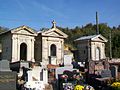 Angy (60), cimetière, rue René Fèvre 02.jpg 3.664 × 2.748; 1,91 MB
-
 Angy (60), cimetière, rue René Fèvre.jpg 3.664 × 2.748; 2,1 MB
-
 Angy (60), lavoir ruiné, rue de l'Église 03.jpg 3.664 × 2.748; 1,67 MB
-
 Angy (60), lavoir ruiné, rue de l'Église.jpg 3.664 × 2.748; 1,95 MB
-
 Angy (60), maison du XIIIe siècle, mur pignon sur la rue de l'Église 2.jpg 2.748 × 3.664; 3,18 MB
-
 Angy (60), maison du XIIIe siècle, mur pignon sur la rue de l'Église 3.jpg 2.748 × 3.664; 2,65 MB
-
 Angy (60), maison du XIIIe siècle, mur pignon sur la rue de l'Église.jpg 2.736 × 3.648; 1,93 MB
-
 Angy (60), paysage au nord du village 01.jpg 3.664 × 2.748; 1,9 MB
-
 Angy (60), paysage au nord du village 02.jpg 3.664 × 2.748; 1,95 MB
-
 Angy (60), plaque de cocher, rue Aristide-Briand.jpg 3.664 × 2.748; 1,81 MB
-
 Angy (60), plaque Michelin de 1934 à l'entrée nord du village.jpg 2.748 × 3.664; 2,9 MB
-
 Angy (60), plaque Michelin sur l'ancienne RD 12 à la sortie nord du village.jpg 2.748 × 3.664; 3,16 MB
-
 Angy (60), rue Aristide-Briand 01.jpg 3.664 × 2.748; 1,85 MB
-
 Angy (60), rue Aristide-Briand 02.jpg 3.664 × 2.748; 1,97 MB
-
 Angy (60), rue Aristide-Briand 03.jpg 2.748 × 3.664; 2,32 MB
-
 Angy (60), rue Aristide-Briand 04.jpg 3.664 × 2.748; 1,91 MB
-
 Angy (60), rue Aristide-Briand 05.jpg 3.664 × 2.748; 1,85 MB
-
 Angy (60), rue de l'Église 02.jpg 3.664 × 2.748; 2,02 MB
-
 Angy (60), rue de l'Église.jpg 3.664 × 2.748; 2,27 MB
-
 Angy (60), rue Jean-Corroyer près de Mouy 01.jpg 3.664 × 2.748; 1,93 MB
-
 Angy (60), rue Jean-Corroyer près de Mouy 02.jpg 3.664 × 2.748; 2,12 MB
-
 Angy (60), secours-incendie, mairie et monument, place Henri-Barbusse.jpg 3.664 × 2.748; 2,04 MB
-
 Angy (60), secours-incendie, place Henri-Barbusse.jpg 3.664 × 2.748; 2,04 MB
-
 Angy (60), sépulture à part en dehors du cimetière.jpg 2.748 × 3.664; 2,47 MB
-
 Angy, around the Saint Nicholas church.JPG 5.184 × 3.456; 8,92 MB
-
 Angy, houses aside from Saint Nicholas church.JPG 4.932 × 3.454; 3,58 MB
-
 Angy, houses on the Rue de l'Église.JPG 1.843 × 2.764; 1,04 MB
-
 Blason ville fr Angy (Oise).svg 600 × 660; 12 KB
-
 Fond des gorguets angy.jpg 3.072 × 2.304; 1,93 MB
-
 Population - Municipality code 60015.svg 475 × 355; 13 KB
-
 Vue aérienne de Mouy - Bury - Angy 01.jpg 1.920 × 1.440; 742 KB
-
 Vue aérienne de Mouy - Bury - Angy 02.jpg 1.920 × 1.440; 971 KB
-
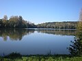 Étang angy.jpg 3.072 × 2.304; 1,9 MB
_-_Carte_de_Cassini.jpg)
,_cimeti%C3%A8re,_rue_Ren%C3%A9_F%C3%A8vre_02.jpg)
,_cimeti%C3%A8re,_rue_Ren%C3%A9_F%C3%A8vre.jpg)
,_lavoir_ruin%C3%A9,_rue_de_l%27%C3%89glise_03.jpg)
,_lavoir_ruin%C3%A9,_rue_de_l%27%C3%89glise.jpg)
,_maison_du_XIIIe_si%C3%A8cle,_mur_pignon_sur_la_rue_de_l%27%C3%89glise_2.jpg)
,_maison_du_XIIIe_si%C3%A8cle,_mur_pignon_sur_la_rue_de_l%27%C3%89glise_3.jpg)
,_maison_du_XIIIe_si%C3%A8cle,_mur_pignon_sur_la_rue_de_l%27%C3%89glise.jpg)
,_paysage_au_nord_du_village_01.jpg)
,_paysage_au_nord_du_village_02.jpg)
,_plaque_de_cocher,_rue_Aristide-Briand.jpg)
,_plaque_Michelin_de_1934_%C3%A0_l%27entr%C3%A9e_nord_du_village.jpg)
,_plaque_Michelin_sur_l%27ancienne_RD_12_%C3%A0_la_sortie_nord_du_village.jpg)
,_rue_Aristide-Briand_01.jpg)
,_rue_Aristide-Briand_02.jpg)
,_rue_Aristide-Briand_03.jpg)
,_rue_Aristide-Briand_04.jpg)
,_rue_Aristide-Briand_05.jpg)
,_rue_de_l%27%C3%89glise_02.jpg)
,_rue_de_l%27%C3%89glise.jpg)
,_rue_Jean-Corroyer_pr%C3%A8s_de_Mouy_01.jpg)
,_rue_Jean-Corroyer_pr%C3%A8s_de_Mouy_02.jpg)
,_secours-incendie,_mairie_et_monument,_place_Henri-Barbusse.jpg)
,_secours-incendie,_place_Henri-Barbusse.jpg)
,_s%C3%A9pulture_%C3%A0_part_en_dehors_du_cimeti%C3%A8re.jpg)


