Category:Anstey, Leicestershire
Vai alla navigazione
Vai alla ricerca
English: Anstey is a large semi-industrialised village in Leicestershire, England, located north west of Leicester in the borough of Charnwood. Its population was about 6,000 at the 2001 census although this is likely to have increased. The village is separated from Leicester by the Rothley Brook, Castle Hill Park and the A46, and it borders the villages of Glenfield, Groby, Newtown Linford, Cropston and Thurcaston as well as the suburb of Beaumont Leys and Anstey Heights. To the north-west lies Bradgate Park.
Italiano: Anstey è un paese di 5.821 abitanti della contea del Leicestershire, in Inghilterra.
large village in Leicestershire, England  | |||||
| Carica un file multimediale | |||||
| Istanza di | |||||
|---|---|---|---|---|---|
| Luogo | Charnwood, Leicestershire, Midlands Orientali, Inghilterra | ||||
| Superficie |
| ||||
| Considerato essere uguale a | Anstey (pagina Wikimedia duplicata, parrocchia civile dell'Inghilterra) | ||||
| sito web ufficiale | |||||
 | |||||
Sottocategorie
Questa categoria contiene le 5 sottocategorie indicate di seguito, su un totale di 5.
File nella categoria "Anstey, Leicestershire"
Questa categoria contiene 111 file, indicati di seguito, su un totale di 111.
-
 A wintry field to the north of Glenfield - geograph.org.uk - 4797870.jpg 1 920 × 1 080; 696 KB
-
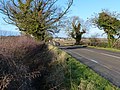
 A46 Bridge across Gorse Hill - geograph.org.uk - 3305046.jpg 3 852 × 2 593; 3,06 MB
-
 A46 slip road for A5630 - geograph.org.uk - 4582417.jpg 2 256 × 1 496; 877 KB
-
 A46 slip road joining ahead - geograph.org.uk - 4586891.jpg 1 600 × 1 061; 247 KB
-
 Allotments north of Anstey - geograph.org.uk - 3299789.jpg 2 362 × 1 982; 1,68 MB
-
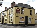
 Anstey Coach ^ Horses Pub - geograph.org.uk - 2758215.jpg 640 × 480; 128 KB
-
 Anstey Crown Inn - geograph.org.uk - 2758220.jpg 640 × 480; 120 KB
-
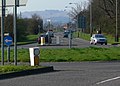
 Anstey Lane (A5630) - geograph.org.uk - 3589270.jpg 640 × 480; 66 KB
-

-
 Anstey Lane towards Anstey - geograph.org.uk - 6311192.jpg 640 × 473; 58 KB
-
 Anstey Lane towards Thurcaston - geograph.org.uk - 6311193.jpg 640 × 402; 62 KB
-
 Anstey Mill - geograph.org.uk - 2153901.jpg 800 × 531; 99 KB
-
 Anstey Plough Inn - geograph.org.uk - 2758247.jpg 640 × 480; 102 KB
-
 Anstey village centre - geograph.org.uk - 3291048.jpg 1 024 × 768; 134 KB
-
 Anstey Watermill - geograph.org.uk - 2153892.jpg 800 × 531; 106 KB
-
 AnsteyGateway20071026.jpg 512 × 600; 118 KB
-
 AnsteyMethodist.jpg 150 × 181; 4 KB
-
 Bradgate Park - geograph.org.uk - 2154015.jpg 800 × 531; 102 KB
-
 Bradgate Park - geograph.org.uk - 2154180.jpg 800 × 531; 88 KB
-
 Bradgate Road in Anstey - geograph.org.uk - 5726434.jpg 736 × 800; 104 KB
-
 Brook near Anstey - geograph.org.uk - 3288187.jpg 1 024 × 768; 299 KB
-
 Cawley Field - geograph.org.uk - 3567744.jpg 640 × 480; 98 KB
-
 Christmas decorations at the Nook in Anstey - geograph.org.uk - 3305044.jpg 3 598 × 2 536; 1,39 MB
-
 Church in hiding, Anstey - geograph.org.uk - 3291041.jpg 1 024 × 768; 254 KB
-
 Coach and Horses, Anstey - geograph.org.uk - 3291054.jpg 1 024 × 768; 167 KB
-
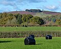
 Countryside north of Anstey - geograph.org.uk - 4003318.jpg 1 600 × 1 194; 364 KB
-
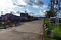
 County Hall, Glenfield. - geograph.org.uk - 386151.jpg 640 × 336; 73 KB
-
 Cropston Road in Anstey - geograph.org.uk - 4656811.jpg 800 × 600; 210 KB
-
 Cropston Road towards Cropston - geograph.org.uk - 3299792.jpg 4 000 × 3 000; 3,44 MB
-
 East end of Bradgate Road, Anstey - geograph.org.uk - 3291044.jpg 1 024 × 768; 172 KB
-
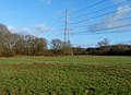 Electricity lines crossing the Castle Hill Country Park - geograph.org.uk - 3299783.jpg 2 432 × 1 756; 1 020 KB
-
 Electricity pylon in the Castle Hill Country Park - geograph.org.uk - 3299784.jpg 4 000 × 3 000; 3,43 MB
-
 Entrance to Anstey Mill and Mill Farm - geograph.org.uk - 4862250.jpg 800 × 578; 127 KB
-
 Entrance to Castle Hill Country Park - geograph.org.uk - 3299774.jpg 3 482 × 2 722; 2,91 MB
-
 Farmland north of the village of Anstey - geograph.org.uk - 4003282.jpg 1 600 × 1 148; 641 KB
-
 Farmland off Anstey Lane - geograph.org.uk - 271171.jpg 640 × 427; 96 KB
-
 Farmland off Anstey Lane - geograph.org.uk - 271176.jpg 640 × 427; 70 KB
-
 Farmland on the edge of Anstey - geograph.org.uk - 5591049.jpg 800 × 638; 146 KB
-
 Field path, Anstey - geograph.org.uk - 6269097.jpg 1 600 × 1 066; 482 KB
-
 Fields next to Gynsill Lane - geograph.org.uk - 4157046.jpg 1 600 × 1 155; 450 KB
-
 Fields north of Anstey - geograph.org.uk - 3299791.jpg 2 227 × 1 782; 1,24 MB
-
 Footpath along Anstey Lane - geograph.org.uk - 4157068.jpg 1 200 × 1 600; 659 KB
-
 Footpath along Bradgate Road in Anstey - geograph.org.uk - 4003268.jpg 1 600 × 1 230; 834 KB
-
 Footpath from Anstey to Cropston - geograph.org.uk - 4744725.jpg 2 000 × 1 500; 626 KB
-
 Footpath from Anstey to Cropston Reservoir - geograph.org.uk - 4745537.jpg 2 000 × 1 500; 428 KB
-
 Footpath leads to Bradgate Park - geograph.org.uk - 4788560.jpg 2 000 × 1 500; 457 KB
-
 Gate and path, Anstey - geograph.org.uk - 6269101.jpg 1 600 × 1 066; 594 KB
-
 Gorse Hill near Beaumont Leys - geograph.org.uk - 5590961.jpg 800 × 551; 123 KB
-
 Gynsill Lane enters Glenfield - geograph.org.uk - 3589322.jpg 640 × 480; 76 KB
-
 Gynsill Lane nearing Glenfield - geograph.org.uk - 3589320.jpg 640 × 480; 76 KB
-
 Horses in a field next to Anstey Lane - geograph.org.uk - 4862276.jpg 800 × 512; 111 KB
-
 House opposite Anstey Lane - geograph.org.uk - 4656823.jpg 800 × 596; 138 KB
-
 King Williams Bridge - geograph.org.uk - 5294769.jpg 800 × 559; 204 KB
-

-
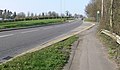
 Looking west along the A46 - geograph.org.uk - 4000458.jpg 1 600 × 1 200; 395 KB
-
 New housing in Anstey - geograph.org.uk - 5591528.jpg 800 × 533; 111 KB
-
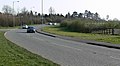
 New roundabout under construction - geograph.org.uk - 5591571.jpg 800 × 560; 167 KB
-
 Old Packhorse Bridge - geograph.org.uk - 2154619.jpg 800 × 531; 149 KB
-
 Old Packhorse Bridge - geograph.org.uk - 2154625.jpg 800 × 531; 129 KB
-
 Pack Horse Bridge in Anstey - geograph.org.uk - 5590979.jpg 800 × 592; 175 KB
-
 Pack Horse Bridge in Anstey - geograph.org.uk - 5591018.jpg 800 × 556; 146 KB
-
 Packhorse Bridge - geograph.org.uk - 2154642.jpg 800 × 531; 145 KB
-
 Packhorse bridge over Rothley Brook - geograph.org.uk - 4575412.jpg 601 × 478; 55 KB
-
 Packhorse bridge, Anstey - geograph.org.uk - 3288178.jpg 1 024 × 768; 337 KB
-
 Path in Maize - geograph.org.uk - 6269109.jpg 1 600 × 1 066; 627 KB
-
 Path to Bradgate Country Park - geograph.org.uk - 6269117.jpg 1 600 × 1 066; 711 KB
-
 Pinfold - Anstey - geograph.org.uk - 2153931.jpg 800 × 531; 184 KB
-
 Potters Superstore, Anstey - geograph.org.uk - 3291033.jpg 1 024 × 768; 170 KB
-
 Road works on Cropston Road - geograph.org.uk - 5591564.jpg 800 × 592; 162 KB
-
 Rothley Brook - geograph.org.uk - 4429752.jpg 2 000 × 1 500; 774 KB
-
 Rothley Brook in the Castle Hill Country Park - geograph.org.uk - 3299782.jpg 4 000 × 3 000; 4,88 MB
-
 Seat along Rothley Brook - geograph.org.uk - 3299781.jpg 3 295 × 2 393; 2,83 MB
-
 Shopping trolley in Rothley Brook - geograph.org.uk - 3305045.jpg 3 000 × 4 000; 3,54 MB
-
 Small park off Leicester Road, Anstey - geograph.org.uk - 3288183.jpg 1 024 × 768; 262 KB
-
 St Mary's church - geograph.org.uk - 4575488.jpg 2 000 × 1 500; 597 KB
-
 St Mary's church, Anstey - geograph.org.uk - 3205300.jpg 1 600 × 1 200; 400 KB
-
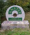
 StoneAnstey20071026.jpg 300 × 431; 32 KB
-
 Sydney John Bunney - Monochrome 1895 Watercolour, Anstey.jpg 1 190 × 866; 244 KB
-
 Temporary pond in Castle Hill Country Park - geograph.org.uk - 3299779.jpg 3 813 × 2 743; 2,73 MB
-
 The Crown Inn on Bradgate Road, Anstey - geograph.org.uk - 4003230.jpg 1 600 × 1 282; 524 KB
-
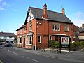
 The Crown Inn, Anstey - geograph.org.uk - 5591027.jpg 800 × 592; 169 KB
-
 The Nook, Anstey. - geograph.org.uk - 384842.jpg 640 × 268; 72 KB
-
 The Old Hare and Hounds in Anstey - geograph.org.uk - 5856495.jpg 640 × 327; 77 KB
-

-
 View towards Anstey Mill - geograph.org.uk - 2154634.jpg 800 × 531; 70 KB
-
 Village Green near Rothley Brook in Anstey - geograph.org.uk - 4003164.jpg 1 600 × 1 200; 848 KB
-
 A46 bridge - geograph.org.uk - 384836.jpg 640 × 358; 94 KB
-
 Anstey Bridge - geograph.org.uk - 2547.jpg 640 × 427; 317 KB
-
 Anstey Lane - geograph.org.uk - 384832.jpg 640 × 422; 88 KB
-
 Anstey Lane, Leicester - geograph.org.uk - 75318.jpg 640 × 427; 154 KB
-
 Cropston Road, Anstey. - geograph.org.uk - 384846.jpg 640 × 496; 157 KB
-
 Darlington Road, Leicester - geograph.org.uk - 75320.jpg 640 × 427; 91 KB
-

-
 Footpath, Glenfield, Leicester - geograph.org.uk - 75391.jpg 640 × 427; 122 KB
-

-
 Leicester Frith Farm, Glenfield - geograph.org.uk - 75410.jpg 640 × 427; 101 KB
-
 Leicester Road close to Anstey - geograph.org.uk - 384838.jpg 640 × 351; 89 KB
-
 Leicester Road looking towards Anstey. - geograph.org.uk - 384837.jpg 640 × 419; 120 KB
-
 Leicester Western By-pass and Gorse Hill - geograph.org.uk - 73290.jpg 640 × 480; 172 KB
-

-

-
-
 Looking northwest along Anstey Lane - geograph.org.uk - 384830.jpg 640 × 459; 99 KB
-

-

-
-
 The A50 Groby Road, Leicester. - geograph.org.uk - 386186.jpg 640 × 442; 101 KB
-
 The Crown, Bradgate Road, Anstey - geograph.org.uk - 78626.jpg 640 × 427; 130 KB
-
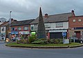
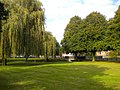
 The Green, Anstey - geograph.org.uk - 78625.jpg 640 × 427; 194 KB
-
 The Nook, Anstey - geograph.org.uk - 78624.jpg 640 × 427; 112 KB
-


_-_geograph.org.uk_-_3589270.jpg)


