Category:Anvers Island
跳转到导航
跳转到搜索
high, mountainous island 61 km (38 miles) long, outside Antarctica  | |||||
| 上传媒体 | |||||
| 隶属于 | |||||
|---|---|---|---|---|---|
| 所属实体 | |||||
| 名称由来 | |||||
| 位置 | 南极条约地区 | ||||
| 相接水体 | |||||
| 發現者或發明者 |
| ||||
| 发现或发明时间 |
| ||||
| 寬度 |
| ||||
| 长度 |
| ||||
| 最高点 |
| ||||
| 人口 |
| ||||
| 面积 |
| ||||
| 海拔 |
| ||||
 | |||||
分类“Anvers Island”中的媒体文件
以下15个文件属于本分类,共15个文件。
-
 00 2183 Antarctica - Neumayer Channel.jpg 2,168 × 1,440;3.12 MB
-
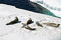 00 3350 Lobodon carcinophagus.jpg 2,168 × 1,440;2.19 MB
-
 Akademik Ioffe - Flickr - puliarf.jpg 1,700 × 1,211;1.01 MB
-
 Ant-pen map anvers.PNG 720 × 989;256 KB
-
 Antarctica - Neumayer Channel (Anvers Island, Wiencke Island) - 2005.jpg 2,048 × 1,360;2.92 MB
-
 Anvers Island (orthographic projection).svg 553 × 553;1.3 MB
-
 Anvers Island, Palmer Archipelago, BAT.svg 522 × 514;3.53 MB
-
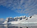
 Anvers Island.jpg 1,280 × 960;1.34 MB
-
 AnversIsland Terra MODIS.jpg 350 × 350;45 KB
-
 Cruise ship Le Lyrial off Anvers Island, Antarctica V-P.jpg 6,254 × 4,172;10.08 MB
-
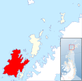
 Location map Anvers Island Antarctica.png 2,878 × 2,218;2.48 MB
-
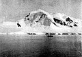
 Mount Francais.jpg 1,280 × 960;1.66 MB
-
 Mount William.jpg 502 × 347;46 KB
-
 Neumayer Channel.JPG 4,608 × 3,456;6.29 MB
-
 Palmer archipelago, Antarctica.jpg 517 × 513;170 KB


_-_2005.jpg)
.svg)


