Category:Appalachian Trail
Przejdź do nawigacji
Przejdź do wyszukiwania
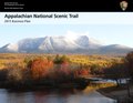
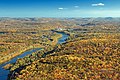
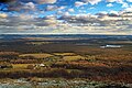
2,198.4-mile (3,538 km) trail going through fourteen US states managed by the National Park Service  Хребет Франконія, ділянка Аппалачської стежки.   | |||||
| Prześlij plik multimedialny | |||||
| Jest to |
| ||||
|---|---|---|---|---|---|
| Część |
| ||||
| Położony na terenie chronionym | |||||
| Miejsce | |||||
| Połączone z |
| ||||
| Operator |
| ||||
| Składa się z | |||||
| Status dobra kultury |
| ||||
| Długość |
| ||||
| Łańcuch górski | |||||
| Najwyższy punkt | |||||
| Punkt skrajny | |||||
| oficjalna strona internetowa | |||||
 | |||||
English: The Appalachian Trail — a long distance National Scenic Trail in the Appalachian Mountains of the Eastern United States.
Podkategorie
Poniżej wyświetlono 11 spośród wszystkich 11 podkategorii tej kategorii.
+
- Maps of the Appalachian Trail (11 plików)
A
- Myron Avery (2 pliki)
G
- Emma Gatewood (5 plików)
- George Masa d. 1933 Historic Marker P-99 (2 pliki)
M
- Max Patch (3 pliki)
S
T
- Raymond H. Torrey (4 pliki)
Pliki w kategorii „Appalachian Trail”
Poniżej wyświetlono 129 spośród wszystkich 129 plików w tej kategorii.
-
 Acer rubrum (10355439495).jpg 3456 × 5184; 19,62 MB
-
 Acer saccharum (10355145306).jpg 3456 × 5184; 20,84 MB
-
 Acer saccharum (10355299666).jpg 3456 × 5184; 20,39 MB
-
 Acer saccharum (10355386973).jpg 3456 × 5184; 19,5 MB
-

-
 ANST-Triangle-Logo 1.jpg 312 × 335; 20 KB
-
 ANSTLogo.jpg 292 × 282; 20 KB
-
 APPA 2015 Business Plan page version.pdf 1650 × 1275, 52 strony; 6,95 MB
-
 APPA compendium 2002.pdf 1275 × 1520, 17 stron; 7,77 MB
-
 APPA FMP 04-23-13.pdf 1275 × 1650, 85 stron; 3,49 MB
-
 APPA Foundation-Document December 2014.pdf 1275 × 1650, 70 stron; 12,45 MB
-
 APPA Policy on Unmanned Aircraft 2014.pdf 1275 × 1650, 2 strony; 917 KB
-
 Appalachian NST AT-report-web.pdf 1275 × 1650, 28 stron; 1,99 MB
-
 Appalachian NST AT-summary-web.pdf 1275 × 1650, 2 strony; 177 KB
-
 Appalachian NST CompPlan web.pdf 1275 × 1650, 42 strony; 161 KB
-
 Appalachian NST Main Report-2.pdf 1275 × 1650, 211 stron; 838 KB
-
 Appalachian NST MainReport Appendices.pdf 1275 × 1650, 281 stron; 863 KB
-
 Appalachian Trail at Georgia - panoramio.jpg 3216 × 2136; 1,78 MB
-
 Appalachian Trail Blaze En Route to Hawksbill Summit.jpg 4032 × 3024; 3,67 MB
-
 Appalachian Trail in downtown Hot Springs, NC.jpg 1814 × 2985; 1,99 MB
-
 Appalachian Trail in winter - Flickr - pellaea.jpg 3380 × 2535; 1,61 MB
-
 Appalachian Trail LCCN2011631216.tif 3453 × 4319; 85,37 MB
-
 Appalachian Trail near top of Snowbird Mountain - Flickr - pellaea.jpg 6898 × 3570; 9,96 MB
-
 Appalachian Trail Pilot Visitor Count Survey 2009.pdf 1275 × 1650, 127 stron; 575 KB
-
 Appalachian Trail, Peter's Mountain WV-VA 2.jpg 4608 × 3456; 7,75 MB
-
 Appalachian Trail, Peter's Mountain WV-VA 3.jpg 4608 × 3456; 7,84 MB
-
 Appalachian Trail, Peter's Mountain WV-VA 4.jpg 4608 × 3456; 8,8 MB
-
 Appalachian Trail, Peter's Mountain WV-VA.jpg 4608 × 3456; 8,59 MB
-
 Appalachian Trail- Totts Gap to Mount Minsi (1) (10355586453).jpg 5184 × 2936; 13,2 MB
-
 Appalachian Trail- Totts Gap to Mount Minsi (10) (10355537623).jpg 5184 × 3051; 14,15 MB
-
 Appalachian Trail- Totts Gap to Mount Minsi (11) (10355327996).jpg 5184 × 3456; 18,43 MB
-
 Appalachian Trail- Totts Gap to Mount Minsi (12) (10355265295).jpg 3456 × 4673; 14,41 MB
-
 Appalachian Trail- Totts Gap to Mount Minsi (14) (10355405723).jpg 5184 × 3262; 12,6 MB
-
 Appalachian Trail- Totts Gap to Mount Minsi (15) (10355246136).jpg 5184 × 3059; 16,65 MB
-
 Appalachian Trail- Totts Gap to Mount Minsi (17) (10355171246).jpg 3456 × 5184; 17,73 MB
-
 Appalachian Trail- Totts Gap to Mount Minsi (19) (10355303223).jpg 5184 × 3456; 15,39 MB
-
 Appalachian Trail- Totts Gap to Mount Minsi (2) (10355544225).jpg 5184 × 3456; 20,18 MB
-
 Appalachian Trail- Totts Gap to Mount Minsi (20) (10355280153).jpg 5184 × 3456; 15,08 MB
-
 Appalachian Trail- Totts Gap to Mount Minsi (3) (10355481004).jpg 3456 × 5184; 10,81 MB
-
 Appalachian Trail- Totts Gap to Mount Minsi (4) (10355468906).jpg 5184 × 3456; 18,25 MB
-
 Appalachian Trail- Totts Gap to Mount Minsi (5) (10355517116).jpg 3456 × 5085; 21,8 MB
-
 Appalachian Trail- Totts Gap to Mount Minsi (6) (10355410375).jpg 3456 × 5184; 10,07 MB
-
 Appalachian Trail- Totts Gap to Mount Minsi (7) (10355367934).jpg 5184 × 3242; 14,47 MB
-
 Appalachian Trail- Totts Gap to Mount Minsi (9) (10355379496).jpg 4199 × 2549; 4,42 MB
-
 Appalachian Trail.jpg 1920 × 2560; 1,39 MB
-
 The Appalachian Trail (IA appalachiantrail951unit).pdf 1168 × 1908, 12 stron; 916 KB
-
 AT - Hog Pen Gap2.jpg 1632 × 1595; 507 KB
-
 AT Visitor Count Pilot Survey 2011.pdf 1275 × 1650, 68 stron; 5,14 MB
-
 Autumn road into the mountains (Unsplash).jpg 5871 × 3919; 15,73 MB
-
 Blood Mountain, United States (Unsplash).jpg 5118 × 3244; 8,82 MB
-
 BlueMountainPanorama.jpg 11 516 × 3948; 21,2 MB
-
 Browned (8177486291).jpg 5153 × 3456; 15,41 MB
-
 Bygone (10368984224).jpg 5184 × 3456; 18,47 MB
-
 Cliff View (10368998854).jpg 3456 × 3317; 7,47 MB
-
 Crinkled (11040839506).jpg 3456 × 5184; 16,01 MB
-
 Downriver View (10369273563).jpg 5184 × 3456; 17,07 MB
-
 End of the ride - panoramio.jpg 2592 × 1952; 1,79 MB
-
 Following the Appalachian Trail LCCN2011630545.tif 4339 × 3450; 42,86 MB
-
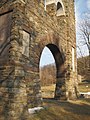 Gathland State Park Arch - panoramio.jpg 2448 × 3264; 4,19 MB
-
 Grassy ridge trail - panoramio.jpg 4480 × 1840; 1,47 MB
-
 Great North Woods - New Hampshire.jpg 2816 × 1880; 5,42 MB
-
 Great Swamp - panoramio.jpg 4352 × 3264; 7,66 MB
-
 Green Mountains 182613785.jpg 1536 × 2048; 812 KB
-
 Heavy fog in the woods (Unsplash).jpg 5184 × 3456; 1,39 MB
-
 Highest point on the A.T. - panoramio.jpg 3264 × 1840; 2,53 MB
-
 Hot Springs campsite along the Appalachian Trail.jpg 4032 × 3024; 15,69 MB
-
 James River Footbridge 1.jpg 4032 × 3024; 4,2 MB
-
 James River Footbridge 2.jpg 4032 × 3024; 3,67 MB
-
 James River Footbridge 3.jpg 4032 × 3024; 3,89 MB
-
 James River Footbridge 4.jpg 4032 × 3024; 2,3 MB
-
 James River Footbridge 6.jpg 4032 × 3024; 3,19 MB
-
 James River Footbridge 7.jpg 4032 × 3024; 3,16 MB
-
 James River Footbridge 8.jpg 4032 × 3024; 4,74 MB
-
 James River Footbridge 9.jpg 4032 × 3024; 4,2 MB
-
 Lemon Squeezer - panoramio.jpg 4352 × 3264; 4,07 MB
-
 Lookout (9528343582).jpg 3456 × 5184; 10,42 MB
-
 Map of Triple Crown of Hiking Trail.png 280 × 183; 56 KB
-
 Marred (11040800216).jpg 3456 × 5184; 19,27 MB
-
 May-2010-LehighGapProject-FactSheet.pdf 1275 × 1650, 2 strony; 769 KB
-
 Moon Over Appalachian Trail by Brian S Woods.jpg 2263 × 3677; 2,84 MB
-
 Mount Rogers summit 2008.jpg 3072 × 2304; 4,61 MB
-
 Mt. Tammany Trail Map.webp 1152 × 718; 95 KB
-
 Nelson Overlook (Revisited) (1) (8298918564).jpg 5184 × 3456; 10,5 MB
-
 Nelson Overlook (Revisited) (2) (8297871481).jpg 5184 × 3456; 11,11 MB
-
 Newfound Gap - panoramio (1).jpg 4608 × 3456; 3,72 MB
-
 NPS-ATC-MOU-2004.pdf 1275 × 1650, 7 stron; 123 KB
-
 Original 1930 ATC brass diamond tree marker.jpg 1600 × 1200; 603 KB
-
 Outcrop (11040949723).jpg 5184 × 2681; 9,51 MB
-
 Pitch Pine (8177521786).jpg 3456 × 4026; 11,87 MB
-
 Rocksylvania (11059547666).jpg 5184 × 3456; 24,72 MB
-
 Round bald - panoramio.jpg 6256 × 1808; 1,89 MB
-
 Scoutatmap.jpg 2592 × 1944; 2,07 MB
-
 Short Hike (1) (20435812532).jpg 5184 × 3114; 14,82 MB
-
 Short Hike (10) (20258015499) (17x22).jpg 2421 × 3134; 3,28 MB
-
 Short Hike (10) (20258015499).jpg 2961 × 3134; 3,4 MB
-
 Short Hike (11) (19822066404).jpg 3456 × 3859; 7,61 MB
-
 Short Hike (12) (20256694420).jpg 5184 × 3456; 20,46 MB
-
 Short Hike (2) (20435835912).jpg 5044 × 3206; 14,58 MB
-
 Short Hike (3) (20257893559).jpg 5016 × 2637; 12,42 MB
-
 Short Hike (3) (9707571300).jpg 5184 × 2823; 10,24 MB
-
 Short Hike (4) (20256557498).jpg 5184 × 3456; 13,22 MB
-
 Short Hike (4) (9704345703).jpg 3456 × 5184; 12,68 MB
-
 Short Hike (5) (9704327217).jpg 5184 × 3456; 12 MB
-
 Short Hike (6) (9704317677).jpg 3456 × 4937; 14,71 MB
-
 Short Hike (7) (9704390767).jpg 5184 × 3456; 19,36 MB
-
 Short Hike (9) (20258019969).jpg 2775 × 2744; 2,78 MB
-
 Smyth Co Recreation (20251247662).jpg 3000 × 2250; 2,55 MB
-
 Spreading Canopy (8484176924).jpg 3456 × 5184; 19,51 MB
-
 Squall Line (1) (8484169882).jpg 5184 × 3212; 12,03 MB
-
 Squall Line (2) (8483071743).jpg 5184 × 3456; 8,41 MB
-
 Squall Line (3) (8484161254).jpg 5184 × 3456; 10,46 MB
-
 Squall Line (4) (8484157000).jpg 5044 × 3397; 10,2 MB
-
 Summit (10369239743).jpg 3456 × 4438; 12,68 MB
-
 Sunfish-pond-nj-november2020.jpg 4096 × 3072; 1,91 MB
-
 TJWikiOldATDiamond.jpg 1200 × 898; 766 KB
-
 Top of Challenge - panoramio.jpg 1280 × 960; 161 KB
-
 Veterans Memorial Monument at High Point State Park in late spring sunset.jpg 2579 × 1720; 1,3 MB
-
 View from Appalachian Trail near Low Gap - Flickr - pellaea.jpg 10 438 × 2553; 4,77 MB
-
 View from Dickey Ridge Visitors Center, Shenandoah NP, Virginia 1.jpg 4032 × 3024; 3,96 MB
-
 View from Dickey Ridge Visitors Center, Shenandoah NP, Virginia 2.jpg 4032 × 2268; 2,67 MB
-
 View from Dickey Ridge Visitors Center, Shenandoah NP, Virginia 3.jpg 4032 × 2268; 3 MB
-
 View from Dickey Ridge Visitors Center, Shenandoah NP, Virginia 4.jpg 4032 × 3024; 4,32 MB
-
 Vt14.jpg 800 × 593; 92 KB
-
 Walasi-Yi Interpretive Center from the shoe tree.jpg 5548 × 3699; 11,33 MB
-
 Waterfall - panoramio (10).jpg 4320 × 3240; 4,65 MB
-
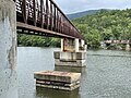
 Where the Potomac merges into the Shenandoah River at Harper's Ferry - panoramio.jpg 3872 × 2592; 3,08 MB
-
 Wild Geranium, Angels Rest Cluster.jpg 5184 × 3456; 6,27 MB
-
 Wildcat Mountain - panoramio.jpg 3456 × 2304; 4,83 MB
-
 Windswept trees on a slope (Unsplash).jpg 4800 × 3200; 2,86 MB
.jpg)
.jpg)
.jpg)
.jpg)


_(10355586453).jpg)
_(10355537623).jpg)
_(10355327996).jpg)
_(10355265295).jpg)
_(10355405723).jpg)
_(10355246136).jpg)
_(10355171246).jpg)
_(10355303223).jpg)
_(10355544225).jpg)
_(10355280153).jpg)
_(10355481004).jpg)
_(10355468906).jpg)
_(10355517116).jpg)
_(10355410375).jpg)
_(10355367934).jpg)
_(10355379496).jpg)


.jpg)
.jpg)
.jpg)
.jpg)
.jpg)
.jpg)
.jpg)


.jpg)


.jpg)

.jpg)


_(1)_(8298918564).jpg)
_(2)_(8297871481).jpg)
.jpg)

.jpg)
.jpg)
.jpg)

_(20435812532).jpg)
_(20258015499)_(17x22).jpg)
_(20258015499).jpg)
_(19822066404).jpg)
_(20256694420).jpg)
_(20435835912).jpg)
_(20257893559).jpg)
_(9707571300).jpg)
_(20256557498).jpg)
_(9704345703).jpg)
_(9704327217).jpg)
_(9704317677).jpg)
_(9704390767).jpg)
_(20258019969).jpg)
.jpg)
.jpg)
_(8484169882).jpg)
_(8483071743).jpg)
_(8484161254).jpg)
_(8484157000).jpg)
.jpg)


.jpg)


.jpg)