Category:Appledore, Torridge
Vai alla navigazione
Vai alla ricerca
village at the mouth of the River Torridge in Devon, England  | |||||
| Carica un file multimediale | |||||
| Istanza di | |||||
|---|---|---|---|---|---|
| Luogo | |||||
 | |||||
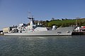
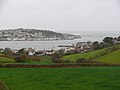
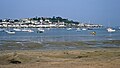
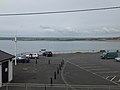
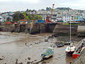
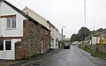
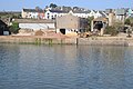
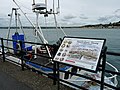
English: Appledore is a village at the mouth of the River Torridge, about 6 miles (10 kilometres) west of Barnstaple in the county of Devon. It is home to Appledore Shipbuilders, a lifeboat slipway and Hockings Ice Cream, a brand of ice cream only sold in North Devon. The local football team is Appledore F.C.
Français : Appledore est un village d'environ situé à l' embouchure du fleuve Torridge, à environ 10 kilomètres à l'ouest de Barnstaple dans le comté de Devon en Angleterre.
Polski: Appledore - niewielkie miasto w Wielkiej Brytanii, w Anglii w hrabstwie Devon, przy ujściu rzeki Torridge, 10 km na zachód od Barnstaple. Port rybacki, niewielka stocznia.
Português: Appledore é um vilarejo localizado no condado de Devon, Inglaterra. Fica na foz do rio Torridge, cerca de 10 quilômetros à oeste de Barnstaple. Possui uma equipe de futebol local, o Appledore F.C..
Sottocategorie
Questa categoria contiene le 8 sottocategorie indicate di seguito, su un totale di 8.
A
- Appledore F.C. (5 F)
- St Mary's church, Appledore (16 F)
- Appledore Pilot Gig Club (2 F)
- Appledore War Memorial (5 F)
File nella categoria "Appledore, Torridge"
Questa categoria contiene 200 file, indicati di seguito, su un totale di 393.
(pagina precedente) (pagina successiva)-
 'Samuel Beckett' at Appledore - geograph.org.uk - 3950576.jpg 1 280 × 851; 197 KB
-
 11 - 13 Meeting Street - geograph.org.uk - 6352820.jpg 678 × 1 024; 528 KB
-
 11 - 13 Meeting Street - geograph.org.uk - 6352822.jpg 1 024 × 678; 558 KB
-
 113 - 115 Irsha Street - geograph.org.uk - 6353174.jpg 678 × 1 024; 510 KB
-
 129 - 131 Irsha Street - geograph.org.uk - 6355747.jpg 678 × 1 024; 632 KB
-
 3 The Quay - geograph.org.uk - 6352808.jpg 1 024 × 678; 599 KB
-
 69 and 70 Irsha Street - geograph.org.uk - 6353341.jpg 678 × 1 024; 441 KB
-
 71 - 72 and 72a Irsha Street - geograph.org.uk - 6353333.jpg 678 × 1 024; 604 KB
-
 7a Meeting Street - geograph.org.uk - 6352826.jpg 678 × 1 024; 499 KB
-
 A service road in West Appledore - geograph.org.uk - 4044779.jpg 1 536 × 1 152; 1 004 KB
-
 A slipway on the River Torridge which leads from Newquay Street (geograph 3360145).jpg 1 063 × 1 600; 544 KB
-
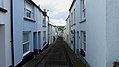
 A Steep Street in Appledore - geograph.org.uk - 347153.jpg 640 × 480; 115 KB
-
 Advertising signs on the seafront - geograph.org.uk - 4555397.jpg 640 × 480; 58 KB
-
 Alpha Lane - Meeting Street - geograph.org.uk - 5393467.jpg 640 × 480; 60 KB
-

-
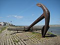
 An anchor at Appledore - geograph.org.uk - 1354801.jpg 640 × 480; 86 KB
-
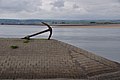
 An anchor in Appledore - geograph.org.uk - 1354781.jpg 640 × 480; 73 KB
-
 Apartments on Staddon Road, Appledore - geograph.org.uk - 3361604.jpg 1 600 × 1 068; 553 KB
-
 Appeldore - geograph.org.uk - 6356834.jpg 1 024 × 678; 703 KB
-
 Appledore , Anchor ^ River Torridge - geograph.org.uk - 4018731.jpg 4 288 × 2 848; 6,65 MB
-
 Appledore , Artwork - geograph.org.uk - 4018711.jpg 3 108 × 2 644; 6,84 MB
-
 Appledore , Car Park ^ River Torridge - geograph.org.uk - 4018738.jpg 4 288 × 2 848; 4,71 MB
-
 Appledore , Coastal Rocks - geograph.org.uk - 4018760.jpg 4 288 × 2 848; 5,2 MB
-
 Appledore , Hubbastone Road - geograph.org.uk - 4018669.jpg 4 288 × 2 848; 6,2 MB
-
 Appledore , Lifeboat Station - geograph.org.uk - 4018768.jpg 4 288 × 2 848; 6,61 MB
-
 Appledore , Middle Dock - geograph.org.uk - 4018695.jpg 4 288 × 2 848; 5,76 MB
-
 Appledore , Myrtle Street - geograph.org.uk - 4018709.jpg 4 288 × 2 848; 4,31 MB
-
 Appledore , Pink House - geograph.org.uk - 4018745.jpg 2 848 × 4 288; 6,19 MB
-
 Appledore , Polywell - geograph.org.uk - 4018769.jpg 4 288 × 2 848; 6,97 MB
-
 Appledore , River Taw ^ Torridge Estuary - geograph.org.uk - 4018730.jpg 4 288 × 2 848; 6,43 MB
-
 Appledore , River Taw ^ Torridge Estuary - geograph.org.uk - 4018756.jpg 4 288 × 2 848; 7,56 MB
-
 Appledore , River Taw ^ Torridge Estuary - geograph.org.uk - 4018757.jpg 4 288 × 2 848; 5,82 MB
-
 Appledore , River Taw ^ Torridge Estuary - geograph.org.uk - 4018758.jpg 4 288 × 2 848; 6,47 MB
-
 Appledore , River Taw ^ Torridge Estuary - geograph.org.uk - 4018761.jpg 4 288 × 2 848; 7,75 MB
-
 Appledore , River Taw ^ Torridge Estuary - geograph.org.uk - 4018763.jpg 4 109 × 2 730; 5,18 MB
-
 Appledore , River Taw ^ Torridge Estuary - geograph.org.uk - 4018764.jpg 4 220 × 2 802; 5,06 MB
-
 Appledore , River Taw ^ Torridge Estuary - geograph.org.uk - 4018766.jpg 4 288 × 2 848; 6,11 MB
-
 Appledore , River Taw ^ Torridge Estuary - geograph.org.uk - 4018767.jpg 4 234 × 2 812; 6,41 MB
-
 Appledore , River Torridge - geograph.org.uk - 4018671.jpg 4 288 × 2 848; 4,8 MB
-
 Appledore , River Torridge - geograph.org.uk - 4018674.jpg 4 288 × 2 848; 7,1 MB
-
 Appledore , River Torridge ^ Instow Scenery - geograph.org.uk - 4018732.jpg 4 123 × 2 738; 6,14 MB
-
 Appledore , South Road - geograph.org.uk - 4018682.jpg 4 288 × 2 848; 5,5 MB
-
 Appledore , St Mary's Church - geograph.org.uk - 4018737.jpg 4 288 × 2 848; 6,52 MB
-
 Appledore , The Beaver Inn - geograph.org.uk - 4018749.jpg 4 288 × 2 848; 5,37 MB
-
 Appledore , The Quay - geograph.org.uk - 4018721.jpg 4 288 × 2 848; 4,49 MB
-
 Appledore , The Skern - geograph.org.uk - 4018765.jpg 4 288 × 2 848; 5,71 MB
-
 Appledore - First 42459 (R459CCV).jpg 1 024 × 768; 191 KB
-
 Appledore - geograph.org.uk - 1394268.jpg 640 × 416; 65 KB
-
 Appledore - panoramio (1).jpg 1 024 × 494; 407 KB
-
 Appledore - panoramio - PJMarriott (1).jpg 3 072 × 2 304; 1,24 MB
-
 Appledore - panoramio - PJMarriott (2).jpg 3 072 × 2 304; 1,15 MB
-
 Appledore - panoramio - PJMarriott (3).jpg 3 072 × 2 304; 1,15 MB
-
 Appledore - panoramio - PJMarriott.jpg 3 072 × 2 304; 1,16 MB
-
 Appledore - panoramio.jpg 3 072 × 2 304; 1,17 MB
-
 Appledore - Richmond Dock - geograph.org.uk - 3442761.jpg 640 × 480; 70 KB
-
 Appledore - River Torridge (geograph 4018715).jpg 4 288 × 2 848; 5,28 MB
-
 Appledore - River Torridge (geograph 4018717).jpg 4 288 × 2 848; 6,27 MB
-
 Appledore - River Torridge (geograph 4018726).jpg 4 205 × 2 793; 6,65 MB
-
 Appledore - Sea Place (geograph 4018705).jpg 4 288 × 2 848; 4,47 MB
-
 Appledore - The Quay & River Torridge (geograph 4018724).jpg 4 266 × 2 834; 4,74 MB
-
 Appledore across the water from Instow Sands - August 2011 - panoramio.jpg 2 288 × 1 712; 793 KB
-
 Appledore and Instow - geograph.org.uk - 713470.jpg 640 × 480; 52 KB
-

-
 Appledore Baptist Church.jpg 4 000 × 6 000; 11,95 MB
-
 Appledore Community Hall (geograph 4044795).jpg 1 536 × 1 150; 785 KB
-
 Appledore Fire Station - geograph.org.uk - 67999.jpg 640 × 428; 225 KB
-
 Appledore Fire Station.jpg 6 000 × 4 000; 12,24 MB
-
 Appledore Fish Dock on the River Torridge - geograph.org.uk - 4862808.jpg 4 000 × 3 000; 4,64 MB
-
 Appledore from Instow Barton Jetty - geograph.org.uk - 5532479.jpg 640 × 480; 53 KB
-
 Appledore from Instow beach - geograph.org.uk - 6129612.jpg 2 382 × 1 340; 2,32 MB
-
 Appledore from Instow Sands - August 2011 - panoramio.jpg 2 288 × 1 712; 783 KB
-
 Appledore from Instow.jpg 3 348 × 2 579; 3,05 MB
-
 Appledore lifeboat station - geograph.org.uk - 5912242.jpg 1 024 × 683; 155 KB
-
 Appledore Lifeboat Station - geograph.org.uk - 6353642.jpg 1 024 × 678; 556 KB
-
 Appledore lifeboat station slipway - geograph.org.uk - 5912246.jpg 1 024 × 683; 171 KB
-
 Appledore Pool - geograph.org.uk - 4670937.jpg 800 × 450; 201 KB
-
 Appledore Quay (geograph 3950367).jpg 1 280 × 851; 220 KB
-
 Appledore Quay - geograph.org.uk - 1392947.jpg 640 × 416; 59 KB
-
 Appledore Quay - geograph.org.uk - 1394261.jpg 640 × 427; 65 KB
-
 Appledore Quay - geograph.org.uk - 31622.jpg 640 × 363; 57 KB
-
 Appledore quay 800.jpg 800 × 586; 163 KB
-
 Appledore riverfront (geograph 4436068).jpg 800 × 531; 88 KB
-
 Appledore riverfrontage (geograph 4436071).jpg 800 × 531; 108 KB
-
 Appledore Royal George at sunset - geograph.org.uk - 1482276.jpg 640 × 480; 54 KB
-
 Appledore shipbuilding yard - geograph.org.uk - 749971.jpg 640 × 339; 48 KB
-
 Appledore shipyard 800.jpg 800 × 513; 96 KB
-
 Appledore Shipyard from Instow Sands - Aug 2011 - panoramio.jpg 2 288 × 1 712; 798 KB
-

-
 Appledore shipyard.jpg 3 864 × 2 744; 4,26 MB
-
 Appledore War Memorial and Baptist Church.jpg 4 896 × 2 752; 6,08 MB
-
 Appledore waterfront - geograph.org.uk - 1742561.jpg 640 × 480; 65 KB
-
 Appledore, as seen from Instow Beach.jpg 4 589 × 2 640; 6,38 MB
-
 Appledore, Devon - geograph.org.uk - 43094.jpg 640 × 427; 63 KB
-
 Appledore, Meeting Street - geograph.org.uk - 3770947.jpg 794 × 1 200; 806 KB
-
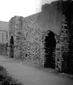
 Appledore, Northern end of the Dockyard - geograph.org.uk - 3770971.jpg 1 199 × 784; 709 KB
-
 Appledore, the Torridge estuary and Bideford Bay - geograph.org.uk - 6432147.jpg 4 470 × 2 400; 5,88 MB
-
 Appledore, viewed from the beach, at Instow - geograph.org.uk - 3055408.jpg 1 024 × 768; 147 KB
-
 Appledore- 5 Meeting Street (geograph 4310182).jpg 1 058 × 1 600; 396 KB
-
 Appledore-Richmond-Dock-June 2021.jpg 1 600 × 1 067; 479 KB
-
 Appledore-shipyard.jpg 640 × 369; 42 KB
-
 Architectural decoration in Appledore's Quay.jpg 2 432 × 2 160; 2,85 MB
-
 Assells, near Appledore - geograph.org.uk - 2854498.jpg 640 × 425; 71 KB
-
 Baptist Church, Appledore - geograph.org.uk - 4555423.jpg 455 × 640; 46 KB
-
-
 Beach, Appledore - geograph.org.uk - 5298324.jpg 2 864 × 1 922; 1,25 MB
-
 Beaver Inn - geograph.org.uk - 4760928.jpg 800 × 600; 78 KB
-
 Beaver Inn - geograph.org.uk - 6353288.jpg 1 024 × 678; 501 KB
-
 Beaver Inn - geograph.org.uk - 6353292.jpg 678 × 1 024; 591 KB
-
 Bell Tower House - Meeting Street - geograph.org.uk - 5393465.jpg 640 × 480; 47 KB
-
 Bethel Chapel - The Quay - geograph.org.uk - 5393533.jpg 640 × 480; 60 KB
-
 Bird of Prey architectural detail in Appledore.jpg 2 206 × 1 444; 1,33 MB
-

-
 Boats on the sand at Appledore - geograph.org.uk - 1394259.jpg 640 × 427; 55 KB
-
 Boats on the Skern - geograph.org.uk - 4670942.jpg 800 × 451; 183 KB
-
 Bude Street - geograph.org.uk - 6352814.jpg 678 × 1 024; 591 KB
-
 Bude Street, Appledore (geograph 3114861).jpg 800 × 533; 408 KB
-
 Bude Street, Appledore - geograph.org.uk - 4670540.jpg 800 × 600; 255 KB
-
 Bude Street, Appledore - geograph.org.uk - 5608535.jpg 768 × 1 024; 191 KB
-
 Bude Street, Appledore, Devon (with resident cat) - geograph.org.uk - 4714065.jpg 2 560 × 1 920; 2,65 MB
-
 Bude Street, Appledore. Looking towards The Quay - geograph.org.uk - 4714064.jpg 2 560 × 1 920; 2,23 MB
-
 Bude Street, Appledore. Showing a resident cat - geograph.org.uk - 4714067.jpg 2 560 × 1 920; 2,53 MB
-
 Bude Street, Appledore.jpg 4 896 × 2 752; 6,39 MB
-
 BWH&AR Appledore station 1969-70.jpg 1 360 × 1 584; 132 KB
-
 BWH&AR Appledore station and railway route in 1969-70.jpg 1 744 × 1 552; 232 KB
-
 BWH&AR Appledore station in 1969-70.jpg 1 792 × 1 120; 172 KB
-
 By the sea at Western Hill - geograph.org.uk - 5298064.jpg 3 072 × 2 048; 1,29 MB
-
 Car Park - off The Quay - geograph.org.uk - 5393559.jpg 640 × 480; 43 KB
-
 Car park by the Torridge in West Appledore - geograph.org.uk - 4044788.jpg 1 536 × 1 152; 804 KB
-
 Car park on the seafront - geograph.org.uk - 4555400.jpg 640 × 480; 73 KB
-
-
 Coach & Horses Appledore.jpg 4 000 × 2 664; 2,49 MB
-
 Coach ^ Horses - Market Street - geograph.org.uk - 5393566.jpg 640 × 611; 78 KB
-
 Coast path at Appledore Western Hill - geograph.org.uk - 5298114.jpg 2 048 × 1 536; 513 KB
-
 Coloured houses in Irsha Street, Appledore - geograph.org.uk - 5912252.jpg 1 024 × 683; 164 KB
-
 Colourful cottages, Appledore - geograph.org.uk - 3070541.jpg 640 × 480; 93 KB
-
 Cottages, at the end of Jubilee Road - geograph.org.uk - 4257549.jpg 1 024 × 768; 119 KB
-
 Crabbing on The Quay at Appledore - geograph.org.uk - 3071030.jpg 640 × 400; 95 KB
-
 Crossroads in Appledore - geograph.org.uk - 1360010.jpg 640 × 480; 61 KB
-
 Darracotts Court - geograph.org.uk - 6353554.jpg 678 × 1 024; 610 KB
-
 Derelict buildings, New Quay Street, Appledore - geograph.org.uk - 4044804.jpg 1 536 × 1 150; 777 KB
-

-
 Disused buildings near middle dock, Appledore - geograph.org.uk - 3360142.jpg 1 600 × 1 063; 472 KB
-
 Dockyard, Appledore (geograph 3040566).jpg 640 × 460; 52 KB
-
 Docton Court - geograph.org.uk - 6352617.jpg 1 024 × 678; 634 KB
-
 Early morning in Appledore - geograph.org.uk - 959768.jpg 640 × 427; 57 KB
-
 East-facing Marine Parade, Appledore - geograph.org.uk - 4488232.jpg 640 × 480; 73 KB
-
 Ebenezer Baptist Church - geograph.org.uk - 6352823.jpg 678 × 1 024; 681 KB
-

-

-
-
 Factory Ope - geograph.org.uk - 6352813.jpg 678 × 1 024; 738 KB
-
 Ferry for Instow leaving Appledore - geograph.org.uk - 5912257.jpg 1 024 × 683; 135 KB
-
-
 Fishing off the quay at Appledore - geograph.org.uk - 1595437.jpg 640 × 480; 28 KB
-
 Foreshore, Appledore Pool - geograph.org.uk - 5297938.jpg 3 072 × 2 048; 1,66 MB
-
 Foreshore, Appledore Pool - geograph.org.uk - 5297952.jpg 2 048 × 3 072; 1,34 MB
-
 Foreshore, West Appledore - geograph.org.uk - 4257660.jpg 1 024 × 768; 176 KB
-
 Gibbs Lane, Appledore - geograph.org.uk - 3584289.jpg 3 456 × 4 608; 2,48 MB
-
 Green Lane, Appledore - geograph.org.uk - 4444263.jpg 640 × 480; 58 KB
-
 Grounded boats at Appledore - geograph.org.uk - 1392945.jpg 640 × 402; 67 KB
-
 Home of Appledore FC - geograph.org.uk - 4055801.jpg 640 × 472; 67 KB
-
 House on Irsha Street - geograph.org.uk - 3036290.jpg 2 000 × 1 504; 405 KB
-
 House with a fine view - geograph.org.uk - 4670947.jpg 800 × 451; 189 KB
-
 Houses along the shoreline - geograph.org.uk - 2264395.jpg 640 × 480; 75 KB
-
 Houses on Irsha Street, Appledore - geograph.org.uk - 1354856.jpg 640 × 480; 83 KB
-
 Hubbastone Road, Appledore - geograph.org.uk - 5298337.jpg 1 841 × 1 112; 288 KB
-
 Hubbastone Road, Appledore - geograph.org.uk - 5298348.jpg 1 916 × 1 192; 381 KB
-
 Ibex Court off Irsha Street - geograph.org.uk - 3036281.jpg 1 500 × 1 990; 312 KB
-
 Ice cream weather today^ - geograph.org.uk - 4497840.jpg 640 × 480; 64 KB
-
 Industrial site, Appledore - geograph.org.uk - 4436060.jpg 800 × 531; 118 KB
-
 Industrial Units on Hubbastone Road, Appledore - geograph.org.uk - 3361591.jpg 1 600 × 1 067; 414 KB
-
 Information Board, The Quay, Appledore - geograph.org.uk - 3072240.jpg 640 × 480; 113 KB
-

-
 Irsha Court - geograph.org.uk - 6353064.jpg 1 024 × 678; 549 KB
-
 Irsha Street - geograph.org.uk - 5297717.jpg 3 072 × 2 048; 1,12 MB
-
 Irsha Street - geograph.org.uk - 5298292.jpg 3 072 × 2 048; 1,25 MB
-
 Irsha Street - geograph.org.uk - 5298313.jpg 1 175 × 1 426; 331 KB
-
 Irsha Street - geograph.org.uk - 6353158.jpg 678 × 1 024; 627 KB
-
 Irsha Street - geograph.org.uk - 6353266.jpg 1 024 × 678; 503 KB
-
 Irsha Street - geograph.org.uk - 6353630.jpg 1 024 × 678; 639 KB
-
 Irsha Street - geograph.org.uk - 6353631.jpg 678 × 1 024; 519 KB
-
 Irsha Street - geograph.org.uk - 6355524.jpg 678 × 1 024; 536 KB
-
 Irsha Street - geograph.org.uk - 6355542.jpg 1 024 × 678; 454 KB
-
 Irsha Street - geograph.org.uk - 6355732.jpg 1 024 × 678; 520 KB
-
 Irsha Street - geograph.org.uk - 6355733.jpg 678 × 1 024; 566 KB
-
 Irsha Street - geograph.org.uk - 6355735.jpg 1 024 × 678; 552 KB
-
 Irsha Street - geograph.org.uk - 959753.jpg 640 × 427; 53 KB
-
 Irsha Street, Appledore - geograph.org.uk - 1354844.jpg 480 × 640; 58 KB
-
 Irsha Street, Appledore - geograph.org.uk - 3033463.jpg 1 500 × 2 007; 392 KB
-
 Irsha Street, Appledore - geograph.org.uk - 3040538.jpg 640 × 480; 59 KB
-
 Irsha Street, Appledore - geograph.org.uk - 4257480.jpg 1 024 × 768; 103 KB
-
 Irsha Street, Appledore - geograph.org.uk - 4257500.jpg 1 024 × 768; 136 KB
-
 Irsha Street, Appledore - geograph.org.uk - 5912250.jpg 1 024 × 683; 143 KB
-
 Irsha Street, looking east - geograph.org.uk - 1377875.jpg 640 × 480; 170 KB
-
 Irsha Street, looking west - geograph.org.uk - 1377879.jpg 640 × 480; 154 KB
-
 Irsha Street, West Appledore - geograph.org.uk - 4257537.jpg 1 024 × 768; 128 KB
-
 Irsha Street, West Appledore - geograph.org.uk - 4670559.jpg 800 × 532; 233 KB
-
 Jubilee Beacon - Car Park - geograph.org.uk - 5393556.jpg 535 × 640; 41 KB
-
 Leading away from a slipway towards Newquay Street - geograph.org.uk - 3360144.jpg 1 600 × 1 063; 760 KB
-
 Lifeboat slipway, Appledore - geograph.org.uk - 3033490.jpg 2 000 × 1 500; 275 KB


.jpg)


.jpg)

.jpg)
.jpg)
.jpg)
.jpg)


.jpg)
.jpg)
.jpg)
.jpg)
.jpg)


.jpg)


.jpg)


.jpg)
.jpg)


.jpg)


.jpg)


.jpg)


_-_geograph.org.uk_-_4714065.jpg)


.jpg)


.jpg)
.jpg)


