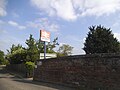
Category:Appleford-on-Thames
Aller à la navigation
Aller à la recherche
localité britannique du comté anglais d'Oxfordshire  | |||||
| Téléverser des médias | |||||
| Nature de l’élément | |||||
|---|---|---|---|---|---|
| Lieu | Vale of White Horse, Oxfordshire, Angleterre du Sud-Est, Angleterre | ||||
| Baigné par | |||||
| Superficie |
| ||||
| site officiel | |||||
 | |||||
English: Appleford-on-Thames is a village and civil parish on the south bank of the River Thames about north of Didcot, Oxfordshire. In 1974 it was transferred from Berkshire.

Sous-catégories
Cette catégorie comprend 4 sous-catégories, dont les 4 ci-dessous.
A
- Carpenters Arms, Appleford (5 F)
- Appleford Railway Bridge (19 F)
- Appleford railway station (7 F)
P
Média dans la catégorie « Appleford-on-Thames »
Cette catégorie comprend 220 fichiers, dont les 200 ci-dessous.
(page précédente) (page suivante)-
 A weir near Clifton Hampden - geograph.org.uk - 4578204.jpg 1 500 × 989 ; 189 kio
-
 Across the East End - geograph.org.uk - 5013244.jpg 1 024 × 683 ; 163 kio
-
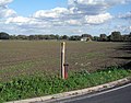
 Allotments south of Appleford - geograph.org.uk - 3945720.jpg 640 × 289 ; 44 kio
-
 Along the cycleway - geograph.org.uk - 2186156.jpg 533 × 800 ; 109 kio
-
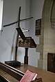
 Altar in St Peter ^ St Paul - geograph.org.uk - 5010343.jpg 1 024 × 683 ; 124 kio
-
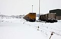 Appleford Sidings - geograph.org.uk - 1653930.jpg 640 × 414 ; 33 kio
-
 Snow covered rails on the Cherwell Valley Line.jpg 640 × 414 ; 28 kio
-
 Thatched wall along the lane - geograph.org.uk - 1597443.jpg 640 × 427 ; 95 kio
-
 Wagons on the Cripple Road - geograph.org.uk - 1654000.jpg 640 × 427 ; 61 kio
-
 Appleford Church - geograph.org.uk - 5010164.jpg 1 024 × 683 ; 101 kio
-
 Appleford Crossing (closed) - geograph.org.uk - 5126663.jpg 2 109 × 1 577 ; 1,08 Mio
-
 Appleford Crossing - geograph.org.uk - 3275447.jpg 640 × 385 ; 55 kio
-
 Appleford Crossing - geograph.org.uk - 3300887.jpg 640 × 480 ; 104 kio
-
 Appleford Crossing from a passing train - geograph.org.uk - 5666613.jpg 5 202 × 3 465 ; 5,52 Mio
-
 Appleford gravel pits - geograph.org.uk - 1232348.jpg 640 × 427 ; 63 kio
-
 Appleford Gravel Pits - geograph.org.uk - 83500.jpg 640 × 481 ; 34 kio
-
 Appleford level crossing - geograph.org.uk - 1232410.jpg 640 × 427 ; 73 kio
-
 Appleford level crossing.jpg 640 × 481 ; 44 kio
-
 Appleford railway station, Oxfordshire - geograph.org.uk - 3387580.jpg 1 024 × 768 ; 289 kio
-
 Appleford Road at the junction of Church Street - geograph.org.uk - 4971395.jpg 2 304 × 1 728 ; 835 kio
-
 Appleford southbound fast freight geograph-2720845-by-Ben-Brooksbank.jpg 2 399 × 1 447 ; 1,03 Mio
-
 Appleford Station - geograph.org.uk - 3300881.jpg 640 × 480 ; 106 kio
-
 Appleford ^ the Powerstation - geograph.org.uk - 5006039.jpg 1 600 × 1 067 ; 211 kio
-
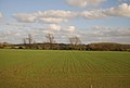 Arable land in the Thames Valley - geograph.org.uk - 3945723.jpg 640 × 430 ; 46 kio
-
 B4016 approaches Appleford - geograph.org.uk - 2803347.jpg 3 648 × 2 688 ; 2,72 Mio
-
 B4016 approaches Appleford Level Crossing - geograph.org.uk - 2803784.jpg 3 251 × 2 388 ; 1,29 Mio
-
 Back to the horseshoe - geograph.org.uk - 1582277.jpg 480 × 640 ; 101 kio
-
 Back to the main road - geograph.org.uk - 1597437.jpg 640 × 427 ; 90 kio
-
 Back up the Nave - geograph.org.uk - 5010181.jpg 533 × 800 ; 89 kio
-
 Barn in the farmyard - geograph.org.uk - 1599783.jpg 640 × 427 ; 82 kio
-
 Below the Didcot - Oxford line - geograph.org.uk - 4690925.jpg 2 592 × 1 944 ; 1,21 Mio
-
 Benchmark on barn at Hill Farm - geograph.org.uk - 2819754.jpg 679 × 1 024 ; 283 kio
-
 Benchmark on Birch Cottage - geograph.org.uk - 2820713.jpg 683 × 1 024 ; 267 kio
-
 Benchmark on buttress of St Peter and St Paul church - geograph.org.uk - 2819926.jpg 683 × 1 024 ; 256 kio
-
 Benchmark on Hartwright House - geograph.org.uk - 2820563.jpg 683 × 1 024 ; 254 kio
-
 Benchmark on the railway bridge at Appleford station - geograph.org.uk - 2820777.jpg 683 × 1 024 ; 277 kio
-
 Bend in the ditch - geograph.org.uk - 1582215.jpg 480 × 640 ; 114 kio
-
 Bend on Appleford Road - geograph.org.uk - 4971392.jpg 2 304 × 1 728 ; 812 kio
-
 Birch Cottage and Crossing Cottage - geograph.org.uk - 2820729.jpg 1 024 × 683 ; 254 kio
-
 Bridge 55 19, north end Appleford Station - geograph.org.uk - 2820797.jpg 1 024 × 683 ; 175 kio
-
 Bridge near the horseshoe - geograph.org.uk - 1582230.jpg 640 × 480 ; 114 kio
-
 Bridge over Moor Ditch - geograph.org.uk - 2186216.jpg 1 024 × 683 ; 174 kio
-
 Bridge over the Ditch - geograph.org.uk - 1582149.jpg 480 × 640 ; 123 kio
-
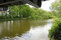
 Bridge over the River Thames - geograph.org.uk - 4690928.jpg 2 592 × 1 944 ; 1,74 Mio
-

-
 Bridleway by Moor Ditch - geograph.org.uk - 3300895.jpg 640 × 480 ; 96 kio
-
 Buildings at Hill Farm - geograph.org.uk - 2819829.jpg 1 024 × 683 ; 181 kio
-
 By the Wall - geograph.org.uk - 5013129.jpg 1 024 × 683 ; 238 kio
-
 Chancel in St Peter ^ St Paul - geograph.org.uk - 5010333.jpg 533 × 800 ; 77 kio
-
 Church in the distance - geograph.org.uk - 1596711.jpg 640 × 427 ; 87 kio
-
 Church Lane - geograph.org.uk - 1599788.jpg 640 × 427 ; 129 kio
-
 Clifton Weir - geograph.org.uk - 4669927.jpg 3 358 × 1 975 ; 1,68 Mio
-
 Cooling towers at Didcot viewed from train - geograph.org.uk - 2874206.jpg 640 × 480 ; 17 kio
-
 Creeping Ivy - geograph.org.uk - 5010513.jpg 533 × 800 ; 143 kio
-
 Cross behind the Lectern - geograph.org.uk - 5010172.jpg 533 × 800 ; 63 kio
-
 Cross Country train heads north - geograph.org.uk - 2820602.jpg 1 024 × 683 ; 114 kio
-
 Crossing up the road - geograph.org.uk - 2186050.jpg 1 024 × 683 ; 146 kio
-
 Cycleway 5 - geograph.org.uk - 1582144.jpg 480 × 640 ; 129 kio
-
 Cycleway across the road - geograph.org.uk - 2186217.jpg 1 024 × 683 ; 99 kio
-
 Details on the signpost - geograph.org.uk - 2186171.jpg 533 × 800 ; 154 kio
-
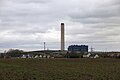
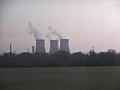
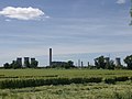 Didcot Power Station - geograph.org.uk - 2213362.jpg 2 560 × 1 920 ; 951 kio
-
 Didcot power station across the field - geograph.org.uk - 2186200.jpg 1 024 × 683 ; 108 kio
-
 Didcot Power Station from above Assendon - geograph.org.uk - 3639972.jpg 3 264 × 2 448 ; 2,79 Mio
-
 Didcot Power Station from Moor Ditch - geograph.org.uk - 3102413.jpg 1 024 × 683 ; 128 kio
-
 Ditch by the path - geograph.org.uk - 1582139.jpg 480 × 640 ; 119 kio
-
 Ditch meets the river - geograph.org.uk - 1584403.jpg 480 × 640 ; 115 kio
-
 Ditch past the bridge - geograph.org.uk - 1582250.jpg 480 × 640 ; 125 kio
-
 Dominates the horizon - geograph.org.uk - 1599773.jpg 640 × 427 ; 86 kio
-
 Don't get that sinking feeling - geograph.org.uk - 1451718.jpg 640 × 454 ; 142 kio
-
 Dovecote in the garden - geograph.org.uk - 1597451.jpg 426 × 640 ; 139 kio
-
 Down the ditch - geograph.org.uk - 1582158.jpg 480 × 640 ; 115 kio
-
 East End of St Peter ^ St Paul - geograph.org.uk - 5013243.jpg 533 × 800 ; 111 kio
-
 Eliza Justice - geograph.org.uk - 5010325.jpg 533 × 800 ; 68 kio
-
 Entrance to Ladygrove Farm - geograph.org.uk - 1240608.jpg 640 × 427 ; 114 kio
-
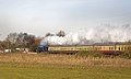
 Evening Steaming - geograph.org.uk - 2708872.jpg 3 772 × 2 408 ; 1 023 kio
-
 Farm building - geograph.org.uk - 3929217.jpg 640 × 398 ; 49 kio
-
 Farmland on the edge of Didcot - geograph.org.uk - 3945724.jpg 640 × 430 ; 48 kio
-
 Farmland south of Appleford Crossing - geograph.org.uk - 3945721.jpg 640 × 430 ; 56 kio
-
 Fence round the Tomb - geograph.org.uk - 5010504.jpg 1 024 × 683 ; 207 kio
-
 Fenced in Tombs - geograph.org.uk - 5013133.jpg 1 024 × 683 ; 206 kio
-
 Field beyond the ditch - geograph.org.uk - 1582196.jpg 640 × 480 ; 54 kio
-
 Field north of Didcot - geograph.org.uk - 1967811.jpg 640 × 480 ; 154 kio
-

-
 Fields west of Oxford-Didcot railway line at Hill Farm - geograph.org.uk - 2764278.jpg 1 024 × 683 ; 117 kio
-
 Flooded field near Appleford - geograph.org.uk - 5666611.jpg 5 202 × 3 465 ; 6,7 Mio
-
 Flooding by the River Thames - geograph.org.uk - 3929228.jpg 640 × 401 ; 45 kio
-
 Flooding, River Thames - geograph.org.uk - 3929239.jpg 640 × 430 ; 72 kio
-
 Footbridge on the Thames Path - geograph.org.uk - 3176238.jpg 640 × 480 ; 188 kio
-
 Footbridge on the Thames Path - geograph.org.uk - 4562255.jpg 1 500 × 999 ; 279 kio
-
 Footpath at the back - geograph.org.uk - 1599765.jpg 640 × 427 ; 121 kio
-
 Footpath beside B4016 - geograph.org.uk - 2820810.jpg 1 024 × 683 ; 221 kio
-
 Footpath between Appleford and Long Wittenham - geograph.org.uk - 1232363.jpg 640 × 427 ; 119 kio
-
 Footpath round the bend - geograph.org.uk - 1597473.jpg 640 × 427 ; 121 kio
-
 Freightliner heads south, south of Culham - geograph.org.uk - 4316222.jpg 1 024 × 683 ; 255 kio
-
 From by the church - geograph.org.uk - 1597464.jpg 640 × 427 ; 73 kio
-
 Gate by Appleford Road - geograph.org.uk - 4971396.jpg 2 304 × 1 728 ; 838 kio
-
 Geranium pratense by the Thames Path - geograph.org.uk - 4562271.jpg 1 500 × 1 403 ; 162 kio
-
 GLC waste container train hiding in the snow - geograph.org.uk - 1653998.jpg 640 × 427 ; 23 kio
-
 Grassed over road in Appleford - geograph.org.uk - 4979757.jpg 2 304 × 1 728 ; 1,23 Mio
-
 Great Western Railway loco at Appleford, Oxfordshire - geograph.org.uk - 1984994.jpg 1 024 × 713 ; 222 kio
-
 Guardsman S.G. Broughton - geograph.org.uk - 5010522.jpg 533 × 800 ; 92 kio
-
 Hartwright House - geograph.org.uk - 2820586.jpg 1 024 × 683 ; 112 kio
-
 Headstones near the Wall - geograph.org.uk - 5010507.jpg 1 024 × 683 ; 231 kio
-
 Headstones ^ Tombs - geograph.org.uk - 5013130.jpg 1 024 × 683 ; 213 kio
-
 Hill Farm fishing lake near Appleford - geograph.org.uk - 1451708.jpg 640 × 416 ; 105 kio
-

-
 House at Appleford Crossing - geograph.org.uk - 3929211.jpg 640 × 430 ; 62 kio
-
 Houses by the railway at Appleford - geograph.org.uk - 5666616.jpg 5 202 × 3 465 ; 7,79 Mio
-
 Icy waters - geograph.org.uk - 1653982.jpg 640 × 427 ; 87 kio
-
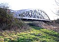
 Iron railway bridge at Appleford - geograph.org.uk - 4526436.jpg 1 500 × 999 ; 278 kio
-
 Junction on Church Street - geograph.org.uk - 1596675.jpg 640 × 427 ; 77 kio
-
 Justice Memorial - geograph.org.uk - 5010323.jpg 533 × 800 ; 68 kio
-
 Lake and landfill - geograph.org.uk - 3929203.jpg 640 × 343 ; 37 kio
-
 Lake by Appleford Station - geograph.org.uk - 2109133.jpg 3 396 × 2 536 ; 2,59 Mio
-
 Lake with Sluice - geograph.org.uk - 1927972.jpg 3 336 × 2 560 ; 2,53 Mio
-
 Large field - geograph.org.uk - 3945722.jpg 640 × 430 ; 47 kio
-
 Large Pond (or Small Lake) - geograph.org.uk - 1927853.jpg 1 600 × 1 168 ; 459 kio
-
 Level crossing at Appleford - geograph.org.uk - 2362339.jpg 1 500 × 1 000 ; 200 kio
-
 Loco in the snow at Appleford - geograph.org.uk - 1653943.jpg 640 × 415 ; 60 kio
-
 Looking across a field towards Appleford - geograph.org.uk - 1232340.jpg 640 × 403 ; 60 kio
-
 Looking across a field towards Appleford - geograph.org.uk - 1451722.jpg 640 × 427 ; 108 kio
-
 Looking along the Ditch - geograph.org.uk - 1582152.jpg 480 × 640 ; 130 kio
-
 Looking over a field to the Sinodun Hills - geograph.org.uk - 1451727.jpg 640 × 416 ; 100 kio
-

-
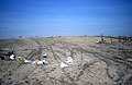
 Looking over the Appleford landfill site - geograph.org.uk - 1451717.jpg 640 × 427 ; 102 kio
-

-

-
 Looking up Lady Grove to the T junction - geograph.org.uk - 1240586.jpg 640 × 427 ; 53 kio
-
 Lych gate along the lane - geograph.org.uk - 1597440.jpg 640 × 427 ; 71 kio
-
 Meadows south of the Thames, from the train - geograph.org.uk - 2421520.jpg 1 024 × 768 ; 118 kio
-
 Memorials above the Altar - geograph.org.uk - 5010339.jpg 1 024 × 683 ; 96 kio
-
 Monitoring Borehole near Appleford - geograph.org.uk - 2109165.jpg 3 336 × 2 612 ; 2,55 Mio
-
 Moor Ditch - geograph.org.uk - 2186186.jpg 533 × 800 ; 121 kio
-
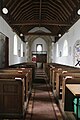
 Nave in St Peter ^ St Paul - geograph.org.uk - 5010170.jpg 1 024 × 683 ; 100 kio
-
 Near the Tower - geograph.org.uk - 5010499.jpg 1 024 × 683 ; 182 kio
-
 New Hill near the Power Station - geograph.org.uk - 3102418.jpg 1 024 × 683 ; 106 kio
-
 North of Appleford - geograph.org.uk - 3929222.jpg 640 × 430 ; 52 kio
-
 Not a Good Place to Park - geograph.org.uk - 5048764.jpg 1 024 × 768 ; 109 kio
-
 Old Gravel Pit - geograph.org.uk - 3300875.jpg 640 × 480 ; 65 kio
-
 Other side of the bend - geograph.org.uk - 1582222.jpg 640 × 480 ; 126 kio
-
 Out from the Chancel - geograph.org.uk - 5010488.jpg 533 × 800 ; 88 kio
-
 Over the weeds - geograph.org.uk - 1420279.jpg 640 × 426 ; 105 kio
-
 Partly Restored Lake - geograph.org.uk - 1927956.jpg 3 648 × 2 736 ; 2,34 Mio
-
 Pillbox beside the Oxford to Reading railway - geograph.org.uk - 2524061.jpg 1 024 × 680 ; 172 kio
-
 Pillbox in a field - geograph.org.uk - 4526455.jpg 1 500 × 999 ; 229 kio
-
 Poking over the hill - geograph.org.uk - 3102421.jpg 1 024 × 683 ; 142 kio
-
 Poppies in a field of rape - geograph.org.uk - 4526475.jpg 1 500 × 999 ; 255 kio
-
 Poppy on the Thames Path - geograph.org.uk - 4526470.jpg 1 500 × 1 442 ; 137 kio
-
 Power station in the haze - geograph.org.uk - 1584153.jpg 640 × 480 ; 52 kio
-
 Pulpit at St Peter ^ St Paul - geograph.org.uk - 5010175.jpg 533 × 800 ; 61 kio
-
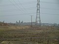
 Pylons near Didcot - geograph.org.uk - 3929184.jpg 640 × 321 ; 35 kio
-
 Rail enthusiasts at Appleford level crossing - geograph.org.uk - 2764331.jpg 1 024 × 683 ; 200 kio
-
 Railway bridge over the River Thames - geograph.org.uk - 4526449.jpg 1 500 × 999 ; 236 kio
-
 Railway bridge over the River Thames and Thames Path - geograph.org.uk - 4317601.jpg 1 024 × 730 ; 233 kio
-
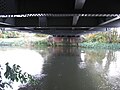
 Railway bridge over the Thames - geograph.org.uk - 2524062.jpg 1 024 × 680 ; 282 kio
-
 Reed Mace at Hill Farm Lake - geograph.org.uk - 1451712.jpg 640 × 427 ; 99 kio
-
 Remnants of a road - geograph.org.uk - 2186210.jpg 1 024 × 683 ; 195 kio
-
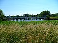
 River Thames - geograph.org.uk - 3270111.jpg 1 024 × 768 ; 257 kio
-
 River Thames - geograph.org.uk - 3945719.jpg 640 × 394 ; 46 kio
-
 River Thames near Appleford - geograph.org.uk - 2524066.jpg 1 024 × 680 ; 194 kio
-
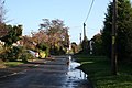
 Road over the green - geograph.org.uk - 1596684.jpg 640 × 427 ; 75 kio
-
 Some on the South - geograph.org.uk - 5013250.jpg 1 024 × 683 ; 206 kio
-
 South Side of St Peter ^ St Paul - geograph.org.uk - 5013252.jpg 1 024 × 683 ; 121 kio
-
 Spire of Appleton church - geograph.org.uk - 2524068.jpg 1 024 × 680 ; 272 kio
-
 St Peter and St Paul church - geograph.org.uk - 2820053.jpg 683 × 1 024 ; 165 kio
-
 Ten Commandments - geograph.org.uk - 5010330.jpg 533 × 800 ; 81 kio
-
 Thames Path - geograph.org.uk - 3270108.jpg 1 024 × 768 ; 219 kio
-
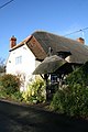 Thatched gate - geograph.org.uk - 1597449.jpg 426 × 640 ; 80 kio
-
 The container crane in Appleford - geograph.org.uk - 1653950.jpg 640 × 409 ; 57 kio
-
 The Didcot Desert 2 - geograph.org.uk - 2408288.jpg 800 × 520 ; 130 kio
-
 The entrance to Appleford Station - geograph.org.uk - 4971397.jpg 2 304 × 1 728 ; 847 kio
-
 The entrance to Appleford Station - geograph.org.uk - 4971398.jpg 2 304 × 1 728 ; 871 kio
-
 The Good Shepherd - geograph.org.uk - 5010336.jpg 533 × 800 ; 78 kio
-
 The Lords Prayer - geograph.org.uk - 5010331.jpg 533 × 800 ; 81 kio
-
 The Old Post Office - geograph.org.uk - 2820293.jpg 1 024 × 683 ; 169 kio
-
 The Orange Way after Wiltshire (187) - geograph.org.uk - 3556512.jpg 800 × 600 ; 233 kio
-
 The Orange Way after Wiltshire (188) - geograph.org.uk - 3556521.jpg 800 × 600 ; 160 kio
-
 The Orange Way after Wiltshire (189) - geograph.org.uk - 3556523.jpg 800 × 600 ; 235 kio
-
 The Orange Way after Wiltshire (190) - geograph.org.uk - 3556529.jpg 800 × 600 ; 129 kio
-
 The Orange Way after Wiltshire (191) - geograph.org.uk - 3556548.jpg 800 × 600 ; 189 kio
-
 The Orange Way after Wiltshire (192) - geograph.org.uk - 3556568.jpg 800 × 600 ; 131 kio
-
 The Orange Way after Wiltshire (193) - geograph.org.uk - 3556571.jpg 800 × 600 ; 151 kio
-
 The Orange Way after Wiltshire (195) - geograph.org.uk - 3556600.jpg 800 × 600 ; 160 kio
-
 The River Thames - geograph.org.uk - 2318458.jpg 1 500 × 1 000 ; 185 kio
-
 The River Thames at Appleford - geograph.org.uk - 4526440.jpg 1 500 × 999 ; 247 kio
-
 The River Thames at Appleford - geograph.org.uk - 4526445.jpg 1 500 × 999 ; 194 kio
-
 The River Thames at Appleford - geograph.org.uk - 4562252.jpg 1 500 × 999 ; 214 kio
-
 The River Thames at Appleford - geograph.org.uk - 4562259.jpg 1 500 × 999 ; 250 kio
-
 The River Thames looking upstream - geograph.org.uk - 4578205.jpg 1 500 × 999 ; 177 kio
-
 The River Thames near Appleford - geograph.org.uk - 4562276.jpg 1 500 × 999 ; 196 kio
-
 The River Thames near Appleford - geograph.org.uk - 4690930.jpg 2 592 × 1 944 ; 1,45 Mio
-
 The River Thames near Long Wittenham - geograph.org.uk - 4562283.jpg 1 500 × 964 ; 239 kio
-
 The road from Appleford Sidings - geograph.org.uk - 1653959.jpg 640 × 427 ; 58 kio
-
 The spoil road in Appleford Sidings - geograph.org.uk - 1267884.jpg 640 × 427 ; 73 kio
-
 The spoil road in Appleford Sidings - geograph.org.uk - 1267887.jpg 640 × 415 ; 70 kio
-
 The Thames Path and River Thames - geograph.org.uk - 4317602.jpg 1 024 × 701 ; 288 kio
-
 The Thames Path to Clifton Hampden - geograph.org.uk - 4526460.jpg 1 500 × 999 ; 245 kio
-
 The Thames Path to Clifton Hampden - geograph.org.uk - 4526463.jpg 1 500 × 999 ; 302 kio
-
 The Thames Path to Clifton Hampden - geograph.org.uk - 4562265.jpg 1 500 × 999 ; 309 kio
-
 The Thames Path to Clifton Hampden - geograph.org.uk - 4562285.jpg 1 500 × 981 ; 299 kio


_-_geograph.org.uk_-_5126663.jpg)


_-_geograph.org.uk_-_1927853.jpg)


_-_geograph.org.uk_-_3556512.jpg)
_-_geograph.org.uk_-_3556521.jpg)
_-_geograph.org.uk_-_3556523.jpg)
_-_geograph.org.uk_-_3556529.jpg)
_-_geograph.org.uk_-_3556548.jpg)
_-_geograph.org.uk_-_3556568.jpg)
_-_geograph.org.uk_-_3556571.jpg)
_-_geograph.org.uk_-_3556600.jpg)


