Category:Archaeological sites in Aberdeenshire
Zur Navigation springen
Zur Suche springen
Council areas (municipalities) of Scotland: Aberdeen · Aberdeenshire · Angus · Argyll and Bute · Dumfries and Galloway · East Dunbartonshire · East Lothian · East Renfrewshire · Falkirk · Fife · Highland · Moray · North Ayrshire · Outer Hebrides · Orkney Islands · Perth and Kinross · Renfrewshire · Scottish Borders · Shetland Islands · South Ayrshire · South Lanarkshire · Stirling · West Dunbartonshire · West Lothian
Wikimedia-Kategorie | |||||
| Medium hochladen | |||||
| Ist ein(e) | |||||
|---|---|---|---|---|---|
| Kategorie kombiniert die Themen | |||||
| Aberdeenshire | |||||
Grafschaft in Schottland    | |||||
| Ist ein(e) | |||||
| Ist Teil von |
| ||||
| Ort | Schottland | ||||
| Hauptstadt | |||||
| Einwohnerzahl |
| ||||
| Fläche |
| ||||
| Verschieden von | |||||
| offizielle Website | |||||
 | |||||
Unterkategorien
Es werden 20 von insgesamt 20 Unterkategorien in dieser Kategorie angezeigt:
In Klammern die Anzahl der enthaltenen Kategorien (K), Seiten (S), Dateien (D)
A
- Ardlair Stone Circle (4 D)
B
- Brandsbutt Symbol Stone (11 D)
- Broomend henge (4 D)
C
- Cullerlie Stone Circle (15 D)
- Culsh Earth House (6 D)
D
- Druminnor Castle (3 D)
- Dunnicaer (8 D)
- Dunnideer stone circle (4 D)
E
- Easter Aquhorthies stone circle (28 D)
F
- Fetternear Palace (13 D)
H
- Hill forts in Aberdeenshire (4 D)
L
- Loanhead Stone Circle (52 D)
M
- Maiden Stone (35 D)
- Memsie Cairn (3 D)
P
- Picardy Symbol Stone (5 D)
S
- St Brandan's Stanes (2 D)
- Sunhoney Stone Circle (6 D)
T
- Tomnaverie Stone Circle (39 D)
Medien in der Kategorie „Archaeological sites in Aberdeenshire“
Folgende 37 Dateien sind in dieser Kategorie, von 37 insgesamt.
-
-
 Capo Long Barrow - geograph.org.uk - 77577.jpg 640 × 475; 80 KB
-

-
 Dragon's Grave 2.jpg 4.608 × 3.456; 6,17 MB
-
 Dragon's Grave 3.jpg 4.432 × 1.824; 2,15 MB
-
 Dragons Grave 1.jpg 7.632 × 1.824; 5,78 MB
-
 Dunnicaer (geograph 5340586).jpg 4.272 × 2.848; 3,73 MB
-
 Dunnicaer hill fort excavated 2015.jpg 1.567 × 951; 275 KB
-
 Garrison Hill, Raedykes Roman Camp, Kincardineshire.jpg 640 × 182; 53 KB
-
 Kinellar Kirkyard - geograph.org.uk - 245246.jpg 320 × 240; 24 KB
-
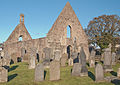
 Kinkardine O'Neil, St Mary's Kirk (ruin).jpg 3.008 × 2.000; 5,1 MB
-
 KoN-1.jpg 2.192 × 1.550; 3,37 MB
-
 KoN-10.jpg 1.571 × 1.807; 3,4 MB
-
 KoN-100.jpg 3.072 × 2.048; 4,75 MB
-
 KoN-1000.jpg 1.566 × 2.564; 4,89 MB
-
 Long Cairn at Cairncatto - geograph.org.uk - 399208.jpg 640 × 480; 94 KB
-
 Maiden Castle - geograph.org.uk - 745024.jpg 640 × 427; 273 KB
-
 Maiden Castle - geograph.org.uk - 745029.jpg 427 × 640; 300 KB
-
-
 Megawal99.png 720 × 540; 52 KB
-

-
 Spot the stones - geograph.org.uk - 916228.jpg 640 × 480; 138 KB
-
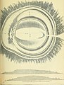
 Strathdon Eirde Houses Buchaam Mitchell 1863 2.png 2.003 × 1.329; 1,03 MB
-
 Strathdon Eirde Houses Glenkindie Mitchell 1863 2.png 2.003 × 1.339; 1,2 MB
-
 Strathdon Eirde Houses Mitchell 1863 2.png 2.118 × 3.049; 2,77 MB
-

-
 View along Top of Long Barrow from North - geograph.org.uk - 921287.jpg 640 × 480; 137 KB
-
 Wormyhillockhenge-mound.jpg 640 × 480; 147 KB
-
 Ancient Church, Kincardine O'Neil - geograph.org.uk - 7331.jpg 621 × 406; 99 KB
-
 Hill of Barra Fort - geograph.org.uk - 671088.jpg 640 × 480; 95 KB
-

-

-
 Mither Tap of Bennachie - geograph.org.uk - 4372.jpg 640 × 422; 231 KB
-
 Remains of cairn above Upper Shampher - geograph.org.uk - 447658.jpg 640 × 480; 117 KB
-
 Small circle - geograph.org.uk - 235696.jpg 640 × 471; 97 KB
-
 The Nine Stanes - geograph.org.uk - 30403.jpg 640 × 480; 182 KB
-
 The Power of the Wind - geograph.org.uk - 688131.jpg 640 × 427; 300 KB
_(14740623046).jpg)


.jpg)


.jpg)


